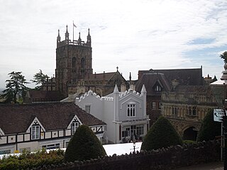
Malvern is a spa town and civil parish in Worcestershire, England. It lies at the foot of the Malvern Hills, a designated Area of Outstanding Natural Beauty. The centre of Malvern, Great Malvern, is a historic conservation area, which grew dramatically in Victorian times due to the natural mineral water springs in the vicinity, including Malvern Water.
Malvern Hills is a local government district in Worcestershire, England. Its council is based in the town of Malvern, and its area covers most of the western half of the county, including the outlying towns of Tenbury Wells and Upton-upon-Severn. It was originally formed in 1974 and was subject to a significant boundary reform in 1998. In the 2011 census the population of the Malvern Hills district was 74,631.

In topography, prominence measures the height of a mountain or hill's summit relative to the lowest contour line encircling it but containing no higher summit within it. It is a measure of the independence of a summit. A peak's key col is a unique point on this contour line and the parent peak is some higher mountain, selected according to various criteria.

Malvern Wells is a village and civil parish south of Great Malvern in the Malvern Hills district of Worcestershire, England. The parish, once known as South Malvern, was formed in 1894 from parts of the civil parishes of Hanley Castle, Welland, and the former parish of Great Malvern, and owes its development to the 19th-century boom years of Malvern as a spa town. Malvern Wells is a centre of commercial bottling of Malvern water. The population of the parishes of Malvern Wells and Little Malvern was recorded in 2011 as 3,196.

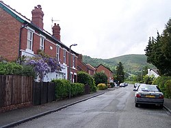
Malvern Link is an area of Malvern, Worcestershire, England to the north and east of Great Malvern. The centres of Malvern Link and Great Malvern are separated by Link Common, an area of open land that is statutorily protected by the Malvern Hills Conservators. In 1900 Malvern Link Urban District, which had been formed only five years earlier, merged with Great Malvern to become Malvern Town. The population of Link in 2011 was 6,155.

Shelsley Walsh is a small village and civil parish in Worcestershire, England, on the western side of the River Teme. For administrative purposes it is presently located in the Teme Valley ward of the county’s Malvern Hills district. In the 2011 Census there was an estimated population of 28 people in 12 households. The site has been farmed since Anglo Saxon times and there are also vestiges of former industry, but it is now best known for its association with the Shelsley Walsh Speed Hill Climb.

Colwall is a civil parish in Herefordshire, England, situated on the border with Worcestershire, nestling on the western side of the Malvern Hills at the heart of the AONB. Areas of the village are known as Colwall Stone, Upper Colwall which shares a common border at the Wyche Cutting with the Malvern suburb of Malvern Wells, and Colwall Green, spread along 2 miles (3.2 km) of the B4218 road, with the historic village core being 1 mile (1.6 km) to the west of Colwall Stone.

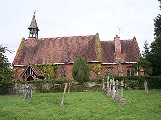
Guarlford is a village and civil parish in the Malvern Hills district in the county of Worcestershire, England. The parish population was 261 in 2021.
Little Malvern is a small village and civil parish in Worcestershire, England. It is situated on the lower slopes of the Malvern Hills, south of Malvern Wells, near Great Malvern, the major centre of the area often referred to as The Malverns. Little Malvern shares a parish council with Welland, with 2 of the 11 councillors.

The Berkeley Hills are a range of the Pacific Coast Ranges that overlook the northeast side of the valley that encompasses San Francisco Bay. They were previously called the "Contra Costa Range/Hills", but with the establishment of Berkeley and the University of California, the current usage was applied by geographers and gazetteers.
Hanley Castle is a village and civil parish in Worcestershire, England, between the towns of Malvern and Upton upon Severn and a short distance from the River Severn. It lies in the administrative area of Malvern Hills District, and is part of the informal region known as The Malverns. It is served primarily by bus service 332 Worcester - Upton upon Severn - Hanley Castle operated by Aston Coaches and 363 Worcester - Tewkesbury operated by First Worcester.

Welland is a village and civil parish in the administrative district of Malvern Hills in the county of Worcestershire, England. It has a combined parish council with Little Malvern, with 9 of the 11 councillors. It is about 6 miles (9.7 km) from the town of Malvern, 15 miles from the city of Worcester, and 18 miles from the city of Gloucester. It is surrounded by farms and common land, and is part of the informal region referred to as The Malverns.
Twelve Mile Creek is a waterway located on the Niagara Peninsula in the Regional Municipality of Niagara in Southern Ontario, Canada. Its headwaters are located in the town of Pelham, encompassing some of the most unspoiled and natural areas of Niagara area. The creek's lower reaches flow through urban areas of Thorold and St. Catharines and has been heavily altered by human activity for almost two centuries. The creek was first known as "Ashquasing" by the Mississaugas Indigenous people, the name meaning "that which lies at the end" in the Anishinaabe language.

The Cochetopa Hills are a ridge of uplands on the Continental Divide in Saguache County, southern Colorado, United States.
Lulsley is a village and civil parish in the Malvern Hills District of the county of Worcestershire, England, UK.

Wyche, often referred to locally as The Wyche, is a village and a suburb of the town of Malvern, Worcestershire, England, and part of the civil parish of Malvern Wells. It is situated approximately 1 mile (1.6 km) south of Great Malvern, the town's centre, on the B4218 road that runs from Malvern to Colwall.
Applebutter Hill is a low mountain in Lehigh County, Pennsylvania. The main peak rises to 850 feet (259 m), and is located in Upper Saucon Township. Applebutter Hill is located to the west of Center Valley, and is north of Coopersburg.
Saucon Hill is a low mountain in Lehigh County, Pennsylvania. The main peak rises to 666 feet (203 m), and is located in Upper Saucon Township. Saucon Hill is located to the southwest of Hellertown.