
Malvern is a spa town and civil parish in Worcestershire, England. It lies at the foot of the Malvern Hills, a designated Area of Outstanding Natural Beauty. The centre of Malvern, Great Malvern, is a historic conservation area, which grew dramatically in Victorian times due to the natural mineral water springs in the vicinity, including Malvern Water.

Birmingham is a major transport hub, due in part to its location in central England. The city is well connected by rail, road, and water. Public transport and key highways in the city are overseen by Transport for West Midlands (TfWM).

Malvern Wells is a village and civil parish south of Great Malvern in the Malvern Hills district of Worcestershire, England. The parish, once known as South Malvern, was formed in 1894 from parts of the civil parishes of Hanley Castle, Welland, and the former parish of Great Malvern, and owes its development to the 19th-century boom years of Malvern as a spa town. Malvern Wells is a centre of commercial bottling of Malvern water. The population of the parishes of Malvern Wells and Little Malvern was recorded in 2011 as 3,196.

Malvern Link is an area in the civil parish of Malvern, in the Malvern Hills District, in Worcestershire, England to the north and east of Great Malvern. The centres of Malvern Link and Great Malvern are separated by Link Common, an area of open land that is statutorily protected by the Malvern Hills Conservators. The population of Link ward in 2022 was 6,301.

Barnards Green is one of the main population areas of Malvern, Worcestershire, England, situated approximately 1 mile (1.6 km) east and downhill from Great Malvern, the town's traditional centre.

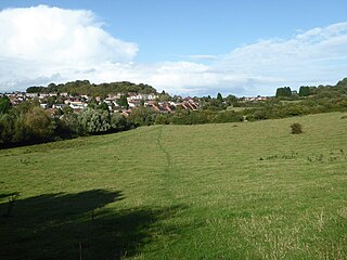
North Malvern is a suburb of Malvern, Worcestershire, England. It nestles on the northern slopes of the Malvern Hills. It is a contiguous urban extension of Link Top, and other neighbouring centres of population are Great Malvern, Malvern Link, West Malvern and the former village of Cowleigh. It is part of the civil parish of Malvern, administered by the Malvern Hills District, and is included in the informal region known as The Malverns.

Ashchurch for Tewkesbury is a railway station on the main Bristol–Birmingham main line, serving the market town of Tewkesbury and the village of Ashchurch in Gloucestershire, England. It is located less than 1⁄4 mile (400 m) from junction 9 of the M5 motorway. Originally opened in 1840 but closed in 1971. The station was reopened on 1 June 1997 by Railtrack. There are regular bus connections from the station to Tewkesbury town centre, Gloucester and Cheltenham.

Midland Red was a bus company that operated in The Midlands from 1905 until 1981. It was one of the largest English bus companies, operating over a large area between Gloucester in the south and Derbyshire in the north, and from Northampton to the Welsh border. The company also manufactured buses.

The Birmingham to Worcester via Kidderminster line is a railway line which runs from Birmingham Snow Hill to Worcester via Stourbridge and Kidderminster in the West Midlands, England. It is one of the Snow Hill Lines, with trains operated by West Midlands Trains and Chiltern Railways using a variety of rolling stock including Class 172 and Class 168 diesel units. It is a future aspiration of Network Rail to electrify the entire line, as well as the Chiltern Main Line to London Marylebone.

Newland is a village and civil parish on the north-eastern edge of Malvern Link, Worcestershire, England, on the A449 road.
Suckley is a village and civil parish in the Malvern Hills District in the county of Worcestershire, England, close to the border with Herefordshire. The parish includes the hamlets of Suckley Knowl, Suckley Green at SO719532 and Longley Green at SO733503.

Barnt Green railway station serves the village of Barnt Green, North Worcestershire, England. It is situated 9+1⁄2 miles (15.3 km) south west of Birmingham New Street. The station, and all trains serving it, are operated by West Midlands Trains.

Great Malvern railway station is one of two stations serving the town of Malvern, Worcestershire, England on the Hereford to Worcester section of the Cotswold Line. It is situated downhill from the centre of Great Malvern and close to Barnards Green. The station retains most of its original Victorian station design by the architect Edmund Wallace Elmslie and is a Grade II listed building.
Ronkswood is an inner-city suburb of Worcester in Worcestershire, England. It is one mile east of the city centre, centered on Newtown Road (B4636). Much of the Ronkswood housing estate was built in the late 1940s.

Clayhanger is a village in the Metropolitan Borough of Walsall in the West Midlands, England. The village is situated between Pelsall, Walsall Wood and Brownhills. The village has only one road running through it from Pelsall/Brownhills to Walsall Wood. The village has no other through roads and is predominantly residential.

First Midland Red Buses, trading as First Worcester, is a bus company operating services in Herefordshire and Worcestershire in the English Midlands. It is a subsidiary of FirstGroup, and is managed as part of the First West of England business unit.

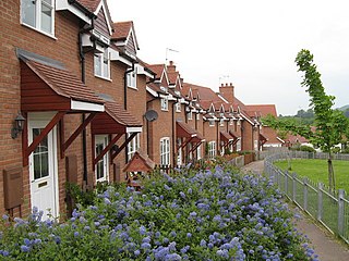
Poolbrook is a village and a suburb of Malvern, Worcestershire, England, situated approximately 1.5 miles (2.4 km) southeast of Great Malvern, the town's centre, and about 0.5 miles (08 km) from the Malvern suburb of Barnards Green on the Poolbrook Road (B4208). The village comprises several shops, a traditional English pub, and a number of council and private housing estates. St Andrew's C of E parish church was built in Early English style in 1882 as a memorial to a member of the Chance Brothers glass manufacturing family. The village occupies the geographical centre of the Chase ward of Malvern Town Council.
Among the places of worship in the town and area of Malvern, Worcestershire are centres of dedication to many faiths and denominations. The town has 31 Christian churches with 11 belonging to the Church of England, ranging from low church to high Anglo-Catholic, two Roman Catholic, one Evangelical, and the others being Non-Conformist and other faiths. Its oldest place of worship is the almost cathedral sized parish church of Great Malvern Priory which is all that remains of the former 10th century abbey in central Malvern, which according to the Worcester Monastic Annals, work began in 1085. The chain of Malvern Hills lies in a north-south direction, thus posing a challenge for the architects of Christian churches located on the steep slopes, chancels being traditionally sited at the east end of the building. Many churches were built in the 19th century concomitant with the rapid expansion of the town due to its popularity as a spa. A few modern buildings such as St Mary's Church (1960) in Sherrard's Green, have been constructed in the second half of the 20th century, and some churches, notably St Andrews in Poolbrook, have had important modern extensions added during the first decade of the 21st century.

Worcestershire bus route 144 is a bus service connecting the Worcestershire areas of Catshill, Bromsgrove. Droitwich and Worcester, operated by First Worcestershire. The service dates back to 1914 and was one of the longest-running double-deck bus operated routes, though it is now more common for single decked buses to be used.

Sherrard's Green is a village and a suburb of Malvern, Worcestershire, England, situated approximately 1.5 miles southeast of Great Malvern, the town's centre, and about 0.5 miles (0.80 km) from the Malvern suburb of Barnards Green. The village comprises a number of council and private housing estates and the small parish church of St Mary's, Pickersleigh, and a Tesco convenience store that opened in 2011 on the site of a former pub, The New Gas Tavern.


