Holt Heath, Worcestershire

Last updated

Holt Heath
Holt Heath - The Heath..jpg
Worcestershire UK location map.svg
Red pog.svg
Holt Heath
Location within Worcestershire
OS grid reference SO816630
District
Shire county
Region
Country England
Sovereign state United Kingdom
Post town WORCESTER
Postcode district WR6
Dialling code 01905
Police West Mercia
Fire Hereford and Worcester
Ambulance West Midlands
List of places
UK
England
Worcestershire
52°15′53″N2°16′16″W / 52.26485°N 2.27103°W / 52.26485; -2.27103 Coordinates: 52°15′53″N2°16′16″W / 52.26485°N 2.27103°W / 52.26485; -2.27103

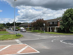
Holt Heath, in the parish of Holt, is a village near the west bank of the River Severn in Worcestershire.

Contents

The nearest towns are all about 6 miles away: to the north Stourport-on-Severn, to the east Droitwich Spa and to the south Worcester.

There is a post office in the centre of the village. Outside Holt Heath is a castle and parish church. There are three schools nearby: Grimley and Holt, Great Witley and Hallow.

Holt Heath is also known for its public houses, The Red Lion [1] [2] and The Wharf Inn. [3]

See also

Related Research Articles

Worcestershire County of England

Worcestershire is a county in the West Midlands of England.

River Severn River in the United Kingdom

The River Severn, at 220 miles (354 km) long, is the longest river in Great Britain. It is also the river with the most voluminous flow of water by far in all of England and Wales, with an average flow rate of 107 m3/s (3,800 cu ft/s) at Apperley, Gloucestershire. It rises in the Cambrian Mountains in mid Wales, at an altitude of 2,001 feet (610 m), on the Plynlimon massif, which lies close to the Ceredigion/Powys border near Llanidloes. The river then flows through Shropshire, Worcestershire and Gloucestershire. The county towns of Shrewsbury, Gloucester and the City of Worcester lie on its course.

Worcester, England Cathedral city in England

Worcester is a cathedral city and the ceremonial county town of Worcestershire, England, 30 miles (48 km) south-west of Birmingham, 101 miles (163 km) north-west of London, 27 miles (43 km) north of Gloucester and 23 miles (37 km) north-east of Hereford. The estimated population in 2019 was 102,791. The River Severn flanks the western side of the city centre. It is overlooked by Worcester Cathedral. The Battle of Worcester in 1651 was the final one in the English Civil War, where Oliver Cromwell's New Model Army defeated King Charles II's Royalists. Worcester is the home of Royal Worcester Porcelain, composer Edward Elgar, Lea & Perrins, makers of traditional Worcestershire sauce, the University of Worcester, and Berrow's Worcester Journal, claimed as the world's oldest newspaper.

Upton-upon-Severn Human settlement in England

Upton-upon-Severn is a small town and civil parish in the Malvern Hills District of Worcestershire, England. Lying on the A4104, the 2011 census recorded a population of 2,881, making it the smallest town in the county.

Malvern Hills District Non-metropolitan district in England

Malvern Hills is a local government district in Worcestershire, England. Its council is based in the town of Malvern, and its area covers most of the western half of the county, including the small towns of Tenbury and Upton. It was originally formed in 1974 and was subject to a significant boundary reform in 1998. In the 2011 census the population of the Malvern Hills district was 74,631.

Kempsey, Worcestershire Human settlement in England

Kempsey is a village and civil parish in the Malvern Hills District in the county of Worcestershire, England. It is bounded by the River Severn on the west, and the A38 main road runs through it and is about 3 miles (5 km) south of Worcester. The village has a long history. Its name is derived from the Saxon "Kemys' Eye", or the island of Kemys. Kemys was a Saxon chief, whose island lay between marshes and the River Severn. One of the roads in Kempsey, Lyf's Lane, is named after another Saxon chief. The village was recorded in the 11th century Domesday Book as having a value of £7.

Holt Heath may refer to:

Holt, Worcestershire Human settlement in England

Holt is a village in the Wychavon district of the county of Worcestershire, England. The church is dedicated to St. Martin, and dates from about the 12th century. Holt Bridge, over the River Severn, was designed by Thomas Telford, and opened in 1830.

Little Witley Human settlement in England

Little Witley is a village and civil parish in the Malvern Hills District in the county of Worcestershire, England.

Grimley, Worcestershire Human settlement in England

Grimley is a village and civil parish in the Malvern Hills District in the county of Worcestershire, England about 3 miles (4.8 km) north of Worcester.

Ronkswood Human settlement in England

Ronkswood is a suburb of the city of Worcester, the county seat of Worcestershire, England. It is around one mile east of the city centre, centred on Newtown Road (B4636). Much of the Ronkswood housing estate was built in the late 1940s.

St Johns, Worcester Human settlement in England

St John's is a suburb of Worcester, England, lying west of the city centre and the River Severn. St. John's is referred to locally as the "Village in the City", which is partly due to being an independent township, before joining the city in 1837. Although there is still a strong sense of pride and identity within the community.

Hallow, Worcestershire Human settlement in England

Hallow is a village and civil parish beside the River Severn, about 2 miles (3.2 km) north-west of Worcester in Worcestershire. The village is on the A443 road that links Worcester with Holt Heath.

The Chantry School is a mixed gender secondary school with academy status located in Martley, Worcestershire, England. The school has about 700 students on roll who come mainly from small villages around the edge of Worcester, The school has a Technology College specialism.

Ripple, Worcestershire Human settlement in England

Ripple is a village and civil parish in the county of Worcestershire, England. Ripple is one of the most southerly parishes in the county and is situated on the A38 road with the River Severn as its western boundary. Together with the villages and hamlets of Ryall, Holly Green, The Grove, Naunton, and Uckinghall, the parish has a combined population of 1,799.

Shrawley Human settlement in England

Shrawley is a village and civil parish in the Malvern Hills District in the county of Worcestershire, England. The village is situated on the western bank of the River Severn. The northern and southern boundaries of the parish are two small tributaries of the River Severn, Dick Brook to the north and Shrawley Brook to the south. To the west is Hillhampton, the north west and north is the parish of Astley and to the south Holt.

Rob Yarnold is a former successful Radio Presenter/Journalist who was popular in the West Midlands for his work on BBC Hereford and Worcester, BBC Radio Stoke and BBC Radio Shropshire. In Herefordshire and Worcestershire, Rob Yarnold was also the founding Director of Radio Wyvern formerly Severn Valley Radio, which was the first local Radio station for the two counties.

Severn Stars Netball Superleague team

Severn Stars are an English netball team based at the University of Worcester and the University of Gloucestershire. The team is named after the River Severn, which runs through Worcester and Gloucester, the home cities of the two universities. Severn Stars were formed in 2016 and since 2017 their senior team has played in the Netball Superleague.

References