| Stanford on Teme | |
|---|---|
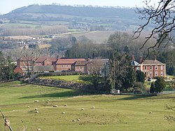 Stanford Court | |
 Stanford on Teme Location within Worcestershire | |
| OS grid reference | SO735658 |
| Civil parish | |
| District | |
| Shire county | |
| Region | |
| Country | England |
| Sovereign state | United Kingdom |
| Post town | WORCESTER |
| Postcode district | WR6 |
| Police | West Mercia |
| Fire | Hereford and Worcester |
| Ambulance | West Midlands |
| UK Parliament |
|
Stanford on Teme is a village and former civil parish, now in the parish of Stanford with Orleton, in the Malvern Hills district, in the county of Worcestershire, England. In 1931 the parish had a population of 144. [1]