Alfrick Pound

Last updated

Alfrick Pound
Alfrick Pound triangle.jpg
Worcestershire UK location map.svg
Red pog.svg
Alfrick Pound
Location within Worcestershire
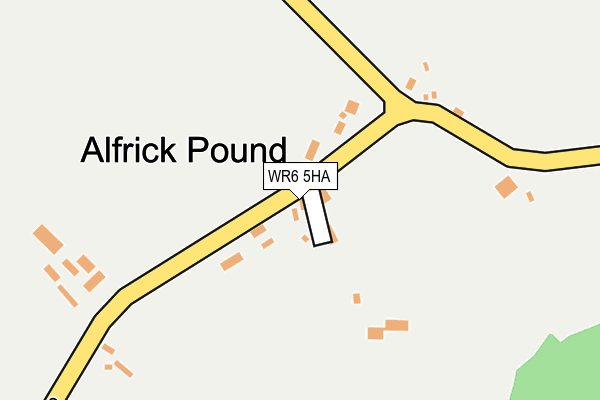
OS grid reference SO744521
  London 108 miles (174 km)
District
Shire county
Region
Country England
Sovereign state United Kingdom
Post town WORCESTER
Postcode district WR6
Dialling code 01886
Police West Mercia
Fire Hereford and Worcester
Ambulance West Midlands
List of places
UK
England
Worcestershire
52°10′00″N2°22′35″W / 52.166536°N 2.376523°W / 52.166536; -2.376523 Coordinates: 52°10′00″N2°22′35″W / 52.166536°N 2.376523°W / 52.166536; -2.376523

Alfrick Pound is a small village in the county of Worcestershire, England, in the United Kingdom.

Contents

Location

Alfrick Pound village is located on the edge of the Malvern Hills area, approximately ten miles west of Worcester near the Suckley Hills and is set in a very rural area.

History and amenities

It has a very small population of residents and a small number of properties. History tells us that the Alfrick Pound was once an area where stray livestock were held in a pound until the owner was traced or turned up to reclaim them, incurring a small fine in order to do so.

Many of the original houses that stand are half-timbered cottages, an old pub (once called the Wobbly Wheel Inn), [1] a small village school, bakery and even a small police house. None of these are still used for their original purpose and have been modernised and made into private residences though still revealing their old architecture.

A small lane [2] opposite the old Wobbly wheel Inn leads up to the Knapp Nature Reserve. [3]

Related Research Articles

Hamlet (place) Small human settlement in a rural area

A hamlet is a small human settlement. In different jurisdictions and geographies, a hamlet may be the size of a town, village or parish, or may be considered to be a smaller settlement or subdivision or satellite entity to a larger settlement. The word and concept of a hamlet have roots in the Anglo-Norman settlement of England, where the old French hamlet came to apply to small human settlements. In British geography, a hamlet is considered smaller than a village and distinctly without a church or other place of worship.

Downley Human settlement in England

Downley is a village and civil parish in the Wycombe district of Buckinghamshire, England. It is high in the Chiltern Hills, overlooking the town of High Wycombe, although today it is almost indistinguishable from the urban spread of the latter town.

River Blackwater (River Loddon) Tributary of the River Loddon in England

The River Blackwater is a tributary of the Loddon in England and sub-tributary of the Thames. It rises at two springs in Rowhill Nature Reserve between Aldershot, Hampshire and Farnham, Surrey. It curves a course north then west to join the Loddon in Swallowfield civil parish, central Berkshire. Part of the river splits Hampshire from Surrey; a smaller part does so as to Hampshire and Berkshire.

Glen Coe Glen in the Highlands of Scotland

Glen Coe is a glen of volcanic origins, in the Highlands of Scotland. It lies in the north of the county of Argyll, close to the border with the historic province of Lochaber, within the modern council area of Highland. The scenic beauty of the glen has led to its inclusion in the Ben Nevis and Glen Coe National Scenic Area, one of 40 such areas in Scotland. A review of the national scenic areas by Scottish Natural Heritage in 2010 made reference to the "soaring, dramatic splendour of Glen Coe", and "the suddenness of the transition between high mountain pass and the lightly wooded strath" in the lower glen. It also described the journey through the glen on the main A82 road as "one of the classic Highland journeys". The main settlement is the village of Glencoe located at the foot of the glen. The glen is regarded as the home of Scottish mountaineering and is popular with hillwalkers and climbers.

Castle Bromwich Human settlement in England

Castle Bromwich is a village situated within the Metropolitan Borough of Solihull in the English county of the West Midlands. It is bordered by the rest of the borough to the south east, Sutton Coldfield to the east and north east; also Shard End to the south west, Castle Vale, Erdington and Minworth to the north and Hodge Hill to the west – all areas of the City of Birmingham. It constitutes a civil parish, which had a population of 11,857 according to the 2001 census, falling to 11,217 at the 2011 census. The population has remained quite stable since then; the 2017 population estimate was 12,309.

Stratford St. Mary Human settlement in England

Stratford St. Mary is a village in Suffolk, England in the heart of 'Constable Country'. John Constable painted a number of paintings in and around Stratford.

Thorpeness Seaside village in East Suffolk, England

Thorpeness is a seaside village in the East Suffolk district of Suffolk, England, which developed in the early 20th century into a holiday village. It belongs to the parish of Aldringham cum Thorpe and lies within the Suffolk Coast and Heaths AONB.

Godstone Human settlement in England

Godstone is a village and civil parish in Surrey, England, 6.3 miles (10.1 km) east of Reigate at the junction of the A22 and A25 roads, near the M25 motorway and the North Downs. Godstone railway station is separated from it by agricultural land. Blindley Heath Site of Special Scientific Interest, the Greensand Way and the North Downs Way all pass through areas of Godstone.

Markfield Human settlement in England

Markfield is a commuter village in both the National Forest and Charnwood Forest and in the Hinckley and Bosworth district of Leicestershire, England. The settlement dates back to at least the time of the Norman conquest and is mentioned in the Domesday Book under the name Merchenefeld. A variant of this is still used as the name for the village primary school, Mercenfeld. It is to the south-east of Junction 22 of the M1, and to the south of the A50. The highest point in Markfield is shown on OS sheet 129 at 222 metres above sea level. Nearby places are Newtown Linford, Groby, Field Head, and Stanton under Bardon. In the 1841 census its population was recorded at 1,203. In the 2011 census the parish had a population of 5681. Markfield is within the LE67 postcode district. In 2012 Hinckley & Bosworth Borough Council published an overview of Markfield conservation area.

Leckhampton

Leckhampton is a district in south Cheltenham, Gloucestershire, England. The area is in the civil parish of Leckhampton with Warden Hill and is part of the district of Cheltenham. The population of the civil parish taken at the 2011 census was 4,409.

Netherton, West Midlands Human settlement in England

Netherton is a town of the Metropolitan Borough of Dudley, 1.5 miles (2 km) south of Dudley town centre in the West Midlands of England, but historically in Worcestershire. In the Black Country, Netherton is bordered by nature reserves to the east and west, and an industrial area and the Dudley Southern By-Pass to the north.

Lübbecke Place in North Rhine-Westphalia, Germany

Lübbecke is a town in northeast North Rhine-Westphalia in north Germany. This former county town lies on the northern slopes of the Wiehen Hills (Wiehengebirge) and has around 26,000 inhabitants. The town is in the Eastwestphalian district of Minden-Lübbecke. Lübbecke was first mentioned in the records in 775 as hlidbeki and was given town rights in 1279.

Kinson Human settlement in England

Kinson is a former village which has been absorbed by the town of Bournemouth in the county of Dorset in England. The area became part of Bournemouth on 1 April 1931. There are two electoral wards containing the name Kinson(North & South). Their joint population at the 2011 Census was 19,824.

Old Winchester Hill

Old Winchester Hill is a 66.2-hectare (164-acre) biological Site of Special Scientific Interest in Hampshire. It is a Nature Conservation Review site, Grade I, and a National Nature Reserve. Part of it is a Scheduled Monument.

Hertford Heath Human settlement in England

Hertford Heath is a small village and civil parish near the county town of Hertford in Hertfordshire, England. The population at the 2011 Census was 2,672.

Grimley, Worcestershire Human settlement in England

Grimley is a village and civil parish in the Malvern Hills District in the county of Worcestershire, England about 3 miles (4.8 km) north of Worcester.

Bussage Human settlement in England

Bussage is a village in Gloucestershire, England in the district of Stroud.

Story, Indiana Unincorporated community in Indiana, United States

Story is an unincorporated community in Van Buren Township, Brown County, in the U.S. state of Indiana.

Oldendorf (Celle district) Subdivision of Südheide in Lower Saxony, Germany

Oldendorf is a village in the municipality of Südheide in the northern part of Celle district in Lower Saxony, Germany. It lies on the western edge of the Southern Heath Nature Park, on the Lüneburg Heath, about 2 km south of the main village of Hermannsburg and currently has about 640 inhabitants. In 1973 Oldendorf was incorporated into Hermannsburg as part of the Lower Saxony regional and administrative reforms.

Welton le Marsh Human settlement in England

Welton le Marsh is a village and civil parish in the East Lindsey district of Lincolnshire, England. It is situated approximately 6 miles (10 km) north-east from the town of Spilsby and approximately 5 miles (8.0 km) south from the town of Alford. The hamlet of Boothby lies within the parish about 1 mile (1.6 km) east of Welton le Marsh village.

References

  1. Shields, Maxine. "Wobbly Wheel".
  2. "open map data". get the data. Retrieved 4 February 2020.
  3. "The Knapp and Papermill Nature Reserve" . Retrieved 4 February 2020.