Lea is a civil parish in Lancashire, England. It contains 12 buildings that are recorded in the National Heritage List for England as designated listed buildings. Of these, one is listed at Grade I, the highest of the three grades, and all the others are at Grade II. The parish is partly residential, but mainly rural, and the Lancaster Canal runs through it. Four bridges crossing the canal are listed, the other listed buildings being houses, farmhouses and associated structures, and a cross that probably has a medieval origin.
Heath Charnock is a civil parish in the Borough of Chorley, Lancashire, England. The parish contains 18 buildings that are recorded in the National Heritage List for England as designated listed buildings. Of these, one is listed at Grade II*, the middle grade, and the others are at Grade II, the lowest grade. The parish is mainly rural, and most of the listed buildings are houses and associated structures, farmhouses and farm buildings. The Leeds and Liverpool Canal passes through the parish, and there are five listed buildings connected with this, four bridges and an aqueduct. The other listed structure is a milepost.
Burrow-with-Burrow is a civil parish in Lancaster, Lancashire, England. It contains 25 listed buildings that are recorded in the National Heritage List for England. Of these, one is listed at Grade I, the highest of the three grades, one is at Grade II*, the middle grade, and the others are at Grade II, the lowest grade. It contains a number of small settlements, including Nether Burrow, Over Burrow, Overtown and Cowan Bridge, and is otherwise rural. The major building in the parish is Burrow Hall; this country house and structures associated with it are listed. Most of the older listed buildings are domestic or agricultural, including houses and associated structures, farmhouses, and farm buildings. Later listed structures are four milestones and four boundary stones. The other listed buildings are a bridge, and inscribed stones re-set into a different bridge.
Cockerham is a civil parish in Lancaster, Lancashire, England. It contains 19 listed buildings that are recorded in the National Heritage List for England. Of these, two are listed at Grade II*, the middle grade, and the others are at Grade II. Apart from the village of Cockerham, the parish is rural, and most of the listed buildings are houses, cottages, farmhouses and farm buildings. The other listed buildings include a church, the base of a sundial, boundary stones, and a bridge.
Gressingham is a civil parish in Lancaster, Lancashire, England. It contains 14 listed buildings that are recorded in the National Heritage List for England. Of these, one is listed at Grade I, the highest of the three grades, two are at Grade II*, the middle grade, and the others are at Grade II, the lowest grade. Apart from the village of Gressingham and the settlement of Eskrigge, the parish is rural. Almost all the listed buildings are houses and associated structures, farmhouses, and farm buildings. Also listed are a church and a bridge crossing the River Lune on the boundary of the parish.
Blacko is a civil parish in Pendle, Lancashire, England. It contains twelve listed buildings that are recorded in the National Heritage List for England. All of the listed buildings are designated at Grade II, the lowest of the three grades, which is applied to "buildings of national importance and special interest". The parish contains the village of Blacko, and is otherwise rural. Most of the listed buildings are houses, farmhouses, or farm buildings. The Leeds and Liverpool Canal passes through the parish, and a bridge crossing it is listed. The other listed buildings consist of a public house, a war memorial, and a tower standing in a prominent position on a hill.
Foulridge is a civil parish in Pendle, Lancashire, England. It contains 18 listed buildings that are recorded in the National Heritage List for England. Of these, two are at Grade II*, the middle grade, and the others are at Grade II, the lowest grade. The parish contains the village of Foulridge, and is otherwise rural. Most of the listed buildings are houses, farmhouses, and farm buildings. The Leeds and Liverpool Canal runs through the parish where it enters the Foulridge Tunnel. The entrance to the tunnel is listed, as are three bridges crossing the canal, and other structures associated with it.
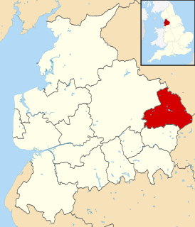
Trawden Forest is a civil parish in Pendle, Lancashire, England. It contains 39 listed buildings that are recorded in the National Heritage List for England. Of these, six are at Grade II*, the middle grade, and the others are at Grade II, the lowest grade. The parish contains the village of Trawden and the hamlets of Cottontree, Winewall, and Wycoller, and is otherwise completely rural. Most of the listed buildings are houses and associated structures, farmhouses and farm buildings. Six bridges are listed, two clapper bridges, a packhorse bridge, two medieval or post-medieval bridges, and a 19th-century road bridge. The other listed buildings include a group of medieval stones, the ruins of a former large house, and a public house.
Barton is a civil parish in the City of Preston, Lancashire, England. It contains ten listed buildings that are recorded in the National Heritage List for England. Of these, one is at Grade II*, the middle grade, and the others are at Grade II, the lowest grade. The parish contains the village of Barton and surrounding countryside. Running through it is the Lancaster Canal, and a bridge crossing it and an aqueduct are listed. The other listed buildings include farm buildings, milestones, a church, and a cross.
Whittingham is a civil parish in the City of Preston, Lancashire, England. It contains 17 listed buildings that are recorded in the National Heritage List for England. Of these, one is at Grade II*, the middle grade, and the others are at Grade II, the lowest grade. The parish contains the village of Whittingham and part of the village of Goosnargh, and is otherwise mainly rural. It also contains the former Whittingham Hospital. Most of the listed buildings in the parish are houses and associated structures, farmhouses, and farm buildings. The other listed buildings are a restored wayside cross, a public house, and the former chapel of the hospital.
Woodplumpton is a civil parish in the City of Preston, Lancashire, England. It contains 20 listed buildings that are recorded in the National Heritage List for England. Of these, one is at Grade II*, the middle grade, and the others are at Grade II, the lowest grade. The parish contains the villages of Woodplumpton and Catforth, and the smaller settlements of Eaves and Lower Bartle, but is otherwise rural. The Lancaster Canal passes through the parish, and three bridges crossing it are listed. The oldest building in the parish is St Anne's Church; this and four structures associated with it, or nearby, are listed. The other listed buildings are houses and associated structures, farmhouses, and farm buildings.
Downham is a civil parish in Ribble Valley, Lancashire, England. It contains 43 listed buildings that are recorded in the National Heritage List for England. Of these, three are at Grade II*, the middle grade, and the others are at Grade II, the lowest grade. The parish contains the village of Downham and surrounding countryside. Most of the listed buildings are in the village, and include Downham Hall and associated structures, houses and cottages, a church, a public house, a school, milestones, a bridge, and a set of stocks. Outside the village the listed buildings are farmhouses and farm buildings.
Horton is a civil parish in Ribble Valley, Lancashire, England. It contains 14 listed buildings that are recorded in the National Heritage List for England. Of these, one is at Grade II*, the middle grade, and the others are at Grade II, the lowest grade. The parish contains the village of Horton, surrounding countryside, and part of the grounds of Gisburne Park. Most of the listed buildings are houses and associated structures, farmhouses and farm buildings. The other listed buildings include a bridge, a chapel, a boundary stone, and a milestone.
West Bradford is a civil parish in Ribble Valley, Lancashire, England. It contains nine listed buildings that are recorded in the National Heritage List for England. All of the listed buildings are designated at Grade II, the lowest of the three grades, which is applied to "buildings of national importance and special interest". The parish contains the village of West Bradford and surrounding countryside. Most of the listed buildings are house, farmhouses and associated structures, the others comprising a public house and a bridge.
Scarisbrick is a civil parish in the West Lancashire district and borough of Lancashire, England. It contains 32 buildings and structures that are recorded in the National Heritage List for England as designated listed buildings. Of these, one is listed at Grade I, the highest of the three grades, and the others are at Grade II, the lowest grade. The most significant building in the parish is Scarisbrick Hall which is listed at Grade I, with several associated structures being listed separately. The parish is a collective of smaller hamlets and is largely rural. Many of the listed buildings are houses, farmhouses or other agricultural buildings that have since been repurposed as dwellings, while the others include a telephone kiosk and the Roman Catholic Church of St Elizabeth.
Burscough is a civil parish in the West Lancashire district of Lancashire, England. It contains 38 buildings that are recorded in the National Heritage List for England as designated listed buildings. Of these, two are at Grade II*, the middle grade, and the others are at Grade II, the lowest grade. The parish contains the large village of Burscough, the rural hamlet of Tarlscough, and the surrounding countryside. Passing through the parish is the Leeds and Liverpool Canal, and the junction between the canal and its Rufford Branch is in the parish. Also passing through the parish are the railways of the Ormskirk - Preston and the Manchester-Southport Lines, which cross in the parish. The oldest listed buildings are farmhouses and farm buildings, and houses and cottages. Associated with the canal are the structures at the junction, bridges and a lock. Associated with the railways are station buildings and a bridge. The other listed buildings include churches, a war memorial, and a former mill and its offices.
Dalton is a civil parish in the West Lancashire district of Lancashire, England. It contains ten buildings that are recorded in the National Heritage List for England as designated listed buildings. Of these, one is at Grade II*, the middle grade, and the others are at Grade II, the lowest grade. The parish contains the village of Dalton, and is otherwise rural. Most of the listed buildings are farmhouses, or houses and associated structures, the others being a church, and a landmark in the form of a beacon.
Tarleton is a civil parish in the West Lancashire district of Lancashire, England. It contains 19 buildings that are recorded in the National Heritage List for England as designated listed buildings. Of these, one is at Grade II*, the middle grade, and the others are at Grade II, the lowest grade. The parish contains the village of Tarleton, the hamlets of Holmes, Mere Brow and Sollom, and surrounding countryside. The Rufford Branch of the Leeds and Liverpool Canal and the River Douglas pass through the parish, and bridges crossing these are listed. The other listed buildings include farmhouses, farm buildings, other houses, a medieval cross base, a church, a war memorial, and a canal warehouse.
Catterall is a civil parish in the Wyre district of Lancashire, England. It contains eight listed buildings that are recorded in the National Heritage List for England. All the listed buildings are designated at Grade II, the lowest of the three grades, which is applied to "buildings of national importance and special interest". The parish includes the village of Catterall and the surrounding countryside. The Lancaster Canal and the River Calder run through the parish, and the listed buildings associated with these are bridges and an aqueduct. The other listed buildings are two medieval cross bases, a farmhouse with an associated barn, and a milestone.