Port of Whitby

Last updated

Port of Whitby
Whitby Harbour (149559325).jpeg
Whitby Harbour looking upriver
Port of Whitby
Location
Country England
Location Whitby, North Yorkshire
Coordinates 54°29′06″N0°36′43″W / 54.485°N 0.612°W / 54.485; -0.612
GB Gridref NZ899108
UN/LOCODE GB GWB
Details
Owned by
  • WHC (1702–1906)
  • WUDC (1906–1974)
  • SBC (1974–2023)
  • NYC (2023–)
Type of harbour River natural

The Port of Whitby is an ancient and historic seaport on the North Yorkshire coast of England. The port lies at the mouth of the River Esk, where it enters into the North Sea. A port has been in existence at Whitby since at least the 7th century, when it was used to bring in supplies for Whitby Abbey. The port is famous for being the port of origin for the sailings of Captain Cook, and some of the ships that he sailed on were also built in the harbour.

Contents

Commercial cargo ceased in the late 20th century, however, the port is still an important location for the landing of fish.

History

Panoramic view of Whitby Harbour from A171 road bridge over River Esk - panoramio.jpg
Panoramic view of Whitby Harbour from A171 road bridge over River Esk

No records exist of actual dates when the port started, but fish were being landed at Whitby during the time that the first abbey had been built in 657. [1] It is thought that the port was in what is now the upper harbour (south of the swing bridge, as coastal erosion had not yet subjected the lower harbour cliff walls to collapse, making that side of the estuary too steep to house piers). [2] William de Percy granted the port to the abbey at Whitby, a grant which was confirmed by William II sometime before 1096. [3] In 1122, a dispute was recorded in the collection of tithes from fishermen due to the abbot, which also noted that coal was imported into Whitby. [4]

During the Middle Ages and into the 18th century, the ports of England were administered by the Exchequer, who divided the ports into the main ports, with lesser ports on the coast near to them being labelled as creco or creek ports. Whitby was a creek port of Newcastle with a reach to what is Spital Bridge in the town, but the authority of the port later reached upstream to the tidal limit of Ruswarp. [5]

The port was never equal to other ports in the area such as Hull or Middlesbrough. This is due to the hinterland that surrounded the port, with Whitby being largely cut-off from overland travel until the 18th and 19th centuries, it had no great industries to export or import for, being surrounded on all sides of the river by moorland (except for the coast to the north). [6] [7] Trade through the port accelerated with the coming of the railways, but its main function was either as a shelter for ships from storms in the North Sea, or as a re-supply point. Between 1702 and 1704, the number of collier ships alone totalled 98, Bridlington, Hull and Scarborough only hosted 48, 28 and 54 respectively. [8] The safe haven almost guaranteed at Whitby (and at Scarborough and Bridlington too), allowed the port to charge a levy towards the upkeep of the harbour and piers. [9] The levy also applied to passing trade of coal from many north-eastern locations, with the levy not being rescinded until 1861. [10]

During the era of timber shipbuilding (mid 16th–late 19th centuries), vessels would arrive from the St. Lawrence Rivercarrying timber, masts and bowsprits. These vessels were too large to enter the harbour, and would unload their cargo onto smaller ships in the Whitby Roads. [note 1] The smaller craft would then enter the harbour to unload the delivery on the dockside. [14] Another method of offloading goods from the ship without actually entering Whitby harbour was to beach the vessel on the sand. This was a common practice for delivering coal to places such as Sandsend, [note 2] and for which, the Whitby Cats (a flat-bottomed boat), was specifically designed for. [17] [18]

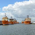
A survey in the 1950s determined that the port at Whitby was not as successful as other neighbouring cargo ports such as Hull, Teesside and West Hartlepool, on account of its lack of urban sprawl, and the absence of warehouses on the dock side with which to store goods in a safe manner before onward export, or inward transportation. [19] It also suffered a loss of traffic due to the depth of the water in the harbour; as the sailing ships gave way to first paddle steamers, and then steel boats of even bigger sizes, the newer ships could not negotiate into the harbour. [20]

Whitby's port was divided into two main sections; the upper harbour south of the swing bridge, and the lower harbour, north of the swing bridge. [21] The lower harbour has been the location of the fish markets during the 20th and 21st centuries. In 1956, a new fish quay was built adjacent to Pier Road on the west bank of the River Esk. Dredging along the lower harbour had damaged the previous fish quay which had been built in 1914. [22] The fish market in Whitby port increased after the railways arrived in the town as this allowed fresh fish to be dispatched across the country at a faster pace than delivered by boat. [23]

Part of the upper harbour area was converted into a marina between 2008 and 2010. [24]

21st century port

The inner harbour Inner Harbour, Whitby - geograph.org.uk - 2626321.jpg
The inner harbour

The maximum DWT in the port is 3,000 tonnes (3,300 tons), with a length of 85 metres (279 ft), a beam of 15 metres (49 ft) and a draught of 6 metres (20 ft). [25] However, cargo trade, except for fish-landing, ceased in the year 2000. [26]

Commodities

Historically, the port was known for its involvement in the export of alum, and the importing of timber, nominally for building ships. [27] Timber, flax and hemp were imported from the Baltic states during the 18th and 19th centuries, but this was to further the shipbuilding, and during the winter months even more importantly, the ship repairing trade due to Whitby's location as a safe port. [28] However, its most lasting and notable trade has been in the landing of fish and the whale industry. [29] In the 17th century, herring were being exported to Scotland, and the associated herring industry required the import of salt. [30]

In the early 17th century, the record books begin to show more and more trade within the port due to the accelerated demand of the alum industry. Coal is shown as increasing rapidly, though peat burning was still being used in domestic capacities, so the increase in coal volumes is tied to the alum-making. [31] A storehouse for coal was built near Haggersgate, a road in the town on the west bank of the harbour where the new fish quay is. [32] Also imported were malt, rye and wine. Exports were finished alum, the bark stripped from timber being used for shipbuilding, and sailcloth. [32] One of the oddest commodities imported into the harbour was human urine. The alum industry required ammonia as part of its process, and the easiest source of this at the time was human urine. Whilst some came in from local areas, it was brought in from as far afield as Newcastle and London. [33] [34]

In 1675, the port was handling alum, ham, butter, salt and fish. [35] Several alum works existed in the area around Whitby, and so the port offered a natural point of offloading. This in turn generated export of alum, and the import of timber, so that Whitby could build its own ships to transport the goods needed, and export the finished alum itself. [36] The landing of whales at Whitby flourished between 1753 and 1835, concentrated on the Northern Whale Fishery around Greenland. No attempt was made by Whitby boats to try whaling in Antarctica , the favoured region by whalers sailing from Hull and London. [37] However, the whaling industry in Whitby was described as a "losing concern" in a government report of 1833 as oil was available from other sources. [38] Between 1753 and 1835, a total of 2,687 whale carcasses were brought back to the port, an average of 32 per year. [39] The rendering of whale blubber was undertaken further upriver than the port, around the area where Larpool Viaduct now stands. [22] The waste from the blubber to oil process, known locally as Fenks, was exported from the port as a manure. [40]

A sample of imports and exports from 1790 shows that imports consisted of fruit, wine, spices and other foods, but most critically, the greatest tonnage came in the form of oars, anchors, pitch, oakum, timber, hemp, rope, cordage, linen and hessian canvas, all of which were essential to the shipbuilding industry. [41] The balance in the exports was a less comprehensive list but included wines, tar, alum, bacon, ham, butter, oats, ale, whale products and dried fish. Again, items associated with the shipbuilding industry are present, but the most interesting export was sleepers and pit props, of which nearly 17,000 were dispatched by ship. [42]

In the 19th century, coal which was formerly offloaded at Whitby, started to arrive in the town via the railway. As most collieries were connected to the railway, and the loading charges for taking wagons over the railway had already been paid by the colliery, having to then trans-ship the coal to a boat to deliver within the UK was uneconomically viable at that time. [43] Iron ore and iron products were exported through Whitby by the South Cleveland Iron Works, who had a smelter at Grosmont, some 6 miles (9.7 km) south of Whitby accessible by the Whitby & Pickering Railway. [44] [45] Smaller iron ore concerns also used the port, with most being transferred to either Teesside or Tyneside by ship, but this was short-lived in the face of the increasing railway network and the quick exhaustion of iron ore seams in the area. [46] [47] Buoyed by the arrival of the railways, minerals were exported through the port, and local sandstone from Aislaby was sent to London to build London Bridge and the Houses of Parliament. [48]

Whilst ferries are not known to have operated from Whitby, shipping did take passengers in the form of convicts transported to Australia and emigrants to Canada, usually to St Lawrence in the 1820s and 1830s. [49]

Owners

See also

Notes

  1. The Whitby Roads is an area of deeper water (typically between 3–6 fathoms (18–36 ft; 5–11 m)), away from the harbour mouth. Ships could wait here for the tide to be right for entering the harbour, or could offload onto smaller craft. [11] [12] [13]
  2. The road between Whitby and Sandsend was actually on the beach in the middle of the 19th century, which would make it impassable when the tide was in. A Whitby Cat was able to deliver its coal direct to Sandsend without the product having to be trans-shipped from ship to horse and cart and then taken along the beach. [15] [16]

Related Research Articles

<span class="mw-page-title-main">Padstow</span> Town in Cornwall, England

Padstow is a town, civil parish and fishing port on the north coast of Cornwall, England, United Kingdom. The town is situated on the west bank of the River Camel estuary, approximately 5 miles (8.0 km) northwest of Wadebridge, 10 miles (16 km) northwest of Bodmin and 10 miles (16 km) northeast of Newquay. The population of Padstow civil parish was 3,162 in the 2001 census, reducing to 2,993 at the 2011 census. In addition an electoral ward with the same name exists but extends as far as Trevose Head. The population for this ward is 4,434.

<span class="mw-page-title-main">Whitby</span> Coastal town in North Yorkshire, England

Whitby is a seaside town, port and civil parish in North Yorkshire, England. It is on the Yorkshire Coast at the mouth of the River Esk. It has a maritime, mineral and tourist economy. The fishing port emerged during the Middle Ages, supporting important herring and whaling fleets, and was where Captain Cook learned seamanship and, coincidentally, where his first vessel to explore the southern ocean, HMS Endeavour, was built. Jet and alum were mined locally, and Whitby jet, which was mined by the Romans and Victorians, became fashionable during the 19th century.

<span class="mw-page-title-main">River Esk, North Yorkshire</span> River in North Yorkshire, England

The River Esk is a river in North Yorkshire, England that empties into the North Sea at Whitby after a course of around 28 miles (45 km) through its valley of Eskdale. The river's name is derived from the Brythonic word "isca" meaning "water". The Esk is the only major river in Yorkshire that flows directly into the North Sea; all other watercourses defined as being major rivers by the Environment Agency, either flow to the North Sea via the River Tees or the Humber Estuary.

<span class="mw-page-title-main">Sandsend Ness</span> Alum quarrying site in North Yorkshire, England

Sandsend Ness is an old alum quarrying site close to Whitby in North Yorkshire, England.

<span class="mw-page-title-main">Malton railway station</span> Railway station in North Yorkshire, England

Malton railway station is a Grade II listed station which serves the towns of Malton and Norton-on-Derwent in North Yorkshire, England. Situated on the York-Scarborough Line, it is operated by TransPennine Express, who provide all passenger train services. Once an interchange between four lines, Malton station is now only served by trains operating between York and Scarborough. The station itself is south of the River Derwent, and is actually in the town of Norton in the East Riding of Yorkshire, which for many years was in a different county to Malton.

<span class="mw-page-title-main">Whitby, Redcar and Middlesbrough Union Railway</span> Former railway line in Yorkshire, England

The Whitby, Redcar and Middlesbrough Union Railway (WRMU), a.k.a. the Whitby–Loftus Line, was a railway line in North Yorkshire, England, built between 1871 and 1886, running from Loftus on the Yorkshire coast to the Esk at Whitby, and connecting Middlesbrough to Whitby along the coast.

<span class="mw-page-title-main">Whitby West Cliff railway station</span> Former railway station in the North Riding of Yorkshire, England

Whitby West Cliff railway station was a railway station on the Whitby Redcar and Middlesbrough Union Railway. It was opened on 3 December 1883, to serve the West Cliff area of the town of Whitby, North Yorkshire, England. It was one of two stations serving Whitby; the other was Whitby Town railway station, which served the lines to Malton and Battersby.

<span class="mw-page-title-main">Sandsend railway station</span> Former railway station in the North Riding of Yorkshire, England

Sandsend railway station was a railway station on the Whitby, Redcar and Middlesbrough Union Railway. It was opened on 3 December 1883, and served the villages of Sandsend and Lythe. It closed on 5 May 1958. The station building is now a private residence. It was the only station between Whitby and Loftus not to possess a passing loop.

<span class="mw-page-title-main">Staithes railway station</span> Former railway station in the North Riding of Yorkshire, England

Staithes railway station was a railway station on the Whitby Redcar and Middlesbrough Union Railway, serving the villages of Staithes and Dalehouse in North Yorkshire, England. It was opened on 3 December 1883.

<span class="mw-page-title-main">Whitby and Pickering Railway</span> Railway company and line in North Yorkshire, England

The Whitby and Pickering Railway (W&P) was built to halt the gradual decline of the port of Whitby on the east coast of England. Its basic industries—whaling and shipbuilding—had been in decline and it was believed that opening transport links inland would help regenerate the town and port.

<span class="mw-page-title-main">Falmouth Docks</span> Port in United Kingdom

Falmouth Docks are a deep-water docks of the town of Falmouth in Cornwall, England, United Kingdom. The docks are the southern shore of the Fal Estuary which is the third largest natural harbour in the world and the deepest in Europe. They extend over 30 hectares and covers a range of services to shipping such as repair, refuelling, cleaning and disposal of waste services. The docks are served by the Falmouth Docks railway station. Policing is by the Falmouth Docks Police.

<span class="mw-page-title-main">Saltwick Bay</span> Bay in North Yorkshire, England

Saltwick Bay is a north-east facing bay approximately one mile (1.6 km) to the east of Whitby, on the east coast of North Yorkshire, England. The bay contains the Saltwick Nab alum quarries, listed under the Ancient Monuments and Archaeological Areas Act 1979. The bay is part of the Saltwick Formation and known for its collections of fossils. The SS Rohilla hospital ship sank in the bay in 1914, and the fishing trawler Admiral Van Tromp was shipwrecked there in 1976. The bay is accessible through Whitby Holiday Park.

<span class="mw-page-title-main">Yorkshire coast fishery</span> History of sea fishing in Yorkshire, England

The Yorkshire coast fishery has long been part of the Yorkshire economy for centuries. The 114-mile (183 km) Yorkshire Coast, from the River Tees to the Humber estuary, has many ports both small and large where the fishing trade thrives. The historic ports at Hull and Whitby are important locations for the landing and processing of fish and shellfish. Scarborough and Bridlington are also sites of commercial fishing.

<span class="mw-page-title-main">Ship and boat building in Whitby</span> Shipbuilders in Whitby, Yorkshire, England

Ship and boat building in Whitby was a staple part of the industry of Whitby, North Yorkshire, England between the 17th and 19th centuries. In 1792 and 1793, Whitby was the second largest ship-building port in England and Wales. Building continued throughout the 20th century but on a smaller scale both in terms of output and overall size of the vessels being built.

<span class="mw-page-title-main">Kettleness</span> Hamlet in North Yorkshire, England

Kettleness, is a hamlet in the Scarborough District of North Yorkshire, England. The settlement only consists of half-a-dozen houses, but up until the early 19th century, it was a much larger village. However, most of that village, which was on the headland, slipped into the sea as a result of instability caused by quarrying for the alum industry. Kettleness became a smaller settlement, with houses rebuilt slightly further inland.

<span class="mw-page-title-main">Grinkle Mine</span> Former ironstone mine in North Yorkshire, England

Grinkle Mine, was an ironstone mine working the main Cleveland Seam near to Roxby in North Yorkshire, England. Initially, the ironstone was mined specifically for the furnaces at the Palmer Shipbuilders in Jarrow on the River Tyne, but later, the mine became independent of Palmers. To enable the output from the mine to be exported, a 3-mile (4.8 km) narrow-gauge tramway was constructed that ran across three viaducts and through two tunnels to the harbour of Port Mulgrave, where ships would take the ore directly to Tyneside.

<span class="mw-page-title-main">Ironstone mining in Cleveland and North Yorkshire</span> Ironstone mines and quarries in Cleveland and North Yorkshire, England

Ironstone mining in Cleveland and North Yorkshire occurred on a sizeable scale from the 1830s to the 1960s in present day eastern parts of North Yorkshire but has been recorded as far back as Roman times in mostly a small-scale and intended for local use. This Cleveland is not to be confused with a smaller area covered by the county of Cleveland from 1974-96.

<span class="mw-page-title-main">Whitby engine shed</span> Former railway locomotive depot in North Yorkshire, England

Whitby engine shed was a steam locomotive depot located at the south end of Whitby railway station in North Yorkshire, England. The shed was opened in 1847, extended in the 1860s, and closed in 1959, when the closure of lines and dieselisation of the routes from Whitby took hold. The shed building, which was grade II listed in 1991, still stands, being utilised for various enterprises, and is now used as holiday accommodation.

<span class="mw-page-title-main">Piers of Whitby</span> Piers in Yorkshire, England

The piers of Whitby are four structures along the River Esk estuary in Whitby, North Yorkshire, England. Whilst all the piers can be accessed by the general public, the piers were not built as seaside attractions – so-called pleasure piers like Redcar, Saltburn or Withernsea – but rather serving a civil purpose, such as ship loading and protecting the harbour. The main West and East piers in the town were built to provide shelter from the currents and storms of the North Sea, and in the 18th and 19th centuries, any ships seeking refuge in the harbour were charged a levy for use of Whitby's safe haven. These levies were used to pay for the maintenance and improvement of the piers.

<span class="mw-page-title-main">Eskdale Anticline</span> Geological feature of North Yorkshire, England

The Eskdale Anticline is a dip-slip fault at Whitby in North Yorkshire, England. The anticline was thought to have stretched for approximately 20 kilometres (12 mi) in a north–south direction underneath the mouth of the River Esk in Whitby, with a depth of 200 feet (61 m). However, modern geological studies have cast doubt on this, with a suggested displacement of only 12 metres (39 ft).

References

  1. Thompson & Frost 2016, p. 5.
  2. Daysh 1958, p. 54.
  3. Page 1968, p. 504.
  4. Hall 2013, p. 11.
  5. Barker 2011, p. 21.
  6. East 1932, pp. 484, 489.
  7. Daysh 1958, p. 51.
  8. Jones 1982, p. 43.
  9. Robinson 2009, p. 76.
  10. Robinson 2009, p. 85.
  11. Barker 2011, p. 54.
  12. "England's Historic Seascapes: Scarborough to Hartlepool". archaeologydataservice.ac.uk. Retrieved 12 April 2023.
  13. Twinn, Frances Elizabeth (1999). 'Half-finished streets', 'Illimitable horizons' and 'Enclosed intimacy' : the landscapes of Elizabeth Gaskell's writing (Thesis). Durham: Durham University. p. 282. OCLC   912675198.
  14. Weatherill 1908, p. 25.
  15. Thompson & Frost 2016, p. 19.
  16. Waters, Colin (2011). A history of Whitby & its place names. Stroud: Amberley. plate 2. ISBN   978-1-4456-0429-9.
  17. Lewis, Stephen (12 August 2013). "Exploring the heroic legacy of Captain James Cook". York Press. Retrieved 12 April 2023.
  18. Sutcliffe, Frank Meadow (1974). Frank Meadow Sutcliffe, Hon. F.R.P.S. : Whitby and its people as seen by one of the founders of the naturalistic movement in photography. A selection of his work. Whitby: Sutcliffe Gallery. p. 9. ISBN   0950317500.
  19. Daysh 1958, p. 120.
  20. Lees, Lynn Hollow (2000). "1: Urban Networks". In Daunton, Martin (ed.). The Cambridge urban history of Britain. Cambridge: Cambridge University Press. p. 92. ISBN   0-521-41707-4.
  21. East 1932, p. 488.
  22. 1 2 Daysh 1958, p. 251.
  23. Robinson 2009, p. 82.
  24. Branagan, Mark (11 June 2010). "Seaside mayors open 'whalebone' marina building after long delay". The Yorkshire Post. p. 9. ISSN   0963-1496.
  25. "Freight Forwarding - Whitby Shipping Services". whitbyshipping.co.uk. Retrieved 29 March 2023.
  26. "Removal of pilotage functions at Scarborough and Whitby harbour". GOV.UK. 7 April 2021. Retrieved 29 March 2023.
  27. Daysh 1958, p. 248.
  28. East 1932, p. 490.
  29. Murphy, P. (2009). The English coast : a history and a prospect. London: Continuum. p. 88. ISBN   9781441145147.
  30. Barker 2011, p. 22.
  31. Thompson & Frost 2016, p. 54.
  32. 1 2 Barker 2011, p. 26.
  33. Newton, Grace (17 April 2019). "The strange story of why human urine was transported to quarries in Yorkshire". The Yorkshire Post. Retrieved 5 April 2023.
  34. "Point 7 - Alum". www.bbc.co.uk. Retrieved 5 April 2023.
  35. East 1932, p. 487.
  36. Daysh 1958, p. 249.
  37. Jones 1982, pp. 276, 289.
  38. Report from the Select Committee on Manufactures, Commerce, and Shipping. London: House of Commons. 1833. p. 700. OCLC   1204858113.
  39. Jones 1982, pp. 302–303.
  40. East 1932, p. 491.
  41. Jones 1982, pp. 226–228.
  42. Jones 1982, pp. 229–230.
  43. Daysh 1958, p. 227.
  44. Padgett, David (2016). Railway track diagrams. Book 2, Eastern. Beckington, Frome: Trackmaps (Firm). 48C. ISBN   978-0-9549866-8-1.
  45. "The South Cleveland Iron Works Ltd". The Times. No. 27292. Column B. 6 February 1872. p. 13. ISSN   0140-0460.
  46. Whellan, T. (1859). History and Topography of the City of York and the North Riding of Yorkshire. Beverley: Welland & Co. p. 293. OCLC   504050072.
  47. Weatherill 1908, p. 24.
  48. Hall 2013, p. 13.
  49. East 1932, p. 489.
  50. Jones 1982, p. 408.
  51. 1 2 Robinson 2009, p. 87.
  52. 1 2 Numminen, Anttoni James (26 January 2023). "Scarborough Council 'envisages' three-day hearing on Whitby Harbour legal dispute". Scarborough News. Retrieved 12 April 2023.
  53. "Local Governance – Whitby Community Network". whitbycommunitynetwork.org. Retrieved 13 April 2023.

Sources