
The M180 is a 25.5-mile (41 km) motorway in eastern England, starting at junction 5 on the M18 motorway in Hatfield, within the Metropolitan Borough of Doncaster, South Yorkshire, and terminating at Barnetby, Lincolnshire, some 10 miles (16 km) from the port of Immingham and 14 miles (23 km) from the port of Grimsby. The A180 road continues to the east for Grimsby, Cleethorpes and Immingham. Scunthorpe, Lincoln, Hull, Brigg, Bawtry and the Isle of Axholme can be accessed using the motorway. Humberside Airport, the now-closed Doncaster Sheffield Airport, and the Killingholme, Humber and Lindsey oil refineries are close to the motorway. The road forms part of the unsigned Euroroute E22 and is the main route along the south bank of the Humber Estuary.
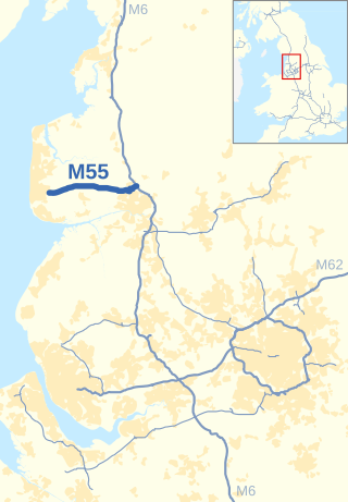
The M55 is a motorway in Lancashire, England, which can also be referred to as the Preston Northern Bypass. It connects the seaside resort of Blackpool to the M6 at Preston. It is 12.2 miles (19.6 km) in length.

Broughton is a village and civil parish in the City of Preston, Lancashire, England, approximately 4 miles (6 km) north of Preston city centre. According to the 2001 census it had a population of 1,735, decreasing to 1,722 at the 2011 Census, increasing to 2,467 at the 2021. The parish is included in Preston Rural East ward of Preston city council, and the Preston Rural division of Lancashire County council.
The Blackpool branch lines are two railway lines running from the West Coast Main Line at Preston to Blackpool. The main branch, which is double tracked and electrified, runs to Blackpool North station via Poulton-le-Fylde. A second branch, which is single tracked and unelectrified, diverges from the main branch at Kirkham and Wesham junction, running on a southerly route to Blackpool South station via Lytham.

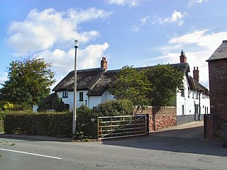
Hambleton is a village and civil parish in the English county of Lancashire. It is situated on a coastal plain called the Fylde and in an area east of the River Wyre known locally as Over Wyre. Hambleton lies approximately 3 miles (4.8 km) north-east of its post town, Poulton-le-Fylde, and about 7 miles (11 km) north-east of the seaside resort of Blackpool. In the 2001 United Kingdom census, the parish had a population of 2,678, increasing to 2,744 at the 2011 census.
The Fleetwood branch line is a railway line that ran from Preston to Fleetwood. It passed through many smaller stations along the way, most of which are now closed. When work at Fleetwood docks was under threat in the mid-1960s, the main Fleetwood station was closed, and the remainder of the branch south to Poulton followed in 1970. There are active proposals to re-open the branch to passenger services.
The A583 is a primary road from Preston to Blackpool in England, via Kirkham. It runs a distance of 17 miles (27.4 km), and was previously the main route into Blackpool until the construction of the M55 motorway.
The Fylde is a coastal plain in western Lancashire, England. It is roughly a 13-mile-long (21-kilometre) square-shaped peninsula, bounded by Morecambe Bay to the north, the Ribble estuary to the south, the Irish Sea to the west, and the foot of the Bowland hills to the east which approximates to a section of the M6 motorway and West Coast Main Line.
Medlar-with-Wesham is a civil parish and an electoral ward on the Fylde in Lancashire, England, which contains the town of Wesham. It lies within the Borough of Fylde, and had a population of 3,245 in 1,294 households recorded in the 2001 census rising to 3,584 in 1,511 households, at the 2021 census.
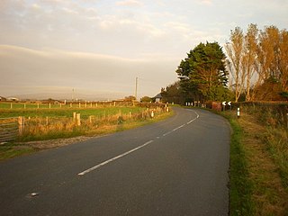
The A588 is a road in England which runs from Poulton-le-Fylde to Lancaster in Lancashire. It is the main route serving the Over Wyre areas of the Fylde.

The A587 is a road in England that runs from Blackpool to Fleetwood in Lancashire.

The A586 is a road in England, which runs from Garstang to Blackpool, in Lancashire.
Greenhalgh-with-Thistleton is a civil parish on the Fylde in Lancashire, England. In 2001 it had a population of 462, falling to 439 at the 2011 Census.

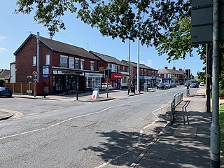
Burn Naze is a residential area of Thornton-Cleveleys, in the Borough of Wyre, Lancashire, England. It is located about 5 miles (8 km) northeast of Blackpool and 2 miles (3 km) southeast of Fleetwood. Cleveleys is about 1.3 miles (2.1 km) to the west, while the River Wyre is about 0.8 miles (1.3 km) to the east.

Skippool is an area of Thornton-Cleveleys, Lancashire, England. It is situated between Little Thornton and Poulton-le-Fylde along the western banks of the River Wyre, about three miles south of its mouth between Fleetwood and Knott End. These banks are known as Skippool Creek, an historic docks area now home to mostly run-down vessels. The MV Good Hope, for example, may date from the 1830s. Skippool Creek is a short branch off Main Dyke, which empties into the River Wyre in front of Blackpool and Fleetwood Yacht Club.
Mill Farm Sports Village is a multi-sport facility located on the outskirts of the town of Wesham in the Borough of Fylde in Lancashire, England. Facilities include the Mill Farm football stadium, home to the football team AFC Fylde since 2016, and several 3G football and hockey pitches.

Norcross Roundabout is a major traffic roundabout in the English village of Thornton, Lancashire. It was built at the junction of the A585, the B5268 Fleetwood Road South and Norcross Lane. As of 2020, an average of 28,000 vehicles utilise the roundabout each day.
Public transport in the Fylde is available for three modes of transport—bus, rail and tram—assisting residents of and visitors to the Fylde, a coastal plain in western Lancashire, England, without their own vehicle, to travel around much of the area's 64 square miles (170 km2).
Victoria Road is a major thoroughfare in Thornton-Cleveleys, Lancashire, England. Originally known as Ramper Road, it runs for about 2 miles (3.2 km) from Station Road in Thornton, in the east, to South Promenade in Cleveleys, in the west. Its addresses are denoted as "Victoria Road East" or "Victoria Road East", the split occurring at the Amounderness Way roundabout carrying traffic of the A585 between Poulton-le-Fylde and Fleetwood. The road picks up the B5412 designation from Station Road until The Crescent and Brighton Avenue in Cleveleys.
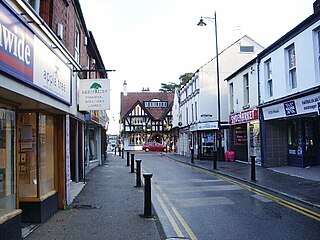
Breck Road is a road in Poulton-le-Fylde, Lancashire, England. Originally known as Breck Street, it runs for about 0.79 miles (1.27 km) from Chapel Street, Ball Street and Vicarage Road in the south to Amounderness Way in the north.

