The A483, officially described as the Swansea to Manchester Trunk Road, although now ending in Chester, is a major road in the United Kingdom. It runs from Swansea in Wales to Chester in England via Llandovery, Llandrindod Wells, Oswestry and Wrexham, a distance of around 153 miles (246 km).

The Ellesmere Canal was a waterway in England and Wales that was planned to carry boat traffic between the rivers Mersey and Severn. The proposal would create a link between the Port of Liverpool and the mineral industries in north east Wales and the manufacturing centres in the West Midlands. However, the canal was never completed as intended because of its rising costs and failure to generate the expected commercial traffic.

The Shropshire Union Canal, nicknamed the "Shroppie", is a navigable canal in England. The Llangollen and Montgomery canals are the modern names of branches of the Shropshire Union (SU) system and lie partially in Wales.

Ellesmere is a town in the civil parish of Ellesmere Urban, in Shropshire, England, located near the Welsh border and the towns of Oswestry and Whitchurch, and the Welsh city of Wrexham. It is notable for its proximity to a number of prominent meres.
The Maelor is an area of north-east Wales along the border with England. It is now entirely part of Wrexham County Borough.

Overton or Overton-on-Dee is a village and community in Wrexham County Borough, Wales. It is situated close to the Welsh-English border on the edge of an escarpment that winds its way around the course of the River Dee, from which Overton-on-Dee derives its name.

Clwyd South is a constituency of the House of Commons of the Parliament of the United Kingdom (Westminster). The constituency was created in 1997, and it elects one Member of Parliament (MP) by the first past the post method of election.
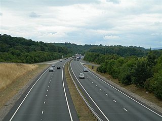
The A5124 is a road in Shropshire, England, that forms part of the northern section of the Shrewsbury by-pass. It is known locally as the Battlefield Link Road.
Maelor was a rural district in the administrative county of Flintshire, Wales, from 1894 to 1974. The area approximated to the hundred of Maelor or English Maelor, and was notable for forming a detached part of the county, surrounded by Cheshire, Denbighshire and Shropshire. The administrative centre was located at Overton.

The A525 is a major route from Rhyl in Wales to Newcastle-under-Lyme in England. The route passes near Denbigh, through Ruthin, through Wrexham and near Whitchurch.

Clwyd South is a constituency of the Senedd. It elects one Member of the Senedd by the first past the post method of election. Also, however, it is one of nine constituencies in the North Wales electoral region, which elects four additional members, in addition to nine constituency members, to produce a degree of proportional representation for the region as a whole.

The A541 is an A road in North Wales. The road starts on the A525 in Trefnant, between St Asaph and Denbigh, and ends in Wrexham. On the way, it passes the town of Mold. It also passes through many villages. In northern-central Wrexham it joins the B5101 road.

Marchwiel is a village and community in Wrexham County Borough, Wales.
The Whitchurch and Tattenhall Railway was a line in Cheshire built by the London and North Western Railway in the 19th century. The branch, which was 14.5 mi (23.3 km) long, connected the North Wales Coast Line from Chester with the Welsh Marches line and Oswestry, Ellesmere and Whitchurch Railway at Whitchurch. Although only a branch line, the route was built to main line standards with double track along its entire length. It was used on occasion to stable the British Royal Train in sidings on the eve of official visits by members of the Royal Family.

Sesswick is a community in Wrexham County Borough, Wales. It lies south-east of Wrexham near Marchwiel. The population of the community at the 2011 Census was 609.
The Wrexham and Ellesmere Railway was a railway line that ran from Wrexham in North Wales, to Ellesmere in Shropshire, England. The line opened in 1895 and closed in 1962, except for a residual goods service which itself closed in 1981.
Marchwiel Hall is a Grade II listed building in the village of Marchwiel, Wrexham County Borough in North Wales.

