| A570 | |
|---|---|
| Major junctions | |
| South end | M62 Junction 7 |
| North end | Southport (Lord Street) |
| Location | |
| Country | United Kingdom |
| Road network | |
The A570 is a primary route in Northern England, that runs from St Helens to Southport.
| A570 | |
|---|---|
| Major junctions | |
| South end | M62 Junction 7 |
| North end | Southport (Lord Street) |
| Location | |
| Country | United Kingdom |
| Road network | |
The A570 is a primary route in Northern England, that runs from St Helens to Southport.
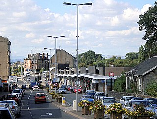
Until the early 1970s, the road ran from a junction with the A57 road at Bold Heath, four miles west of Warrington. The road currently begins at junction 7 (Rainhill Stoops) of the M62 motorway in Merseyside, and runs in a northerly direction as a dual carriageway through the centre of St Helens, meeting the A58 road, then the A580 road to the north of the town. The road continues in a north-westerly direction, bypassing Rainford to dual carriageway standard. It crosses the border into Lancashire, before reaching junction 3 of the M58 motorway. Continuing north-westerly still, as a single carriageway road it travels through Ormskirk, meeting the A59 road at a crossroads. North-west of Ormskirk, it crosses over the Leeds and Liverpool Canal, and meets the A5147 road near Scarisbrick. Shortly afterwards, it crosses the border back into Merseyside, and reaches the town of Southport. It terminates at its junction with the A565 road in the centre of the town.
53°30′38″N2°48′08″W / 53.51066°N 2.8022°W

The A6 is one of the main north–south roads in England. It runs from Luton in Bedfordshire to Carlisle in Cumbria, although it formerly started at a junction with the A1 at Barnet. It is the fourth longest numbered road in Britain; only the A1, A38 and A30 are longer.

The A44 is a major road in the United Kingdom that runs from Oxford in southern England to Aberystwyth in west Wales.

The M56 motorway serves the Cheshire and Greater Manchester areas of England. It runs east to west from junction 4 of the M60 at Gatley, south of Manchester, to Dunkirk, approximately four miles north of Chester. With a length of 33.3 miles (53.6 km), it connects North Wales and the Wirral peninsula with much of the rest of North West England, serves business and commuter traffic heading towards Manchester, particularly that from the wider Cheshire area, and provides the main road access to Manchester Airport from the national motorway network.

The A61 is a major trunk road in England connecting Derby and Thirsk in North Yorkshire by way of Alfreton, Clay Cross, Chesterfield, Sheffield, Barnsley, Wakefield, Leeds, Harrogate and Ripon. The road is closely paralleled by the M1 motorway between Derby and Leeds.

The A48 is a trunk road in Great Britain running from the A40 at Highnam, 3 miles (4.8 km) west of Gloucester, England, to the A40 at Carmarthen, Wales. Before the Severn Bridge opened on 8 September 1966, it was a major route between England and South Wales. For most of its route, it runs almost parallel to the M4 motorway. During times of high winds at the Severn Bridge, the A48 is used as part of the diversion route and is still marked as a Holiday Route.

The A59 is a major road in England which is around 109 miles (175 km) long and runs from Wallasey, Merseyside to York, North Yorkshire. The alignment formed part of the Trunk Roads Act 1936, being then designated as the A59. It is a key route connecting Merseyside at the M53 motorway to Yorkshire, passing through three counties and connecting to various major motorways. The road is a combination of historical routes combined with contemporary roads and a mixture of dual and single carriageway. Some sections of the A59 in Yorkshire closely follow the routes of Roman roads, some dating back to the Middle Ages as salt roads, whilst much of the A59 in Merseyside follows Victorian routes which are largely unchanged to the present day.

The A58 is a major road in Northern England running between Prescot, Merseyside and Wetherby, West Yorkshire.

The M57 motorway, also known as the Liverpool Outer Ring Road, is a motorway in England. Designed as a ring road for Liverpool, it is 10 miles (16 km) long between Tarbock Green and Switch lsland, and links various towns east of the city, as well as the M62 and M58 motorways.

The M58 is a motorway passing through Merseyside and Lancashire, terminating in Greater Manchester. It is 12 miles (19.3 km) long and provides a link between the M6 motorway and the Metropolitan Borough of Sefton and hence on, via the A5036, to the Mersey docks in Liverpool and Birkenhead.

The A53 is a primary route in the English Midlands, that runs from Buxton in Derbyshire to Shrewsbury in Shropshire.

Known as the Hagley Road in Birmingham, the A456 is a main road in England running between Central Birmingham and Woofferton, Shropshire, south of Ludlow. Some sections of the route, for example Edgbaston near Bearwood, are also the route of the Elan Aqueduct which carries Birmingham's water supply from the Elan Valley.

The A43 is a primary route in the English Midlands and northern South East England, that runs from the M40 motorway near Ardley in Oxfordshire to Stamford in Lincolnshire. Through Northamptonshire it bypasses the towns of Northampton, Kettering and Corby which are the three principal destinations on the A43 route. The A43 also links to the M1 motorway.

The A556 is a road in England which extends from the village of Delamere in Cheshire West and Chester to the Bowdon Interchange in Cheshire East, bordering Greater Manchester. The road contains a mixture of single and dual carriageway sections and forms a large part of the route between Manchester and Chester. It also acts as a major access route to Chester/North Wales to the west and to Manchester to the east for the conurbation of towns and villages around the Dane Valley centering on Winsford and Northwich. The central part, which forms the Northwich Bypass between Davenham and Lostock Gralam, suffers because of the amount of commuter traffic from this area. The part of the route between the M6 motorway Junction 19 and the M56 motorway Junction 7 is a major route into Manchester and has been recently upgraded to a four-lane dual carriageway.

The A5103 is a major road in England. It runs from Piccadilly Gardens in Manchester city centre to junction 3 of the M56 motorway and is one of Manchester's principal radial routes.

The A572 is a main road serving the Greater Manchester and Merseyside areas, running from Swinton to St Helens via Leigh and Newton-le-Willows.

The A726 road in Scotland is a major route with several distinct sections with different characteristics and names; owing to its stages of construction, since 2005 it has two separate parts, the first running between Strathaven in South Lanarkshire and Junction 5 of the M77 motorway south of Newton Mearns in East Renfrewshire via East Kilbride, and the other running between Junction 3 of the M77 and the M898 motorway near the Erskine Bridge, via Paisley and Junction 29 of the M8 motorway near Glasgow International Airport.

The A26 is a road in Northern Ireland. It travels in a north–south direction from Coleraine, County Londonderry to Banbridge, County Down.

The A727 road in Scotland runs from East Kilbride in South Lanarkshire, through East Renfrewshire, to Junction 3 of the M77 motorway in Glasgow.

Kingsway is a dual carriageway in Greater Manchester, England, which runs from Levenshulme to Cheadle. It is approximately 7.3 mi (11.7 km) long and is a link road between the city centre and the southern suburbs of Greater Manchester, forming part of the A34. Kingsway was built in the late 1920s between Levenshulme and Parrs Wood, and was originally designed as a combined road and tram route. The tram tracks were eventually removed and the road was later extended to bypass Cheadle and join onto the M60 motorway.

The A724 road in Scotland runs within South Lanarkshire between Rutherglen and Hamilton. It follows an ancient route which is marked on William Roy's Lowland Map of Scotland (1755) with only minor deviations from its modern course.