The River Severn, at 220 miles (354 km) long, is the longest river in Great Britain. It is also the river with the most voluminous flow of water by far in all of England and Wales, with an average flow rate of 107 m3/s (3,800 cu ft/s) at Apperley, Gloucestershire. It rises in the Cambrian Mountains in mid Wales, at an altitude of 2,001 feet (610 m), on the Plynlimon massif, which lies close to the Ceredigion/Powys border near Llanidloes. The river then flows through Shropshire, Worcestershire and Gloucestershire. The county towns of Shrewsbury and Gloucester and the City of Worcester lie on its course.

Offa's Dyke Path is a long-distance footpath loosely following the Wales–England border. Officially opened on 10 July 1971, by Lord Hunt, it is one of Britain's National Trails and draws walkers from throughout the world. About 60 miles (97 km) of the 177-mile (285 km) route either follows, or keeps close company with, the remnants of Offa's Dyke, an earthwork traditionally thought to have been constructed in the late 8th century on the orders of King Offa of Mercia.

Powys is a county and preserved county in Wales. It is named after the Kingdom of Powys which was a Welsh successor state, petty kingdom and principality that emerged during the Middle Ages following the end of Roman rule in Britain.

Montgomeryshire is one of thirteen historic counties and a former administrative county of Wales. It is named after its county town, Montgomery, which in turn is named after one of William the Conqueror's main counsellors, Roger de Montgomerie, who was the 1st Earl of Shrewsbury.
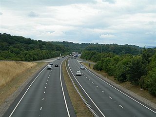
The A483, officially described as the Swansea to Manchester Trunk Road, although now ending in Chester, is a major road in the United Kingdom. It runs from Swansea in Wales to Chester in England via Llandovery, Llandrindod Wells, Oswestry and Wrexham, a distance of around 153 miles (246 km).

Welshpool is a market town and community in Powys, Wales, historically in the county of Montgomeryshire. The town is four miles from the Wales–England border and low-lying on the River Severn; its Welsh language name Y Trallwng means "the marshy or sinking land". The community includes Cloddiau and Pool Quay.
Llandrinio is a small village and community in Montgomeryshire, Powys, Wales, close to the Wales-England border. It is situated on the B4393 road which travels from the village of Ford, Shropshire to Lake Vyrnwy. The community, Llandrinio and Arddleen includes Arddlin and a small part of Four Crosses, Powys.

The Montgomery Canal, known colloquially as "The Monty", is a partially restored canal in eastern Powys and northwest Shropshire. The canal runs 33 miles (53 km) from the Llangollen Canal at Frankton Junction to Newtown via Llanymynech and Welshpool and crosses the England–Wales border.

Llanymynech is a village straddling the border between Montgomeryshire/Powys, Wales, and Shropshire, England, about 9 miles (14 km) north of the Welsh town of Welshpool. The name is Welsh for "Church of the Monks". The village is on the banks of the River Vyrnwy, and the Montgomery Canal passes through it.

Meifod, formerly also written Meivod, is a small village, community and electoral ward 7 miles north-west of Welshpool in Montgomeryshire, Powys, Wales, on the A495 road and located in the valley of the River Vyrnwy. The River Banwy has a confluence with the Vyrnwy approximately two miles to the west of the village. The village itself had a population of 317. The community includes the village of Bwlch-y-cibau and the hamlet of Allt-y-Main.
The Central Wales Football League(formerly the Mid Wales Football League) is a football league in Wales at tier 4 of the Welsh Football pyramid, run by the Central Wales Football Association. The league consists of two regionally based divisions - a North Division and a South Division. The league offers a promotion route to the Football Association of Wales administered Tier 3 Ardal Leagues. Relegation is possible to the relevant tier 5 level leagues in Aberystwyth, Ceredigion, Mid Wales South and Powys.

Chirbury is a village in west Shropshire, England. It is situated in the Vale of Montgomery, close to the Wales–England border, which is to its north, west and south. The A490 and B4386 routes cross at Chirbury.

Llansantffraid-ym-Mechain is a large village in Powys, Mid Wales, close to the border with Shropshire in England, about 7 miles (11 km) south west of Oswestry and 8 miles (13 km) north of Welshpool. It is on the A495 road and is at the confluence of the River Vyrnwy and the River Cain. The population as of the 2011 UK census was 1,415. The community includes the village of Deuddwr and several hamlets.

Llanfyllin is a market town and community in Powys, Wales. The town population in 2021 was 1,586 and the town's name means church or parish (llan) of St Myllin. The community includes the settlements of Bodfach, Ty Crwyn, Abernaint and several farms.

The A489, officially known as the Newtown to Machynlleth Trunk Road in Wales, is a trunk road in the United Kingdom running from Craven Arms, Shropshire to Machynlleth, Powys and crossing the Wales-England border.
National Cycle Network Route 44, part of the National Cycle Network, connects Shrewsbury, Shropshire with Cinderford, Gloucestershire. The part of the route from Shrewsbury to Bromfield is signed - the remainder of the route is currently unsigned.
The Oswestry and Newtown Railway was a British railway company that built a line between Oswestry in Shropshire and Newtown Montgomeryshire, now Powys. The line opened in stages in 1860 and 1861. It was conceived to open up the area to rail transport, when local opinion formed the view that the trunk railway companies would not do so. Subscription money for the construction proved very difficult to generate. It was the action of a contractor partnership, Davies and Savin, in agreeing to accept shares as the majority of their payment for construction work, that saved the company from failure.

Llanymynech railway station was an important junction station on the Cambrian Railways mainline from Welshpool, Powys to Oswestry, Shropshire, serving the village of Llanymynech which is partly situated in Shropshire, England and partly in Powys, Wales.

Llanymynech Heritage Area is an historic former lime kiln, quarry and industrial site near the village of Llanymynech, Shropshire in the Welsh Marches. The site is adjacent to the A483 road and close to the Montgomery Canal. It is about 6 miles (10 km) south of Oswestry on the English side of the border, and about 9 miles (14 km) north of the Powys town of Welshpool.
The Vale of Montgomery is an area of low land straddling the border between Shropshire, England and the former county of Montgomeryshire, Wales. The three principal settlements within it are the former county town of Montgomery and the village of Churchstoke, both in Wales, and Chirbury in England. The earthworks of Offa's Dyke run NNW-ESE through the middle of the vale and are followed by the Offa's Dyke Path. The national boundary also follows this monument for 3 km within the vale. The River Camlad rises to the southeast of the vale whilst its tributary the Caebitra rises to its southwest. They combine at Churchstoke and flow north within a gorge along the eastern margin of the vale, before turning west across the north end of the vale to join the River Severn.