
Neath Abbey was a Cistercian monastery, located near the present-day town of Neath in South Wales, UK. It was once the largest abbey in Wales. Substantial ruins can still be seen, and are in the care of Cadw. Tudor historian John Leland called Neath Abbey "the fairest abbey of all Wales."

Neath Port Talbot is a county borough in the south-west of Wales. Its principal towns are Neath, Port Talbot, Briton Ferry and Pontardawe. The county borough borders Bridgend County Borough and Rhondda Cynon Taf to the east, Powys and Carmarthenshire to the north; and Swansea to the west.

The A48 is a trunk road in Great Britain running from the A40 at Highnam, 3 miles (4.8 km) west of Gloucester, England, to the A40 at Carmarthen, Wales. Before the Severn Bridge opened on 8 September 1966, it was a major route between England and South Wales. For most of its route, it runs almost parallel to the M4 motorway. During times of high winds at the Severn Bridge, the A48 is used as part of the diversion route and is still marked as a Holiday Route.

The A465 is a trunk road that runs from Bromyard in Herefordshire, England to Llandarcy near Swansea in South Wales. The western half is known officially as the Neath to Abergavenny Trunk Road, but the section from Abergavenny to the Vale of Neath is more commonly referred to as the Heads of the Valleys Road because it links the northern heads of the South Wales Valleys. Approximately following the southern boundary of the Brecon Beacons National Park, the Ordnance Survey Pathfinder guide describes it as the unofficial border between rural and industrial South Wales. The A465 provides an alternative route between England and the counties in South West Wales and to the ferries to Ireland.
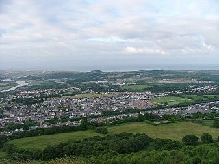
Skewen is a village within the county borough of Neath Port Talbot, in Wales. The village is served by Skewen railway station and has its own rugby club.

River Neath is a river in south Wales running south west from the point at which its headwaters arising in the Brecon Beacons National Park converge to its mouth at Baglan Bay below Briton Ferry on the east side of Swansea Bay.
Coedffranc is a village in the county borough of Neath Port Talbot, Wales.

Coedffranc West is an electoral ward of Neath Port Talbot county borough, Wales. As of May 2022, it is represented by two councillors from the Welsh Liberal Democrats.
Coedffranc Central is an electoral ward of Neath Port Talbot county borough, Wales. Coedffranc Central is a part of the Coedffranc community and falls within the parliamentary constituency of Aberavon.

Bryncoch is a village near Neath in Neath Port Talbot County Borough, Wales. The name derives from the Welsh 'red hill', originally the name of a nearby farm.

The A4232, which is also known either as the Peripheral Distributor Road (PDR) (Welsh: Ffordd Ddosbarthu Ymylol) or the Cardiff Link Road (Welsh: Ffordd Gyswllt Caerdydd), is a distributor road in Cardiff, the capital of Wales.

The A4107 road is an A road in Neath Port Talbot County Borough, Wales. It begins in Port Talbot and heads up the Afan Valley in a north easterly direction. It then continues over the moors eastwards until it connects with the A4061 road south west of Treorchy in the Rhondda Valley.
Crymlyn Burrows is an area of land in Wales, UK to the east of Swansea city centre, and south of Crymlyn Bog. It is bounded by Jersey Marine Beach to the south and the River Neath to the east. The land west of Baldwin's Crescent falls within the City and County of Swansea and from Baldwin's Crescent eastwards falls within Neath Port Talbot.

The A474 is a suburban main route in south Wales.

The A4109 road, known as the Inter-Valley Road, links Aberdulais with Glynneath in Neath Port Talbot county borough, Wales.

The A4241 Port Talbot Peripheral Distributor Road is a distributor road serving Port Talbot, Wales.

The A4060, also known as the East of Abercynon to East of Dowlais Trunk Road, is a trunk road in Wales.

The A4069 is an A road which connects Llandovery with Gwaun-Cae-Gurwen in Wales, UK.

The Skewen Dram Road was a 3 miles (5 km) long mining railway near Skewen in Wales with a gauge of 2 feet 7+1⁄2 inches (800 mm).

