List of crossings of the River Thames

Last updated

London Bridge, in central London London Bridge Illuminated.jpg
London Bridge, in central London
Newbridge, in rural Oxfordshire Newbridge, Oxfordshire.jpg
Newbridge, in rural Oxfordshire

The River Thames is the second-longest river in the United Kingdom, passes through the capital city, and has many crossings.

Contents

Counting every channel such as by its islands linked to only one bank it is crossed by over 300 bridges. If taking cuts excavated channels to be measurements of river, its 185-mile (298 km) course west of Tilbury has 27 tunnels, six public ferries, one cable car link, and one ford. From end to end, a channel of the Thames can be seen, mostly its main flow, which is passed over by 138 bridges. These are listed here with 2 former bridges and a seasonal festival bridge. Over 162 other bridges link to such places as typical or man-made islands or across an array of corollary and lesser side channels (backwaters), particularly in and around Oxford and the non-village channel of Ashton Keynes these are not listed.

The river's lower estuary is shallow but wide and has no crossing east of Tilbury, the easternmost half as most broadly defined which even extends to the end of the rivers Medway and Crouch.

Barrier and boundary

Until sufficient crossings were established, the river provided a formidable barrier for most of its course in post-Roman Britain during the Dark Ages, Belgic-Celtic tribal lands and Anglo-Saxon kingdoms and subdivisions were defined by which side of the river they were on. In the latter's system of English counties continued by predominantly Norman England and for some centuries thereafter, the river formed a mutual limit of counties. After rising in Gloucestershire, the river flows between, on the north bank, the historic counties of Oxfordshire, Buckinghamshire, Middlesex and Essex; and on the south bank, the counties of Wiltshire, Berkshire, Surrey, and Kent. However the many permanent crossings that have been built over the centuries have changed the dynamics and made cross-river development and shared responsibilities more practicable.

In 1911, Caversham, on the north bank, was transferred into Berkshire. In 1965, with the creation of Greater London, the London Borough of Richmond upon Thames united areas formerly in Middlesex and Surrey; and at the same time two urban districts in Middlesex (united in 1974) became part of Surrey. Further changes in 1974 moved some of the boundaries away from the river. For example, much of the north west of Berkshire including Wallingford, Abingdon and Wantage became part of Oxfordshire, and some southern parts of Buckinghamshire became part of Berkshire, including Slough, Eton and Wraysbury. The number of county councils has fallen (and some others have dwindled in area) in England in favour of increased localisation. [note 1]

Lessening these last changes, in the sports of rowing and skiffing, the river banks are referred to by their traditional county names, and in football and cricket the traditional counties also often persist. [note 2]

History of crossings

Wallingford Bridge (Oxfordshire) Wallingford Bridge - geograph.org.uk - 1116490.jpg
Wallingford Bridge (Oxfordshire)

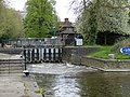
The original crossings over the Thames would all have been fords- typically on gravel beds. Well known ones include Wallingford and Oxford, but it is likely that there was a prehistoric ford where the Romans built London Bridge. In the upper reaches of the Thames, the river depth was raised by dams and in the lower reaches it was raised by embankments, so gradually most fords were lost. [1] At least one regular ford remains, at Duxford.

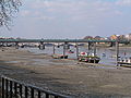
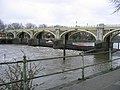
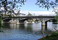
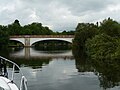
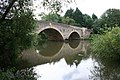
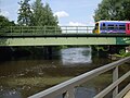
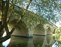
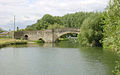
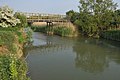
Many of the present road bridges over the river are on the sites of earlier fords, ferries and wooden structures. The earliest known major crossings of the Thames by the Romans were at London Bridge and Staines Bridge. At Folly Bridge in Oxford the remains of the Saxon forerunner can be seen, and medieval stone ones such as Wallingford, Newbridge in west Oxfordshire and Abingdon Bridges are still in use. In today's south-west London lies Kingston Bridge, which was the only crossing between London Bridge and Staines until the beginning of the 18th century and has been twice widened since its completion.

Proposals to build bridges for Lambeth/Westminster and Putney/Fulham in around 1670 were defeated by the Rulers of the Company of Watermen, since it would cut the trade of the then 60,000 rivermen plying ferry services and who were noted as a pool of naval reserves. [2]

An engraving by Claes Van Visscher showing Old London Bridge in 1616 London Bridge (1616) by Claes Van Visscher.jpg
An engraving by Claes Van Visscher showing Old London Bridge in 1616

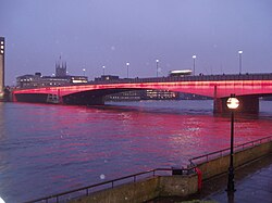
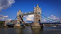
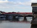
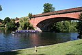
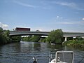
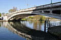
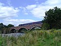
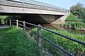
During the 18th century, many stone and brick instances were built from new or to replace existing structures in London and further up the river. These included Westminster, Putney, Datchet, Windsor and Sonning Bridges. Several central London road bridges were built in the 19th century, most conspicuously Tower Bridge, the only bascule bridge on the river, which enables some types of ocean-going ships to pass beneath it. The most recent road bridge sites are the bypasses at Isis Bridge and Marlow By-pass Bridge and for motorways such as the two for the M25: Queen Elizabeth II Bridge and M25 Runnymede Bridge.

The development of the railways resulted in a spate of bridge building in the 19th century, including Blackfriars and Charing Cross (Hungerford) Railway Bridges in central London, and the simple but majestic three, of grand arch design, by Isambard Kingdom Brunel at Maidenhead, Gatehampton and Moulsford.

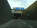
The world's first underwater tunnel was the Thames Tunnel by Marc Brunel built in 1843, designed for horse-drawn carriages but used as a pedestrian route; since 1869 the tunnel has carried trains on the East London Line. The Tower Subway (1870) was briefly used for a railway; later came all the deep-level tube lines. Two road tunnels were built in East London at the end of the 19th century, the Blackwall Tunnel and the Rotherhithe Tunnel, and the latest tunnel is the Silvertown Tunnel.

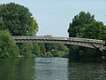
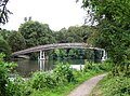
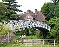
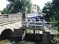
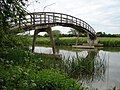
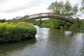
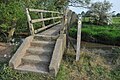
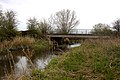
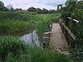
Many footbridges were made across the weirs that were built on the non-tidal river, and some of these remained when the locks were built, such as at Benson Lock. Some, above Oxford, have survived when the weir was lost, as at Hart's Weir Footbridge. Around the year 2000 several were added, as part of the Thames Path or for the Millennium. These include Temple, Bloomers Hole, the Hungerford Footbridges and the Millennium Bridge in distinct, aesthetic but durable, forms.

Six ferries cross the river:

Note on the listing

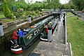
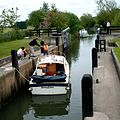
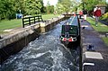
The list is from the estuary to the source. A few of the crossings listed are public foot bridges using walkways across lock gates and then bridges parallel to or on top of the associated weir(s) to the non-lock-associated bank. Most of the other locks on the River Thames also have walkways across their lock gates and/or weirs, but these do not completely cross the river, or are restricted to authorised personnel only, and are therefore not listed.

In addition to ferry services which directly cross the river, and are listed here, there are also other boat services running along the river. Whilst their main purpose is not to carry people across the river, they may provide incidental crossing facilities, although usually not to points facing each other. Such services are not listed.

North Sea to London

CrossingTypeCoordinatesOpenedNotesPhoto
Thames Cable Tunnel   OOjs UI icon edit-ltr-progressive.svg Utility tunnel 1970Carries two 400kV circuits; [5] [6] accessible by authorised personnel only
Gravesend–Tilbury Ferry   OOjs UI icon edit-ltr-progressive.svg Ferry route 1571 or before [7] Foot/bicycle ferry. Ferry service discontinued March 2024. [8] GravesendThames3393.JPG
400 kV Thames Crossing   OOjs UI icon edit-ltr-progressive.svg Overhead power line crossing 1965Overhead power line 623 ft tall crossing the Thames at Swanscombe and Grays Thames Estuary at Grays - geograph.org.uk - 305379.jpg
High Speed 1 tunnels  OOjs UI icon edit-ltr-progressive.svg Railway tunnel 2007Two 2.5 km tunnels, 7.15 m internal diameter, between West Thurrock (Essex) and Swanscombe (Kent) Thames Tunnel - geograph.org.uk - 48959.jpg
Queen Elizabeth II Bridge   OOjs UI icon edit-ltr-progressive.svg Cable-stayed bridge, road bridge 30 Oct 1991 Cable-stayed bridge – the southbound element of the Dartford Crossing Queen Elizabeth II Bridge - geograph.org.uk - 1323615.jpg
Dartford Tunnel (eastern)   OOjs UI icon edit-ltr-progressive.svg Road tunnel May 1980 Dartford Tunnel 01.JPG
Dartford Tunnel (western)   OOjs UI icon edit-ltr-progressive.svg Road tunnel 18 Nov 1963 Dartford West Tunnel (geograph 5729137).jpg
Dartford Cable Tunnel   OOjs UI icon edit-ltr-progressive.svg Utility tunnel 2005Carrying electrical cable; accessible by authorised personnel only

Proposed

East London

CrossingTypeCoordinatesOpenedNotesPhoto
Barking cable tunnel  OOjs UI icon edit-ltr-progressive.svg Utility tunnel 1920s [13] Carries four 33 kV electricity circuits from Barking substation to Sewell Road substation, Thamesmead [14]
Docklands Light Railway tunnel  OOjs UI icon edit-ltr-progressive.svg Railway tunnel 2009Between King George V and Woolwich Arsenal stations
Crossrail tunnels  OOjs UI icon edit-ltr-progressive.svg Railway tunnel 2014 [15] Completed in 2014, [16] part of the Elizabeth line, opened to the public in 2022.
Woolwich foot tunnel   OOjs UI icon edit-ltr-progressive.svg Pedestrian tunnel 26 Oct 1912 WoolwichTunnelLondon.jpg
Woolwich Ferry   OOjs UI icon edit-ltr-progressive.svg Ferry route 23 Mar 1889 London, Woolwich Ferry 02.jpg
Thames Barrier   OOjs UI icon edit-ltr-progressive.svg Flood barrier 1984Service tunnel accessible by authorised personnel only Thames Barrier 03.jpg
Silvertown Tunnel   OOjs UI icon edit-ltr-progressive.svg Road tunnel 7 Apr 2025 Silvertown Tunnel boreholes (1) (geograph 4275684).jpg
London cable car   OOjs UI icon edit-ltr-progressive.svg Gondola lift, public transport route 28 Jun 2012 London Cable Car (110813-203 CPS 11711627636).jpg
Millennium Dome cable tunnel  OOjs UI icon edit-ltr-progressive.svg Utility tunnel 1999Accessible by authorised personnel only
Jubilee line tunnels  OOjs UI icon edit-ltr-progressive.svg Railway tunnel 1999Between North Greenwich and Canning Town stations.
Blackwall Tunnel (eastern)   OOjs UI icon edit-ltr-progressive.svg Road tunnel 2 Aug 1967For southbound vehicular traffic only Inside the Blackwall Tunnel.JPG
Blackwall Tunnel (western)   OOjs UI icon edit-ltr-progressive.svg Road tunnel 22 May 1897 [17] For northbound vehicular traffic only Blackwall tunnel southern portal.jpg
Isle of Dogs Jubilee line tunnels  OOjs UI icon edit-ltr-progressive.svg Railway tunnel 1999Between Canary Wharf and North Greenwich stations.
Greenwich foot tunnel   OOjs UI icon edit-ltr-progressive.svg Pedestrian tunnel 1899 Greenwich Foot Tunnel.jpg
Docklands Light Railway tunnel  OOjs UI icon edit-ltr-progressive.svg Railway tunnel 1999Between Island Gardens and Cutty Sark stations.
Deptford cable tunnel  OOjs UI icon edit-ltr-progressive.svg Utility tunnel Carries 30 11 kV electricity circuits [18]
Jubilee line tunnels  OOjs UI icon edit-ltr-progressive.svg Railway tunnel 1999Between Canada Water and Canary Wharf stations.
Canary Wharf – Rotherhithe Ferry   OOjs UI icon edit-ltr-progressive.svg Ferry route Canary Wharf - Rotherhithe Ferry.jpg
Rotherhithe Tunnel   OOjs UI icon edit-ltr-progressive.svg Road tunnel, pedestrian tunnel 12 Jun 1908Single carriageway in each direction, with footways on each side. Built originally for horse-drawn carriages. Pedestrians, riders, cyclists are permitted, but advised to use alternatives due to fumes and speed. Rotherhithe tunnel map 1906.png
Thames Tunnel   OOjs UI icon edit-ltr-progressive.svg Railway tunnel [19] 1843The world's first underwater tunnel, linking Wapping to Rotherhithe. Originally designed as a road tunnel for horse-drawn traffic, the necessary access ramps were never built and it was opened as a pedestrian tunnel. It was converted to a rail tunnel, reopening in 1869 and becoming part of the London Overground network in 2010. Thames Tunnel walk.jpg
New Cross to Finsbury Market Cable Tunnel   OOjs UI icon edit-ltr-progressive.svg Utility tunnel , 2017Carries three 132 kV electricity circuits [20]

Proposed

Central London

CrossingTypeCoordinatesOpenedNotesPhoto
Tower Bridge   OOjs UI icon edit-ltr-progressive.svg Bascule bridge, steel bridge, road bridge, tourist attraction, suspension bridge, gothic revival bridge 1886 London - London Tower Bridge - 140806 171049.jpg
Tower Subway   OOjs UI icon edit-ltr-progressive.svg Utility tunnel, tube railway (until Dec 1870), pedestrian tunnel (from Dec 1870) 2 Aug 1870Formerly an underground railway – now used for water mains and telephone cables and accessible only by authorised personnel Tower Subway 1870.jpg
Northern Line (Bank branch) tunnels  OOjs UI icon edit-ltr-progressive.svg Railway tunnel 1900Between London Bridge and Bank
London Bridge   OOjs UI icon edit-ltr-progressive.svg Road bridge, prestressed concrete bridge, arch bridge, box girder bridge, Roman bridge 16 Mar 1973 [22] Other bridges have stood on or near this site since around AD 50 London Bridge from South bank.jpg
City & South London Railway tunnels  OOjs UI icon edit-ltr-progressive.svg Railway tunnel 1890This railway's original crossing of the river between Borough and King William Street; abandoned in 1900 when the Northern line City branch tunnels were opened on a new alignment
Cannon Street Railway Bridge   OOjs UI icon edit-ltr-progressive.svg Girder bridge, steel bridge, railway bridge 1883 Cannon street railway bridge 2.jpg
Southwark Bridge   OOjs UI icon edit-ltr-progressive.svg Steel bridge, road bridge, arch bridge 1921 Southwark Bridge, River Thames, London, England.jpg
Millennium Bridge   OOjs UI icon edit-ltr-progressive.svg Suspension bridge, footbridge 10 Jun 2000 Mill.bridge.from.tate.modern.arp.jpg
Bankside Cable Tunnel  OOjs UI icon edit-ltr-progressive.svg Utility tunnel 1940sEast of Blackfriars rail bridge, 132 kV and 33 kV electricity circuits [23]
Blackfriars Railway Bridge   OOjs UI icon edit-ltr-progressive.svg Steel bridge, arch bridge [24] , truss bridge, railway bridge 1886 St Pauls Cathedral From BlackFriars.jpg
Blackfriars Bridge   OOjs UI icon edit-ltr-progressive.svg Steel bridge, road bridge, arch bridge, tram bridge (from 1909 until Jul 1952) 1869 Blackfriars Bridge, River Thames, London, with St Pauls Cathedral.jpg
Waterloo & City line tunnels  OOjs UI icon edit-ltr-progressive.svg Railway tunnel 1898Between Waterloo and Bank
Waterloo Bridge   OOjs UI icon edit-ltr-progressive.svg box girder bridge, girder bridge, road bridge, Zone 3 A road 1945, 18 Jun 1817 Waterloo bridge.jpg
Northern line (Charing Cross branch) tunnels  OOjs UI icon edit-ltr-progressive.svg Railway tunnel 1926Between Waterloo and Embankment
Hungerford Bridge and Golden Jubilee Bridges   OOjs UI icon edit-ltr-progressive.svg Steel bridge, footbridge, railway bridge, cable-stayed bridge 1845Rail bridge incorporating newer pedestrian paths on either side Hungerford.bridge.arp.750pix.jpg
Bakerloo line tunnels  OOjs UI icon edit-ltr-progressive.svg Railway tunnel 1906Between Waterloo and Embankment
Bankside–Charing Cross cable tunnel  OOjs UI icon edit-ltr-progressive.svg Utility tunnel Underneath Hungerford Bridge [23]
Jubilee Line Extension tunnels  OOjs UI icon edit-ltr-progressive.svg Railway tunnel 1999Between Waterloo and Westminster
Westminster Bridge   OOjs UI icon edit-ltr-progressive.svg Road bridge, arch bridge, tram bridge (from 1909 until Jul 1952) [25] [26] 24 May 1862, 18 Nov 1750 Westminster, London (7660306446).jpg
Lambeth Bridge   OOjs UI icon edit-ltr-progressive.svg Road bridge, arch bridge [27] 12 May 1932 Lambeth bridge.jpg
Vauxhall Bridge   OOjs UI icon edit-ltr-progressive.svg Deck arch bridge, steel bridge, road bridge, tram bridge (from 1906 until Jan 1952) 1816 Architectuur london.jpg
Victoria line tunnels  OOjs UI icon edit-ltr-progressive.svg Railway tunnel 1971Between Vauxhall and Pimlico
Wimbledon – Pimlico cable tunnel  OOjs UI icon edit-ltr-progressive.svg Utility tunnel 1996Electricity cables [28]
Battersea steam tunnel  OOjs UI icon edit-ltr-progressive.svg Utility tunnel 20th centuryBetween Battersea and Pimlico is a single tunnel carrying four pipes, two 30" Thames Water mains and two 11" pipes feeding the Pimlico District Heating system, originally powered by Battersea Power Station. [29]
Battersea exhaust tunnels  OOjs UI icon edit-ltr-progressive.svg Utility tunnel 1920sBetween Battersea and either side of Victoria are two tunnels. Tunnels are labelled 'A' and 'B'; A splits further to become 'C' under Ranelagh Gardens.[ citation needed ]
Grosvenor Bridge   OOjs UI icon edit-ltr-progressive.svg Steel bridge, railway bridge, arch bridge 1860Also known as Victoria Railway Bridge Grosvenor Bridge, London.jpg

Former

Planned

South West London

CrossingTypeCo-ordinatesDate openedNotesPhoto
Chelsea Bridge   OOjs UI icon edit-ltr-progressive.svg Road bridge, suspension bridge 6 May 1937 [35] Chelsea Bridge, London.jpg
Albert Bridge   OOjs UI icon edit-ltr-progressive.svg Suspension bridge, beam bridge, Ordish–Lefeuvre system, steel bridge, road bridge [36] 1873 Albert Bridge from the South.jpg
Battersea Bridge   OOjs UI icon edit-ltr-progressive.svg Arch bridge [37] , iron bridge [37] , tram bridge (from 1909 until 1950) 21 Jul 1890Replaced an earlier bridge, opened in 1771. Battersea Bridge - geograph.org.uk - 493706.jpg
Battersea Railway Bridge   OOjs UI icon edit-ltr-progressive.svg Steel bridge, arch bridge, railway bridge [38] [39] 2 Mar 1863 West London Line. Also called the Cremorne Bridge. Battersea Railway Bridge, London 04.JPG
Wandsworth Bridge   OOjs UI icon edit-ltr-progressive.svg Cantilever bridge, steel bridge, road bridge 25 Sep 1940 WandsworthBridge.jpg
London Power Tunnels   OOjs UI icon edit-ltr-progressive.svg Utility tunnel 51°27′47″N0°11′35″W / 51.463°N 0.193°W / 51.463; -0.193 (London Power Tunnels Wimbledon - Kensal Green) 2018, 2011Wimbledon – Kensal Green
Fulham Railway Bridge   OOjs UI icon edit-ltr-progressive.svg Railway bridge, footbridge, truss bridge 3 Jun 1889 FulhamRailwayBridge.jpg
Putney Bridge   OOjs UI icon edit-ltr-progressive.svg Stone bridge, road bridge, tram bridge (from 1909 until 1935), arch bridge [40] [41] 1729Replaced an earlier bridge, known as Fulham Bridge, opened in 1729.
This is the downstream limit of the Thames towpath. [42]
Putney Bridge.jpg
Hammersmith Bridge   OOjs UI icon edit-ltr-progressive.svg Suspension bridge [43] , road bridge [44] [45] 1827As of April 2025, Hammersmith Bridge reopened to pedestrians and cyclists after having been closed while structural issues were remedied. Hammersmith Bridge 1, London, UK - April 2012.jpg
Barnes Railway Bridge   OOjs UI icon edit-ltr-progressive.svg Truss arch bridge, steel bridge, arch bridge, railway bridge, footbridge 1895 BarnesRailwayBridgeUpstream.jpg
Chiswick Bridge   OOjs UI icon edit-ltr-progressive.svg Road bridge, reinforced concrete bridge, arch bridge [46] 3 Jul 1933 Chiswick-Bridge-15-540-3.jpg
Kew Railway Bridge   OOjs UI icon edit-ltr-progressive.svg Railway bridge, truss bridge, girder bridge 1 Jan 1869 The Other Kew Bridge - geograph.org.uk - 1230501.jpg
Kew Bridge   OOjs UI icon edit-ltr-progressive.svg arch bridge, Stone bridge, road bridge 1903 Kew Bridge in London 2007 Sept 21.jpg
Richmond Lock and Footbridge   OOjs UI icon edit-ltr-progressive.svg footbridge, arch bridge, Lock 1894 Richmond Lock from Isleworth,Middx looking SE.jpg
Twickenham Bridge   OOjs UI icon edit-ltr-progressive.svg Arch bridge, road bridge 3 Jul 1933 Twickenham Bridge312-315b.jpg
Richmond Railway Bridge   OOjs UI icon edit-ltr-progressive.svg Steel bridge, arch bridge, railway bridge 1848 Richmond Railway Bridge 333r1.jpg
Richmond Bridge   OOjs UI icon edit-ltr-progressive.svg Bridge 1777 Richmond 018 Richmond Bridge TT panorama.JPG
Hammerton's Ferry   OOjs UI icon edit-ltr-progressive.svg Ferry route 1909From Marble Hill House, Twickenham to Ham House, Ham. Hammerton's Ferry midriver.jpg
Teddington Lock Footbridges   OOjs UI icon edit-ltr-progressive.svg Iron bridge, suspension bridge, girder bridge, footbridge 1889The Thames Path crosses these bridges; downstream there are paths on both sides of the river until the Greenwich foot tunnel. TeddBridge.JPG
Kingston Railway Bridge   OOjs UI icon edit-ltr-progressive.svg Arch bridge, railway bridge 1863 Kingston Railway Bridge.JPG
Kingston Bridge   OOjs UI icon edit-ltr-progressive.svg Stone bridge, road bridge, arch bridge, toll bridge (until Mar 1870) [47] [48] 17 Jul 1828The Thames Path crosses this bridge. Kingston Bridge2.jpg
Hampton Court Bridge   OOjs UI icon edit-ltr-progressive.svg Concrete bridge, steel bridge, road bridge, arch bridge 1933From Hampton Court to East Molesey. The Thames Path crosses this bridge. Hampton Court Bridge 1.jpg
Hampton Ferry   OOjs UI icon edit-ltr-progressive.svg Ferry route 1519From Hampton to Hurst Park, East Molesey. Hampton Ferry (geograph 2070883).jpg

Planned

London to Windsor

CrossingTypeCo-ordinatesDate openedNotesPhoto
Sunbury Ferry  OOjs UI icon edit-ltr-progressive.svg Ferry route 2019April to November
Walton Bridge   OOjs UI icon edit-ltr-progressive.svg Road bridge 2013 Walton Bridge - Aug 2013.JPG
Shepperton to Weybridge Ferry   OOjs UI icon edit-ltr-progressive.svg Passenger ferry 16th centuryThe only ferry on any form of the Thames Path and the most upstream Shepperton Ferry.jpg
Chertsey Bridge   OOjs UI icon edit-ltr-progressive.svg Road bridge [49] [50] [51] 1785 Chertsey Bridge.jpg
M3 Chertsey Bridge   OOjs UI icon edit-ltr-progressive.svg Highway bridge 1971Carrying the M3 motorway M3Bridge01.JPG
Staines Railway Bridge   OOjs UI icon edit-ltr-progressive.svg Railway bridge 1856Built by the London and South Western Railway. Carries the Waterloo to Reading Line. Staines Railway Bridge Over The Thames.jpg
Staines Bridge   OOjs UI icon edit-ltr-progressive.svg Road bridge 1832Bridges continuously recorded near this site since 1228. StainesBridge01.JPG
Runnymede Bridge   OOjs UI icon edit-ltr-progressive.svg Highway bridge 1961Carrying the M25 motorway and, on the older part of the bridge, the A30; widened in 1983 and 2005. Runnymede Bridge (downstream).JPG
Albert Bridge   OOjs UI icon edit-ltr-progressive.svg Road bridge 1927Replaced a cast-iron bridge built in 1850–51. Albert Bridge, Dachet (Nancy).JPG
Victoria Bridge   OOjs UI icon edit-ltr-progressive.svg Road bridge 1967Replacing an 1851 bridge. Victoria Bridge Datchet.JPG
Black Potts Railway Bridge   OOjs UI icon edit-ltr-progressive.svg Railway bridge 1850 Black Potts Bridge (Nancy).JPG
Windsor Bridge   OOjs UI icon edit-ltr-progressive.svg Footbridge (from 1970), bicycle bridge 1 Jun 1824Bridges recorded on this site since 1172. Pedestrian/cycle bridge since 1970. Windsortownbridge.jpg
Windsor Railway Bridge   OOjs UI icon edit-ltr-progressive.svg Railway bridge [52] 1849 Brunelwindsorbridge.jpg
Queen Elizabeth Bridge   OOjs UI icon edit-ltr-progressive.svg Road bridge 1966 Queen Elizabeth Bridge, Windsor (Nancy).JPG

Former

Windsor to Reading

CrossingTypeCo-ordinatesDate openedNotesImage
Summerleaze Footbridge   OOjs UI icon edit-ltr-progressive.svg Wooden bridge, footbridge 1992 Summerleaze footbridge (Nancy).JPG
M4 Thames Bridge   OOjs UI icon edit-ltr-progressive.svg Highway bridge 1961Carrying the M4 Motorway; incorporates a footbridge M4 Thames Bridge 20190711 121622 (48256348266).jpg
Maidenhead Railway Bridge   OOjs UI icon edit-ltr-progressive.svg Railway bridge 1838Carrying the Great Western Main Line. Brunel's Railway Bridge at Maidenhead - geograph.org.uk - 94793.jpg
Maidenhead Bridge   OOjs UI icon edit-ltr-progressive.svg Bridge 1777Bridge recorded 1280. Maidenhead Bridge (1).jpg
Taplow Bridge  OOjs UI icon edit-ltr-progressive.svg Footbridge 2018Newest Thames crossing.
Cookham Bridge   OOjs UI icon edit-ltr-progressive.svg Road bridge 1867 CookhamBridge01.JPG
Bourne End Railway Bridge   OOjs UI icon edit-ltr-progressive.svg Railway bridge, footbridge 1895Footbridge added onto the rail bridge specifically for the Thames Path. Bourne End Railway and Foot Bridge.JPG
Marlow By-pass Bridge   OOjs UI icon edit-ltr-progressive.svg Road bridge 1972Carries the A404 road between Maidenhead and High Wycombe. Marlow Bypass Bridge.JPG
Marlow Bridge   OOjs UI icon edit-ltr-progressive.svg Road bridge [53] [54] 1832Replaced bridge built in 1530. Uk-marlow-bridge.jpg
Temple Footbridge   OOjs UI icon edit-ltr-progressive.svg Footbridge 1989Temple Footbridge was built in 1989 specifically for the Thames Path. TempleFootbridge01.JPG
Hambleden Lock   OOjs UI icon edit-ltr-progressive.svg Lock, footbridge 1884 Hambleden Lock - geograph.org.uk - 956439.jpg
Henley Bridge   OOjs UI icon edit-ltr-progressive.svg Road bridge 1786Earlier bridge dates from at least 1232. Henley Bridge.jpg
Shiplake Railway Bridge   OOjs UI icon edit-ltr-progressive.svg Railway bridge 1897 ShiplakeRlyBr01.JPG
Sonning Bridge   OOjs UI icon edit-ltr-progressive.svg Road bridge [55] [56] 1775Earlier bridge recorded 1530 and one in 1125. SonningBridge01.JPG
Sonning Backwater Bridges   OOjs UI icon edit-ltr-progressive.svg Road bridge 1986 The French Horn from Sonning Backwater Bridge.JPG
Caversham Lock and Weir   OOjs UI icon edit-ltr-progressive.svg Lock, footbridge, weir 1875 Reading, UK - panoramio (42).jpg
Reading Bridge   OOjs UI icon edit-ltr-progressive.svg Road bridge 1923 Reading Bridge.jpg
Christchurch Bridge   OOjs UI icon edit-ltr-progressive.svg Footbridge, bicycle bridge, cable-stayed bridge 30 Sep 2015 Reading Cycle and Pedestrian Bridge 02.jpg
Caversham Bridge   OOjs UI icon edit-ltr-progressive.svg Road bridge 1926Earliest bridge on site recorded in 1231. Caversham Bridge.jpg

Former

Reading to Oxford

CrossingTypeCo-ordinatesDate openedNotesPhoto
Reading Festival bridge   OOjs UI icon edit-ltr-progressive.svg Footbridge 2008Temporarily erected each year on permanent footings for the period of the annual Reading Festival; accessible to festival ticket-holders and other authorised personnel only Reading Festival Bridge.jpg
Whitchurch Bridge   OOjs UI icon edit-ltr-progressive.svg Road bridge 1902Toll bridge Whitchurch toll bridge - geograph.org.uk - 924807.jpg
Gatehampton Railway Bridge   OOjs UI icon edit-ltr-progressive.svg Arch bridge, railway bridge [58] 1838 2008-05 Gatehampton Railway Bridge.JPG
Goring and Streatley Bridge   OOjs UI icon edit-ltr-progressive.svg Road bridge 1923 GoringBridge01.JPG
Moulsford Railway Bridge   OOjs UI icon edit-ltr-progressive.svg Arch bridge, railway viaduct [59] [59] 1839 MoulsfordRlyBr01.JPG
Winterbrook Bridge   OOjs UI icon edit-ltr-progressive.svg Road bridge 1993 ByPass Bridge.JPG
Wallingford Bridge   OOjs UI icon edit-ltr-progressive.svg Road bridge [60] [61] 1809Bridge recorded 1141. UK-Wallingford Bridge.JPG
Benson Lock   OOjs UI icon edit-ltr-progressive.svg Lock, footbridge Benson Lock - geograph.org.uk - 2536402.jpg
Shillingford Bridge   OOjs UI icon edit-ltr-progressive.svg Road bridge , [62] [63] 1827Replaced bridge built 1763. Shillingford Bridge.JPG
Little Wittenham Bridge   OOjs UI icon edit-ltr-progressive.svg Footbridge 1870 LittleWitBr01.JPG
Day's Lock   OOjs UI icon edit-ltr-progressive.svg Lock, footbridge Day's Lock and weir - geograph.org.uk - 1248222.jpg
Clifton Hampden Bridge   OOjs UI icon edit-ltr-progressive.svg Road bridge 1867 Clifton Hampden Bridge (4) (Nancy).JPG
Appleford Railway Bridge   OOjs UI icon edit-ltr-progressive.svg Railway bridge 1927 2008-05 Appleford Rail Bridge (2).JPG
Sutton Bridge   OOjs UI icon edit-ltr-progressive.svg Road bridge [64] [65] 1807 Along Sutton bridge - geograph.org.uk - 1433848.jpg
Sutton Pools footbridges  OOjs UI icon edit-ltr-progressive.svg Footbridge Linking four islands in the river course Weir at Sutton Courtenay (geograph 5597973).jpg
Culham Cut Bridge  OOjs UI icon edit-ltr-progressive.svg Bridge [66] A bridge across the weir on the Culham Cut, west of Culham Lock Bridge over the Culham Cut (geograph 5187956).jpg
Culham Lock   OOjs UI icon edit-ltr-progressive.svg Lock, footbridge Other bridges cross the main river channel Culham Lock - geograph.org.uk - 1336789.jpg
Abingdon Bridge   OOjs UI icon edit-ltr-progressive.svg Arch bridge, road bridge [67] 1416 AbingdonBrBu02.JPG
Abingdon Lock   OOjs UI icon edit-ltr-progressive.svg Lock, footbridge AbingdonLock01.JPG
Nuneham Viaduct   OOjs UI icon edit-ltr-progressive.svg Railway bridge, bowstring arch truss bridge [68] 1929 NunehamRlyBridge01.JPG
Sandford Lock   OOjs UI icon edit-ltr-progressive.svg Lock, footbridge Sandford Lock 05.jpg
Kennington Railway Bridge   OOjs UI icon edit-ltr-progressive.svg Railway bridge 1923 KenningtonRlyBridge01.JPG
Isis Bridge   OOjs UI icon edit-ltr-progressive.svg Road bridge 1965 IsisBridge01.JPG
Iffley Lock   OOjs UI icon edit-ltr-progressive.svg Lock, footbridge A narrowboat in Iffley Lock - geograph.org.uk - 1253460.jpg
Donnington Bridge   OOjs UI icon edit-ltr-progressive.svg Road bridge 1962 Donnington Bridge.jpg
Folly Bridge   OOjs UI icon edit-ltr-progressive.svg Deck arch bridge [69] 1827Stone bridge built 1085 Folly Bridge from the west.jpg
Grandpont Bridge   OOjs UI icon edit-ltr-progressive.svg Footbridge 1930s FriarsWharfFootbridge.jpg
Gasworks Bridge   OOjs UI icon edit-ltr-progressive.svg Footbridge 1886Originally built to carry a rail line to the Oxford Gasworks, which closed in 1960. Gasworks Bridge, Oxford - geograph.org.uk - 872489.jpg
Osney Rail Bridge   OOjs UI icon edit-ltr-progressive.svg Railway bridge 1850, 1887Two adjacent bridges OsneyRailBridge.jpg
Osney Bridge   OOjs UI icon edit-ltr-progressive.svg Road bridge 1889 OsneyBridge01.JPG

Planned

Oxford to Cricklade

CrossingTypeCo-ordinatesDate openedNotesPhoto
Medley Footbridge   OOjs UI icon edit-ltr-progressive.svg Footbridge [71] 1865Also called Rainbow footbridge. RainbowBridgeBinsey.jpg
Tank footbridge  OOjs UI icon edit-ltr-progressive.svg Footbridge Sep 1947 [72] Bridge over Fiddler's Island Stream - geograph.org.uk - 1758528.jpg
Godstow Bridge   OOjs UI icon edit-ltr-progressive.svg Road bridge [73] 1792A previous bridge was held by the Royalists in 1645. Godstow Bridge.jpg
A34 Road Bridge   OOjs UI icon edit-ltr-progressive.svg Road bridge 1961 A34 Thames Bridge 909053 db01759e-by-Pierre-Terre.jpg
King's Lock   OOjs UI icon edit-ltr-progressive.svg Lock, footbridge 1928 King's Lock - geograph.org.uk - 909039.jpg
Eynsham Lock   OOjs UI icon edit-ltr-progressive.svg Lock, footbridge 1928Permissive River Thames - Eynsham Lock - geograph.org.uk - 120014.jpg
Swinford Toll Bridge   OOjs UI icon edit-ltr-progressive.svg Road bridge [74] [75] 1769 Oxfordeynsham5.JPG
Pinkhill Lock   OOjs UI icon edit-ltr-progressive.svg Lock, footbridge 1791 Pinkhill Lock.jpg
Hart's Weir Footbridge   OOjs UI icon edit-ltr-progressive.svg Footbridge 1879 Hart's Weir Footbridge.jpg
New Bridge   OOjs UI icon edit-ltr-progressive.svg Road bridge [76] [77] [78] 1250 [79] Newbridge, Oxfordshire.jpg
Duxford ford   OOjs UI icon edit-ltr-progressive.svg Ford The ford crosses the original river channel to an island formed on its other side by the Shifford Lock Cut, which is crossed by a footbridge. There is no footbridge across the original river channel, which must be forded by pedestrians. Ford across the Thames - geograph.org.uk - 1461303.jpg
Shifford Lock   OOjs UI icon edit-ltr-progressive.svg Lock, footbridge Shifford Lock - geograph.org.uk - 436078.jpg
Tenfoot Bridge   OOjs UI icon edit-ltr-progressive.svg Footbridge 1869 Tenfoot Bridge.jpg
Tadpole Bridge   OOjs UI icon edit-ltr-progressive.svg Road bridge [80] 1784 Tadpole Bridge on the Thames nr Buckland from downstream - geograph.org.uk - 708444.jpg
Rushey Lock   OOjs UI icon edit-ltr-progressive.svg Lock, footbridge 1790 Rushey Lock River Thames1.jpg
Old Man's Bridge   OOjs UI icon edit-ltr-progressive.svg Footbridge 1894 Old Man's Bridge.jpg
Radcot Bridge   OOjs UI icon edit-ltr-progressive.svg Road bridge [81] [82] [83] 1787 Radcot Bridge.JPG
Eaton Footbridge   OOjs UI icon edit-ltr-progressive.svg Footbridge 1936 Eaton Footbridge.jpg
Buscot Lock   OOjs UI icon edit-ltr-progressive.svg Lock, footbridge 1790 Buscot Lock - geograph.org.uk - 912890.jpg
Bloomers Hole Footbridge   OOjs UI icon edit-ltr-progressive.svg Footbridge 2000Built in 2000 for the Thames Path. Bloomers Hole Footbridge.jpg
St. John's Bridge   OOjs UI icon edit-ltr-progressive.svg Road bridge 1886 St John's Bridge, Lechlade - geograph.org.uk - 2395105.jpg
Halfpenny Bridge   OOjs UI icon edit-ltr-progressive.svg Road bridge [84] [85] 1792The upstream limit of the navigable Thames. Halfpenny Bridge, Lechlade.jpg
Inglesham Footbridge  OOjs UI icon edit-ltr-progressive.svg Footbridge 1996The original towpath extends upstream to this point, by the connection with the now disused Thames and Severn Canal. Footbridge over the River Thames, near Inglesham - geograph.org.uk - 2914470.jpg
Hannington Bridge   OOjs UI icon edit-ltr-progressive.svg Road bridge 1841 Hannington Bridge.jpg
Castle Eaton Bridge   OOjs UI icon edit-ltr-progressive.svg Road bridge 1893 Bridge over the Thames at Castle Eaton - geograph.org.uk - 2395656.jpg
Water Eaton House Bridge   OOjs UI icon edit-ltr-progressive.svg Footbridge Described in 1896 as a small occupation bridge for pedestrians and cattle. [86] Footbridge over the Thames - geograph.org.uk - 2394279.jpg
Eysey Footbridge   OOjs UI icon edit-ltr-progressive.svg Footbridge A Thames footbridge between fields of Cricklade (geograph 2393879).jpg
A419 Road Bridge   OOjs UI icon edit-ltr-progressive.svg Road bridge 1988 The Thames passing under the A419 (geograph 2393540).jpg
Abingdon Court Lane Bridge  OOjs UI icon edit-ltr-progressive.svg Road bridge 20th centuryFor sewage works & cricket club: accessible to authorised personnel only.
Cricklade Town Bridge   OOjs UI icon edit-ltr-progressive.svg Road bridge 1852 Town Bridge, Cricklade - geograph.org.uk - 1420167.jpg

Cricklade to the source

Not all of the bridges above Cricklade are listed below. For example, there are a number of small agricultural bridges allowing access between fields, and bridges to properties in Ashton Keynes that are not mentioned.

CrossingTypeCo-ordinatesDate openedNotesPhoto
Aqueduct footings footbridge  OOjs UI icon edit-ltr-progressive.svg Footbridge, navigable aqueduct Site of a former aqueduct carrying the North Wilts Canal over the Thames. Footbridge over River Thames, Cricklade - geograph.org.uk - 417033.jpg
Midland and South Western Junction Railway bridge  OOjs UI icon edit-ltr-progressive.svg Railway bridge, footbridge Formerly a bridge for the Midland and South Western Junction Railway. Thames Path - geograph.org.uk - 2201012.jpg
Stones Lane footbridge  OOjs UI icon edit-ltr-progressive.svg Footbridge Footbridge at Hailstone House. Footbridge across the Thames - geograph.org.uk - 436560.jpg
Manor Farm bridge  OOjs UI icon edit-ltr-progressive.svg Road bridge North of Manor Farm, Waterhay.
Brook Farm bridge  OOjs UI icon edit-ltr-progressive.svg Road bridge North of Brook Farm, Waterhay.
Waterhay bridge  OOjs UI icon edit-ltr-progressive.svg Road bridge Waterhay Bridge over the Thames - geograph.org.uk - 2892740.jpg
Unnamed footbridge  OOjs UI icon edit-ltr-progressive.svg Footbridge The footbridge and a ford carry a bridlepath over the river, just outside Ashton Keynes. Footbridge and ford across the Thames (geograph 4031809).jpg
Bridge on High Road  OOjs UI icon edit-ltr-progressive.svg Road bridge Bridge on High Road, Ashton Keynes
Bridge on The Derry  OOjs UI icon edit-ltr-progressive.svg Road bridge Bridge on The Derry, Ashton Keynes High Road in Ashton Keynes - geograph.org.uk - 1776023.jpg
Bridge on Gosditch, Ashton KeynesRoad bridge 51°38′42″N1°56′7″W / 51.64500°N 1.93528°W / 51.64500; -1.93528 (Bridge on Gosditch, Ashton Keynes)
Bridge on Church Walk, Ashton KeynesRoad bridge 51°38′48″N1°56′10″W / 51.64667°N 1.93611°W / 51.64667; -1.93611 (Bridge on Church Walk, Ashton Keynes)
Bridge on Church Lane, Ashton KeynesRoad bridge 51°38′48″N1°56′14″W / 51.64667°N 1.93722°W / 51.64667; -1.93722 (Bridge on Church Lane, Ashton Keynes)
Bridge on B4696, Ashton KeynesRoad bridge 51°38′46″N1°56′31″W / 51.64611°N 1.94194°W / 51.64611; -1.94194 (Bridge on B4696, Ashton Keynes)
BridgesRoad bridge and pedestrian bridge 51°38′46″N1°56′56″W / 51.64611°N 1.94889°W / 51.64611; -1.94889 (Bridges)
BridgeRoad bridge 51°38′43″N1°57′38″W / 51.64528°N 1.96056°W / 51.64528; -1.96056 (Bridge)
FootbridgePedestrian bridge 51°38′48″N1°57′46″W / 51.64667°N 1.96278°W / 51.64667; -1.96278 (Footbridge)
BridgeRoad bridge 51°38′51″N1°57′58″W / 51.64750°N 1.96611°W / 51.64750; -1.96611 (Bridge)
BridgeRoad bridge 51°38′52″N1°58′2″W / 51.64778°N 1.96722°W / 51.64778; -1.96722 (Bridge)
BridgeRoad bridge 51°38′54″N1°58′8″W / 51.64833°N 1.96889°W / 51.64833; -1.96889 (Bridge)
FootbridgePedestrian bridge 51°38′59″N1°58′17″W / 51.64972°N 1.97139°W / 51.64972; -1.97139 (Footbridge)
BridgeRoad bridge 51°39′2″N1°58′24″W / 51.65056°N 1.97333°W / 51.65056; -1.97333 (Bridge)
Neigh BridgeRoad bridge 51°39′6″N1°58′29″W / 51.65167°N 1.97472°W / 51.65167; -1.97472 (Neigh Bridge)
Bridge south of Ewen Road bridge 51°40′27″N1°59′44″W / 51.67417°N 1.99556°W / 51.67417; -1.99556 (Bridge south of Ewen)
Parker's Bridge, EwenRoad bridge 51°40′31″N2°0′25″W / 51.67528°N 2.00694°W / 51.67528; -2.00694 (Parker's Bridge, Ewen)
A429 Road BridgeRoad bridge 51°40′47″N2°0′53″W / 51.67972°N 2.01472°W / 51.67972; -2.01472 (A429 Road Bridge) Demolished bridge on the currently closed Cirencester Branch Line ran over the road. Part of the Beeching Axe legacy.
A433 Road Bridge, Fosse Way Roman RoadRoad bridge 51°41′24″N2°1′21″W / 51.69000°N 2.02250°W / 51.69000; -2.02250 (A433 Road Bridge) At Thames Head

The river splits as it passes through Ashton Keynes. An alternative route to that listed above crosses High Bridge at 51°38′13″N1°55′46″W / 51.63694°N 1.92944°W / 51.63694; -1.92944 (High Bridge, Ashton Keynes) and Three Bridges at 51°38′18″N1°56′21″W / 51.63833°N 1.93917°W / 51.63833; -1.93917 (Three Bridges, Ashton Keynes) .

See also

Notes

  1. For example Berkshire County Council and Middlesex County Council were abolished and smaller authorities have been created in the counties adjoining the Thames, from the Borough of Swindon unitary authority to Medway Council on the Thames Estuary.
  2. e.g. Buckinghamshire County Cricket Club, Middlesex County Football Association and Middlesex County Cricket Club

References

  1. "The river environment: Fords and ferries". Thames Pilot. Retrieved 22 June 2023.
  2. "Parishes: Putney – British History Online". www.british-history.ac.uk.
  3. "HAMMERTONS FERRY". HAMMERTONS FERRY. Archived from the original on 22 July 2013. Retrieved 4 May 2023.
  4. "Sunbury Ferry - Connecting Sunbury on Thames & Walton on Thames". sunburyferry.co.uk. Retrieved 4 May 2023.
  5. Anon (May 1970). "Cables Down Under". Electronics & Power. 16 (5): 175. doi:10.1049/ep.1970.0161.
  6. Haswell, C.K. (December 1969). "Thames Cable Tunnel". Proceedings of the Institution of Civil Engineers. 44 (4): 323–430. doi:10.1680/iicep.1969.7250.
  7. Map drawn by a one-time Portreve (Mayor) of Gravesend, William Bourne, and included in The Book of Gravesham Sydney Harker, 1979 ISBN   0 86023 091 0
  8. Simmonds, Cara (30 March 2024). "Final crossing of Gravesend to Tilbury ferry link after decision to axe service". Kent Online . Retrieved 24 May 2024.
  9. "Grain to Tilbury". nationalgrid.com. Retrieved 25 May 2024.
  10. "Lower Thames Crossing – Design and build – Highways England". Highways England . 15 June 2020. Retrieved 6 February 2021.
  11. Adams, Lewis (25 March 2025). "Lower Thames Crossing plan for Essex and Kent is approved". BBC News. Retrieved 19 April 2025.
  12. Drake, Matt (27 March 2023). "Plans progress for £800m tram project connecting Kent and Essex". Kent Live. Retrieved 16 April 2024.
  13. https://historicengland.org.uk/services-skills/education/educational-images/barking-power-station-creekmouth-barking-11049
  14. "Open Infrastructure Map". Open Infrastructure Map. Retrieved 20 March 2020.
  15. http://www.crossrail.co.uk/construction/tunnelling/railway-tunnels/thames-tunnel-plumstead-to-north-woolwich
  16. "Thames Tunnel – Plumstead to North Woolwich". Crossrail. Archived from the original on 21 November 2019. Retrieved 21 August 2020.
  17. Tony Gallagher; John Witherow; James Harding; Robert Barrington-Ward; Flora Shaw (eds.), Times, London: Times Newspapers Ltd, ISSN   0140-0460, OCLC   992611467, Wikidata   Q50008
  18. "Open Infrastructure Map". Open Infrastructure Map. Retrieved 20 March 2020.
  19. Historic England. "Details from listed building database (1242119)". National Heritage List for England .
  20. "Open Infrastructure Map". Open Infrastructure Map. Retrieved 20 March 2020.
  21. "TfL Press Release – TfL and its partners commence further feasibility work on extending DLR into Thamesmead to support new homes and growth". tfl-newsroom.prgloo.com. Transport for London . Retrieved 21 December 2020.
  22. https://hemeroteca.lavanguardia.com/preview/1973/03/17/pagina-23/34246951/pdf.html
  23. 1 2 "Open Infrastructure Map". Open Infrastructure Map. Retrieved 23 March 2020.
  24. https://structurae.net/structures/blackfriars-railway-bridge-1886
  25. Historic England. "Details from listed building database (1081058)". National Heritage List for England .
  26. Historic England. "Details from listed building database (1066172)". National Heritage List for England .
  27. Historic England. "Details from listed building database (1393007)". National Heritage List for England .
  28. "Open Infrastructure Map". Open Infrastructure Map. Retrieved 23 March 2020.
  29. "Pimlico District Heating" (PDF). Westminster Council. Archived from the original (PDF) on 18 May 2020. Retrieved 21 August 2020.
  30. "Emergency Thames Bridge: Victoria Embankment to County Hall, construction work in progress". City of London Corporation. Archived from the original on 6 November 2015. Retrieved 28 March 2013.
  31. "Emergency Thames Bridge: Victoria Embankment to County Hall, demolition work in progress". City of London Corporation. Archived from the original on 6 November 2015. Retrieved 28 March 2013.
  32. "Emergency Thames Bridge: Millbank site, construction work in progress". City of London Corporation. Archived from the original on 6 November 2015. Retrieved 28 March 2013.
  33. "Emergency Thames Bridge: Millbank site, structure is dismantled". City of London Corporation. Archived from the original on 6 November 2015. Retrieved 28 March 2013.
  34. "London bridge designs unveiled". BBC News. 21 July 2015.
  35. Matthews, Peter (2008), London's Bridges, Bloomsbury Publishing, OL   23615119M, Wikidata   Q105305831
  36. Historic England. "Details from listed building database (1358138)". National Heritage List for England .
  37. 1 2 https://www.dwwindsor.com/.../in-situ-refurbishment-o...
  38. Historic England. "Details from listed building database (1393005)". National Heritage List for England .
  39. Historic England. "Details from listed building database (1393006)". National Heritage List for England .
  40. Historic England. "Details from listed building database (1079799)". National Heritage List for England .
  41. Historic England. "Details from listed building database (1357672)". National Heritage List for England .
  42. Walton, A. (1834). A Tour on the Banks of the Thames from London to Oxford, in the Autumn of 1829. London: T. W. Hord. Retrieved 12 June 2019 via Where Thames Smooth Waters Glide.
  43. http://list.english-heritage.org.uk/resultsingle.aspx?uid=1080793
  44. Historic England. "Details from listed building database (1080793)". National Heritage List for England .
  45. Historic England. "Details from listed building database (1079819)". National Heritage List for England .
  46. Historic England. "Details from listed building database (1031877)". National Heritage List for England .
  47. Historic England. "Details from listed building database (1065378)". National Heritage List for England .
  48. Historic England. "Details from listed building database (1300232)". National Heritage List for England .
  49. Historic England. "Details from listed building database (1204646)". National Heritage List for England .
  50. Historic England. "Details from listed building database (1003752)". National Heritage List for England .
  51. Historic England. "Details from listed building database (1029204)". National Heritage List for England .
  52. Historic England. "Details from listed building database (1319297)". National Heritage List for England .
  53. Historic England. "Details from listed building database (1332381)". National Heritage List for England .
  54. Historic England. "Details from listed building database (1117598)". National Heritage List for England .
  55. Historic England. "Details from listed building database (1117436)". National Heritage List for England .
  56. Historic England. "Details from listed building database (1369302)". National Heritage List for England .
  57. "Olympic bridge in place at Dorney Lake". www.sloughexpress.co.uk.
  58. Historic England. "Details from listed building database (1290673)". National Heritage List for England .
  59. 1 2 Historic England. "Details from listed building database (1285970)". National Heritage List for England .
  60. Historic England. "Details from listed building database (1368917)". National Heritage List for England .
  61. Historic England. "Details from listed building database (1006294)". National Heritage List for England .
  62. Historic England. "Details from listed building database (1059632)". National Heritage List for England .
  63. Historic England. "Details from listed building database (1180968)". National Heritage List for England .
  64. Historic England. "Details from listed building database (1182464)". National Heritage List for England .
  65. Historic England. "Details from listed building database (1194571)". National Heritage List for England .
  66. Historic England. "Details from listed building database (1368839)". National Heritage List for England .
  67. Historic England. "Details from listed building database (1048926)". National Heritage List for England .
  68. https://structurae.net/en/structures/nuneham-railway-bridge
  69. Historic England. "Details from listed building database (1319913)". National Heritage List for England .
  70. "Oxpens River Bridge". Oxford City Council. Retrieved 25 March 2024.
  71. Historic England. "Details from listed building database (1047095)". National Heritage List for England .
  72. https://www.dailyinfo.co.uk/guide/cartoonist/binsey
  73. Historic England. "Details from listed building database (1369373)". National Heritage List for England .
  74. Historic England. "Details from listed building database (1284764)". National Heritage List for England .
  75. Historic England. "Details from listed building database (1006292)". National Heritage List for England .
  76. Historic England. "Details from listed building database (1368262)". National Heritage List for England .
  77. Historic England. "Details from listed building database (1048348)". National Heritage List for England .
  78. Historic England. "Details from listed building database (1004851)". National Heritage List for England .
  79. Thacker, Fred. S. (1920). The Thames Highway: A History of the Locks and Weirs. Vol. 2, Locks and Weirs. p. 77.
  80. Historic England. "Details from listed building database (1181619)". National Heritage List for England .
  81. Historic England. "Details from listed building database (1048414)". National Heritage List for England .
  82. Historic England. "Details from listed building database (1006361)". National Heritage List for England .
  83. Historic England. "Details from listed building database (1053405)". National Heritage List for England .
  84. Historic England. "Details from listed building database (1003424)". National Heritage List for England .
  85. Historic England. "Details from listed building database (1023393)". National Heritage List for England .
  86. Anon (24 July 1896). "Thames Bridges no. XLIII. 92.-Water Eaton Bridge". Engineering. 62: 105–6. Retrieved 27 October 2023.

Further reading