Tenfoot Bridge

Last updated

Tenfoot Bridge
Tenfoot Bridge.jpg
Coordinates 51°41′39″N1°29′24″W / 51.694223°N 1.489891°W / 51.694223; -1.489891 Coordinates: 51°41′39″N1°29′24″W / 51.694223°N 1.489891°W / 51.694223; -1.489891
Carries Footpath
Crosses River Thames
Locale Oxford
Characteristics
Material Wood
Height 12 feet 2 inches (3.71 m)
No. of spans 1
History
Opened 1869

Tenfoot Bridge is a wooden footbridge across the River Thames in Oxfordshire, England. It is situated on the reach above Shifford Lock and was built in 1869. It connects Buckland on the south bank to Chimney on the north.

River Thames river in southern England

The River Thames, known alternatively in parts as the Isis, is a river that flows through southern England including London. At 215 miles (346 km), it is the longest river entirely in England and the second longest in the United Kingdom, after the River Severn.

Oxfordshire County of England

Oxfordshire is a county in South East England. The ceremonial county borders Warwickshire to the north-west, Northamptonshire to the north-east, Buckinghamshire to the east, Berkshire to the south, Wiltshire to the south-west and Gloucestershire to the west.

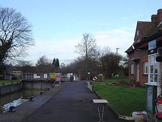
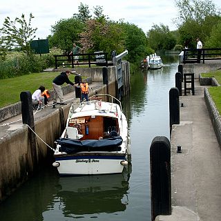
Shifford Lock is a lock on the River Thames in England. It is in the centre of a triangle formed by the small villages of Shifford, Duxford and Chimney in Oxfordshire. It is at the start of a navigation cut built with the lock by the Thames Conservancy in 1898. It replaced a flash lock in a weir about 3/4 mile downstream.

The name derives from a pre-existing weir which had a 10-foot-wide flash lock (3.0 m) in it. In 1867 there were complaints about the state of the weir bridge and after a dispute, the Thames Conservancy removed the weir and built the bridge two years later. [1]

Flash lock A gate in the flow of a river which could be opened to allow boats through

Early locks were designed with a single gate, known as a flash lock or staunch lock. The earliest European references to what were clearly flash locks were in Roman times.

Thames Conservancy

The Thames Conservancy was a historical body responsible for the management of the River Thames in England. It was founded in 1857, initially replacing the jurisdiction of the City of London up to Staines and later taking responsibility for the whole river from Cricklade in Wiltshire to the sea at Yantlet Creek on the Isle of Grain. Responsibilities were reduced when the Tideway was transferred to the Port of London Authority in 1909 and in 1974 the Conservancy was taken into the Thames Water Authority.

The Thames Path passes the bridge on the north bank, but does not cross it. The path formerly crossed the bridge to Duxford south of the old course of the Thames.

Thames Path long-distance trail following the River Thames in England

The Thames Path is a National Trail following the River Thames from its source near Kemble in Gloucestershire to the Thames Barrier at Charlton, south east London. It is about 184 miles (296 km) long. A path was first proposed in 1948 but it only opened in 1996.

Duxford, Oxfordshire village in United Kingdom

Duxford is a hamlet in the civil parish of Hinton Waldrist 5.5 miles (9 km) northeast of Faringdon. It was part of Berkshire until the 1974 boundary changes transferred it to Oxfordshire. It is on the south bank of the River Thames, where there is a ford leading to Chimney on the north bank.

See also

Related Research Articles

Teddington Lock

Teddington Lock is a complex of three locks and a weir on the River Thames in England between Ham and Teddington in the London Borough of Richmond upon Thames. It was first built in 1810.

Caversham Lock

Caversham Lock is a lock and main weir on the River Thames in England at Reading, Berkshire. Both structures connect to De Bohun Island, a long island. The original lock was built by the Thames Navigation Commissioners in 1778. Additional sluices north of verdant View Island and multiple home Heron Island form the whole weir complex. A footbridge passes over all three islands to connect Lower Caversham to Reading via an alternative route than George Street and Reading Bridge.

Marsh Lock lock and weir situated on the River Thames in England near Henley-on-Thames

Marsh Lock is a lock and weir situated on the River Thames in England near Henley-on-Thames, Oxfordshire. The lock is close to the Berkshire bank, but accessed from the Oxfordshire side via two long walkways, the downstream one being near Mill Meadows. The first pound lock was built by the Thames Navigation Commission in 1773.

Whitchurch-on-Thames village and civil parish in South Oxfordshire district, Oxfordshire, England

Whitchurch-on-Thames is a village and civil parish on the Oxfordshire bank of the River Thames, about 5.5 miles (9 km) northwest of Reading, Berkshire, in close proximity to Whitchurch Hill. Opposite Whitchurch on the Berkshire bank is the village of Pangbourne.

Hambleden Lock

Hambleden Lock is a lock with a long weir situated on the River Thames in England. The lock is on the Berkshire bank between Aston and Remenham. It was built by the Thames Navigation Commission in 1773, The lock is named after the village of Hambleden, a mile (1.5 km) to the north.

Days Lock

Day's Lock is a lock on the River Thames near Dorchester-on-Thames, Oxfordshire, England on the Dorchester side of the river.

Iffley Lock lock in England

Iffley Lock is a lock on the River Thames in England near the village of Iffley, Oxfordshire. It is on the southern outskirts of Oxford. The original lock was built by the Oxford-Burcot Commission in 1631 and the Thames Navigation Commission replaced this in 1793. The lock has a set of rollers to allow punts and rowing boats to be moved between the water levels.

Clifton Lock

Clifton Lock is a lock on River Thames in Oxfordshire, England. It is located south of the village of Clifton Hampden and north of Long Wittenham. It is at the start of the Clifton Cut, which bypasses the river to the north of Long Wittenham. The lock was completed in 1822 by the Thames Navigation Commissioners.

Benson Lock

Benson Lock is a lock on the River Thames in England, close to Benson, Oxfordshire but on the opposite bank of the river. The first pound lock here was built by the Thames Navigation Commission in 1788 and it was replaced by the present masonry lock in 1870. The distance between Benson Lock and Cleeve Lock downstream is 6.5 miles (10.4 km) - the longest distance between locks on the River Thames.

Sunbury Lock lock on the River Thames in England near Walton-on-Thames in north-west Surrey

Sunbury Lock is a lock complex of the River Thames in England near Walton-on-Thames in north-west Surrey, the third lowest of forty four on the non-tidal reaches. The complex adjoins the right, southern bank about 12 mile (0.80 km) downstream of the Weir Hotel.

Romney Lock

Romney Lock is a lock on the River Thames in England near Windsor and Eton. It is on the Windsor side of the river next to a boatyard and adjoins Romney Island, a long strip of land in the middle of the river. The first lock was built by the Thames Navigation Commission in 1798.

Abingdon Lock lock on the River Thames in England

Abingdon Lock is a lock on the River Thames in England, less than 1 mile east and upstream of Abingdon, Oxfordshire, on the opposite bank of the river. It was originally built in 1790 by the Thames Navigation Commission.

Osney Lock

Osney Lock is a lock on the River Thames in Oxford, England, where the village or island of Osney is next to the river.

Eynsham Lock

Eynsham Lock is a lock on the River Thames in England. It is on the southern bank near Swinford Oxfordshire. The large village of Eynsham is a little distance away on the northern bank.

Northmoor Lock is a lock on the River Thames in Oxfordshire, England, on the northern bank about a mile from Northmoor.

Rushey Lock

Rushey Lock is a lock on the River Thames in England. It is on the northern bank of the river in Oxfordshire, at a considerable distance from any village, the nearest being Buckland Marsh, a hamlet on the road to Buckland to the south of the river.

Lea Valley Walk

The Lea Valley Walk is a 50-mile (80 km) long-distance path located between Leagrave, the source of the River Lea near Luton, and the Thames, at Limehouse Basin, Limehouse, east London. From its source much of the walk is rural. At Hertford the path follows the towpath of the River Lee Navigation, and it becomes increasingly urbanised as it approaches London. The walk was opened in 1993 and is waymarked throughout using a swan logo.

References

  1. Fred. S. Thacker The Thames Highway: Volume II Locks and Weirs 1920 - republished 1968 David & Charles
Next crossing upstream River Thames Next crossing downstream
Tadpole Bridge (road)Tenfoot Bridge Duxford Ford and Shifford Lock Cut footbridge
Next crossing upstream Thames Path Next crossing downstream
northern bank
Tadpole Bridge
Tenfoot Bridge southern bank
Newbridge