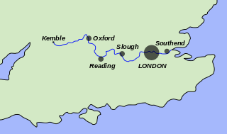
The River Thames, known alternatively in parts as the River Isis, is a river that flows through southern England including London. At 215 miles (346 km), it is the longest river entirely in England and the second-longest in the United Kingdom, after the River Severn.

The Thames and Severn Canal is a canal in Gloucestershire in the south of England, which was completed in 1789. It was conceived as part of a canal route from Bristol to London. At its eastern end, it connects to the River Thames at Inglesham Lock near Lechlade, while at its western end, it connects to the Stroudwater Navigation at Wallbridge near Stroud, and thence to the River Severn. It has one short arm (branch), from Siddington to the town of Cirencester. It includes Sapperton Tunnel, which when built was the longest canal tunnel in Britain, and remains the second-longest complete tunnel. There were always problems with water supply, as no reservoirs were built, while the summit section near the tunnel ran through porous limestone, and there were constant difficulties with leakage. Competition from the railways took much of the canal's traffic by the end of the 19th century, and most of the canal was abandoned in 1927, the remainder in 1941.
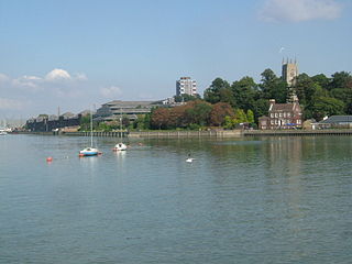
The River Medway is a river in South East England. It rises in the High Weald, Sussex and flows through Tonbridge, Maidstone and the Medway conurbation in Kent, before emptying into the Thames Estuary near Sheerness, a total distance of 70 miles (113 km). About 13 miles (21 km) of the river lies in Sussex, with the remainder being in Kent.

The Jubilee River is a hydraulic channel in southern England. It is 11.6 km (7.2 mi) long and is on average 45 metres wide. It was constructed in the late 1990s and early 2000s to take overflow from the River Thames and so alleviate flooding to areas in and around the towns of Maidenhead, Windsor, and Eton in the counties of Berkshire and Buckinghamshire. It achieves this by taking water from the left bank of the Thames upstream of Boulter's Lock near Maidenhead and returning it via the north bank downstream of Eton. Although successful in its stated aims, residents of villages downstream, such as Wraysbury, claim it has increased flooding.

The Thames Path is a National Trail following the River Thames from its source near Kemble in Gloucestershire to the Thames Barrier at Charlton, south east London. It is about 184 miles (296 km) long. A path was first proposed in 1948 but it only opened in 1996.

Kingston Railway Bridge in Kingston upon Thames, London, crosses the River Thames on the reach above Teddington Lock. It carries the Kingston Loop Line train service from London Waterloo station, where the majority of services begin and end and which line includes a maintenance depot. The loop diverges from main lines at New Malden and Richmond. East and west of the bridge along the line are Kingston and Hampton Wick stations. The loop returns to the south bank of its terminus via Richmond Railway Bridge. The loop feeds a branch line, a further incentive for the 1863 construction of the bridge, Shepperton Branch Line.
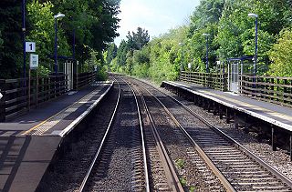
The Cherwell Valley line is the railway line between Didcot and Banbury via Oxford. It links the Great Western Main Line and the south to the Chiltern Main Line and the Midlands. The line follows the River Cherwell for much of its route between Banbury and Oxford.

Gatehampton Railway Bridge, otherwise referred to as Gatehampton Viaduct, is a railway bridge carrying the Great Western Main Line over the River Thames in Lower Basildon, Berkshire, England. It takes the line between the stations at Goring and Streatley and Pangbourne, and crosses the Thames on the reach between Whitchurch Lock and Goring Lock.
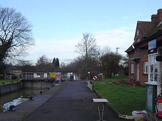
Clifton Lock is a lock on River Thames in Oxfordshire, England. It is located south of the village of Clifton Hampden and north of Long Wittenham. It is at the start of the Clifton Cut, which bypasses the river to the north of Long Wittenham. The lock was completed in 1822 by the Thames Navigation Commissioners.

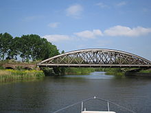
Windsor Railway Bridge is a wrought iron 'bow and string' bridge in Windsor, Berkshire, designed by Isambard Kingdom Brunel. It carries the ex-GWR branch line from Slough to Windsor into Windsor and Eton Central station. It crosses the River Thames on the reach between Romney Lock and Boveney Lock.

Bourne End Railway Bridge is a railway bridge carrying the Marlow Branch Line, and a footpath over the River Thames in Bourne End, Buckinghamshire, England. It crosses the Thames on the reach between Cookham Lock and Marlow Lock.
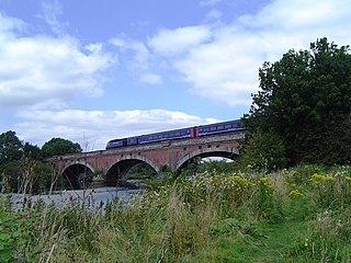
Moulsford Railway Bridge, also known locally as "Four Arches" bridge, is a pair of parallel bridges located a little to the north of Moulsford and South Stoke in Oxfordshire, UK. It carries the Great Western Main Line from Paddington, London to Wales and the West across the River Thames. The bridge lies between the stations at Goring & Streatley and Cholsey, and crosses the Thames at an oblique angle on the reach between Cleeve Lock and Benson Lock.

Nuneham Railway Bridge, known as the Black Bridge. is near the town of Abingdon in Oxfordshire, England. It carries the Cherwell Valley Line across the River Thames between Abingdon Lock and Sandford Lock on the line between Didcot and Oxford.

Kennington Railway Bridge is a railway bridge over the River Thames near Kennington, Oxfordshire between Sandford Lock and Iffley Lock. It carries the freight railway branch line that serves the BMW Mini factory at Cowley. The freight railway is part of the former Wycombe Railway that linked Maidenhead and Oxford via High Wycombe and Princes Risborough.

The A34 Road Bridge is a modern road bridge carrying the Oxford ring road at Oxford, England, across the River Thames. It crosses the Thames just upstream of Godstow Lock near Wolvercote on the reach to King's Lock. The bridge was built in 1961.
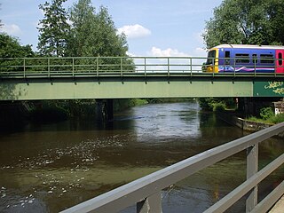
Osney Rail Bridge is a railway bridge over the River Thames at Oxford in England. It carries the Cherwell Valley Line between Didcot and Oxford across the river on the reach between Iffley Lock and Osney Lock.

Castle Mill Stream is a backwater of the River Thames in the west of Oxford, England. It is 5.5 km long.

Sheepwash Channel connects the River Thames to the west and the Castle Mill Stream next to the Oxford Canal to the east, in west Oxford, England. To the north are Cripley Meadow and Fiddler's Island. To the south are Osney Island and the Botley Road.
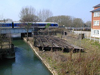
Sheepwash Channel Railway Bridge is a railway bridge over Sheepwash Channel in west Oxford, England, just north of Oxford railway station. To the north are Cripley Meadow and Fiddler's Island. To the south are Osney Island and the Botley Road.
