The River Thames, known alternatively in parts as the River Isis, is a river that flows through southern England including London. At 215 miles (346 km), it is the longest river entirely in England and the second-longest in the United Kingdom, after the River Severn.
This article lists the islands in the River Thames, or at the mouth of a tributary, in England. It excludes human-made islands built as part of the building of forty-five two-gate locks which each accompany a weir, and islets subordinate to and forming part of the overall shape of another. The suffix -ey is common across England and Scotland and cognate with ait and meaning island, a term – as ait or eyot – unusually well-preserved on the Thames. A small minority of list entries are referred to as Island, Ait or Eyot and are vestiges, separated by a depression in the land or high-water-level gully.

The Thames Path is a National Trail following the River Thames from one of its sources near Kemble in Gloucestershire to the Woolwich foot tunnel, south east London. It is about 185 miles (298 km) long. A path was first proposed in 1948 but it only opened in 1996.

Osney or Osney Island is a riverside community in the west of the city of Oxford, England. In modern times the name is applied to a community also known as Osney Town astride Botley Road, just west of the city's main railway station, on an island surrounded by the River Thames, Osney Ditch and another backwater connecting the Thames to Osney Ditch.

Iffley Lock is a lock on the River Thames in England near the village of Iffley, Oxfordshire. It is on the southern outskirts of Oxford. The original lock was built by the Oxford-Burcot Commission in 1631 and the Thames Navigation Commission replaced this in 1793. The lock has a set of rollers to allow punts and rowing boats to be moved between the water levels.

Hinksey Stream is a branch of the River Thames to the west of the city of Oxford, England. It starts as Seacourt Stream, which leaves the Thames at a bifurcation north of the village of Wytham, and rejoins the river south of the city near Kennington.
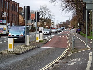
Botley Road is the main road into the centre of Oxford, England from the west. It stretches between Botley, on the Oxford Ring Road (A34) to the west of the city, and Frideswide Square at the junction with Oxford railway station, close to central Oxford.

Osney Lock is a lock on the River Thames in Oxford, England, where the village or island of Osney is next to the river.
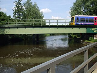
Osney Rail Bridge is a railway bridge over the River Thames at Oxford in England. It carries the Cherwell Valley Line between Didcot and Oxford across the river on the reach between Iffley Lock and Osney Lock.

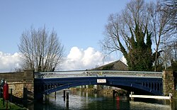
Hythe Bridge is a Victorian flat cast iron beamed bridge on Hythe Bridge Street in the west of central Oxford, England. It spans the Castle Mill Stream, a backwater of the River Thames. Hythe Bridge forms part of the main arterial route west of Oxford. It lies on the A4144, which continues west as the Botley Road (A420).

Castle Mill Stream is a backwater of the River Thames in the west of Oxford, England. It is 5.5 km long.
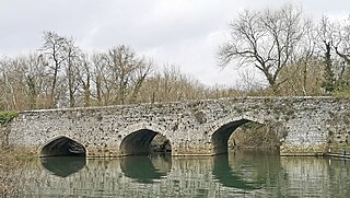
The Swift Ditch is a 2 km (1.2 mi) long artificial channel that formed a short-cut for river traffic to and from Oxford, across a meander of the River Thames in England. It was formerly the primary navigation channel. With the main river, it creates Andersey Island on the left bank of the Thames opposite Abingdon-on-Thames. Within a poem published in 1632, the Water Poet John Taylor wrote:
At Abingdon the shoals are worse and worse
That Swift Ditch seems to be the better course
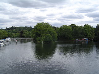
Hedsor Water is a stretch of the River Thames near Cookham, Berkshire which runs to the north of Sashes Island. Hedsor Water was once the main navigation of the Thames but was by-passed by the construction of Cookham Lock in 1830. Navigation is only possible for the first 100 metres (330 ft) from the downstream end, where a few temporary moorings are available, except for smaller boats.
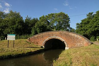
Duke's Cut is a short waterway in Oxfordshire, England, which connects the Oxford Canal with the River Thames via the Wolvercote Mill Stream. It is named after George Spencer, 4th Duke of Marlborough, across whose land the waterway was cut. It is seen as a branch of the Oxford Canal.

Bulstake Stream, also spelt Bullstake Stream, is a backwater of the River Thames at Oxford, England.

Sheepwash Channel connects the River Thames to the west and the Castle Mill Stream next to the Oxford Canal to the east, in west Oxford, England. To the north are Cripley Meadow and Fiddler's Island. To the south are Osney Island and the Botley Road.

Botley Bridge is a road bridge across Seacourt Stream, a branch of the River Thames in Oxford, England.

Bulstake Bridge is a road bridge across the Bulstake Stream, a branch of the River Thames in Oxford, England.
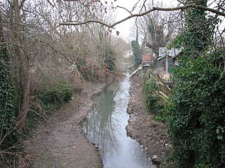
The Osney Ditch is a side channel of the River Thames at Oxford, England. It is one of the principal watercourses in west Oxford.
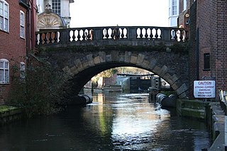
Newbury Bridge, also known as Kennet Bridge or Town Bridge, is a bridge across the River Kennet in the town centre of Newbury in the English county of Berkshire. The bridge carries Bridge Street, which links Northbrook Street, to the north of the river, with Bartholomew Street, to the south. The river channel under the bridge is also used by boats navigating the Kennet and Avon Canal. The current bridge was built between 1769 and 1772 and has three arches, although the two outer arches are now hidden by flanking buildings. It is a Grade II* listed structure.
