
The M25 or London Orbital Motorway is a major road encircling most of Greater London. The 117-mile-long (188 km) motorway is one of the most important roads in the UK and one of the busiest. Margaret Thatcher opened the final section in 1986, making the M25 the longest ring road in Europe upon opening. The Dartford Crossing completes the orbital route but is not classed as motorway; it is classed as a trunk road and designated as the A282. In some cases, including notable legal contexts such as the Communications Act 2003, the M25 is used as a de facto alternative boundary for Greater London.

The Dartford–Thurrock River Crossing, commonly known as the Dartford Crossing and until 1991 the Dartford Tunnel, is a major road crossing of the River Thames in England, carrying the A282 road between Dartford in Kent in the south and Thurrock in Essex in the north.

The M1 motorway connects London to Leeds, where it joins the A1(M) near Aberford, to connect to Newcastle. It was the first inter-urban motorway to be completed in the UK; the first motorway in the country was the Preston Bypass, which later became part of the M6.
The A1, also known as the Great North Road, is the longest numbered road in the United Kingdom, at 410 miles (660 km). It connects London, the capital of England, with Edinburgh, the capital of Scotland. The numbering system for A-roads, devised in the early 1920s, was based around patterns of roads radiating from two hubs at London and Edinburgh. The first number in the system, A1, was given to the most important part of that system: the road from London to Edinburgh, joining the two central points of the system and linking the UK's (then) two mainland capital cities. It passes through or near north London, Hatfield, Welwyn Garden City, Stevenage, Baldock, Letchworth Garden City, Biggleswade, Eaton Socon, Buckden, Peterborough, Stamford, Grantham, Newark-on-Trent, Retford, Doncaster, Pontefract, York, Wetherby, Ripon, Darlington, Durham, Gateshead, Newcastle upon Tyne, Morpeth, Alnwick and Berwick-upon-Tweed.

The A14 is a major trunk road in England, running 127 miles (204 km) from Catthorpe Interchange, a major intersection at the southern end of the M6 and junction 19 of the M1 in Leicestershire to the Port of Felixstowe, Suffolk. The road forms part of the unsigned Euroroutes E24 and E30. It is the busiest shipping lane in East Anglia carrying anything from cars to large amounts of cargo between the UK and Mainland Europe.

Electronic toll collection (ETC) is a wireless system to automatically collect the usage fee or toll charged to vehicles using toll roads, HOV lanes, toll bridges, and toll tunnels. It is a faster alternative which is replacing toll booths, where vehicles must stop and the driver manually pays the toll with cash or a card. In most systems, vehicles using the system are equipped with an automated radio transponder device. When the vehicle passes a roadside toll reader device, a radio signal from the reader triggers the transponder, which transmits back an identifying number which registers the vehicle's use of the road, and an electronic payment system charges the user the toll.

The M6 Toll, referred to on some signs as the Midland Expressway, and stylised as M6toll, connects M6 Junction 3a at the Coleshill Interchange to M6 Junction 11A at Wolverhampton with 27 miles (43 km) of six-lane motorway.

FasTrak is the electronic toll collection (ETC) system used in the state of California in the United States. The system is used statewide on all of the toll roads, toll bridges, and high-occupancy toll lanes along the California Freeway and Expressway System.
National Highways (NH), formerly the Highways Agency and later formerly Highways England, is a government-owned company charged with operating, maintaining and improving motorways and major A roads in England. It also sets highways standards used by all four UK administrations, through the Design Manual for Roads and Bridges. Within England, it operates information services through the provision of on-road signage and its Traffic England website, provides traffic officers to deal with incidents on its network, and manages the delivery of improvement schemes to the network.

The A419 road is a primary route between Chiseldon near Swindon at junction 15 of the M4 with the A346 road, and Whitminster in Gloucestershire, England near the M5 motorway. The A419 is managed and maintained by a private company, Road Management Group, on behalf of the UK Department for Transport.

The A417 is a main road in England, running from Streatley, Berkshire to Hope under Dinmore, Herefordshire. It is best known for its section between Cirencester and Gloucester where it has primary status and forms part of the link between the major settlements of Swindon and Gloucester.

A1(M) is the designation given to a series of four separate motorway sections in the UK. Each section is an upgrade to a section of the A1, a major north–south road which connects London, the capital of England, with Edinburgh, the capital of Scotland. The first section, the Doncaster Bypass, opened in 1961 and is one of the oldest sections of motorway in Britain. Construction of a new section of A1(M) between Leeming and Barton was completed on 29 March 2018, a year later than the anticipated opening in 2017 due to extensive archaeological excavations. Its completion linked the Barton to Washington section with the Darrington to Leeming Bar section, forming the longest A1(M) section overall and reducing the number of sections from five to four.

Alconbury is a village and civil parish in Cambridgeshire, England. Alconbury is situated within Huntingdonshire which is a non-metropolitan district of Cambridgeshire as well as being an historic county of England. Alconbury lies approximately 5 miles (8 km) north-west of Huntingdon.

Open road tolling (ORT), also called all-electronic tolling, cashless tolling, or free-flow tolling, is the collection of tolls on toll roads without the use of toll booths. An electronic toll collection system is usually used instead. The major advantage to ORT is that users are able to drive through the toll plaza at highway speeds without having to slow down to pay the toll. In some installations, ORT may also reduce congestion at the plazas by allowing more vehicles per hour/per lane.

The A249 is a road in Kent, England, running from Maidstone to Sheerness on the Isle of Sheppey. It mainly functions as a link between the M2 and M20 motorways, and for goods vehicle traffic to the port at Sheerness.

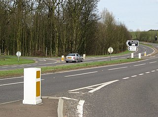
A toll road is a road over which users may travel over on payment of a toll, or fee. Tolls are a form of use tax that pays for the cost of road construction and maintenance, without raising taxes on non-users. Investor's bonds necessary for the construction of the roads are issued and sold with the expectation that the bonds will be paid back with user tolls. The toll roads may be run by government agencies that have bond issuing authority and/or private companies that sell bonds or have other sources of finance. Toll roads are usually a government guaranteed road monopoly that guarantees limited or no competing roads will be built by government agencies for the duration of the bonds. Private toll roads built with money raised from private investors in expectation of making money from the tolls probably dominated early toll roads. Government sponsored toll roads often guarantee a minimum payment to the bond holders if traffic volume and toll collections are less than predicted. If the toll authority is a private company there is often a maximum amount of fees that they may extract from users. Toll road operators are typically responsible for maintaining the roads. After the bonds are paid off the road typically reverts to the government agency that authorized the road and owns the land it was built on. Like most government taxes it is not unusual for tolls to continue to be charged after the bonds have been paid off.

The Sheppey Crossing is a bridge which carries the A249 road across the Swale, linking the Isle of Sheppey with the mainland of Kent. The four-lane crossing measures 21.5 m in width, at a height of 35 m over the water. The A249 links the M20 and M2 motorways to Sheppey. The bridge opened in 2006, and it provides an alternative highway to the neighbouring Kingsferry Bridge that was completed in 1959.

The A168 is a major road in North Yorkshire, England. It runs from Northallerton to Wetherby, acting as a local access road for the A1(M).
The A1307 is a secondary class A road in Cambridgeshire and Suffolk between the A1(M) near Alconbury and Haverhill, Suffolk. In 2020 the former A14 between North of Cambridge and Alconbury was reclassified as the A1307. Whilst it generally follows the route of the Roman Road Via Devana from Alconbury to Haverhill. As it becomes unroutable through Cambridge, and sections were developed in different decades, it has been delt with in three parts: Cambridge city, Eastern and Northern.

The Highways in Albania are the central state and main transport network in Albania. The motorways and expressways are both part of the national road network. The motorways are primary roads with a speed limit of 110 kilometres per hour (68 mph). They have white on green road signs such as in Italy and other countries nearby. The expressways are the secondary roads, also dual carriageways, but without an emergency lane. They have a speed limit of 90 kilometres per hour (56 mph). They have white-on-blue road signs.