Moulton | |
---|---|
The Three Horse Shoes Pub, Moulton | |
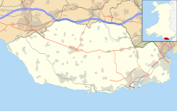
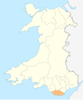
Location within the Vale of Glamorgan | |
Community | |
Principal area | |
Preserved county | |
Country | Wales |
Sovereign state | United Kingdom |
Post town | Barry |
Postcode district | CF62 |
Police | South Wales |
Fire | South Wales |
Ambulance | Welsh |
UK Parliament | |
Senedd Cymru – Welsh Parliament | |
Moulton is a hamlet in the Vale of Glamorgan, southeastern Wales. It lies off the A4226 road on the road, northwest of Barry and east of Llancarfan. The landmark of note is the Three Horse Shoes pub and restaurant [1] which attracts visitors from all across the Vale of Glamorgan. To the south of Moulton is the small hamlet of Sutton.
There has been evidence of settlement in the area since at least the 4th Century [2] with the discovery in 1956 of Roman ruins in the area dating as far back as the 2nd Century.
The local Ty Uchaf farmhouse could be the oldest inhabited home in the Vale of Glamorgan [3] .
The Vale of Glamorgan, often referred to as The Vale, is a county borough in the south-east of Wales. It borders Bridgend County Borough to the west, Cardiff to the east, Rhondda Cynon Taf to the north, and the Bristol Channel to the south. With an economy based largely on agriculture and chemicals, it is the southernmost unitary authority in Wales. Attractions include Barry Island Pleasure Park, the Barry Tourist Railway, Medieval wall paintings in St Cadoc's Church, Llancarfan, Porthkerry Park, St Donat's Castle, Cosmeston Lakes Country Park and Cosmeston Medieval Village. The largest town is Barry. Other towns include Penarth, Llantwit Major, and Cowbridge. There are many villages in the county borough.
Glamorgan, or sometimes Glamorganshire, is one of the thirteen historic counties of Wales and a former administrative county of Wales. Originally an early medieval petty kingdom of varying boundaries known in Welsh as the Kingdom of Morgannwg, which was then invaded and taken over by the Normans as the Lordship of Glamorgan. The area that became known as Glamorgan was both a rural, pastoral area, and a conflict point between the Norman lords and the Welsh princes. It was defined by a large concentration of castles.
Llantwit Major is a town and community in Wales on the Bristol Channel coast. It is one of four towns in the Vale of Glamorgan, with the third largest population after Barry and Penarth, and ahead of Cowbridge. It is 4+1⁄2 miles (7.2 km) from Cowbridge, 9 miles (14 km) from Bridgend, 10 miles (16 km) from Barry, and 15 miles (24 km) from Cardiff. It had a population of 9,530 in 2021.
Llantrisant is a town in the county borough of Rhondda Cynon Taf, within the historic county boundaries of Glamorgan, Wales, lying on the River Ely and the Afon Clun. The three saints of the town's name are SS. Illtyd, Gwynno, and Dyfodwg. Llantrisant is a hilltop settlement, at an altitude of 174 m (565 ft) above sea level. The town is home to the Royal Mint.
Colwinston is both a village and a community in the Vale of Glamorgan, Wales, approximately 4 miles (6.4 km) southeast of the centre of Bridgend and 21 miles (34 km) west of the centre of Cardiff. The village is located within 1⁄2 mile (0.80 km) of the A48. The population in 2005 was approximately 400 but with recent building development, the population is now estimated at over 600 people.
Peterston-super-Ely is a village and community situated on the River Ely in the county borough of the Vale of Glamorgan, Wales. The community population at the 2011 census was 874. The community includes the hamlet of Gwern-y-Steeple.
St Athan is a village and community in the Vale of Glamorgan in South Wales. The village and its parish church are dedicated to Saint Tathan. The church dates to the 13th–14th century, though an earlier church was dated to the Norman period. The village and the adjacent dormitory village of Eglwys Brewis are known primarily for the MOD St Athan RAF base. There are two pubs in the village, as well as a football team at St Athan Football Club and the St Athan Golf Club. The community includes West Aberthaw.
Dinas Powys is a small town and community in the Vale of Glamorgan, South Wales. Its name means "fort of the provincial place" and refers to the Iron Age hillfort which overlooks the village. Dinas Powys is 5.6 miles (9.0 km) south-west of the centre of Cardiff and is situated on the A4055 road from Cardiff to Barry, making it a popular dormitory village for city commuters. It neighbours the larger town of Penarth.
Llandough is a village, community and electoral ward in the Vale of Glamorgan, Wales, approximately 2.3 miles (3.7 km) south west of Cardiff city centre, and approximately 1.3 miles (2 km) north west of Penarth.
The hamlet of Porthkerry lies on the Bristol Channel coast of South Wales within the community of Rhoose between that village and the town of Barry to the east. It is very close to the end of the runway of Cardiff International Airport. To the east of the hamlet is Porthkerry Country Park which occupies the valley leading down to the coast.
Wenvoe is a village, community and electoral ward between Barry and Cardiff in the Vale of Glamorgan, Wales. Nearby are the Wenvoe Transmitter near Twyn-yr-Odyn and the site of the former HTV Wales Television Centre at Culverhouse Cross which is now a housing estate. It is home to the Wenvoe Quarry and Wenvoe Castle Golf Club.
Aberthaw is an area containing the villages of East Aberthaw and West Aberthaw, on the coast of South Wales about 5 miles (8 km) west of Barry. It is home to Aberthaw Cement Works, Aberthaw Lime Works, and Aberthaw Power Station, a decommissioned coal power station that was linked to the South Wales Valleys via the Vale of Glamorgan Railway. The area is historically within the parish of Penmark in the Vale of Glamorgan. The two villages of West and East Aberthaw are separated by the River Thaw. The village of East Aberthaw, near Rhoose, has a 13th-century pub. The village Baptist Chapel and Mission Room no longer exist as such and have been converted for other uses.
Llancarfan is a rural village and community in the Vale of Glamorgan, Wales. The village, located west of Barry and near Cowbridge, has a well-known parish church, the site of Saint Cadoc's 6th-century clas, famed for its learning. Cainnech of Aghaboe, Caradoc of Llancarfan and many other Welsh holy men studied there. Antiquarian Iolo Morganwg was born in the hamlet of Pen-onn near Llancarfan. At the 2001 census, the community had a population of 736. In the 2011 census, the population was 747. Most of the village lies within a conservation area designated by the local authority in 1971. Buildings listed as being of special historic interest include The Fox and Hounds public house, the former Bethlehem Chapel, the former Wesleyan Chapel, Chapel Cottage, Great House, Corner House and Llancarfan Primary School. The community includes village of Moulton.
Sigingstone is a small hamlet in the Vale of Glamorgan, Wales.
The A4226 is a main road linking Bonvilston to Barry and Cardiff International Airport (CIA) in the Vale of Glamorgan, Wales.
St Hilary is a village in the Vale of Glamorgan, Wales. It is located just south of the A48, about a mile southeast of the market town of Cowbridge. The village has a population of about 260, in approximately 80 houses. Notable landmarks in the vicinity include The Bush Inn, the Church of St Hilary, the Old Beaupre Castle, New Beaupre, Coed Hills and St. Hilary mast.
St Lythans is an affluent hamlet and former parish in the Vale of Glamorgan, southeast Wales, just outside western Cardiff. It lies southwest of Culverhouse Cross, west of Wenvoe and southwest of Twyn-yr-Odyn and is also connected by road from Dyffryn and the Five Mile Lane in the west. It is one of the wealthiest communities in the Vale of Glamorgan, containing some notable mansions and cottages, valued on average at over £500,000 as of 2011. The megalithic St Lythans burial chamber, over 6000 years old, lies 1 km to the west of the village and the hamlet also contains the St.Lythans Parish Church or Church of St Bleddian, a Grade II* listed building.
Clawdd Coch is a hamlet in the Vale of Glamorgan. It lies to the northeast of Tredodridge in the parish of Pendoylan. It is located near the edge of the Vale of Glamorgan Golf Club and Hensol Castle.
Lidmore or Lydmore is a small hamlet and farm in the Vale of Glamorgan. It is located just off the A4226 road, to the northwest of Highlight Park in Barry, Vale of Glamorgan and in close proximity to Brynhill Golf Club. To the north is Great Hamston and Dyffryn and the hamlet is accessed through another hamlet called Northcliff from the main road. To the southwest is Lidmore Wood and the Welsh Hawking Centre.
St Brides Major is a community on the western edge of the Vale of Glamorgan, South Wales. Its largest settlement is the village of St Brides Major, and also includes the villages of Ogmore-by-Sea and Southerndown, and the hamlets of Ogmore Village, Castle-upon-Alun, Heol-y-Mynydd, Norton and Pont-yr-Brown It is notable for coastal geology and scenery, limestone downlands and fossilised primitive mammals, sea cliffs and beaches, two Iron Age hillforts, three medieval castle sites,, two stepping stone river crossings and a clapper bridge. Three long distance paths cross the community. It is the western limit of the Vale of Glamorgan Heritage Coast, and has a visitor centre and tourist facilities.