Walterston

Last updated

Walterston
Walterston fach - Walterston - geograph.org.uk - 1732290.jpg
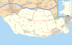
Vale of Glamorgan UK location map.svg
Red pog.svg
Walterston
Location within the Vale of Glamorgan
Principal area
Ceremonial county
Country Wales
Sovereign state United Kingdom
Historic county
Postcode district CF
Police South Wales
Fire South Wales
Ambulance Welsh
UK Parliament
Senedd Cymru – Welsh Parliament
List of places
UK
Wales
Vale of Glamorgan
51°25′55″N3°20′26″W / 51.431948°N 3.340492°W / 51.431948; -3.340492 Coordinates: 51°25′55″N3°20′26″W / 51.431948°N 3.340492°W / 51.431948; -3.340492
The capstone of the Trewalter burial chamber Capstone of Trewalter burial chamber - geograph.org.uk - 421527.jpg
The capstone of the Trewalter burial chamber

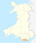
Walterston (Welsh : Tre-walter) is a small farming hamlet just north of Barry in the Vale of Glamorgan in South Wales and west of Dyffryn.

Walterston lies just to west of the Five Mile Lane leading down to Waycock Cross, Barry. The hamlet is very small and has just a few farms, all of which are twelfth to thirteenth century in origin. There are also several houses of which the two largest are the thatched 'Walterston Fach' and its neighbouring 'Trewalter Fawr'. The old monastic village of Llancarfan lies a further two miles to the west.
Related Research Articles

Rawcliffe Bridge Hamlet in the East Riding of Yorkshire, England

Rawcliffe Bridge is a small hamlet in the East Riding of Yorkshire, England. It is situated approximately 3 miles (4.8 km) south-west of Goole and lies just south of the M62 motorway.

Porthkerry Human settlement in Wales

The hamlet of Porthkerry lies on the Bristol Channel coast of South Wales within the community of Rhoose between that village and the town of Barry to the east. It is very close to the end of the runway of Cardiff International Airport. To the east of the hamlet is Porthkerry Country Park which occupies the valley leading down to the coast.

Coffinswell Village in Devon, England

Coffinswell is a small village in South Devon, England, just off the A380, the busy Newton Abbot to Torquay road. It lies within Teignbridge District Council.

Warnham Human settlement in England

Warnham is a village and civil parish in the Horsham district of West Sussex, England. The village is centred 2 miles (3.2 km) north-northwest of Horsham, 31 miles (50 km) from London, to the west of the A24 road. Other named settlements within the parish include the hamlets of Goosegreen, Kingsfold and Winterfold as well as parts of Strood Green and Rowhook. The area is in the northwest of the Weald, a gently sloped remnant forest in southeast England and largely a plain by erosion this does not help.

West Harting Human settlement in England

West Harting is a hamlet in the Chichester district of West Sussex, England. At the 2011 Census the population of the hamlet was included in the civil parish of Harting. It lies just off the B2146 road 2.4 miles (4 km) southeast of Petersfield and encompasses three additional houses which come under their own hamlet name of Quebec. All evidence suggests there was originally one main farm in the hamlet, named Manor Farm, which still exists to this day. However, there are several other farms which own the remainder of the land around West Harting in the hamlet's vicinity.

Mainstone Human settlement in England

Mainstone is a small village and civil parish in southwest Shropshire, England, near the border with Powys, Wales. The village lies approximately 1 mile northwest of the small village of Cefn Einion. The market town of Bishop's Castle lies some 3 miles to the east, while the small town of Clun is about 5 miles away to the south.

West Compton, Dorset Human settlement in England

West Compton is a hamlet and civil parish in the county of Dorset, England. It lies in western Dorset, about 7 miles to the east of the town of Bridport. The county town of Dorchester lies about 9 miles east-southeast. The A35 trunk road, which runs between these two towns, is about 2 miles to the south. Dorset County Council estimate that in 2013 the parish had a population of 24.

Little Ajo Mountains

The Little Ajo Mountains is a mountain range in southern Arizona, in extreme western Pima County, Arizona. The city of Ajo sits on the northeast of this small mountain range. Both the mountain range and city take their name from the Spanish word for garlic.

Steni Place in Paphos District, Cyprus

Steni is a village in the Paphos District of Cyprus, located 6 km southeast of Polis Chrysochous.

City, Powys Human settlement in Wales

City is a hamlet in Powys, Wales.

Blissford Human settlement in England

Blissford is a hamlet in the civil parish of Hyde situated in the New Forest National Park in Hampshire, England. Its nearest town is Fordingbridge, which lies approximately 2 miles (2.5 km) west from the village. The hamlet lies just to the north of the small village of Frogham. Blissford is situated on low ground around Blissford Cross and towards Ditchend Brook where the ford can be found. References to Blissford appear in records in the early 16th century. The houses in the hamlet are surrounded by patches of woodland and pasture, and there is also a small settlement of mobile homes sited on higher ground.

East End, Hampshire Human settlement in England

East End is a hamlet in the civil parish of East Boldre in the New Forest National Park of Hampshire, England. Its nearest town is Lymington, which lies approximately 4.2 miles (6.7 km) south-west from the hamlet.

Flexcombe Human settlement in England

Flexcombe is a two housed place in the civil parish of Liss, in the East Hampshire district of Hampshire, England. The hamlet is situated in the South Downs National Park, just off the A3 bypass near Petersfield. Its nearest town is Petersfield, which lies approximately 3.3 miles (4.9 km) south-west from the hamlet. Although, it lies closer to Liss.

Hungerford, Hampshire Human settlement in England

Hungerford is a hamlet in the New Forest National Park of Hampshire, England. Its nearest town is Fordingbridge, which lies approximately 2 miles (3.4 km) north-west of the village.

Cadoxton River

The Cadoxton River is a short river in the Vale of Glamorgan, South Wales and with a length of about 5 miles/8 kilometres it is one of Wales's shortest rivers.

South Hay Human settlement in England

South Hay is a hamlet within the civil parish of Kingsley in the East Hampshire district of Hampshire, England. Its nearest town is Alton, which lies approximately 4 miles (6.4 km) west from the hamlet, just off the B3004 road between Alton and Bordon.

Strefford Human settlement in England

Strefford is a historic hamlet in Shropshire, England.

Dyffryn, Vale of Glamorgan Human settlement in Wales

Dyffryn, often Duffryn, is a small village in the Vale of Glamorgan in south Wales. It is located 4.8 miles (7.7 km) north of the town centre of Barry, roughly 1 mile (1.6 km) west of St Lythans and 2 miles (3.2 km) south of St. Nicholas. It lies off the A4226 road, along St Lythans Road, directly east of Walterston. Dyffryn is best known for its Dyffryn Gardens and its megalithic monuments nearby including the Tinkinswood and St Lythans Burial Chamber and also the caves of nearby Goldsland. The River Waycock flows through the village.

Great Hamston Human settlement in Wales

Great Hamston is a small hamlet and farm in the Vale of Glamorgan in south Wales. It is located about 4.2 miles (6.8 km) north of the town centre of Barry, about 600 metres to the south of the main village of Dyffryn, even nearer to Lower Dyffryn, west along the lane from Goldsland, and just north of Lidmore and North Cliff Farm. It lies off the A4226 road. The River Waycock flows through the hamlet and the Goldsland Brook joins this stream from the east just to the northeast of Great Hamston. The Hamston Pond Cottage is let out to tourists. Just to the north is the Aqua farm, Dyffryn Springs, which is a noted commercial fishing spot for trout in the county and the hamlet also contains an allotment. Great Hamston Farm has a distinctive white tower which can be viewed on Bing Maps Birdseye view. The lane to Goldsland and Wenvoe to the east contains the Old Wallace Farm and the New Wallace Farm.

Mahimangad

Mahimangad Fort, in Maan lies within the village limits of Mahimangad village about five and a half miles west of Dahivadi.