Downs | |
---|---|
The Traherne Arms | |
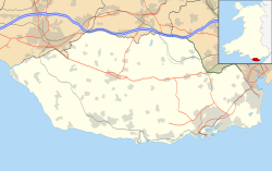
Location within the Vale of Glamorgan | |
Principal area | |
Ceremonial county | |
Country | Wales |
Sovereign state | United Kingdom |
Postcode district | CF |
Police | South Wales |
Fire | South Wales |
Ambulance | Welsh |
UK Parliament | |
Senedd Cymru – Welsh Parliament | |
Downs is a hamlet in the Vale of Glamorgan near the county border with the City of Cardiff. It lies just off the A48 road along a road called Grant's Field, just west of Culverhouse Cross and just south of the historical estate of Coedarhydyglyn. [1] The village of St. Nicholas, Vale of Glamorgan lies to the west. The Traherne Arms lies along the main road near the village and, being near the top of The Tumble hill above Culverhouse Cross, has panoramic views of the Welsh capital of Cardiff.
The Vale of Glamorgan, often referred to as The Vale, is a county borough in Wales, bordering Bridgend, Cardiff, and Rhondda Cynon Taf. With an economy based largely on agriculture and chemicals, it is the southernmost unitary authority in Wales. Attractions include Barry Island Pleasure Park, the Barry Tourist Railway, Medieval wall paintings in St Cadoc's Church, Llancarfan, Porthkerry Park, St Donat's Castle, Cosmeston Lakes Country Park and Cosmeston Medieval Village.
Sully is a village in the community of Sully and Lavernock, in the Vale of Glamorgan, Wales lying on the northern coast of the Bristol Channel, midway between the towns of Penarth and Barry and 7 miles southwest of the Welsh capital city of Cardiff.
Ely is a district and community in Cardiff, Wales. It is to the north of Cowbridge Road West. Caerau defines the boundary to the south as does River Ely to the east and in part to the north.
Culverhouse Cross is a district straddling the boundary between Cardiff and the Vale of Glamorgan, Wales, in the community of Wenvoe.
Corntown is a small village in the Vale of Glamorgan. It lies along the B4524 road, just outside Bridgend, 21.6 miles west of the centre of Cardiff. It has grown around Corntown Farm. Chapel Wood frames part of its western side. The Golden Mile Inn lies along the B4524 just to the northeast of the village.
The hamlet of Porthkerry lies on the Bristol Channel coast of South Wales within the community of Rhoose between that village and the town of Barry to the east. It is very close to the end of the runway of Cardiff International Airport. To the east of the hamlet is Porthkerry Country Park which occupies the valley leading down to the coast.
Wenvoe is a village and community between Barry and Cardiff in the Vale of Glamorgan, Wales. Nearby are the Wenvoe Transmitter near Twyn-yr-Odyn and the site of the former HTV Wales Television Centre at Culverhouse Cross which is now a housing estate. It is home to the Wenvoe Quarry and Wenvoe Castle Golf Club.
Caerau[ˈkai̯r.ai] is a community in the west of Cardiff, capital city of Wales. Often considered part of Wenvoe by gully, Heol Trelai is the main road or avenue, lined with large trees. Dominated mostly by private housing, it has the Western Leisure Centre, supermarkets, schools and churches.
The A4232, which is also known either as the Peripheral Distributor Road (PDR) or the Cardiff Link Road, is a distributor road in Cardiff, the capital of Wales.
The River Ely is in South Wales flowing generally southeast, from Tonyrefail to Cardiff.
The A4050 road connects Barry, Vale of Glamorgan with Culverhouse Cross on the outskirts of Cardiff, Wales. It is approximately 10 miles (16 km) long, and is the key link road between the M4 motorway and Cardiff International Airport.
St. Nicholas is a small village in the Vale of Glamorgan, South Wales. It lies 2 miles west of the capital city, Cardiff and 7 miles from its city centre. St. Nicholas is also the highest altitude village in the Vale of Glamorgan. The population was 417 in 2011. It is in the community of St Nicholas and Bonvilston.
St Lythans is an affluent hamlet and former parish in the Vale of Glamorgan, southeast Wales, just outside western Cardiff. It lies southwest of Culverhouse Cross, west of Wenvoe and southwest of Twyn-yr-Odyn and is also connected by road from Dyffryn and the Five Mile Lane in the west. It is one of the wealthiest communities in the Vale of Glamorgan, containing some notable mansions and cottages, valued on average at over £500,000 as of 2011. The megalithic St Lythans burial chamber, over 6000 years old, lies 1 km to the west of the village and the hamlet also contains the St.Lythans Parish Church or Church of St Bleddian, a Grade II* listed building.
The centre of Cardiff, the capital of Wales, is relatively flat and is bounded by hills on the outskirts to the east, north and west. Its geographic features were influential in its development as the world's largest coal port, most notably its proximity and easy access to the coal fields of the south Wales valleys.
Western Cemetery is a major cemetery located in the western suburb of Ely, Cardiff, Wales. It is located near the Culverhouse Cross roundabout on the A48 road west of the city and provides burial facilities for people of all faiths.
Drope is a hamlet in the valley of the River Ely in Vale of Glamorgan, southeast Wales, just beyond the territorial border of western Cardiff. It lies immediately east from Michaelston-super-Ely, west of Ely, Cardiff and southeast of St Georges-super Ely and is accessed via a bridge along Drope Road across the A4232 road to the north of Culverhouse Cross. Drope was designated a special conservation area in March 1973 by the former Glamorgan County Council due to its architectural heritage.
Twyn-yr-Odyn is a hamlet in the Vale of Glamorgan, southeast Wales, just beyond the territorial border of western Cardiff. It lies just southwest of Culverhouse Cross, very close to Wenvoe and St Lythans. The Wenvoe Transmitter is located here. It is home to a pub named the Horse and Jockey Inn. There is an allotment in the vicinity.
Coedarhydyglyn or Coedriglan, formerly Old Coedarhydyglyn, is a private Grade I listed neo-classical regency villa and estate on the western rim of Cardiff, less than half a mile from Culverhouse Cross, southeast Wales. It is accessed via the A48 road between Cardiff and St. Nicholas at the top of "The Tumble" hill leading up from Culverhouse Cross and Coedarhydyglyn Lane which leads to Drope to the north. The estate lies between the villages of St Georges-super-Ely and Downs just inside the boundary of the Vale of Glamorgan.
St Georges super Ely, also known as St Georges, is a small village and community in the western outskirts of Cardiff, in the Vale of Glamorgan, South Wales. Lying to the northwest of Culverhouse Cross, between Peterston-super-Ely and Michaelston-super-Ely, it contains a medieval church and ruined manor house dated to the fifteenth century.
Wenvoe Tunnel is a disused tunnel on the defunct Barry Railway that runs under Culverhouse Cross in the Vale of Glamorgan in south Wales, on the western outskirts of Cardiff. It was opened in 1889 on a line used to carry coal to Barry Docks. The line also had a sparse passenger service and closed after March 1963.