Penmark

Last updated

Penmark
Kenson Bridge, Penmark.jpg
Vale of Glamorgan UK location map.svg
Red pog.svg
Penmark
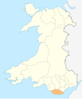
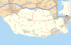
Location within the Vale of Glamorgan
OS grid reference ST058688
Community
Principal area
Ceremonial county
Country Wales
Sovereign state United Kingdom
Post town Barry
Postcode district CF62
Dialling code 01446
Police South Wales
Fire South Wales
Ambulance Welsh
UK Parliament
List of places
UK
Wales
Vale of Glamorgan
51°24′39″N3°21′18″W / 51.41078°N 3.35507°W / 51.41078; -3.35507 Coordinates: 51°24′39″N3°21′18″W / 51.41078°N 3.35507°W / 51.41078; -3.35507

Penmark (Welsh : Pen-marc) is a rural village south-west of Barry near Rhoose in the Vale of Glamorgan, in South Wales. The village is a parish and is a linear village. It has a parish church along the main road running through the village.

Contents

Penmark is located near the international airport for Wales, Cardiff International Airport.
Penmark Castle

The village has the remains of a 13th-century castle. [1]

See also

Related Research Articles

<span class="mw-page-title-main">Vale of Glamorgan</span> County borough in Wales

The Vale of Glamorgan, often referred to as The Vale, is a county borough in the south-east of Wales. It borders Bridgend County Borough to the west, Cardiff to the east, Rhondda Cynon Taf to the north, and the Bristol Channel to the south. With an economy based largely on agriculture and chemicals, it is the southernmost unitary authority in Wales. Attractions include Barry Island Pleasure Park, the Barry Tourist Railway, Medieval wall paintings in St Cadoc's Church, Llancarfan, Porthkerry Park, St Donat's Castle, Cosmeston Lakes Country Park and Cosmeston Medieval Village. The largest town is Barry. Other towns include Penarth, Llantwit Major, and Cowbridge. There are many villages in the county borough.

<span class="mw-page-title-main">Hawarden</span> Village in Flintshire, Wales

Hawarden is a village, community and electoral ward, in Flintshire, Wales. It is part of the Deeside conurbation on the Wales-England border and is home to Hawarden Castle. In the 2011 census the ward of the same name had a population of 1,887, whereas the community of the same name, which also includes Ewloe Mancot and Aston had a population of 13,920. The scenic wooded Hawarden Park abuts the clustered settlement in the south. Hawarden Bridge consists of distribution and industrial business premises beyond Shotton/Queensferry and the Dee. The west of the main street is called The Highway, its start marked by the crossroads with a fountain in the middle, near which are public houses, some with restaurants.

<span class="mw-page-title-main">Splott</span> Area of Cardiff, Wales

Splott is a district and community in the south of the city of Cardiff, capital of Wales, just east of the city centre. It was built up in the late 19th century on the land of two farms of the same name: Upper Splott and Lower Splott Farms. Splott is characterised by its once vast steelworks and rows of tightly knit terraced houses. The suburb of Splott falls into the Splott electoral ward.

<span class="mw-page-title-main">Rhoose</span> Village in the Vale of Glamorgan, Wales

Rhoose is a village and community near the sea in the Vale of Glamorgan, Wales, near Barry. The wider community includes villages and settlements such as Font-y-Gary, Penmark, East Aberthaw and Porthkerry. The population of the community in 2011 was 6,160.

<span class="mw-page-title-main">Barry, Vale of Glamorgan</span> Town in the Vale of Glamorgan, Wales

Barry is a town in the Vale of Glamorgan, Wales, on the north coast of the Bristol Channel approximately 9 miles (14 km) south-southwest of Cardiff. Barry is a seaside resort, with attractions including several beaches and the resurrected Barry Island Pleasure Park. According to Office for National Statistics 2016 estimate data, the population of Barry was 54,673.

<span class="mw-page-title-main">Christ Church, Barbados</span> Parish in Barbados

The parish of Christ Church is one of eleven historic political divisions of Barbados. It has a land area of 57 km2 (22 sq mi) and is found at the southern end of the island. Christ Church has survived by name as one of the original six parishes created in 1629 by Governor Sir William Tufton.

<span class="mw-page-title-main">Middleton St George</span> Human settlement in England

Middleton St George is a large village and civil parish in the borough of Darlington and the ceremonial county of County Durham, England. It is situated approximately 3.5 miles (5.6 km) east of Darlington. According to the 2011 UK Census the population was 3,779, including Middleton One Row, Low Middleton and Oak Tree. It has grown rapidly since the mid-1990s, becoming a commuter area for Darlington. The population of the Darlington ward in question again taken at the 2011 Census was 4,650.

<span class="mw-page-title-main">Elwick, County Durham</span> Village in County Durham, England

Elwick is a village and civil parish in the borough of Hartlepool and the ceremonial county of County Durham, in England. It is situated near the A19 road to the west of Hartlepool. Hartlepool Borough Council governs Elwick. As Elwick is only a small parish it is not able to run itself as its own district. It does have a Parish Council. Elwick was known as a township until 1866, but then was changed to a civil parish status.

<span class="mw-page-title-main">Lliswerry</span> Human settlement in Wales

Lliswerry, or Liswerry is an electoral district (ward) and community of the city of Newport, South Wales. The area is governed by Newport City Council. It is the largest community/ward in the city.

<span class="mw-page-title-main">Whitchurch, Bristol</span> Human settlement in England

Whitchurch is a village in north Somerset, England and an adjoining suburb of southern Bristol, bounded by Hartcliffe to the west and Hengrove and Knowle to the north. The suburb was initially developed during the 1930s.

<span class="mw-page-title-main">Chirbury</span> Human settlement in England

Chirbury is a village in west Shropshire, England. It is situated in the Vale of Montgomery, close to the Wales–England border, which is to its north, west and south. The A490 and B4386 routes cross at Chirbury.

<span class="mw-page-title-main">Porthkerry</span> Hamlet in the Vale of Glamorgan, Wales

The hamlet of Porthkerry lies on the Bristol Channel coast of South Wales within the community of Rhoose between that village and the town of Barry to the east. It is very close to the end of the runway of Cardiff International Airport. To the east of the hamlet is Porthkerry Country Park which occupies the valley leading down to the coast.

<span class="mw-page-title-main">Aberthaw</span> Human settlement in Wales

Aberthaw is an area containing the villages of East Aberthaw and West Aberthaw, on the coast of South Wales about 5 miles (8 km) west of Barry. It is home to Aberthaw Cement Works, Aberthaw Lime Works, and Aberthaw Power Station, a coal power station that is linked to the South Wales Valleys via the Vale of Glamorgan Railway. The area is historically within the parish of Penmark in the Vale of Glamorgan. The two villages of West and East Aberthaw are separated by the River Thaw. The village of East Aberthaw, near Rhoose, has a 13th-century pub. The village Baptist Chapel and Mission Room, no longer exist as such and have been converted for other uses.

<span class="mw-page-title-main">Little Snoring</span> Village in Norfolk, England

Little Snoring is a village and a civil parish in Norfolk, England.

<span class="mw-page-title-main">Plumstead, Norfolk</span> Village and civil parish in Norfolk, England

Plumstead is a village and a civil parish in the English county of Norfolk. The village is 19.7 miles (31.7 km) north north west of Norwich, 9.5 miles (15.3 km) south-west of Cromer and 134 miles (216 km) north-east of London. The nearest town is Holt which is 4.8 miles (7.7 km) to the north west of the village. The nearest railway station is in the town of Sheringham where access to the national rail network can be made via the Bittern Line to Norwich. The nearest airport is Norwich International Airport. Plumstead falls within the area covered by North Norfolk District Council.

<span class="mw-page-title-main">Gimingham</span> Human settlement in England

Gimingham is a village and civil parish in the English county of Norfolk. Gimingham has no shops, but has a Church, a pond and a preserved Water Mill. The village is 4.1 miles (6.6 km) north of North Walsham and 6.1 miles (9.8 km) south east of Cromer. It is 21.6 miles (34.8 km) north of the city of Norwich. Nearby road communications with Gimingham are the A140 to Norwich, the A148 (direct) and A149 to King's Lynn, and the A149 into the Norfolk Broads and Great Yarmouth. The B1159 is a coastal road between Cromer and Mundesley. The nearest airport is Norwich International Airport.

<span class="mw-page-title-main">Guestwick</span> Human settlement in England

Guestwick is a village and a civil parish in the English county of Norfolk. The village is 19.6 miles (31.5 km) south-west of Cromer, 18.7 miles (30.1 km) north-west of Norwich and 131 miles (211 km) north-east of London. The village lies 10.2 miles (16.4 km) west of the nearby town of Aylsham. The village lies far from any High roads. The nearest railway station is at Sheringham for the Bittern Line which runs between Sheringham, Cromer and Norwich. The nearest airport is Norwich International Airport.

<span class="mw-page-title-main">A4226 road</span> Road in the Vale of Glamorgan

The A4226 is a main road linking Bonvilston to Barry and Cardiff International Airport (CIA) in the Vale of Glamorgan, Wales.

<span class="mw-page-title-main">River Thaw</span> River in United Kingdom, Wales

The River Thaw is a river in the Vale of Glamorgan, south Wales. At 20 kilometres/12.4 miles, it is the longest river entirely in the Vale of Glamorgan.

<span class="mw-page-title-main">B4265 road</span>

The B4265 road is a main road in the Vale of Glamorgan, southeastern Wales, running in a northwesterly direction along near the coast. It links Cardiff Airport to Bridgend, lasting for 15.9 miles (25.6 km). The road begins at the roundabout near the airport and the village of Penmark at 51°24′21″N3°20′39″W as a continuation of the A4226 road leading from Barry. Passing the junction turnoff to Gileston and St Athan, at Llantwit Major, the B4270 road branches off to the northwest to Llandow Industrial Estate. The road then moves progressively in northwesterly direction until St Brides Major, where the B4524 road to the south connects it to Southerndown and Ogmore-by-Sea. At St Brides Major, the road shifts to a northerly direction, where it passes Ewenny and Ogmore village leading to Bridgend, where it joins the A48 road and finally A473 road at 51°30′7″N3°34′34″W.

References

  1. Joanna Billing (2003). The Hidden Places Of Wales. Travel Publishing Ltd. ISBN   190443407X.