Broughton, Vale of Glamorgan

Last updated

Broughton
The Malthouse, Broughton, Vale of Glamorgan. - geograph.org.uk - 374656.jpg
The Malthouse
Vale of Glamorgan UK location map.svg
Red pog.svg
Broughton
Location within the Vale of Glamorgan
OS grid reference SS922710
Principal area
Ceremonial county
Country Wales
Sovereign state United Kingdom
Postcode district CF
Police South Wales
Fire South Wales
Ambulance Welsh
UK Parliament
Senedd Cymru – Welsh Parliament
List of places
UK
Wales
Vale of Glamorgan
51°25′39″N3°33′09″W / 51.4275°N 3.5525°W / 51.4275; -3.5525 Coordinates: 51°25′39″N3°33′09″W / 51.4275°N 3.5525°W / 51.4275; -3.5525

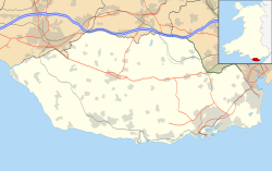
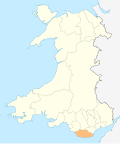
Broughton is a small village in the western part of the Vale of Glamorgan, southeast Wales. It lies just northeast of Monknash and south of Wick. It contains a building known as "The Malthouse", now converted into flats. [1] The village has extensive remains of a grange of the former Cistercian Neath Abbey including a dove cote and tithe barn.
Related Research Articles

Vale of Glamorgan County borough

The Vale of Glamorgan, often referred to as The Vale, is a county borough in Wales, bordering Bridgend, Cardiff, and Rhondda Cynon Taf. With an economy based largely on agriculture and chemicals, it is the southernmost unitary authority in Wales. Attractions include Barry Island Pleasure Park, the Barry Tourist Railway, Medieval wall paintings in St Cadoc's Church, Llancarfan, Porthkerry Park, St Donat's Castle, Cosmeston Lakes Country Park and Cosmeston Medieval Village.

Glamorgan Historic county of Wales

Glamorgan, or sometimes Glamorganshire, is one of the thirteen historic counties of Wales and a former administrative county of Wales. Originally an early medieval petty kingdom of varying boundaries known as Glywysing. Then taken over by the Normans as a lordship. The area that became known as Glamorgan was both a rural, pastoral area, and a conflict point between the Norman lords and the Welsh princes. It was defined by a large concentration of castles.

Ogmore is a village in the Vale of Glamorgan, Wales on the River Ogmore. It grew around the now ruined Ogmore Castle, built by the Normans.

Colwinston Human settlement in Wales

Colwinston is both a village and a community in the Vale of Glamorgan, Wales, approximately 4 miles (6.4 km) southeast of the centre of Bridgend and 21 miles (34 km) west of the centre of Cardiff. The village is located within 12 mile (0.80 km) of the A48. The population in 2005 was approximately 400 but with recent building development, the population is now estimated at over 600 people.

Rhoose Human settlement in Wales

Rhoose is a village and community near the sea in the Vale of Glamorgan, Wales, near Barry. The wider community includes villages and settlements such as Font-y-Gary, Penmark, East Aberthaw and Porthkerry. The population of the community in 2011 was 6,160.

Barry, Vale of Glamorgan Settlement in the Vale of Glamorgan, Wales

Barry is a town in the Vale of Glamorgan, Wales, on the north coast of the Bristol Channel approximately 9 miles (14 km) south-southwest of Cardiff. Barry is a seaside resort, with attractions including several beaches and the resurrected Barry Island Pleasure Park. According to Office for National Statistics 2016 estimate data, the population of Barry was 54,673.

Vale of Glamorgan (UK Parliament constituency) Parliamentary constituency in the United Kingdom, 1983 onwards

Vale of Glamorgan is a constituency represented in the House of Commons of the UK Parliament since 2010 by Alun Cairns, a Conservative.

Vale of Glamorgan Line Commuter rail line in Wales

The Vale of Glamorgan Line is a commuter railway line in Wales, running through the Vale of Glamorgan from Barry to Bridgend, via Rhoose and Llantwit Major.

Llantwit Major railway station Railway station in South Wales

Llantwit Major railway station is a railway station serving the small town of Llantwit Major, South Wales. It is located on the Vale of Glamorgan Line, 18+14 miles (29.4 km) west of Cardiff Central towards Bridgend via Barry and Rhoose. The present station opened on 12 June 2005, when passenger services were restored on the section of line between Barry and Bridgend.

St Brides Major Human settlement in Wales

St. Brides Major is a village within the community also called St Brides Major in the Vale of Glamorgan in Wales.

Aberthaw Human settlement in Wales

Aberthaw is an area containing the villages of East Aberthaw and West Aberthaw, on the coast of South Wales about 5 miles (8 km) west of Barry. It is home to Aberthaw Cement Works, Aberthaw Lime Works, and Aberthaw Power Station, a coal power station that is linked to the South Wales Valleys via the Vale of Glamorgan Railway. The area is historically within the parish of Penmark in the Vale of Glamorgan. The two villages of West and East Aberthaw are separated by the River Thaw. The village of East Aberthaw, near Rhoose, has a 13th century pub. The village Baptist Chapel and Mission Room, no longer exist as such and have been converted for other uses.

Cosmeston Lakes Country Park

Cosmeston Lakes Country Park is a public country park in Great Britain, owned and managed by Vale of Glamorgan Council. It is situated between Penarth and Sully, Vale of Glamorgan, 7.3 miles from Cardiff. On 1 May 2013 the country park was designated a Local Nature Reserve LNR. Parts are Sites of Special Scientific Interest. The park, visitor centre and cafe are open all year round.

Llancarfan Human settlement in Wales

Llancarfan is a rural village and community in the Vale of Glamorgan, Wales. The village, located west of Barry and near Cowbridge, has a well-known parish church, the site of Saint Cadoc's 6th-century clas, famed for its learning. Cainnech of Aghaboe, Caradoc of Llancarfan and many other Welsh holy men studied there. At the 2001 census, the community had a population of 736., in 2011 census it was 747. Most of the village lies within a conservation area designated by the local authority in 1971. Buildings listed as being of special historic interest include The Fox and Hounds public house, the former Bethlehem Chapel, the former Wesleyan Chapel, Chapel Cottage, Great House, Corner House and Llancarfan Primary School. The community includes village of Moulton.

Cowbridge with Llanblethian Human settlement in Wales

Cowbridge with Llanblethian is a community in the Vale of Glamorgan, Wales, which incorporates Llanblethian and the town of Cowbridge. It also covers the village of Aberthin to the northeast of Cowbridge. The population was 4,063 in 2011.

Llandow Human settlement in Wales

Llandow is a village and community in the Vale of Glamorgan, Wales. The community population taken at the 2011 census was 726. The village is located 15 miles (24 km) south west of Cardiff. The community includes the villages of Sigingstone and Llysworney.

Llysworney Human settlement in Wales

Llysworney is a small village in the Vale of Glamorgan, South Wales, in the community of Llandow.

Downs, Vale of Glamorgan Human settlement in Wales

Downs is a hamlet in the Vale of Glamorgan near the county border with the City of Cardiff. It lies just off the A48 road along a road called Grant's Field, just west of Culverhouse Cross and just south of the historical estate of Coedarhydyglyn. The village of St. Nicholas, Vale of Glamorgan lies to the west. The Traherne Arms lies along the main road near the village and, being near the top of The Tumble hill above Culverhouse Cross, has panoramic views of the Welsh capital of Cardiff.

Eglwys Brewis Human settlement in Wales

Eglwys Brewis is a village in the Vale of Glamorgan in south Wales. It is located just to the north of the village of St Athan, south of Flemingston and northeast of Llantwit Major. Greenlands and St Mary Church lie to the north by road from Eglwys Brewis. The village consists primarily of residential estates which were originally built in the mid-20th century for service families stationed at nearby RAF St Athan. The estates are regularly used by driving instructors in the Vale of Glamorgan. Nant y Stepsau flows in the vicinity.

St Nicholas and Bonvilston Community in Vale of Glamorgan, Wales

St Nicholas with Bonvilston is a Community Council in the Vale of Glamorgan, Wales. Formed in 1982, it includes the villages of St Nicholas, Bonvilston, and four properties in Dyffryn.

Michaelston-le-Pit and Leckwith

Michaelston-le-Pit and Leckwith is a community in the Vale of Glamorgan, Wales. It is located immediately southwest of the city of Cardiff and to the north of the Vale of Glamorgan villages of Llandough and Dinas Powys. As its name suggests, the community includes the small villages of Michaelston-le-Pit and Leckwith. The community population comprises only just under 250 adults.

References

  1. "County treasures" (PDF). Vale of Glamorgan Council . Retrieved 19 April 2012.