Llysworney

Last updated

Llysworney
Llysworney village centre - geograph.org.uk - 288823.jpg
Llysworney village centre
Vale of Glamorgan UK location map.svg
Red pog.svg
Llysworney
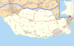
Location within the Vale of Glamorgan
OS grid reference SS962741
Principal area
Preserved county
Country Wales
Sovereign state United Kingdom
Postcode district CF
Police South Wales
Fire South Wales
Ambulance Welsh
UK Parliament
Senedd Cymru – Welsh Parliament
List of places
UK
Wales
Vale of Glamorgan
51°27′24″N3°29′42″W / 51.4566°N 3.4951°W / 51.4566; -3.4951

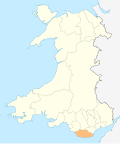
Llysworney (Welsh : Llyswyrni) is a small village in the Vale of Glamorgan, South Wales, in the community of Llandow.

Contents

Llysworney is home to about 240 people and has around 100 houses. It is situated about 2 miles away from Cowbridge in the Vale of Glamorgan. It is in the historic county of Glamorgan. The B4268 runs through the village. The village includes the Carne Arms pub, St. Tydfil's Church, a duck pond, and Llysworney Garage.
Notable landmarks

The Carne Arms

Dating back over 400 years the Carne Arms is an old inn with open fires. Thought to have originally been part of the local Rectory, it is named after the Carne family, who were wealthy landowners in the local area.

St. Tydfil's Church

St Tydfil's Church St.Tydfils Church, Llysworney (geograph 4777340).jpg
St Tydfil's Church

St. Tydfil's Church is dedicated to the fifth century saint Tydfil. The church is medieval. [1]

Worney Wood

The wood was established in 2000 and is managed by the Woodland Trust. It is open to the public. [2]

References

  1. "St Tydfil's Church, Llysworney (409956)". Coflein. RCAHMW . Retrieved 3 March 2024.
  2. "Worney Wood Llysworney". Woodland Trust . Retrieved 3 March 2024.