Newport West Central | |
|---|---|
| General information | |
| Location | Maesglas, Newport Wales |
| Grid reference | ST300863 |
Newport West Central railway station is a proposed station on the Ebbw Valley Railway in the city of Newport, Wales.
Newport West Central | |
|---|---|
| General information | |
| Location | Maesglas, Newport Wales |
| Grid reference | ST300863 |
Newport West Central railway station is a proposed station on the Ebbw Valley Railway in the city of Newport, Wales.
The station is proposed in SEWTA's Rail Strategy [1] to serve the Monmouthshire Bank redevelopment area. [2] The site for the station is on Bideford Road, adjacent to the Harlech Retail Park. [3] Access to the Monmouthshire Bank redevelopment area will be via the original Western Valley Line bridge over the South Wales Main Line.
The station received attention from the Welsh Government in 2011 following queries made by South Wales East AM Jocelyn Davies, [4] but has in recent years been neglected in favour of station reopenings in the Cardiff area.
Following the decision by First Minister Mark Drakeford in 2019 to reject the M4 relief road proposal, [5] up to £1.4bn is available through the Welsh Government's borrowing facility [6] for improving infrastructure in and around the south east Wales M4. Reopenings in Newport have as a result been again debated. [7]
| Preceding station | Future services | Following station | ||
|---|---|---|---|---|
| Cardiff Central | Transport for Wales South Wales Main Line | Newport | ||

The M4, originally the London-South Wales Motorway, is a motorway in the United Kingdom running from west London to southwest Wales. The English section to the Severn Bridge was constructed between 1961 and 1971; the Welsh element was largely complete by 1980, though a non-motorway section around Briton Ferry bridge remained until 1993. On the opening of the Second Severn Crossing in 1996, the M4 was rerouted over it.

Newport is a city and county borough in Wales, situated on the River Usk close to its confluence with the Severn Estuary, 12 mi (19 km) northeast of Cardiff. With a population of 145,700 at the 2011 census, Newport is the third-largest principal authority with city status in Wales, and seventh most populous overall. Newport became a unitary authority in 1996 and forms part of the Cardiff-Newport metropolitan area, also known as the Cardiff Capital Region. Newport was the site of the last large-scale armed insurrection in Great Britain, the Newport Rising of 1839. The population grew considerably between the 2011 and the 2021 census, rising to 159,587, the largest growth of any unitary authority in Wales.

Newport is the second-busiest railway station in Wales. It is situated in Newport city centre and 158 miles 50 chains (255.3 km) from London Paddington, via Stroud.
The Merthyr line is a commuter railway line in South Wales from central Cardiff to Merthyr Tydfil and Aberdare. The line is part of the Cardiff urban rail network, known as the Valley Lines.

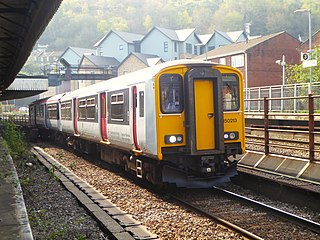
The Ebbw Valley Railway is a branch line of the South Wales Main Line in South Wales. Transport for Wales Rail provides an hourly passenger service each way between Ebbw Vale Town and Cardiff Central, and an hourly service each way between Ebbw Vale Town and Newport.

Transport in Wales is heavily influenced by the country's geography. Wales is predominantly hilly or mountainous, and the main settlements lie on the coasts of north and south Wales, while mid Wales and west Wales are lightly populated. The main transport corridors are east–west routes, many continuing eastwards into England.

Pontyclun railway station is an unstaffed, minor railway station in Pontyclun, in the County Borough of Rhondda Cynon Taf, South Wales. The station is at street level, on Station Approach, Pontyclun. It is a stop on the South Wales Main Line, served by trains on the Maesteg Line, and occasionally by the Swanline Cardiff to Swansea regional services, as well as one early-morning daily service to Manchester and a late-night daily service to Carmarthen. The station and all trains are operated by Transport for Wales Rail. It is 181 miles 40 chains (292.1 km) from the zero point at London Paddington, measured via Stroud.
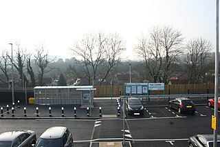
Pye Corner railway station is a station serving a residential area in the west of Newport, Wales, between the suburbs of Bassaleg and High Cross. It opened on 14 December 2014.

Talbot Green is a town just north of the M4 motorway, in the County Borough of Rhondda Cynon Taf, Wales in the United Kingdom. The town is part of Llantrisant Community Council.

The M4 relief road, also known as M4 Corridor around Newport (M4CaN), was a proposed motorway, south of the city of Newport, South Wales, intended to relieve traffic congestion on the M4 motorway.

Abertillery railway station was a station which served Abertillery, in the Welsh county of Monmouthshire.

Ebbw Vale Town railway station serves the town centre of Ebbw Vale in Blaenau Gwent, Wales, serving as the terminus of the Ebbw Valley Railway.
Llanwern railway station is a former station serving Llanwern on the east side of the city of Newport.
Newport West railway station is a proposed station to serve the western suburbs of the city of Newport, Wales.

Caerleon railway station is a former station serving Caerleon on the east side of the city of Newport, UK and a proposed future station as part of the South Wales Metro.

St Clears railway station served the town of St Clears, Carmarthenshire, Wales between 1854 and 1964. It was on the West Wales Line.

Magor railway station is a former station serving Magor, Monmouthshire, east of the city of Newport and west of Caldicot. It was opened as a broad gauge line with the South Wales Railway in 1850 and closed to passengers in 1964. The line was quadrupled in 1941.
The South Wales Metro is an integrated heavy rail, light rail and bus-based public transport services and systems network currently being developed in South East Wales around the hub of Cardiff Central. The first phase was approved for development in October 2013. Works are currently under way, with a new depot under construction at Taff's Well and new trains being built by Stadler Rail in Switzerland. The development will also include the electrification of the core Valley Lines and new stations.
Somerton railway station is a proposed station to serve the Somerton suburb of the city of Newport, Wales.
| Organisations | |
|---|---|
| Main lines | |
| Metro lines | |
| Major rail stations | |
| Bus interchanges | |
| Bus operators | |
| Proposed stations | |
| Active travel | |
Transport in Newport | ||
|---|---|---|
| Road |  | |
| Bus | ||
| Railway lines | ||
| Railway stations | ||
| Cycling | ||
| Walking | ||
| Waterways | ||
| Sea | ||
| Transporter bridge | ||
51°34′17″N3°00′32″W / 51.5715°N 3.009°W
| | This Wales railway station-related article is a stub. You can help Wikipedia by expanding it. |