List of United Kingdom locations: Hu-Hz

Last updated

The United Kingdom Uk-map.svg
The United Kingdom

This is part of the list of United Kingdom locations: a gazetteer of place names in the United Kingdom showing each place's locality and geographical coordinates.

Contents

Hu

Hub-Hum

LocationLocality Coordinates
(links to map & photo sources)
OS grid
reference
Hubbard's Hill Kent 51°14′N0°11′E / 51.24°N 00.19°E / 51.24; 00.19 TQ5352
Hubberholme North Yorkshire 54°11′N2°07′W / 54.19°N 02.12°W / 54.19; -02.12 SD9278
Hubberston Pembrokeshire 51°43′N5°03′W / 51.71°N 05.05°W / 51.71; -05.05 SM8906
Hubbersty Head Cumbria 54°19′N2°53′W / 54.31°N 02.89°W / 54.31; -02.89 SD4291
Hubberton Green Calderdale 53°41′N1°57′W / 53.69°N 01.95°W / 53.69; -01.95 SE0322
Hubbert's Bridge Lincolnshire 52°58′N0°07′W / 52.96°N 00.12°W / 52.96; -00.12 TF2643
Huby Harrogate, North Yorkshire 53°55′N1°35′W / 53.91°N 01.59°W / 53.91; -01.59 SE2747
Huby Hambleton, North Yorkshire 54°04′N1°08′W / 54.07°N 01.14°W / 54.07; -01.14 SE5665
Hucclecote Gloucestershire 51°51′N2°12′W / 51.85°N 02.20°W / 51.85; -02.20 SO8617
Hucking Kent 51°17′N0°38′E / 51.29°N 00.63°E / 51.29; 00.63 TQ8458
Hucknall Nottinghamshire 53°02′N1°13′W / 53.03°N 01.21°W / 53.03; -01.21 SK5349
Huddersfield Kirklees 53°38′N1°47′W / 53.64°N 01.78°W / 53.64; -01.78 SE1416
Huddington Worcestershire 52°13′N2°05′W / 52.21°N 02.08°W / 52.21; -02.08 SO9457
Huddisford Devon 50°56′N4°25′W / 50.94°N 04.42°W / 50.94; -04.42 SS3019
Huddlesford Staffordshire 52°40′N1°46′W / 52.67°N 01.77°W / 52.67; -01.77 SK1509
Hud Hey Lancashire 53°43′N2°20′W / 53.71°N 02.33°W / 53.71; -02.33 SD7824
Hudnall Hertfordshire 51°48′N0°33′W / 51.80°N 00.55°W / 51.80; -00.55 TL0013
Hudnalls Gloucestershire 51°43′N2°40′W / 51.72°N 02.66°W / 51.72; -02.66 SO5403
Hudswell North Yorkshire 54°23′N1°47′W / 54.39°N 01.78°W / 54.39; -01.78 NZ1400
Hudswell Wiltshire 51°25′N2°13′W / 51.42°N 02.21°W / 51.42; -02.21 ST8569
Huggate East Riding of Yorkshire 53°59′N0°39′W / 53.98°N 00.65°W / 53.98; -00.65 SE8855
Hugglepit Devon 50°59′N4°25′W / 50.99°N 04.42°W / 50.99; -04.42 SS3024
Hugglescote Leicestershire 52°42′N1°22′W / 52.70°N 01.37°W / 52.70; -01.37 SK4212
Hughenden Valley Buckinghamshire 51°39′N0°45′W / 51.65°N 00.75°W / 51.65; -00.75 SU8696
Hughley Shropshire 52°34′N2°39′W / 52.56°N 02.65°W / 52.56; -02.65 SO5697
Hugh Mill Lancashire 53°41′N2°15′W / 53.68°N 02.25°W / 53.68; -02.25 SD8321
Hughton Highland 57°26′N4°33′W / 57.43°N 04.55°W / 57.43; -04.55 NH4741
Hugh Town Isles of Scilly 49°54′N6°19′W / 49.90°N 06.31°W / 49.90; -06.31 SV9010
Hugus Cornwall 50°14′N5°07′W / 50.24°N 05.12°W / 50.24; -05.12 SW7743
Huish (near Instow)Devon 51°02′N4°10′W / 51.04°N 04.16°W / 51.04; -04.16 SS4829
Huish (near Merton)Devon 50°52′N4°05′W / 50.87°N 04.09°W / 50.87; -04.09 SS5311
Huish Wiltshire 51°22′N1°48′W / 51.36°N 01.80°W / 51.36; -01.80 SU1463
Huish Champflower Somerset 51°03′N3°22′W / 51.05°N 03.37°W / 51.05; -03.37 ST0429
Huish Episcopi Somerset 51°02′N2°49′W / 51.03°N 02.81°W / 51.03; -02.81 ST4326
Hulcote Bedfordshire 52°02′N0°38′W / 52.03°N 00.63°W / 52.03; -00.63 SP9438
Hulcote Northamptonshire 52°08′N0°58′W / 52.13°N 00.97°W / 52.13; -00.97 SP7049
Hulcott Buckinghamshire 51°50′N0°46′W / 51.83°N 00.76°W / 51.83; -00.76 SP8516
Hulham Devon 50°38′N3°24′W / 50.63°N 03.40°W / 50.63; -03.40 SY0183
Hull East Riding of Yorkshire 53°59′N0°23′W / 53.98°N 00.38°W / 53.98; -00.38 TA057558
Hulland Derbyshire 53°01′N1°38′W / 53.01°N 01.64°W / 53.01; -01.64 SK2446
Hulland Moss Derbyshire 53°01′N1°37′W / 53.01°N 01.62°W / 53.01; -01.62 SK2546
Hulland Ward Derbyshire 53°01′N1°37′W / 53.02°N 01.62°W / 53.02; -01.62 SK2547
Hullavington Wiltshire 51°32′N2°10′W / 51.53°N 02.16°W / 51.53; -02.16 ST8982
Hull Bridge East Riding of Yorkshire 53°52′N0°23′W / 53.86°N 00.39°W / 53.86; -00.39 TA0541
Hullbridge Essex 51°37′N0°37′E / 51.61°N 00.61°E / 51.61; 00.61 TQ8194
Hull End Derbyshire 53°20′N1°55′W / 53.33°N 01.92°W / 53.33; -01.92 SK0582
Hulme Trafford 53°28′N2°15′W / 53.46°N 02.25°W / 53.46; -02.25 SJ8396
Hulme Cheshire 53°25′N2°36′W / 53.41°N 02.60°W / 53.41; -02.60 SJ6091
Hulme Staffordshire 53°00′N2°06′W / 53.00°N 02.10°W / 53.00; -02.10 SJ9345
Hulme End Staffordshire 53°07′N1°51′W / 53.12°N 01.85°W / 53.12; -01.85 SK1059
Hulme Walfield Cheshire 53°11′N2°14′W / 53.18°N 02.24°W / 53.18; -02.24 SJ8465
Hulseheath Cheshire 53°20′N2°25′W / 53.34°N 02.42°W / 53.34; -02.42 SJ7283
Hulverstone Isle of Wight 50°39′N1°26′W / 50.65°N 01.44°W / 50.65; -01.44 SZ3984
Hulver Street Suffolk 52°25′N1°38′E / 52.41°N 01.63°E / 52.41; 01.63 TM4786
Humber Devon 50°33′N3°34′W / 50.55°N 03.56°W / 50.55; -03.56 SX8974
Humber Herefordshire 52°12′N2°41′W / 52.20°N 02.68°W / 52.20; -02.68 SO5356
Humberston North East Lincolnshire 53°31′N0°01′W / 53.52°N 00.02°W / 53.52; -00.02 TA3105
Humberstone City of Leicester 52°38′N1°05′W / 52.63°N 01.08°W / 52.63; -01.08 SK6205
Humberston Fitties North East Lincolnshire 53°31′N0°01′E / 53.52°N 00.01°E / 53.52; 00.01 TA3305
Humberton North Yorkshire 54°07′N1°21′W / 54.11°N 01.35°W / 54.11; -01.35 SE4268
Humbie East Lothian 55°50′N2°53′W / 55.84°N 02.88°W / 55.84; -02.88 NT4562
Humbledon Sunderland 54°53′N1°25′W / 54.88°N 01.42°W / 54.88; -01.42 NZ3755
Humble Green Suffolk 52°04′N0°49′E / 52.07°N 00.81°E / 52.07; 00.81 TL9345
Humbleton East Riding of Yorkshire 53°47′N0°08′W / 53.78°N 00.14°W / 53.78; -00.14 TA2234
Humby Lincolnshire 52°52′N0°31′W / 52.87°N 00.51°W / 52.87; -00.51 TF0032
Hume Scottish Borders 55°40′N2°28′W / 55.66°N 02.47°W / 55.66; -02.47 NT7041
Humla Highland 57°01′N6°37′W / 57.01°N 06.61°W / 57.01; -06.61 NG197005
Hummersknott Darlington 54°31′N1°35′W / 54.52°N 01.59°W / 54.52; -01.59 NZ2614
Humshaugh Northumberland 55°02′N2°08′W / 55.03°N 02.14°W / 55.03; -02.14 NY9171

Hun

LocationLocality Coordinates
(links to map & photo sources)
OS grid
reference
Huncoat Lancashire 53°46′N2°21′W / 53.76°N 02.35°W / 53.76; -02.35 SD7730
Huncote Leicestershire 52°34′N1°14′W / 52.56°N 01.24°W / 52.56; -01.24 SP5197
Hunda Orkney Islands 58°51′N2°58′W / 58.85°N 02.97°W / 58.85; -02.97 ND436971
Hundalee Scottish Borders 55°27′N2°34′W / 55.45°N 02.57°W / 55.45; -02.57 NT6418
Hundall Derbyshire 53°17′N1°26′W / 53.28°N 01.43°W / 53.28; -01.43 SK3877
Hunder Holm Shetland Islands 60°21′N1°04′W / 60.35°N 01.07°W / 60.35; -01.07 HU513634
Hunderthwaite Durham 54°35′N2°02′W / 54.58°N 02.03°W / 54.58; -02.03 NY9821
Hunderton Herefordshire 52°02′N2°44′W / 52.03°N 02.74°W / 52.03; -02.74 SO4938
Hundleby Lincolnshire 53°10′N0°04′E / 53.17°N 00.06°E / 53.17; 00.06 TF3866
Hundle Houses Lincolnshire 53°04′N0°09′W / 53.06°N 00.15°W / 53.06; -00.15 TF2453
Hundleshope Scottish Borders 55°37′N3°13′W / 55.61°N 03.22°W / 55.61; -03.22 NT2336
Hundleton Pembrokeshire 51°40′N4°57′W / 51.66°N 04.95°W / 51.66; -04.95 SM9600
Hundon Suffolk 52°06′N0°31′E / 52.10°N 00.52°E / 52.10; 00.52 TL7348
Hundred End Lancashire 53°41′N2°53′W / 53.69°N 02.89°W / 53.69; -02.89 SD4122
Hundred House Powys 52°10′N3°18′W / 52.17°N 03.30°W / 52.17; -03.30 SO1154
Huney Shetland Islands 60°44′N0°49′W / 60.73°N 00.81°W / 60.73; -00.81 HP647064
Hungarton Leicestershire 52°39′N0°59′W / 52.65°N 00.98°W / 52.65; -00.98 SK6907
Hungate Leeds 53°43′N1°26′W / 53.72°N 01.44°W / 53.72; -01.44 SE3726
Hungerford Somerset 51°09′N3°22′W / 51.15°N 03.37°W / 51.15; -03.37 ST0440
Hungerford Shropshire 52°29′N2°41′W / 52.49°N 02.69°W / 52.49; -02.69 SO5389
Hungerford (Waltham St Lawrence)Berkshire 51°27′N0°49′W / 51.45°N 00.82°W / 51.45; -00.82 SU8274
Hungerford (town)Berkshire 51°25′N1°31′W / 51.41°N 01.52°W / 51.41; -01.52 SU3368
Hungerford Green Berkshire 51°30′N1°12′W / 51.50°N 01.20°W / 51.50; -01.20 SU5579
Hungerford Newtown Berkshire 51°26′N1°29′W / 51.43°N 01.49°W / 51.43; -01.49 SU3571
Hunger Hill Lancashire 53°35′49″N2°41′47″W / 53.59694°N 2.69639°W / 53.59694; -2.69639 SD5311
Hunger Hill Bolton 53°33′N2°29′W / 53.55°N 02.49°W / 53.55; -02.49 SD6706
Hungershall Park Kent 51°07′N0°14′E / 51.11°N 00.24°E / 51.11; 00.24 TQ5738
Hungerstone Herefordshire 52°01′N2°49′W / 52.01°N 02.81°W / 52.01; -02.81 SO4435
Hungerton Lincolnshire 52°52′N0°42′W / 52.86°N 00.70°W / 52.86; -00.70 SK8730
Hungladder Highland 57°39′N6°23′W / 57.65°N 06.39°W / 57.65; -06.39 NG3871
Hungreyhatton Shropshire 52°50′N2°29′W / 52.83°N 02.49°W / 52.83; -02.49 SJ6726
Hunmanby North Yorkshire 54°10′N0°20′W / 54.17°N 00.33°W / 54.17; -00.33 TA0977
Hunmanby Moor North Yorkshire 54°10′N0°18′W / 54.17°N 00.30°W / 54.17; -00.30 TA1177
Hunningham Warwickshire 52°18′N1°27′W / 52.30°N 01.45°W / 52.30; -01.45 SP3768
Hunningham Hill Warwickshire 52°18′N1°26′W / 52.30°N 01.44°W / 52.30; -01.44 SP3867
Hunnington Worcestershire 52°25′N2°04′W / 52.42°N 02.06°W / 52.42; -02.06 SO9681
Hunny Hill Isle of Wight 50°41′N1°18′W / 50.69°N 01.30°W / 50.69; -01.30 SZ4989
Hunsdon Hertfordshire 51°48′N0°02′E / 51.80°N 00.04°E / 51.80; 00.04 TL4114
Hunsdonbury Hertfordshire 51°47′N0°02′E / 51.79°N 00.04°E / 51.79; 00.04 TL4113
Hunsingore North Yorkshire 53°58′N1°22′W / 53.97°N 01.36°W / 53.97; -01.36 SE4253
Hunslet Leeds 53°46′N1°32′W / 53.77°N 01.54°W / 53.77; -01.54 SE3031
Hunslet Carr Leeds 53°46′N1°32′W / 53.76°N 01.54°W / 53.76; -01.54 SE3030
Hunsonby Cumbria 54°42′N2°39′W / 54.70°N 02.65°W / 54.70; -02.65 NY5835
Hunstanton Norfolk 52°56′N0°29′E / 52.93°N 00.48°E / 52.93; 00.48 TF6740
Hunstanworth Durham 54°50′N2°05′W / 54.83°N 02.09°W / 54.83; -02.09 NY9449
Hunsterson Cheshire 53°01′N2°28′W / 53.01°N 02.46°W / 53.01; -02.46 SJ6946
Hunston West Sussex 50°48′N0°47′W / 50.80°N 00.78°W / 50.80; -00.78 SU8601
Hunston Suffolk 52°16′N0°53′E / 52.27°N 00.88°E / 52.27; 00.88 TL9768
Hunston Green Suffolk 52°15′N0°53′E / 52.25°N 00.89°E / 52.25; 00.89 TL9866
Hunstrete Bath and North East Somerset 51°21′N2°31′W / 51.35°N 02.51°W / 51.35; -02.51 ST6462
Hunsworth Kirklees 53°44′N1°43′W / 53.73°N 01.72°W / 53.73; -01.72 SE1827
Hunt End Worcestershire 52°16′N1°57′W / 52.27°N 01.95°W / 52.27; -01.95 SP0364
Huntenhull Green Wiltshire 51°13′N2°15′W / 51.22°N 02.25°W / 51.22; -02.25 ST8247
Huntercombe End Oxfordshire 51°34′N1°01′W / 51.57°N 01.01°W / 51.57; -01.01 SU6887
Hunters Forstal Kent 51°21′N1°07′E / 51.35°N 01.12°E / 51.35; 01.12 TR1866
Hunter's Quay Argyll and Bute 55°58′N4°55′W / 55.96°N 04.91°W / 55.96; -04.91 NS1879
Huntham Somerset 51°01′N2°57′W / 51.02°N 02.95°W / 51.02; -02.95 ST3325
Huntingdon Cambridgeshire 52°20′N0°11′W / 52.33°N 00.18°W / 52.33; -00.18 TL2472
Huntingfield Suffolk 52°19′N1°25′E / 52.31°N 01.41°E / 52.31; 01.41 TM3374
Huntingford Dorset 51°04′N2°17′W / 51.06°N 02.28°W / 51.06; -02.28 ST8029
Huntingford South Gloucestershire 51°38′N2°25′W / 51.63°N 02.42°W / 51.63; -02.42 ST7193
Huntington Cheshire 53°10′N2°52′W / 53.17°N 02.86°W / 53.17; -02.86 SJ4264
Huntington East Lothian 55°57′N2°50′W / 55.95°N 02.83°W / 55.95; -02.83 NT4874
Huntington (parish)Herefordshire 52°10′N3°05′W / 52.17°N 03.09°W / 52.17; -03.09 SO2553
Huntington (Hereford)Herefordshire 52°04′N2°46′W / 52.06°N 02.76°W / 52.06; -02.76 SO4841
Huntington Shropshire 52°39′N2°31′W / 52.65°N 02.51°W / 52.65; -02.51 SJ6507
Huntington Staffordshire 52°42′N2°02′W / 52.70°N 02.04°W / 52.70; -02.04 SJ9712
Huntington York 53°59′N1°04′W / 53.98°N 01.07°W / 53.98; -01.07 SE6155
Huntingtower Perth and Kinross 56°23′N3°30′W / 56.39°N 03.50°W / 56.39; -03.50 NO0724
Huntingtower Haugh Perth and Kinross 56°24′N3°30′W / 56.40°N 03.50°W / 56.40; -03.50 NO0725
Huntley Gloucestershire 51°52′N2°24′W / 51.86°N 02.40°W / 51.86; -02.40 SO7219
Huntley Staffordshire 52°58′N2°00′W / 52.96°N 02.00°W / 52.96; -02.00 SK0041
Huntly Aberdeenshire 57°26′N2°48′W / 57.44°N 02.80°W / 57.44; -02.80 NJ5240
Hunton Hampshire 51°08′N1°19′W / 51.14°N 01.31°W / 51.14; -01.31 SU4839
Hunton Kent 51°13′N0°26′E / 51.21°N 00.44°E / 51.21; 00.44 TQ7149
Hunton North Yorkshire 54°19′N1°43′W / 54.32°N 01.72°W / 54.32; -01.72 SE1892
Hunton Bridge Hertfordshire 51°41′N0°26′W / 51.68°N 00.43°W / 51.68; -00.43 TL0800
Hunt's Corner Norfolk 52°27′N1°01′E / 52.45°N 01.01°E / 52.45; 01.01 TM0588
Huntscott Somerset 51°10′N3°32′W / 51.17°N 03.54°W / 51.17; -03.54 SS9243
Hunt's Cross Liverpool 53°21′N2°52′W / 53.35°N 02.87°W / 53.35; -02.87 SJ4284
Hunts Green Warwickshire 52°34′N1°44′W / 52.57°N 01.73°W / 52.57; -01.73 SP1897
Hunt's Green Buckinghamshire 51°43′N0°43′W / 51.71°N 00.71°W / 51.71; -00.71 SP8903
Hunts Green Berkshire 51°25′N1°23′W / 51.42°N 01.38°W / 51.42; -01.38 SU4370
Huntsham Devon 50°58′N3°25′W / 50.97°N 03.42°W / 50.97; -03.42 ST0020
Huntshaw Devon 50°58′N4°08′W / 50.97°N 04.13°W / 50.97; -04.13 SS5022
Huntshaw Water Devon 50°59′N4°08′W / 50.98°N 04.13°W / 50.98; -04.13 SS5023
Hunt's Hill Buckinghamshire 51°39′N0°47′W / 51.65°N 00.78°W / 51.65; -00.78 SU8496
Hunt's Lane Leicestershire 52°37′N1°20′W / 52.62°N 01.33°W / 52.62; -01.33 SK4503
Huntstile Somerset 51°05′N3°03′W / 51.09°N 03.05°W / 51.09; -03.05 ST2633
Huntworth Somerset 51°06′N2°59′W / 51.10°N 02.98°W / 51.10; -02.98 ST3134
Hunwick Durham 54°41′N1°42′W / 54.68°N 01.70°W / 54.68; -01.70 NZ1932
Hunworth Norfolk 52°52′N1°03′E / 52.87°N 01.05°E / 52.87; 01.05 TG0635

Hur-Huy

LocationLocality Coordinates
(links to map & photo sources)
OS grid
reference
Hurcot (Somerton)Somerset 51°03′N2°43′W / 51.05°N 02.71°W / 51.05; -02.71 ST5029
Hurcott (Seavington St Mary)Somerset 50°56′N2°52′W / 50.94°N 02.86°W / 50.94; -02.86 ST3916
Hurcott Worcestershire 52°23′N2°13′W / 52.39°N 02.22°W / 52.39; -02.22 SO8577
Hurdcott Wiltshire 51°05′N1°45′W / 51.09°N 01.75°W / 51.09; -01.75 SU1733
Hurdley Powys 52°32′N3°02′W / 52.53°N 03.04°W / 52.53; -03.04 SO2994
Hurdsfield Cheshire 53°16′N2°07′W / 53.26°N 02.12°W / 53.26; -02.12 SJ9274
Hurgill North Yorkshire 54°24′N1°45′W / 54.40°N 01.75°W / 54.40; -01.75 NZ1601
Hurlet East Renfrewshire 55°49′N4°22′W / 55.81°N 04.37°W / 55.81; -04.37 NS5161
Hurley Warwickshire 52°34′N1°38′W / 52.56°N 01.64°W / 52.56; -01.64 SP2496
Hurley Berkshire 51°32′N0°49′W / 51.54°N 00.81°W / 51.54; -00.81 SU8283
Hurley Bottom Berkshire 51°32′N0°49′W / 51.54°N 00.81°W / 51.54; -00.81 SU8283
Hurley Common Warwickshire 52°34′N1°38′W / 52.56°N 01.64°W / 52.56; -01.64 SP2496
Hurlford East Ayrshire 55°35′N4°28′W / 55.59°N 04.46°W / 55.59; -04.46 NS4536
Hurliness Orkney Islands 58°47′N3°14′W / 58.78°N 03.24°W / 58.78; -03.24 ND2889
Hurlston Lancashire 53°35′N2°54′W / 53.58°N 02.90°W / 53.58; -02.90 SD4010
Hurlston Green Lancashire 53°35′N2°55′W / 53.59°N 02.92°W / 53.59; -02.92 SD3911
Hurn Dorset 50°46′N1°50′W / 50.76°N 01.83°W / 50.76; -01.83 SZ1296
Hurn East Riding of Yorkshire 53°50′N0°27′W / 53.84°N 00.45°W / 53.84; -00.45 TA0240
Hurn's End Lincolnshire 53°01′N0°07′E / 53.01°N 00.11°E / 53.01; 00.11 TF4249
Hursey Dorset 50°49′N2°49′W / 50.81°N 02.81°W / 50.81; -02.81 ST4302
Hursley Hampshire 51°01′N1°24′W / 51.02°N 01.40°W / 51.02; -01.40 SU4225
Hurst Berkshire 51°27′N0°52′W / 51.45°N 00.86°W / 51.45; -00.86 SU7973
Hurst Cumbria 54°45′N2°55′W / 54.75°N 02.91°W / 54.75; -02.91 NY4140
Hurst Dorset 50°42′N2°17′W / 50.70°N 02.29°W / 50.70; -02.29 SY7990
Hurst Bexley 51°26′20″N0°07′30″E / 51.439°N 00.125°E / 51.439; 00.125 TQ478733
Hurst North Yorkshire 54°25′N1°56′W / 54.42°N 01.93°W / 54.42; -01.93 NZ0402
Hurst Somerset 50°57′N2°47′W / 50.95°N 02.78°W / 50.95; -02.78 ST4518
Hurst Tameside 53°29′N2°05′W / 53.49°N 02.09°W / 53.49; -02.09 SD9400
Hurstbourne Priors Hampshire 51°13′N1°23′W / 51.21°N 01.38°W / 51.21; -01.38 SU4346
Hurstbourne Tarrant Hampshire 51°16′N1°27′W / 51.27°N 01.45°W / 51.27; -01.45 SU3853
Hurstead Rochdale 53°38′N2°08′W / 53.63°N 02.13°W / 53.63; -02.13 SD9115
Hurst Green East Sussex 51°01′N0°28′E / 51.01°N 00.46°E / 51.01; 00.46 TQ7327
Hurst Green Dudley 52°28′N2°02′W / 52.46°N 02.03°W / 52.46; -02.03 SO9885
Hurst Green Essex 51°48′N1°02′E / 51.80°N 01.03°E / 51.80; 01.03 TM0916
Hurst Green Surrey 51°14′N0°01′W / 51.24°N 00.01°W / 51.24; -00.01 TQ3951
Hurst Green Lancashire 53°50′N2°29′W / 53.83°N 02.48°W / 53.83; -02.48 SD6838
Hurst Hill Dudley 52°32′N2°06′W / 52.54°N 02.10°W / 52.54; -02.10 SO9394
Hurstley Herefordshire 52°07′N2°57′W / 52.12°N 02.95°W / 52.12; -02.95 SO3548
Hurst Park Surrey 51°23′N0°22′W / 51.39°N 00.37°W / 51.39; -00.37 TQ1368
Hurstpierpoint West Sussex 50°55′N0°10′W / 50.92°N 00.17°W / 50.92; -00.17 TQ2816
Hurst Wickham West Sussex 50°55′N0°10′W / 50.92°N 00.16°W / 50.92; -00.16 TQ2916
Hurstwood Lancashire 53°46′N2°11′W / 53.77°N 02.18°W / 53.77; -02.18 SD8831
Hurtmore Surrey 51°11′N0°38′W / 51.19°N 00.64°W / 51.19; -00.64 SU9545
Hurworth-on-Tees Darlington 54°29′N1°32′W / 54.48°N 01.53°W / 54.48; -01.53 NZ3010
Hurworth Place Darlington 54°29′N1°33′W / 54.48°N 01.55°W / 54.48; -01.55 NZ2910
Hury Durham 54°34′N2°04′W / 54.56°N 02.07°W / 54.56; -02.07 NY9519
Husbands Bosworth Leicestershire 52°27′N1°03′W / 52.45°N 01.05°W / 52.45; -01.05 SP6484
Husborne Crawley Bedfordshire 52°00′N0°37′W / 52.00°N 00.61°W / 52.00; -00.61 SP9535
Hushinish Western Isles 57°59′N7°07′W / 57.99°N 07.11°W / 57.99; -07.11 NA9812
Hushinish Point Western Isles 57°59′N7°06′W / 57.99°N 07.10°W / 57.99; -07.10 NA982115
Huskeiran Western Isles 57°32′N7°44′W / 57.54°N 07.73°W / 57.54; -07.73 NF570645
Husthwaite North Yorkshire 54°10′N1°13′W / 54.16°N 01.22°W / 54.16; -01.22 SE5175
Hutcherleigh Devon 50°20′N3°43′W / 50.33°N 03.71°W / 50.33; -03.71 SX7850
Hutchesontown City of Glasgow 55°50′N4°15′W / 55.84°N 04.25°W / 55.84; -04.25 NS5963
Hut Green North Yorkshire 53°42′N1°09′W / 53.70°N 01.15°W / 53.70; -01.15 SE5623
Huthwaite Nottinghamshire 53°07′N1°19′W / 53.12°N 01.31°W / 53.12; -01.31 SK467592
Hutlerburn Scottish Borders 55°30′N2°57′W / 55.50°N 02.95°W / 55.50; -02.95 NT4024
Huttock Top Lancashire 53°41′N2°13′W / 53.69°N 02.21°W / 53.69; -02.21 SD8622
Huttoft Lincolnshire 53°15′N0°16′E / 53.25°N 00.26°E / 53.25; 00.26 TF5176
Hutton Cumbria 54°37′N2°53′W / 54.62°N 02.88°W / 54.62; -02.88 NY4326
Hutton East Riding of Yorkshire 53°58′N0°26′W / 53.96°N 00.44°W / 53.96; -00.44 TA0253
Hutton Essex 51°38′N0°21′E / 51.63°N 00.35°E / 51.63; 00.35 TQ6395
Hutton Lancashire 53°43′N2°46′W / 53.72°N 02.77°W / 53.72; -02.77 SD4926
Hutton North Somerset 51°19′N2°56′W / 51.31°N 02.93°W / 51.31; -02.93 ST3558
Hutton Scottish Borders 55°46′N2°10′W / 55.77°N 02.16°W / 55.77; -02.16 NT9053
Hutton Bonville North Yorkshire 54°23′N1°28′W / 54.39°N 01.47°W / 54.39; -01.47 NZ3400
Hutton Buscel North Yorkshire 54°14′N0°31′W / 54.24°N 00.51°W / 54.24; -00.51 SE9784
Hutton Conyers North Yorkshire 54°09′N1°31′W / 54.15°N 01.51°W / 54.15; -01.51 SE3273
Hutton Cranswick East Riding of Yorkshire 53°57′N0°26′W / 53.95°N 00.44°W / 53.95; -00.44 TA0252
Hutton End Cumbria 54°44′N2°52′W / 54.73°N 02.87°W / 54.73; -02.87 NY4438
Hutton Gate Redcar and Cleveland 54°31′N1°05′W / 54.52°N 01.08°W / 54.52; -01.08 NZ5915
Hutton Hang North Yorkshire 54°17′N1°44′W / 54.28°N 01.74°W / 54.28; -01.74 SE1788
Hutton Henry Durham 54°43′N1°20′W / 54.71°N 01.34°W / 54.71; -01.34 NZ4236
Hutton-le-Hole North Yorkshire 54°17′N0°55′W / 54.29°N 00.92°W / 54.29; -00.92 SE7089
Hutton Magna Durham 54°30′N1°49′W / 54.50°N 01.81°W / 54.50; -01.81 NZ1212
Hutton Mount Essex 51°37′N0°19′E / 51.62°N 00.32°E / 51.62; 00.32 TQ6194
Hutton Roof (Eden)Cumbria 54°41′N2°58′W / 54.69°N 02.97°W / 54.69; -02.97 NY3734
Hutton Roof (South Lakeland)Cumbria 54°11′N2°40′W / 54.19°N 02.66°W / 54.19; -02.66 SD5778
Hutton Rudby North Yorkshire 54°26′N1°17′W / 54.44°N 01.29°W / 54.44; -01.29 NZ4606
Huttons Ambo North Yorkshire 54°05′N0°50′W / 54.09°N 00.83°W / 54.09; -00.83 SE7667
Hutton Sessay North Yorkshire 54°10′N1°17′W / 54.17°N 01.28°W / 54.17; -01.28 SE4776
Hutton Village Redcar and Cleveland 54°30′N1°04′W / 54.50°N 01.07°W / 54.50; -01.07 NZ6013
Hutton Wandesley North Yorkshire 53°56′N1°14′W / 53.94°N 01.23°W / 53.94; -01.23 SE5050
Huxham Devon 50°46′N3°30′W / 50.76°N 03.50°W / 50.76; -03.50 SX9497
Huxham Green Somerset 51°07′N2°35′W / 51.12°N 02.58°W / 51.12; -02.58 ST5936
Huxley Cheshire 53°08′N2°44′W / 53.14°N 02.74°W / 53.14; -02.74 SJ5061
Huxter Shetland Islands 60°17′N1°41′W / 60.29°N 01.69°W / 60.29; -01.69 HU1757
Huyton Knowsley 53°25′N2°50′W / 53.41°N 02.84°W / 53.41; -02.84 SJ4491
Huyton Park Knowsley 53°24′N2°50′W / 53.40°N 02.84°W / 53.40; -02.84 SJ4490
Huyton Quarry Knowsley 53°24′N2°49′W / 53.40°N 02.82°W / 53.40; -02.82 SJ4590
Huyton-With-Roby Knowsley 53°25′N2°50′W / 53.41°N 02.84°W / 53.41; -02.84 SJ4491

Hw

LocationLocality Coordinates
(links to map & photo sources)
OS grid
reference
Hwlffordd (Haverfordwest) Pembrokeshire 51°47′N4°58′W / 51.79°N 04.97°W / 51.79; -04.97 SM9515

Hy

LocationLocality Coordinates
(links to map & photo sources)
OS grid
reference
Hycemoor Cumbria 54°17′N3°23′W / 54.28°N 03.39°W / 54.28; -03.39 SD0989
Hyde Dorset 50°43′N2°45′W / 50.72°N 02.75°W / 50.72; -02.75 SY4792
Hyde (Minchinhampton)Gloucestershire 51°42′N2°10′W / 51.70°N 02.17°W / 51.70; -02.17 SO8801
Hyde (Temple Guiting)Gloucestershire 51°57′N1°53′W / 51.95°N 01.88°W / 51.95; -01.88 SP0828
Hyde Tameside 53°26′N2°05′W / 53.44°N 02.09°W / 53.44; -02.09 SJ9494
Hyde (New Forest)Hampshire 50°54′N1°46′W / 50.90°N 01.77°W / 50.90; -01.77 SU1612
Hyde (Winchester)Hampshire 51°04′N1°19′W / 51.06°N 01.31°W / 51.06; -01.31 SU4830
Hyde Herefordshire 52°11′N2°48′W / 52.19°N 02.80°W / 52.19; -02.80 SO4555
Hyde Chase Essex 51°41′N0°36′E / 51.69°N 00.60°E / 51.69; 00.60 TL8003
Hyde End Berkshire 51°22′N1°13′W / 51.36°N 01.21°W / 51.36; -01.21 SU5563
Hyde Heath Buckinghamshire 51°41′N0°39′W / 51.69°N 00.65°W / 51.69; -00.65 SP9300
Hyde Lea Staffordshire 52°46′N2°08′W / 52.77°N 02.13°W / 52.77; -02.13 SJ9120
Hyde Park Sheffield 53°22′59″N1°27′00″W / 53.383°N 01.45°W / 53.383; -01.45 SK3687
Hydestile Surrey 51°09′N0°37′W / 51.15°N 00.62°W / 51.15; -00.62 SU9640
Hylton Castle Sunderland 54°55′N1°27′W / 54.91°N 01.45°W / 54.91; -01.45 NZ3558
Hylton Red House Sunderland 54°55′N1°26′W / 54.92°N 01.43°W / 54.92; -01.43 NZ3659
Hyltons Crossways Norfolk 52°48′N1°18′E / 52.80°N 01.30°E / 52.80; 01.30 TG2328
Hyndburn Bridge Lancashire 53°47′N2°23′W / 53.78°N 02.39°W / 53.78; -02.39 SD7432
Hyndford Bridge South Lanarkshire 55°39′N3°44′W / 55.65°N 03.73°W / 55.65; -03.73 NS9141
Hyndhope Scottish Borders 55°28′N3°01′W / 55.47°N 03.01°W / 55.47; -03.01 NT3621
Hynish Argyll and Bute 56°26′N6°54′W / 56.44°N 06.90°W / 56.44; -06.90 NL9839
Hysbackie Highland 58°28′N4°25′W / 58.46°N 04.41°W / 58.46; -04.41 NC5955
Hyssington Powys 52°32′N3°01′W / 52.53°N 03.01°W / 52.53; -03.01 SO3194
Hystfield South Gloucestershire 51°40′N2°29′W / 51.66°N 02.49°W / 51.66; -02.49 ST6696
Hythe Kent 51°04′N1°05′E / 51.06°N 01.08°E / 51.06; 01.08 TR1634
Hythe Hampshire 50°52′N1°24′W / 50.86°N 01.40°W / 50.86; -01.40 SU4207
Hythe Surrey 51°25′N0°32′W / 51.42°N 00.53°W / 51.42; -00.53 TQ0270
Hythe Somerset 51°16′N2°48′W / 51.26°N 02.80°W / 51.26; -02.80 ST4452
Hythe End Windsor and Maidenhead 51°26′N0°32′W / 51.43°N 00.54°W / 51.43; -00.54 TQ0172
Hythie Aberdeenshire 57°32′N2°00′W / 57.54°N 02.00°W / 57.54; -02.00 NK0051
Hyton Cumbria 54°16′N3°23′W / 54.27°N 03.39°W / 54.27; -03.39 SD0987

Related Research Articles

Britain most often refers to:

<span class="mw-page-title-main">Parliament of the United Kingdom</span> Legislative body in the United Kingdom

The Parliament of the United Kingdom of Great Britain and Northern Ireland is the supreme legislative body of the United Kingdom, and may also legislate for the Crown Dependencies and the British Overseas Territories. It meets at the Palace of Westminster in London. Parliament possesses legislative supremacy and thereby holds ultimate power over all other political bodies in the United Kingdom and the Overseas Territories. While Parliament is bicameral, it has three parts: the sovereign (King-in-Parliament), the House of Lords, and the House of Commons. In theory, power is officially vested in the King-in-Parliament. However, the Crown normally acts on the advice of the prime minister, and the powers of the House of Lords are limited to only delaying legislation; thus power is de facto vested in the House of Commons.

<span class="mw-page-title-main">Prime Minister of the United Kingdom</span> Head of government in the United Kingdom

The prime minister of the United Kingdom is the head of government of the United Kingdom. The prime minister advises the sovereign on the exercise of much of the royal prerogative, chairs the Cabinet and selects its ministers. As modern prime ministers hold office by virtue of their ability to command the confidence of the House of Commons, they sit as members of Parliament. The current prime minister is Rishi Sunak of the Conservative Party, who assumed the office on 25 October 2022.

<span class="mw-page-title-main">Primary school</span> School for children

A primary school, elementary school, or grade school is a school for primary education of children who are 4 to 10 years of age. Primary schooling follows preschool and precedes secondary schooling.
<span class="mw-page-title-main">United Kingdom</span> Country in Northwestern Europe

The United Kingdom of Great Britain and Northern Ireland, commonly known as the United Kingdom (UK) or Britain, is a country in Northwestern Europe, off the north-western coast of the continental mainland. It comprises England, Scotland, Wales, and Northern Ireland. It includes the island of Great Britain, the north-eastern part of the island of Ireland, and most of the smaller islands within the British Isles. Northern Ireland shares a land border with the Republic of Ireland; otherwise, the United Kingdom is surrounded by the Atlantic Ocean, the North Sea, the English Channel, the Celtic Sea, and the Irish Sea. The total area of the United Kingdom is 94,354 square miles (244,376 km2), with an estimated population of just over 67 million people in 2021.

The Peerage of Ireland consists of those titles of nobility created by the English monarchs in their capacity as Lord or King of Ireland, or later by monarchs of the United Kingdom of Great Britain and Ireland. It is one of the five divisions of Peerages in the United Kingdom. The creation of such titles came to an end in the 19th century. The ranks of the Irish peerage are duke, marquess, earl, viscount and baron. As of 2016, there were 135 titles in the Peerage of Ireland extant: two dukedoms, ten marquessates, 43 earldoms, 28 viscountcies, and 52 baronies. However, these titles have no official recognition in the Republic of Ireland, with Article 40.2 of the Constitution of Ireland forbidding the state conferring titles of nobility and stating that an Irish citizen may not accept titles of nobility or honour except with the prior approval of the Irish government.
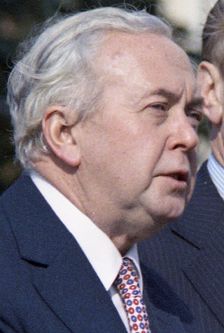
<span class="mw-page-title-main">October 1974 United Kingdom general election</span>

The October 1974 United Kingdom general election took place on Thursday 10 October 1974 to elect 635 members of the British House of Commons. It was the second general election held that year; the first year that two general elections were held in the same year since 1910; and the first time that two general elections were held less than a year apart from each other since the 1923 and 1924 elections, which took place 10 months apart. The election resulted in the Labour Party, led by Prime Minister Harold Wilson, winning a bare majority of three seats. That enabled the remainder of the Labour government to take place, but it saw a gradual loss of its majority.
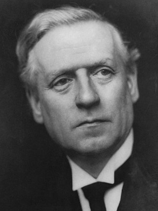
<span class="mw-page-title-main">December 1910 United Kingdom general election</span>

The December 1910 United Kingdom general election was held from 3 to 19 December. It was the last general election to be held over several days and the last to be held before the First World War.

<span class="mw-page-title-main">Lists of places in Wales</span>

These are lists of places in Wales.

<span class="mw-page-title-main">Kingdom of Israel (united monarchy)</span> Hypothesized Israelite kingdom in the Southern Levant

According to the Deuteronomistic history in the Hebrew Bible, a United Monarchy or United Kingdom of Israel existed under the reigns of Saul, Eshbaal, David, and Solomon, encompassing the territories of both the later kingdoms of Judah and Israel.

<span class="mw-page-title-main">Constituencies of the Parliament of the United Kingdom</span> Electoral divisions of the parliament of the United Kingdom

The Parliament of the United Kingdom currently has 650 parliamentary constituencies across the constituent countries, each electing a single member of parliament (MP) to the House of Commons by the plurality voting system, ordinarily every five years. Voting last took place in all 650 of those constituencies at the United Kingdom general election on 12 December 2019.
<span class="mw-page-title-main">United Kingdom of Portugal, Brazil and the Algarves</span> Pluricontinental monarchy

The United Kingdom of Portugal, Brazil and the Algarves was a pluricontinental monarchy formed by the elevation of the Portuguese colony named State of Brazil to the status of a kingdom and by the simultaneous union of that Kingdom of Brazil with the Kingdom of Portugal and the Kingdom of the Algarves, constituting a single state consisting of three kingdoms.

<span class="mw-page-title-main">Unitary authorities of England</span> Local government in some parts of England

The unitary authorities of England are a type of local authority responsible for all local government services in an area. They combine the functions of a non-metropolitan county council and a non-metropolitan district council, which elsewhere in England provide two tiers of local government.

<span class="mw-page-title-main">Kingdom of Portugal</span> Kingdom in Southwestern Europe (1139–1910)

The Kingdom of Portugal was a monarchy in the western Iberian Peninsula and the predecessor of the modern Portuguese Republic. Existing to various extents between 1139 and 1910, it was also known as the Kingdom of Portugal and the Algarves after 1415, and as the United Kingdom of Portugal, Brazil and the Algarves between 1815 and 1822. The name is also often applied to the Portuguese Empire, the realm's overseas colonies.

<span class="mw-page-title-main">United Kingdom in the Eurovision Song Contest</span>

The United Kingdom has participated in the Eurovision Song Contest 65 times. It first took part in the second contest in 1957 and has entered every year since 1959. Along with Sweden and the Netherlands, the UK is one of only three countries with Eurovision victories in four different decades. It is one of the "Big Five" countries, along with France, Germany, Italy and Spain, that are automatically prequalified for the final each year as they are the biggest financial contributors to the European Broadcasting Union (EBU). The British national broadcaster, the BBC, broadcasts the event and has, on multiple occasions, organised different national selection processes to choose the British entry. The United Kingdom has won the Eurovision Song Contest five times, and has finished as runner-up on a record sixteen occasions. The UK has hosted the contest a record nine times, four times in London and once each in Edinburgh (1972), Brighton (1974), Harrogate (1982), Birmingham (1998), and Liverpool (2023).

<span class="mw-page-title-main">Countries of the United Kingdom</span> Component parts of the UK since 1922

Since 1922, the United Kingdom has been made up of four countries: England, Scotland, Wales and Northern Ireland. The UK Prime Minister's website has used the phrase "countries within a country" to describe the United Kingdom. Some statistical summaries, such as those for the twelve NUTS 1 regions of the UK, refer to Northern Ireland, Scotland, and Wales as "regions". With regard to Northern Ireland, Scotland and Wales particularly, the descriptive name one uses "can be controversial, with the choice often revealing one's political preferences".