Hurst Green, East Sussex

Last updated

Hurst Green
A21 High Street Hurst Green.JPG
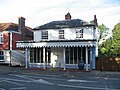
View along the A21 towards Hastings with the old courthouse on the left
East Sussex UK location map.svg
Red pog.svg
Hurst Green
Location within East Sussex
Area10.4 km2 (4.0 sq mi)  [1]
Population1,481 (Parish-2011) [2]
  Density 362/sq mi (140/km2)
OS grid reference TQ733271
  London 42 miles (68 km) NW
Civil parish
  • Hurst Green
District
Shire county
Region
Country England
Sovereign state United Kingdom
Post town ETCHINGHAM
Postcode district TN19
Dialling code 01580
Police Sussex
Fire East Sussex
Ambulance South East Coast
UK Parliament
Website http://www.hurstgreen-pc.gov.uk
List of places
UK
England
East Sussex
51°01′N0°28′E / 51.02°N 0.47°E / 51.02; 0.47

Hurst Green is a village and civil parish in the Rother district of East Sussex, England, and is located south of the East Sussex / Kent border at Flimwell.

Contents

The area is entirely contained within the High Weald Area of Outstanding Natural Beauty.

The village is located on the A21 road, halfway between Tunbridge Wells, Kent, in the north and Hastings in the south, approx 13 miles (20 km) each way. [3] The A265 road starts in the village at the A21, previously starting in Hawkhurst.

There is one active church in the village: the brick-built Church of England parish church, dedicated to the Holy Trinity. The Roman Catholic church of Our Lady Help of Christians is now disused and has now been converted into a community shop, which also contains the village post office. [4] The local primary school is Hurst Green CE Primary School. [5]

The settlements of Silver Hill and Swiftsden are also located within the parish.

There is an active parish council.

History

Before the Norman conquest, Hurst Green was part of the parish of Salehurst which belonged to Countess Goda, however it is likely that few people lived in the area.

There is a ridgeway track that runs through Hurst Green via Etchingham to Heathfield, and which was likely to have been in use during the Iron Age. [6]

In 1744 the village green covered a triangular area from the courthouse to the village hall, including land on which some houses in Station Road now stand. "The Cottage" (MES3972) and "Yew Tree" (DES4516) are shown on a map dated 1650, and so must have stood on the edge of the village green.

In the 1870s Hurst Green was described as a "hamlet in Salehurst parish, Sussex; 1½ mile ENE of Etchingham station, and 7 N of Battle. It has a head post office and Iridge Place is adjacent". [7]

The Church of England primary school was originally built in 1862 with an adjacent residence for the master.

The tower and the clock were erected by public subscription in memory of George Burrow Gregory of Boarzell who died 5 March 1892. [8]

In 1952 the civil parish of Hurst Green was created from portions of the parishes of Etchingham, Salehurst and Ticehurst and the ecclesiastical parish was formed in 1907. [9]

By the 1930s, the population of Hurst Green was 628 (counts in 1934 and 1938).

Local legend

Village organisations

Hurst Green has several clubs and organisations, many of these use the village hall to meet and details of upcoming meetings are posted on the noticeboard within the hall foyer.

Twin towns

Notable buildings

Hurst Green and surrounding areas are home to several notable buildings and areas, including:

Despite its small size, Hurst Green has a considerable number of Grade II listed buildings, including: [11]

Photographs

Related Research Articles

<span class="mw-page-title-main">Rother District</span> Non-metropolitan district in England

Rother is a local government district in East Sussex, England. Its council is based in Bexhill-on-Sea. The district is named after the River Rother which flows within its boundaries.

<span class="mw-page-title-main">Hawkhurst</span> Village in Kent, England

Hawkhurst is a village and civil parish in the borough of Tunbridge Wells in Kent, England. The village is located close to the border with East Sussex, around 12 miles (19 km) south-east of Royal Tunbridge Wells and within the High Weald Area of Outstanding Natural Beauty.

<span class="mw-page-title-main">Burwash</span> Village in East Sussex, England

Burwash, archaically known as Burghersh, is a rural village and civil parish in the Rother district of East Sussex, England. Situated in the High Weald of Sussex some 15 miles (24 km) inland from the port of Hastings, it is located five miles (8 km) south-west of Hurst Green, on the A265 road, and on the River Dudwell, a tributary of the River Rother. In an area steeped in history, some nine miles (14 km) to the south-east lies Battle Abbey and eight miles (13 km) to the east is Bodiam Castle.

<span class="mw-page-title-main">Salehurst</span> Village in East Sussex, England

Salehurst is a village in the Rother district of East Sussex, England, within the civil parish of Salehurst and Robertsbridge. It lies immediately to the north-east of the larger village of Robertsbridge, on a minor road; it is approximately thirteen miles (21 km) north of Hastings, just east of the A21 road.

<span class="mw-page-title-main">Robertsbridge</span> Village in East Sussex, England

Robertsbridge is a village in the civil parish of Salehurst and Robertsbridge, and the Rother district of East Sussex, England. It is approximately 10 miles (16 km) north of Hastings and 13 miles (21 km) south-east of Royal Tunbridge Wells. The River Rother passes through the village.

<span class="mw-page-title-main">Flimwell</span> Village in East Sussex, England

Flimwell is a village in the civil parish of Ticehurst, in the Rother district of East Sussex, England. It is located close to the border with Kent at the junction of the A21 road with the A268 and the B2087. The village is situated in an Area of Outstanding Natural Beauty near Bewl Water and Bedgebury Pinetum, and neighbouring villages include Ticehurst, Hurst Green and Hawkhurst.

Etchingham is a village and civil parish in the Rother district of East Sussex in southern England. The village is located approximately 15 miles (24 km) southeast of Royal Tunbridge Wells in Kent and 13 miles (21 km) northwest of Hastings, on the A265, half a mile west of its junction with the A21.

<span class="mw-page-title-main">Alpheton</span> Human settlement in England

Alpheton is a village and civil parish in the Babergh district of Suffolk, England. Located on the A134 road about six miles north of Sudbury, in 2005 it had a population of 260, reducing to 256 at the 2011 Census. According to Eilert Ekwall the meaning of the village name is the homestead of Aelfled.

<span class="mw-page-title-main">Whatlington</span> Village in East Sussex, England

Whatlington is a village and civil parish in the Rother district of East Sussex, England. The village is seven miles (11 km) north of Hastings, just off the A21 road.

<span class="mw-page-title-main">Gotherington</span> Human settlement in England

Gotherington is a small village north of Bishops Cleeve in Gloucestershire, England. It is surrounded on the north by the villages of Woolstone and Oxenton, and to the south by Woodmancote and Bishop's Cleeve, a very large urban village. Gotherington has a population of around 1,200, while its neighbour, Bishops Cleeve, has a population of 15,000. The populations reduced at the 2011 census to 995 for Gotherington.

<span class="mw-page-title-main">Sheldwich</span> Human settlement in England

Sheldwich is a village and civil parish in the far south of the Borough of Swale in Kent, England.

<span class="mw-page-title-main">Blackstone, West Sussex</span> Parish in West Sussex, England

Blackstone is a hamlet in the civil parish of Woodmancote and the Horsham district of West Sussex, England. Blackstone is significant for its listed 17th- and 18th-century houses and cottages.

<span class="mw-page-title-main">Stanningfield</span> Village in Suffolk, England

Stanningfield is a village and former civil parish, now in the parish of Bradfield Combust with Stanningfield, in the West Suffolk district of the county of Suffolk, England. The village lies just off of the A134 road, about 5 miles (8 km) south-east of Bury St Edmunds, 5 miles/8 km north-west of Lavenham, and 10 miles/16 km north of Sudbury. In 1961 the parish had a population of 211.

Iden Green is a small village, near Benenden, in the county of Kent. It belongs to the civil parish of Benenden and the Tunbridge Wells Borough District of Kent, in the South East of England.

The Vale of Glamorgan has 740 listed buildings of which 4% are Grade I listed, 10% Grade II* listed and remainder Grade II listed.

Over Kellet is a civil parish in Lancaster, Lancashire, England. It contains 35 buildings that are recorded in the National Heritage List for England as designated listed buildings. Of these, two are at Grade II*, the middle grade, and the others are at Grade II, the lowest grade. The parish contains the villages of Over Kellet and Capernwray, and is otherwise rural. Most of the listed buildings are houses, farmhouses and associated structures. The Lancaster Canal passes through the parish, and two bridges crossing it are listed. The other listed buildings include a church, a chapel, two country houses, a public house, a derelict tower, and a village cross.

<span class="mw-page-title-main">Staplecross</span> Village in East Sussex, England

Staplecross is a village in the civil parish of Ewhurst and the Rother district of East Sussex, England. Staplecross is the largest settlement in Ewhurst parish, and is on a southern ridge of the valley of the River Rother which flows through Bodiam at the north of Staplecross. The village is in the High Weald Area of Outstanding Natural Beauty. In 2011 it had a population of 760.

<span class="mw-page-title-main">Cripps Corner</span> Village in East Sussex, England

Cripps Corner is a village in the civil parish of Ewhurst and the Rother district of East Sussex, England. It is in the High Weald Area of Outstanding Natural Beauty, and on a southern ridge of the valley of the River Rother which flows through Bodiam, 2.5 miles (4 km) to the north of Cripps Corner.

<span class="mw-page-title-main">Vinehall Street</span> Vinehall Street linear settlement in East Sussex, England

Vinehall Street, is a linear settlement in the civil parishes of Mountfield and Whatlington, and the Rother district of East Sussex, England. Vinehall School is situated in Vinehill Street.

References

  1. "East Sussex in Figures". East Sussex County Council. Archived from the original on 28 December 2012. Retrieved 26 April 2008.
  2. "Civil Parish population 2011". Archived from the original on 4 March 2016. Retrieved 7 October 2015.
  3. East Sussex Community Information Service
  4. "Community Shop Blog". www.hurstgreen.com. Archived from the original on 12 July 2011.
  5. Hurst Green CE Primary School
  6. MES4360
  7. 1870-72, John Marius Wilson's Imperial Gazetteer of England and Wales
  8. Memorial Plaque affixed to Hurst Green Court House
  9. Hodson, L.J (1914). A Short History of the Parish of Salehurst, Roberstbridge.
  10. "Partnerschaft Hurst Green". Archived from the original on 19 August 2011. Retrieved 11 June 2011.
  11. England, Historic. "Historic England - Championing England's heritage | Historic England". historicengland.org.uk. Retrieved 18 April 2017.