| Cripps Corner | |
|---|---|
 Entering Cripps Corner on the B2089 | |
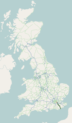
 Cripps Corner Location within East Sussex | |
| OS grid reference | TQ777212 |
| • London | 46 miles (74 km) NW |
| District | |
| Shire county | |
| Region | |
| Country | England |
| Sovereign state | United Kingdom |
| Post town | ROBERTSBRIDGE |
| Postcode district | TN32 |
| Dialling code | 01580 |
| Police | Sussex |
| Fire | East Sussex |
| Ambulance | South East Coast |
| UK Parliament | |
Cripps Corner is a village in the civil parish of Ewhurst and the Rother district of East Sussex, England. It is in the High Weald Area of Outstanding Natural Beauty, and on a southern ridge of the valley of the River Rother which flows through Bodiam, 2.5 miles (4 km) to the north of Cripps Corner. [1]
Contents
Cripps Corner is one of three settlements in Ewhurst parish, the others being Staplecross and Ewhurst Green to the north. The village borders, and extends over the north-east edge of Sedlescombe civil parish, and is 24 miles (40 km) east-northeast from the county town of Lewes, and 2 miles (3 km) east from the A21 road which in East Sussex runs north to south from Flimwell to Hastings. The village is centred on the convergence of three roads forming an open triangle. These roads are the B2165 which runs from Cripps Corner to Beckley at the north-east; the B2089 from the A21 road at the west to Rye at the east; and the B2244 from The Moor (village) in Hawkhurst at the north to Sedlescombe at the south, which within the settlement is named Junction Road. [2] [3] [4]
A viaduct carries the B2089 over the B2244. It was built in 1834 by Stephen Putnam of St Leonards-on-Sea who was responsible for the improvement of the East Sussex section of the road between the Medway towns and Hastings. Putnam followed the designs of Thomas Telford who had, a short while beforehand, been responsible for road-over-road bridges in Kent.[ citation needed ]
The closest school is Staplecross Methodist Primary School to the north in Staplecross. To the north-east, adjacent to the village on the B2165 to Staplecross, is a garden centre and a plant nursery. To the north on the B2244 is a Glamping site. To the west on the B2089 is a pet supplies company; and, at Swaile's Green, a furniture maker & seller. Adjacent at the south, on the B2244 in Sedlescombe, is an organic vineyard and a small light industrial site. [2] [3] [4] Opposite the vineyard is the site venue for the annual 'Big Green Cardigan', a multi-genre music event for approximately 500 people. [5]
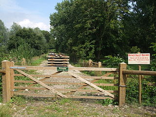
Cripps Corner is connected by bus to Hastings, Bodiam, and Hawkhurst (349); Etchingham, Sedlescombe, and Bexhill-on-Sea (360); Westfield, Northiam, Staplecross, and Robertsbridge (381); Westfield, and Robertsbridge (382); Peasmarsh, Sedlescombe, and Robertsbridge (383); and Mountfield, Broad Oak, and Battle (B72). [6] The closest railway station is 2.5 miles (4 km) north at Bodiam, part of the heritage Kent and East Sussex Railway linking to the town of Tenterden to the north-east. [1] The closest National Rail station is at Robertsbridge on the Hastings line, 3 miles (5 km) to the north-west, linking to Tunbridge Wells and Hastings.