Hoddesdon is a town in the Borough of Broxbourne, Hertfordshire, lying entirely within the London Metropolitan Area and Greater London Urban Area. The area is on the River Lea and the Lee Navigation along with the New River.

Bourne is a market town and civil parish in the South Kesteven district of Lincolnshire, England. It lies on the eastern slopes of the limestone Kesteven Uplands and the western edge of the Fens, 11 miles north-east of Stamford, 12 miles west of Spalding and 17 miles north of Peterborough. The population at the 2011 census was 14,456. A 2019 estimate put it at 16,780.

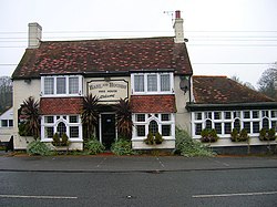
Lamberhurst ( is a village and civil parish in the borough of Tunbridge Wells in Kent, England. The parish contains the hamlets of The Down and Hook Green. At the 2001 Census it had a population of 1,491, increasing to 1,706 at the 2011 Census.

Herstmonceux is a village and civil parish in the Wealden District of East Sussex, England, which includes Herstmonceux Castle.
Icklesham is a village and civil parish in the Rother district of East Sussex, England. The village is located about six miles (10 km) east of Hastings, on the main A259 Hastings to Rye road. The surrounding countryside is a made up of fields, hills, woods, orchards and vineyards.

Camber is a village and civil parish in the Rother district of East Sussex, England, 3 miles (4.8 km) south-east of Rye. The village is located behind the sand dunes that occupy the estuary of the River Rother, where the seaside settlement of Camber Sands is situated.

West Horndon is a village and civil parish in the south of the Borough of Brentwood, Essex on the boundary with Thurrock. It is located 20 miles (32 km) east north-east of Charing Cross in London. The civil parish also includes East Horndon and Dunton Hills.

Barley is a village and civil parish in the district of North Hertfordshire, England. According to the 2001 census, it has a population of 659, increasing to 662 at the 2011 Census. The place-name refers to a lea or meadow and not to the grain-producing plant. Coincidentally to the southwest lies the village of Reed. The Prime Meridian passes to the west of Barley, which is located on the Royston to Saffron Walden road, as well as the medieval London to Cambridge road.
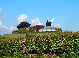
Parham is a civil parish in the Horsham District of West Sussex, England. There was a village of Parham, around the parish church, but its few houses were destroyed in the early 19th century to create the landscaped park and gardens. The parish now consists of Parham Park and the farms and smaller settlements around it. The village is between Wiggonholt and Cootham, about 3 miles (4.8 km) south of Pulborough on the A283 road.
Chiddingly is an English village and civil parish in the Wealden District of the administrative county of East Sussex, within historic Sussex, some five miles (8 km) northwest of Hailsham.

Playden is a village and civil parish in the Rother district of East Sussex, England. The village is located one mile (1.6 km) north-west of Rye.

East Dean and Friston is a civil parish in the Wealden District of East Sussex, England.The two villages in the parish are in a dry valley on the South Downs – between Eastbourne three miles (4.8 km) to the east and Seaford an equal distance to the west. The main A259 road goes through both village centres. The coast and much of the land between it and the A259 from the east edge of Seaford to the west edge of Eastbourne is owned by the National Trust, and this has prevented further development to the area.

Hellingly is a village, and can also refer to a civil parish, and to a district ward, in the Wealden District of East Sussex, England.

Frant is a village and civil parish in the Wealden District of East Sussex, England, on the Kentish border about three miles (5 km) south of Royal Tunbridge Wells.

Landican is a hamlet on the Wirral Peninsula, in the Metropolitan Borough of Wirral, Merseyside, England. The hamlet is on the outskirts of Birkenhead, near to Woodchurch and the M53 motorway. Historically part of the county of Cheshire, it is within the local government ward of Pensby and Thingwall and the parliamentary constituency of Wirral West.
Dunton is a village and civil parish in the Central Bedfordshire district of the county of Bedfordshire, England; about 12 miles (19 km) east south-east of the county town of Bedford. The civil parish includes the hamlets of Newton and Millow.

Norton-sub-Hamdon is a village and civil parish in the South Somerset district of the English county of Somerset, situated five miles west of Yeovil. The village has a population of 743.

Hound is a village and civil parish in the borough of Eastleigh in southern Hampshire, England. The parish encompasses the villages of Netley, Butlocks Heath and Old Netley, and includes such landmarks as Netley Castle and Netley Abbey. In the 2001 census, the parish had a headcount of 6,846 living in 2,928 households.

West Hendred is a village and civil parish about 3 miles (5 km) east of Wantage. It was part of Berkshire until the 1974 boundary changes transferred it to Oxfordshire. West Hendred is downland village, its parish stretching from the Ridgeway in the south through the spring line and meadows to the former marshland of the Oxfordshire plain in the north. The parish is about 2,000 acres (810 ha) in area and 6 miles (10 km) long, but only being about 1⁄2 mile (800 m) wide at the widest point. This is an example of a downland linear parish encompassing a wide variety of land types – chalk downland, greensand on the spring line and clay to the north. The Great Western Main Line crosses the northern part of the parish. The Icknield Way and The Ridgeway cross the parish in the south.

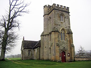
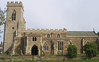
Harlaston is a village and civil parish in Staffordshire, England. It lies on the River Mease, about 5 miles (8 km) north of Tamworth. There is an Early English church, dedicated to St Matthew, and a public house, the White Lion.