List of United Kingdom locations: Upper I-Upper W

Last updated

The United Kingdom Uk-map.svg
The United Kingdom

This is part of the list of United Kingdom locations: a gazetteer of place names in the United Kingdom showing each place's locality and geographical coordinates.

Upper I-Z

LocationLocality Coordinates
(links to map & photo sources)
OS grid
reference
Upper Ifold Surrey 51°05′N0°34′W / 51.08°N 00.57°W / 51.08; -00.57 TQ0033
Upper Inglesham Swindon 51°40′N1°43′W / 51.66°N 01.71°W / 51.66; -01.71 SU2096
Upper Kenley Fife 56°17′N2°43′W / 56.29°N 02.71°W / 56.29; -02.71 NO5611
Upper Kergord Shetland Islands 60°17′N1°16′W / 60.28°N 01.27°W / 60.28; -01.27 HU4056
Upper Kidston Scottish Borders 55°40′N3°14′W / 55.66°N 03.24°W / 55.66; -03.24 NT2242
Upper Kilchattan Argyll and Bute 56°04′N6°13′W / 56.07°N 06.22°W / 56.07; -06.22 NR3795
Upper Kilcott South Gloucestershire 51°35′N2°18′W / 51.59°N 02.30°W / 51.59; -02.30 ST7988
Upper Killay Swansea 51°36′N4°03′W / 51.60°N 04.05°W / 51.60; -04.05 SS5892
Upper Kinsham Herefordshire 52°16′N2°56′W / 52.27°N 02.93°W / 52.27; -02.93 SO3665
Upper Knockando Moray 57°28′N3°22′W / 57.47°N 03.36°W / 57.47; -03.36 NJ1843
Upper Lambourn Berkshire 51°31′N1°33′W / 51.51°N 01.55°W / 51.51; -01.55 SU3180
Upper Landywood Staffordshire 52°38′N2°02′W / 52.64°N 02.03°W / 52.64; -02.03 SJ9805
Upper Langford North Somerset 51°20′N2°46′W / 51.33°N 02.77°W / 51.33; -02.77 ST467594
Upper Langwith Derbyshire 53°13′N1°14′W / 53.21°N 01.23°W / 53.21; -01.23 SK5169
Upper Largo (Kirkton of Largo)Fife 56°13′N2°56′W / 56.21°N 02.93°W / 56.21; -02.93 NO4203
Upper Layham Suffolk 52°01′N0°57′E / 52.02°N 00.95°E / 52.02; 00.95 TM0340
Upper Leigh Staffordshire 52°55′N1°59′W / 52.92°N 01.98°W / 52.92; -01.98 SK0136
Upper Littleton North Somerset 51°22′N2°38′W / 51.37°N 02.64°W / 51.37; -02.64 ST5564
Upper Loads Derbyshire 53°13′N1°32′W / 53.21°N 01.53°W / 53.21; -01.53 SK3169
Upper Lochton Aberdeenshire 57°04′N2°31′W / 57.06°N 02.51°W / 57.06; -02.51 NO6997
Upper Lode Gloucestershire 51°59′N2°10′W / 51.99°N 02.17°W / 51.99; -02.17 SO8833
Upper Longdon Staffordshire 52°43′N1°55′W / 52.72°N 01.92°W / 52.72; -01.92 SK0514
Upper Longwood Shropshire 52°39′N2°35′W / 52.65°N 02.59°W / 52.65; -02.59 SJ6007
Upper Ludstone Shropshire 52°33′N2°17′W / 52.55°N 02.29°W / 52.55; -02.29 SO8095
Upper Lybster Highland 58°19′N3°17′W / 58.31°N 03.28°W / 58.31; -03.28 ND2537
Upper Lydbrook Gloucestershire 51°50′N2°35′W / 51.83°N 02.58°W / 51.83; -02.58 SO6015
Upper Lyde Herefordshire 52°05′N2°44′W / 52.09°N 02.74°W / 52.09; -02.74 SO4944
Upper Lye Herefordshire 52°17′N2°53′W / 52.28°N 02.89°W / 52.28; -02.89 SO3965
Upper Maes-coed Herefordshire 52°00′N2°58′W / 52.00°N 02.97°W / 52.00; -02.97 SO3334
Upper Marsh Bradford 53°49′N1°58′W / 53.82°N 01.97°W / 53.82; -01.97 SE0236
Upper Midhope Sheffield 53°29′N1°41′W / 53.48°N 01.68°W / 53.48; -01.68 SK2199
Upper Midway Derbyshire 52°46′N1°33′W / 52.77°N 01.55°W / 52.77; -01.55 SK3020
Uppermill Oldham 53°32′N2°01′W / 53.54°N 02.01°W / 53.54; -02.01 SD9905
Upper Milovaig Highland 57°26′N6°45′W / 57.44°N 06.75°W / 57.44; -06.75 NG1549
Upper Milton Somerset 51°13′N2°40′W / 51.22°N 02.66°W / 51.22; -02.66 ST5447
Upper Milton Oxfordshire 51°51′N1°38′W / 51.85°N 01.63°W / 51.85; -01.63 SP2517
Upper Minety Wiltshire 51°37′N2°00′W / 51.61°N 02.00°W / 51.61; -02.00 SU0091
Upper Moor Worcestershire 52°07′N2°02′W / 52.12°N 02.04°W / 52.12; -02.04 SO9747
Upper Moor Side Leeds 53°46′N1°38′W / 53.76°N 01.63°W / 53.76; -01.63 SE2430
Upper Morton South Gloucestershire 51°37′N2°30′W / 51.61°N 02.50°W / 51.61; -02.50 ST6591
Upper Nash Pembrokeshire 51°41′N4°52′W / 51.68°N 04.86°W / 51.68; -04.86 SN0202
Upper Neapaback Shetland Islands 60°30′N1°03′W / 60.50°N 01.05°W / 60.50; -01.05 HU5280
Upper Netchwood Shropshire 52°31′N2°35′W / 52.52°N 02.59°W / 52.52; -02.59 SO6092
Upper Newbold Derbyshire 53°15′N1°28′W / 53.25°N 01.47°W / 53.25; -01.47 SK3573
Upper Nobut Staffordshire 52°55′N1°56′W / 52.91°N 01.94°W / 52.91; -01.94 SK0435
Upper North Dean Buckinghamshire 51°40′N0°47′W / 51.67°N 00.78°W / 51.67; -00.78 SU8498
Upper Norwood West Sussex 50°56′N0°40′W / 50.94°N 00.67°W / 50.94; -00.67 SU9317
Upper Norwood Croydon 51°24′N0°05′W / 51.40°N 00.08°W / 51.40; -00.08 TQ3369
Upper Ochrwyth Caerphilly 51°35′N3°07′W / 51.59°N 03.11°W / 51.59; -03.11 ST2389
Upper Oddington Gloucestershire 51°55′N1°41′W / 51.92°N 01.68°W / 51.92; -01.68 SP2225
Upper Ollach Highland 57°20′N6°08′W / 57.34°N 06.14°W / 57.34; -06.14 NG5136
Upper Padley Derbyshire 53°18′N1°38′W / 53.30°N 01.64°W / 53.30; -01.64 SK2479
Upper Persley City of Aberdeen 57°11′N2°11′W / 57.18°N 02.18°W / 57.18; -02.18 NJ8910
Upper Pickwick Wiltshire 51°26′N2°13′W / 51.43°N 02.21°W / 51.43; -02.21 ST8571
Upper Pollicott Buckinghamshire 51°49′N0°59′W / 51.81°N 00.98°W / 51.81; -00.98 SP7013
Upper Poppleton York 53°58′N1°10′W / 53.97°N 01.16°W / 53.97; -01.16 SE5554
Upper Postern Kent 51°11′N0°18′E / 51.19°N 00.30°E / 51.19; 00.30 TQ6146
Upper Quinton Warwickshire 52°07′N1°45′W / 52.11°N 01.75°W / 52.11; -01.75 SP1746
Upper Race Torfaen 51°41′N3°03′W / 51.68°N 03.05°W / 51.68; -03.05 ST2799
Upper Ratley Hampshire 51°00′N1°32′W / 51.00°N 01.54°W / 51.00; -01.54 SU3223
Upper Rochford Herefordshire 52°18′N2°33′W / 52.30°N 02.55°W / 52.30; -02.55 SO6267
Upper Rodmersham Kent 51°18′N0°45′E / 51.30°N 00.75°E / 51.30; 00.75 TQ9260
Upper Ruxley Bexley/Bromley 51°25′N0°09′E / 51.41°N 00.15°E / 51.41; 00.15 TQ4970
Upper Sanday Orkney Islands 58°55′N2°48′W / 58.91°N 02.80°W / 58.91; -02.80 HY5403
Upper Sapey Herefordshire 52°16′N2°28′W / 52.26°N 02.47°W / 52.26; -02.47 SO6863
Upper Seagry Wiltshire 51°31′N2°05′W / 51.51°N 02.08°W / 51.51; -02.08 ST9480
Upper Shelton Bedfordshire 52°04′N0°33′W / 52.07°N 00.55°W / 52.07; -00.55 SP9943
Upper Sheringham Norfolk 52°55′N1°11′E / 52.92°N 01.18°E / 52.92; 01.18 TG1441
Upper Shirley City of Southampton 50°55′N1°26′W / 50.92°N 01.43°W / 50.92; -01.43 SU4014
Upper Shirley Croydon 51°21′N0°04′W / 51.35°N 00.06°W / 51.35; -00.06 TQ3564
Upper Siddington Gloucestershire 51°41′N1°58′W / 51.68°N 01.97°W / 51.68; -01.97 SU0299
Upper Skelmorlie North Ayrshire 55°52′N4°53′W / 55.86°N 04.89°W / 55.86; -04.89 NS1967
Upper Slackstead Hampshire 51°02′N1°26′W / 51.03°N 01.44°W / 51.03; -01.44 SU3926
Upper Slaughter Gloucestershire 51°54′N1°47′W / 51.90°N 01.78°W / 51.90; -01.78 SP1523
Upper Solva Pembrokeshire 51°52′N5°13′W / 51.87°N 05.21°W / 51.87; -05.21 SM7924
Upper Soudley Gloucestershire 51°47′N2°30′W / 51.78°N 02.50°W / 51.78; -02.50 SO6510
Uppersound Shetland Islands 60°08′N1°11′W / 60.14°N 01.19°W / 60.14; -01.19 HU4540
Upper Stanton Drew Bath and North East Somerset 51°21′N2°34′W / 51.35°N 02.57°W / 51.35; -02.57 ST6062
Upper Staploe Bedfordshire 52°13′N0°20′W / 52.21°N 00.33°W / 52.21; -00.33 TL1459
Upper Stoke Coventry 52°25′N1°29′W / 52.41°N 01.48°W / 52.41; -01.48 SP3580
Upper Stoke Kent 51°27′N0°39′E / 51.45°N 00.65°E / 51.45; 00.65 TQ8376
Upper Stoke Norfolk 52°34′N1°19′E / 52.56°N 01.31°E / 52.56; 01.31 TG2502
Upper Stondon Bedfordshire 52°00′N0°20′W / 52.00°N 00.34°W / 52.00; -00.34 TL1435
Upper Stowe Northamptonshire 52°11′N1°04′W / 52.19°N 01.06°W / 52.19; -01.06 SP6456
Upper Stratton Swindon 51°35′N1°46′W / 51.58°N 01.77°W / 51.58; -01.77 SU1687
Upper Street Hampshire 50°58′N1°47′W / 50.96°N 01.78°W / 50.96; -01.78 SU1518
Upper Street (Southrepps)Norfolk 52°52′N1°20′E / 52.87°N 01.34°E / 52.87; 01.34 TG2536
Upper Street (Sloley)Norfolk 52°46′N1°24′E / 52.76°N 01.40°E / 52.76; 01.40 TG3024
Upper Street (Hoveton)Norfolk 52°42′N1°26′E / 52.70°N 01.43°E / 52.70; 01.43 TG3217
Upper Street (Horning)Norfolk 52°41′N1°28′E / 52.69°N 01.47°E / 52.69; 01.47 TG3517
Upper Street (Scole)Norfolk 52°22′N1°11′E / 52.37°N 01.18°E / 52.37; 01.18 TM1780
Upper Street (Stansfield)Suffolk 52°07′N0°35′E / 52.12°N 00.59°E / 52.12; 00.59 TL7851
Upper Street (Baylham)Suffolk 52°07′N1°04′E / 52.11°N 01.06°E / 52.11; 01.06 TM1051
Upper Street (Stutton)Suffolk 51°58′N1°07′E / 51.96°N 01.11°E / 51.96; 01.11 TM1434
Upper Strensham Worcestershire 52°02′N2°08′W / 52.04°N 02.14°W / 52.04; -02.14 SO9039
Upper Studley Wiltshire 51°18′N2°14′W / 51.30°N 02.23°W / 51.30; -02.23 ST8456
Upper Sundon Bedfordshire 51°56′N0°29′W / 51.93°N 00.48°W / 51.93; -00.48 TL0427
Upper Swainswick Bath and North East Somerset 51°25′N2°22′W / 51.41°N 02.36°W / 51.41; -02.36 ST7568
Upper Swanmore Hampshire 50°56′N1°10′W / 50.94°N 01.17°W / 50.94; -01.17 SU5817
Upper Swell Gloucestershire 51°56′N1°45′W / 51.93°N 01.75°W / 51.93; -01.75 SP1726
Upper Sydenham Bromley 51°25′N0°04′W / 51.42°N 00.07°W / 51.42; -00.07 TQ3471
Upper Tankersley Barnsley 53°29′N1°29′W / 53.48°N 01.48°W / 53.48; -01.48 SK3499
Upper Tean Staffordshire 52°56′N1°59′W / 52.94°N 01.98°W / 52.94; -01.98 SK0139
Upperthong Kirklees 53°34′N1°48′W / 53.56°N 01.80°W / 53.56; -01.80 SE1308
Upperthorpe Derbyshire 53°19′N1°19′W / 53.31°N 01.31°W / 53.31; -01.31 SK4680
Upperthorpe North Lincolnshire 53°29′N0°52′W / 53.49°N 00.87°W / 53.49; -00.87 SE7500
Upper Threapwood Wrexham 52°59′N2°50′W / 52.99°N 02.83°W / 52.99; -02.83 SJ4445
Upper Thurnham Lancashire 53°58′N2°50′W / 53.97°N 02.84°W / 53.97; -02.84 SD4554
Upperton West Sussex 50°59′N0°38′W / 50.98°N 00.64°W / 50.98; -00.64 SU9522
Upperton East Sussex 50°46′N0°16′E / 50.77°N 00.26°E / 50.77; 00.26 TQ6000
Upperton Oxfordshire 51°38′N1°04′W / 51.64°N 01.06°W / 51.64; -01.06 SU6594
Upper Tooting Wandsworth 51°26′N0°10′W / 51.43°N 00.17°W / 51.43; -00.17 TQ2772
Upper Town Bradford 53°48′N1°58′W / 53.80°N 01.97°W / 53.80; -01.97 SE0234
Upper Town (Hognaston)Derbyshire 53°03′N1°39′W / 53.05°N 01.65°W / 53.05; -01.65 SK2351
Upper Town (Bonsall)Derbyshire 53°07′N1°35′W / 53.11°N 01.59°W / 53.11; -01.59 SK2758
Uppertown Cumbria 54°59′45″N2°52′30″W / 54.99579°N 02.87508°W / 54.99579; -02.87508 NY4467
Uppertown Derbyshire 53°10′N1°31′W / 53.17°N 01.52°W / 53.17; -01.52 SK3264
Upper Town Durham 54°43′N1°53′W / 54.72°N 01.89°W / 54.72; -01.89 NZ0737
Upper Town Herefordshire 52°08′N2°37′W / 52.13°N 02.61°W / 52.13; -02.61 SO5849
Uppertown Highland 58°40′N3°07′W / 58.66°N 03.12°W / 58.66; -03.12 ND3576
Uppertown Northumberland 55°02′N2°13′W / 55.04°N 02.22°W / 55.04; -02.22 NY8672
Upper Town North Somerset 51°23′N2°41′W / 51.39°N 02.69°W / 51.39; -02.69 ST5266
Upper Town Suffolk 52°16′N0°49′E / 52.26°N 00.81°E / 52.26; 00.81 TL9267
Upper Town Wiltshire 51°31′N2°02′W / 51.51°N 02.04°W / 51.51; -02.04 ST9779
Upper Treverward Shropshire 52°23′N3°04′W / 52.39°N 03.07°W / 52.39; -03.07 SO2778
Upper Tullich Highland 57°43′N4°08′W / 57.72°N 04.13°W / 57.72; -04.13 NH7373
Upper Tysoe Warwickshire 52°05′N1°31′W / 52.08°N 01.51°W / 52.08; -01.51 SP3343
Upper Up Wiltshire 51°40′N1°56′W / 51.66°N 01.94°W / 51.66; -01.94 SU0496
Upper Upham Wiltshire 51°29′N1°41′W / 51.49°N 01.68°W / 51.49; -01.68 SU2277
Upper Upnor Kent 51°24′N0°31′E / 51.40°N 00.51°E / 51.40; 00.51 TQ7570
Upper Urafirth Shetland Islands 60°29′N1°27′W / 60.48°N 01.45°W / 60.48; -01.45 HU3078
Upper Vobster Somerset 51°14′N2°26′W / 51.23°N 02.43°W / 51.23; -02.43 ST7049
Upper Walthamstow Waltham Forest 51°35′N0°01′W / 51.58°N 00.01°W / 51.58; -00.01 TQ3889
Upper Wardington Oxfordshire 52°07′N1°17′W / 52.11°N 01.28°W / 52.11; -01.28 SP4946
Upper Wardley West Sussex 51°02′N0°48′W / 51.04°N 00.80°W / 51.04; -00.80 SU8428
Upper Weald Milton Keynes 52°01′N0°50′W / 52.02°N 00.83°W / 52.02; -00.83 SP8037
Upper Weedon Northamptonshire 52°13′N1°05′W / 52.21°N 01.09°W / 52.21; -01.09 SP6258
Upper Welland Worcestershire 52°03′N2°20′W / 52.05°N 02.33°W / 52.05; -02.33 SO7740
Upper Wellingham East Sussex 50°53′N0°02′E / 50.89°N 00.03°E / 50.89; 00.03 TQ4313
Upper Welson Herefordshire 52°09′N3°02′W / 52.15°N 03.03°W / 52.15; -03.03 SO2951
Upper Westholme Somerset 51°09′N2°37′W / 51.15°N 02.61°W / 51.15; -02.61 ST5740
Upper Weston Bath and North East Somerset 51°24′N2°24′W / 51.40°N 02.40°W / 51.40; -02.40 ST7267
Upper Weybread Suffolk 52°22′N1°16′E / 52.36°N 01.27°E / 52.36; 01.27 TM2379
Upper Whiston Rotherham 53°23′N1°19′W / 53.39°N 01.32°W / 53.39; -01.32 SK4589
Upper Wick Gloucestershire 51°40′N2°25′W / 51.66°N 02.42°W / 51.66; -02.42 ST7196
Upper Wick Worcestershire 52°10′N2°16′W / 52.17°N 02.26°W / 52.17; -02.26 SO8253
Upper Wield Hampshire 51°08′N1°07′W / 51.13°N 01.11°W / 51.13; -01.11 SU6238
Upper Wigginton Shropshire 52°54′N2°59′W / 52.90°N 02.99°W / 52.90; -02.99 SJ3335
Upper Winchendon Buckinghamshire 51°49′N0°55′W / 51.81°N 00.92°W / 51.81; -00.92 SP7414
Upper Witton Birmingham 52°31′N1°53′W / 52.52°N 01.88°W / 52.52; -01.88 SP0892
Upper Wolvercote Oxfordshire 51°46′N1°17′W / 51.77°N 01.29°W / 51.77; -01.29 SP4909
Upper Wolverton Worcestershire 52°08′N2°08′W / 52.14°N 02.13°W / 52.14; -02.13 SO9150
Upperwood Derbyshire 53°06′N1°34′W / 53.10°N 01.56°W / 53.10; -01.56 SK2957
Upper Woodend Aberdeenshire 57°16′N2°34′W / 57.26°N 02.56°W / 57.26; -02.56 NJ6619
Upper Woodford Wiltshire 51°08′N1°49′W / 51.13°N 01.82°W / 51.13; -01.82 SU1237
Upper Woolhampton Berkshire 51°23′N1°11′W / 51.39°N 01.18°W / 51.39; -01.18 SU5767
Upper Wootton Hampshire 51°17′N1°11′W / 51.28°N 01.18°W / 51.28; -01.18 SU5754
Upper Wraxall Wiltshire 51°28′N2°17′W / 51.46°N 02.28°W / 51.46; -02.28 ST8074
Upper Wyche Herefordshire 52°05′N2°20′W / 52.08°N 02.33°W / 52.08; -02.33 SO7743

Related Research Articles

Britain most often refers to:

<span class="mw-page-title-main">Parliament of the United Kingdom</span> Supreme legislative body of the United Kingdom

The Parliament of the United Kingdom of Great Britain and Northern Ireland is the supreme legislative body of the United Kingdom, and may also legislate for the Crown Dependencies and the British Overseas Territories. It meets at the Palace of Westminster in London. Parliament possesses legislative supremacy and thereby holds ultimate power over all other political bodies in the United Kingdom and the Overseas Territories. While Parliament is bicameral, it has three parts: the sovereign, the House of Lords, and the House of Commons. The three parts acting together to legislate may be described as the King-in-Parliament. The Crown normally acts on the advice of the prime minister, and the powers of the House of Lords are limited to only delaying legislation.

<span class="mw-page-title-main">Primary school</span> School for children

A primary school, elementary school, or grade school is a school for primary education of children who are 4 to 10 years of age. Primary schooling follows preschool and precedes secondary schooling.
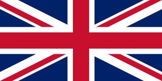
<span class="mw-page-title-main">United Kingdom</span> Island country in Northwestern Europe

The United Kingdom of Great Britain and Northern Ireland, commonly known as the United Kingdom (UK) or Britain, is a country in Northwestern Europe, off the coast of the continental mainland. It comprises England, Scotland, Wales, and Northern Ireland. The UK includes the island of Great Britain, the north-eastern part of the island of Ireland, and most of the smaller islands within the British Isles, a total area of 94,354 square miles (244,376 km2). Northern Ireland shares a land border with the Republic of Ireland; otherwise, the United Kingdom is surrounded by the Atlantic Ocean, the North Sea, the English Channel, the Celtic Sea, and the Irish Sea. The United Kingdom had an estimated population of nearly 68.3 million people in 2023. The capital and largest city of both England and the United Kingdom is London, whose wider metropolitan area is the largest in Western Europe, with a population of 14.9 million. The cities of Edinburgh, Cardiff, and Belfast are the national capitals of Scotland, Wales, and Northern Ireland, respectively.

The Peerage of Ireland consists of those titles of nobility created by the English monarchs in their capacity as Lord or King of Ireland, or later by monarchs of the United Kingdom of Great Britain and Ireland. It is one of the five divisions of Peerages in the United Kingdom. The creation of such titles came to an end in the 19th century. The ranks of the Irish peerage are duke, marquess, earl, viscount and baron. As of 2016, there were 135 titles in the Peerage of Ireland extant: two dukedoms, ten marquessates, 43 earldoms, 28 viscountcies, and 52 baronies. However, these titles have no official recognition in Ireland, with Article 40.2 of the Constitution of Ireland forbidding the state conferring titles of nobility and stating that an Irish citizen may not accept titles of nobility or honour except with the prior approval of the Irish government.

<span class="mw-page-title-main">Kingdom of England</span> Kingdom in northwestern Europe (927–1707)

The Kingdom of England was a sovereign state on the island of Great Britain from the early tenth century, when it was unified from various Anglo-Saxon kingdoms, until 1 May 1707, when it united with Scotland to form the Kingdom of Great Britain, which would later become the United Kingdom. The Kingdom of England was among the most powerful states in Europe during the medieval and early modern periods.
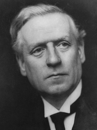
<span class="mw-page-title-main">December 1910 United Kingdom general election</span>

The December 1910 United Kingdom general election was held from 3 to 19 December. It was the last general election to be held over several days and the last to be held before the First World War.
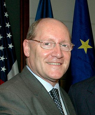
<span class="mw-page-title-main">2004 European Parliament election in the United Kingdom</span> Election

The 2004 European Parliament election was the United Kingdom's part of the wider 2004 European Parliament election which was held between 10 and 13 June 2004 in the 25 member states of the European Union. The United Kingdom's part of this election was held on Thursday 10 June 2004. The election also coincided with the 2004 local elections and the London Assembly and mayoral elections. In total, 78 Members of the European Parliament were elected from the United Kingdom using proportional representation.

<span class="mw-page-title-main">Lists of places in Wales</span>

These are lists of places in Wales.

<span class="mw-page-title-main">Member of Parliament (United Kingdom)</span> Representative in the House of Commons

In the United Kingdom, a member of Parliament (MP) is an individual elected to serve in the House of Commons, the lower house of the Parliament of the United Kingdom.
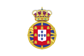
<span class="mw-page-title-main">United Kingdom of Portugal, Brazil and the Algarves</span> Pluricontinental monarchy

The United Kingdom of Portugal, Brazil and the Algarves was a pluricontinental monarchy formed by the elevation of the Portuguese colony named State of Brazil to the status of a kingdom and by the simultaneous union of that Kingdom of Brazil with the Kingdom of Portugal and the Kingdom of the Algarves, constituting a single state consisting of three kingdoms.

<span class="mw-page-title-main">Unitary authorities of England</span> Local government in some parts of England

The unitary authorities of England are a type of local authority responsible for all local government services in an area. They combine the functions of a non-metropolitan county council and a non-metropolitan district council, which elsewhere in England provide two tiers of local government.

<span class="mw-page-title-main">Kingdom of Portugal</span> Kingdom in Southwestern Europe (1139–1910)

The Kingdom of Portugal was a monarchy in the western Iberian Peninsula and the predecessor of the modern Portuguese Republic. Existing to various extents between 1139 and 1910, it was also known as the Kingdom of Portugal and the Algarves after 1415, and as the United Kingdom of Portugal, Brazil and the Algarves between 1815 and 1822. The name is also often applied to the Portuguese Empire, the realm's overseas colonies.

<span class="mw-page-title-main">United Kingdom in the Eurovision Song Contest</span>

The United Kingdom has participated in the Eurovision Song Contest 66 times. Its first participation was at the second contest, in 1957, and it has entered every year since 1959. The British participant broadcaster in the contest is the British Broadcasting Corporation (BBC). The country has won the contest five times: in 1967, with "Puppet on a String" performed by Sandie Shaw; in 1969, with "Boom Bang-a-Bang" by Lulu ; in 1976, with "Save Your Kisses for Me" by Brotherhood of Man; in 1981, with "Making Your Mind Up" by Bucks Fizz; and in 1997, with "Love Shine a Light" by Katrina and the Waves. The UK has also achieved a record sixteen second-place finishes, the first in 1959 and the most recent in 2022.

<span class="mw-page-title-main">New Zealand–United Kingdom relations</span> Bilateral relations

New Zealand–United Kingdom relations are the bilateral relations between New Zealand and the United Kingdom. New Zealand has maintained a close relationship with Britain, since gaining independence from the United Kingdom.

<span class="mw-page-title-main">Countries of the United Kingdom</span> Component parts of the UK since 1922

Since 1922, the United Kingdom has been made up of four countries: England, Scotland, Wales and Northern Ireland. The UK Prime Minister's website has used the phrase "countries within a country" to describe the United Kingdom.