Upper Lybster

Last updated

Upper Lybster
Caithness UK location map.svg
Red pog.svg
Upper Lybster
Location within the Caithness area
OS grid reference ND249373
Council area
Country Scotland
Sovereign state United Kingdom
Historic county
Post town Lybster
Postcode district KW3 6
Police Scotland
Fire Scottish
Ambulance Scottish
List of places
UK
Scotland
58°19′07″N3°17′01″W / 58.31848°N 3.28362°W / 58.31848; -3.28362 Coordinates: 58°19′07″N3°17′01″W / 58.31848°N 3.28362°W / 58.31848; -3.28362

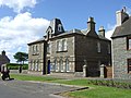
Upper Lybster is a scattered and crofting village, situated 2 miles north of Lybster, in eastern Caithness, Scottish Highlands [1] and is in the Scottish council area of Highland.

Related Research Articles

Eriskay

Eriskay, from the Old Norse for "Eric's Isle", is an island and community council area of the Outer Hebrides in northern Scotland with a population of 143, as of the 2011 census. It lies between South Uist and Barra and is connected to South Uist by a causeway which was opened in 2001. In the same year Ceann a' Ghàraidh in Eriskay became the ferry terminal for travelling between South Uist and Barra. The Caledonian MacBrayne vehicular ferry travels between Eriskay and Ardmore in Barra. The crossing takes around 40 minutes.

Caithness Historic county in Scotland

Caithness is a historic county, registration county and lieutenancy area of Scotland.

Island of Stroma Island off the coast of Scotland

The Island of Stroma or Stroma, is an island off the northern coast of the mainland of Scotland. It is the most southerly of the islands in the Pentland Firth between the Orkney islands and the traditional county of Caithness and therein the civil parish of Canisbay, the northeasternmost part of the mainland. Stroma is part of the county of Caithness. The name is from the Old Norse Straumr-øy meaning "island in the [tidal] stream".

Latheronwheel Human settlement in Scotland

Latheronwheel is a small Scottish village, in Caithness. It is six kilometres southwest of Lybster on the A9 road to Helmsdale, near the junction with the A99 road to Wick, which lies in the equally small village of Latheron.

Wick, Caithness Human settlement in Scotland

Wick is a town and royal burgh in Caithness, in the far north of Scotland. The town straddles the River Wick and extends along both sides of Wick Bay. "Wick Locality" had a population of 6,954 at the time of the 2011 census, a decrease of 3.8% from 2001.

Golspie Human settlement in Scotland

Golspie is a village and parish in Sutherland, Highland, Scotland, which lies on the North Sea coast in the shadow of Ben Bhraggie. It has a population of around 1,350.

Lybster Human settlement in Scotland

Lybster is a village on the east coast of Caithness in northern Scotland. It was once a big herring fishing port.

Tarskavaig Human settlement in Scotland

Tarskavaig is a crofting village on the West coast of Sleat on the Isle of Skye in Scotland. It sits in a glen which meets Tarskavaig Bay and lies opposite the Isles of Eigg, Rum and Canna. It is often said that Tarskavaig has the best view of the Cuillin in Skye.

Berriedale, Highland

Berriedale is a small estate village on the northern east coast of Caithness, Scotland, on the A9 road between Helmsdale and Lybster, close to the boundary between Caithness and Sutherland. It is sheltered from the North Sea. The village has a parish church in the Church of Scotland.

Wick and Lybster Light Railway

The Wick and Lybster Light Railway was a light railway opened in 1903, with the intention of opening up the fishing port of Lybster, in Caithness, Scotland, to the railway network at Wick. Its construction was heavily supported financially by local government and the Treasury. It was worked by the Highland Railway.

Broubster Human settlement in Scotland

Broubster is a village in Highland, Scotland. Near Broubster, there is a Bronze Age megalithic arrangement. Ten stones remain of an original set of approximately 36. The arrangement is similar to a larger arrangement at Achavanich.

Ulbster Human settlement in Scotland

Ulbster is a scattered crofting hamlet on the eastern coast of Caithness, within the parish of Wick, in the Scottish Highlands, within the Highland Council area. The town of Wick is located seven miles north of the village along the A99 road. To the south of the village, two miles along the A99, lies the ancient port of Whaligoe, where the famous 330 steps were cut into a cliff on the instruction of Thomas Telford in 1786.

Thrumster, Caithness Human settlement in Scotland

Thrumster is a crofting township on the main A99 road between Wick and Inverness. It is the nearest village to Wick. The transmission mast used to broadcast BBC television and radio signals to Caithness was located here until 1960.

Bruan Human settlement in Scotland

Bruan is a small crofting hamlet on the east coast of Scotland in Lybster, Caithness, Highland and is in the Scottish council area of the Highland.

Milovaig Human settlement in Scotland

Milovaig, comprises two small scattered, mixed crofting and residential townships, consisting of Lower Milovaig to the North and Upper Milovaig to the South, situated on the south shore of Loch Pooltiel on the Duirinish peninsula, on the Isle of Skye, in the Highlands of Scotland. It is in the Scottish council area of Highland.

Brough, Caithness Village in Scotland

Brough is a small village in Caithness in the North of Scotland. It is located on the B855 single-track road, the most northerly numbered road on the mainland of Great Britain, and is a few miles to the south east of Dunnet Head, the most northerly point on the British mainland, and a mile or so north of the village of Dunnet. Brough is the site of Brough Castle, a twelfth Century Norse fortress; the ruins are on the property now known as Heathcliff. Brough is the most northerly village on the British mainland.

Clyth Human settlement in Scotland

Clyth is a remote scattered coastal crofting village, in eastern Caithness, Scottish Highlands and is in the Scottish council area of Highland.

Upper Camster Human settlement in Scotland

Upper Camster is a small hamlet, which lies at the source of the Camster Burn, 4 miles north of Lybster, in Caithness, Scottish Highlands and is in the Scottish council area of Highland.

Ramscraig Human settlement in Scotland

Ramscraig is a small scattered crofting hamlet, located 2 miles southwest from Dunbeath, in eastern Caithness, Scottish Highlands and is in the Scottish council area of Highland.

Roster, Caithness Human settlement in Scotland

Roster is a remote scattered crofting township, in Caithness, Scottish Highlands and is in the Scottish council area of Highland.

References

  1. Microsoft; Nokia (27 February 2017). "Upper Lybster, Caithness" (Map). Bing Maps . Microsoft. Retrieved 27 February 2017.