List of United Kingdom locations: Old H-Om

Last updated

The United Kingdom Uk-map.svg
The United Kingdom

This is part of the list of United Kingdom locations: a gazetteer of place names in the United Kingdom showing each place's locality and geographical coordinates.

Contents

Ol (continued)

Old H – Old Z

LocationLocality Coordinates
(links to map & photo sources)
OS grid
reference
Old Hall Powys 52°26′N3°37′W / 52.44°N 03.61°W / 52.44; -03.61 SN9084
Oldhall Renfrewshire 55°50′N4°23′W / 55.84°N 04.39°W / 55.84; -04.39 NS5064
Oldhall Green Suffolk 52°10′N0°46′E / 52.17°N 00.76°E / 52.17; 00.76 TL8956
Old Hall Green Hertfordshire 51°53′N0°01′W / 51.88°N 00.01°W / 51.88; -00.01 TL3722
Old Hall Street Norfolk 52°50′N1°25′E / 52.84°N 01.41°E / 52.84; 01.41 TG3033
Oldham Oldham 53°32′N2°07′W / 53.53°N 02.12°W / 53.53; -02.12 SD9204
Oldham Edge Oldham 53°32′N2°07′W / 53.54°N 02.12°W / 53.54; -02.12 SD9205
Oldhamstocks East Lothian 55°55′N2°25′W / 55.92°N 02.41°W / 55.92; -02.41 NT7470
Old Harlow Essex 51°46′N0°07′E / 51.77°N 00.12°E / 51.77; 00.12 TL4711
Old Hatfield Hertfordshire 51°45′N0°13′W / 51.75°N 00.21°W / 51.75; -00.21 TL2308
Old Heath Essex 51°52′N0°55′E / 51.86°N 00.91°E / 51.86; 00.91 TM0123
Old Heathfield East Sussex 50°57′N0°16′E / 50.95°N 00.26°E / 50.95; 00.26 TQ5920
Old Hill Sandwell 52°28′N2°04′W / 52.47°N 02.07°W / 52.47; -02.07 SO9586
Old Hill Western Isles 58°16′N6°55′W / 58.27°N 06.91°W / 58.27; -06.91 NB120424
Old Hills Worcestershire 52°08′N2°14′W / 52.13°N 02.24°W / 52.13; -02.24 SO8348
Old Hunstanton Norfolk 52°56′N0°29′E / 52.94°N 00.49°E / 52.94; 00.49 TF6842
Old Hurst Cambridgeshire 52°22′N0°05′W / 52.37°N 00.09°W / 52.37; -00.09 TL3077
Old Hutton Cumbria 54°17′N2°40′W / 54.28°N 02.67°W / 54.28; -02.67 SD5688
Oldington Shropshire 52°34′N2°23′W / 52.57°N 02.39°W / 52.57; -02.39 SO7397
Old Johnstone Dumfries and Galloway 55°16′N3°11′W / 55.27°N 03.19°W / 55.27; -03.19 NY2499
Old Kea Cornwall 50°13′N5°02′W / 50.22°N 05.03°W / 50.22; -05.03 SW8441
Old Kilpatrick West Dunbartonshire 55°55′N4°28′W / 55.92°N 04.46°W / 55.92; -04.46 NS4673
Old Kinnernie Aberdeenshire 57°10′N2°28′W / 57.17°N 02.46°W / 57.17; -02.46 NJ7209
Old Knebworth Hertfordshire 51°52′N0°13′W / 51.86°N 00.21°W / 51.86; -00.21 TL2320
Oldland South Gloucestershire 51°26′N2°29′W / 51.43°N 02.49°W / 51.43; -02.49 ST6671
Oldland Common South Gloucestershire 51°26′N2°28′W / 51.43°N 02.47°W / 51.43; -02.47 ST6771
Old Langho Lancashire 53°49′N2°27′W / 53.81°N 02.45°W / 53.81; -02.45 SD7035
Old Law Northumberland 55°39′N1°47′W / 55.65°N 01.79°W / 55.65; -01.79 NU131400
Old Laxey Isle of Man 54°13′N4°23′W / 54.21°N 04.39°W / 54.21; -04.39 SC4483
Old Leake Lincolnshire 53°01′N0°05′E / 53.02°N 00.08°E / 53.02; 00.08 TF4050
Old Lindley Calderdale 53°40′N1°52′W / 53.66°N 01.86°W / 53.66; -01.86 SE0919
Old Linslade Bedfordshire 51°55′N0°40′W / 51.92°N 00.67°W / 51.92; -00.67 SP9126
Old Llanberis Gwynedd 53°06′N4°05′W / 53.10°N 04.09°W / 53.10; -04.09 SH6058
Old Malden Kingston upon Thames 51°23′N0°16′W / 51.38°N 00.26°W / 51.38; -00.26 TQ2166
Old Malton North Yorkshire 54°08′N0°47′W / 54.13°N 00.79°W / 54.13; -00.79 SE7972
Old Man of Hoy Orkney Islands 58°53′N3°25′W / 58.89°N 03.42°W / 58.89; -03.42 HY181011
Old Marton Shropshire 52°53′N2°59′W / 52.89°N 02.98°W / 52.89; -02.98 SJ3434
Old Mead Essex 51°55′N0°13′E / 51.92°N 00.22°E / 51.92; 00.22 TL5327
Oldmeldrum Aberdeenshire 57°20′N2°20′W / 57.33°N 02.33°W / 57.33; -02.33 NJ8027
Old Micklefield Leeds 53°47′N1°20′W / 53.79°N 01.33°W / 53.79; -01.33 SE4433
Old Mill Cornwall 50°32′N4°19′W / 50.53°N 04.31°W / 50.53; -04.31 SX3673
Old Milton Hampshire 50°44′N1°40′W / 50.74°N 01.67°W / 50.74; -01.67 SZ2394
Old Milverton Warwickshire 52°18′N1°34′W / 52.30°N 01.56°W / 52.30; -01.56 SP3067
Oldmixon North Somerset 51°19′N2°58′W / 51.31°N 02.96°W / 51.31; -02.96 ST3358
Old Monkland North Lanarkshire 55°50′N4°02′W / 55.84°N 04.04°W / 55.84; -04.04 NS7263
Old Montrose Angus 56°42′N2°32′W / 56.70°N 02.54°W / 56.70; -02.54 NO6757
Old Nenthorn Scottish Borders 55°37′N2°31′W / 55.61°N 02.52°W / 55.61; -02.52 NT6736
Old Netley Hampshire 50°53′N1°20′W / 50.88°N 01.33°W / 50.88; -01.33 SU4710
Old Neuadd Powys 52°28′N3°21′W / 52.46°N 03.35°W / 52.46; -03.35 SO0886
Old Newton Suffolk 52°13′N0°59′E / 52.21°N 00.99°E / 52.21; 00.99 TM0562
Old Oak Common Ealing 51°31′N0°15′W / 51.52°N 00.25°W / 51.52; -00.25 TQ2182
Old Park Cornwall 50°27′N4°29′W / 50.45°N 04.48°W / 50.45; -04.48 SX2465
Old Park Shropshire 52°40′N2°28′W / 52.67°N 02.47°W / 52.67; -02.47 SJ6809
Old Passage South Gloucestershire 51°35′N2°38′W / 51.58°N 02.63°W / 51.58; -02.63 ST5688
Old Perton Staffordshire 52°34′N2°13′W / 52.57°N 02.22°W / 52.57; -02.22 SO8598
Old Philpstoun West Lothian 55°58′N3°31′W / 55.97°N 03.52°W / 55.97; -03.52 NT0577
Old Portsmouth City of Portsmouth 50°47′N1°06′W / 50.78°N 01.10°W / 50.78; -01.10 SZ6399
Old Quarrington Durham 54°43′N1°30′W / 54.72°N 01.50°W / 54.72; -01.50 NZ3237
Old Radnor Powys 52°13′N3°05′W / 52.22°N 03.09°W / 52.22; -03.09 SO2559
Old Rayne Aberdeenshire 57°20′N2°32′W / 57.34°N 02.54°W / 57.34; -02.54 NJ6728
Old Romney Kent 50°59′N0°53′E / 50.98°N 00.89°E / 50.98; 00.89 TR0325
Old Scone Perth and Kinross 56°25′N3°26′W / 56.41°N 03.44°W / 56.41; -03.44 NO1126
Old Shirley City of Southampton 50°55′N1°26′W / 50.92°N 01.44°W / 50.92; -01.44 SU3914
Oldshore Beg Highland 58°29′N5°06′W / 58.48°N 05.10°W / 58.48; -05.10 NC1959
Old Shoreham West Sussex 50°50′N0°17′W / 50.84°N 00.29°W / 50.84; -00.29 TQ2006
Oldshoremore Highland 58°28′N5°05′W / 58.47°N 05.08°W / 58.47; -05.08 NC2058
Old Snydale Wakefield 53°41′N1°23′W / 53.68°N 01.39°W / 53.68; -01.39 SE4021
Old Sodbury South Gloucestershire 51°31′N2°22′W / 51.52°N 02.36°W / 51.52; -02.36 ST7581
Old Somerby Lincolnshire 52°53′N0°34′W / 52.88°N 00.57°W / 52.88; -00.57 SK9633
Oldstead North Yorkshire 54°13′N1°11′W / 54.21°N 01.18°W / 54.21; -01.18 SE5380
Old Stillington Durham 54°35′N1°26′W / 54.59°N 01.44°W / 54.59; -01.44 NZ3622
Old Storridge Common Worcestershire 52°09′N2°23′W / 52.15°N 02.38°W / 52.15; -02.38 SO7451
Old Stratford Northamptonshire 52°04′N0°52′W / 52.06°N 00.87°W / 52.06; -00.87 SP7741
Old Struan Perth and Kinross 56°46′N3°58′W / 56.76°N 03.96°W / 56.76; -03.96 NN8065
Old Swan Liverpool 53°25′N2°55′W / 53.41°N 02.91°W / 53.41; -02.91 SJ3991
Old Swarland Northumberland 55°18′N1°44′W / 55.30°N 01.74°W / 55.30; -01.74 NU1601
Old Swinford Dudley 52°26′N2°08′W / 52.44°N 02.14°W / 52.44; -02.14 SO9083
Old Tame Oldham 53°34′N2°04′W / 53.57°N 02.06°W / 53.57; -02.06 SD9609
Old Tebay Cumbria 54°26′N2°36′W / 54.43°N 02.60°W / 54.43; -02.60 NY6105
Old Thirsk North Yorkshire 54°14′N1°20′W / 54.23°N 01.34°W / 54.23; -01.34 SE4382
Old Tinnis Scottish Borders 55°33′N2°59′W / 55.55°N 02.98°W / 55.55; -02.98 NT3829
Old Toll South Ayrshire 55°26′N4°35′W / 55.44°N 04.59°W / 55.44; -04.59 NS3620
Oldtown Highland 57°52′N4°22′W / 57.86°N 04.37°W / 57.86; -04.37 NH5989
Old Town Calderdale 53°44′N2°01′W / 53.74°N 02.01°W / 53.74; -02.01 SD9928
Old Town (High Hesket)Cumbria 54°46′N2°49′W / 54.77°N 02.82°W / 54.77; -02.82 NY4743
Old Town (ManserghCumbria 54°14′N2°38′W / 54.24°N 02.63°W / 54.24; -02.63 SD5983
Old Town East Riding of Yorkshire 54°05′N0°11′W / 54.08°N 00.19°W / 54.08; -00.19 TA1867
Old Town (Eastbourne)East Sussex 50°46′N0°15′E / 50.76°N 00.25°E / 50.76; 00.25 TV5999
Old Town (Bexhill)East Sussex 50°50′N0°28′E / 50.84°N 00.47°E / 50.84; 00.47 TQ7408
Old Town (Hastings)East Sussex 50°51′N0°35′E / 50.85°N 00.58°E / 50.85; 00.58 TQ8209
Old Town City of Edinburgh 55°56′N3°12′W / 55.94°N 03.20°W / 55.94; -03.20 NT2573
Old Town Hertfordshire 51°55′N0°13′W / 51.91°N 00.21°W / 51.91; -00.21 TL2325
Old Town Isles of Scilly 49°55′N6°18′W / 49.91°N 06.30°W / 49.91; -06.30 SV9110
Old Town Swindon 51°32′N1°47′W / 51.54°N 01.78°W / 51.54; -01.78 SU1583
Old Trafford Trafford 53°27′N2°16′W / 53.45°N 02.27°W / 53.45; -02.27 SJ8295
Old Tree Kent 51°20′N1°09′E / 51.33°N 01.15°E / 51.33; 01.15 TR2064
Old Tupton Derbyshire 53°11′N1°26′W / 53.18°N 01.43°W / 53.18; -01.43 SK3865
Oldwalls Swansea 51°35′N4°11′W / 51.59°N 04.19°W / 51.59; -04.19 SS4891
Old Warden Bedfordshire 52°04′N0°21′W / 52.07°N 00.35°W / 52.07; -00.35 TL1343
Old Warren Flintshire 53°10′N3°01′W / 53.16°N 03.01°W / 53.16; -03.01 SJ3263
Old Way Somerset 50°56′N2°55′W / 50.94°N 02.91°W / 50.94; -02.91 ST3617
Oldway Devon 50°26′N3°34′W / 50.43°N 03.57°W / 50.43; -03.57 SX8861
Oldway Swansea 51°34′N4°03′W / 51.57°N 04.05°W / 51.57; -04.05 SS5888
Oldways End Devon 51°00′N3°37′W / 51.00°N 03.62°W / 51.00; -03.62 SS8624
Old Westhall Aberdeenshire 57°19′N2°32′W / 57.31°N 02.54°W / 57.31; -02.54 NJ6725
Old Weston Cambridgeshire 52°23′N0°23′W / 52.38°N 00.39°W / 52.38; -00.39 TL0977
Old Wharf Herefordshire 52°01′N2°26′W / 52.02°N 02.43°W / 52.02; -02.43 SO7036
Oldwhat Aberdeenshire 57°32′N2°14′W / 57.54°N 02.23°W / 57.54; -02.23 NJ8651
Old Whittington Derbyshire 53°16′N1°26′W / 53.26°N 01.43°W / 53.26; -01.43 SK3874
Oldwich Lane Solihull 52°22′N1°41′W / 52.36°N 01.69°W / 52.36; -01.69 SP2174
Old Wimpole Cambridgeshire 52°08′N0°02′W / 52.14°N 00.04°W / 52.14; -00.04 TL3451
Old Windsor Berkshire 51°27′N0°35′W / 51.45°N 00.59°W / 51.45; -00.59 SU9874
Old Wingate Durham 54°43′N1°25′W / 54.72°N 01.42°W / 54.72; -01.42 NZ3737
Old Wives Lees Kent 51°14′N0°58′E / 51.24°N 00.96°E / 51.24; 00.96 TR0754
Old Woking Surrey 51°18′N0°33′W / 51.30°N 00.55°W / 51.30; -00.55 TQ0157
Old Wolverton Milton Keynes 52°04′N0°49′W / 52.06°N 00.81°W / 52.06; -00.81 SP8141
Oldwood Worcestershire 52°17′N2°36′W / 52.29°N 02.60°W / 52.29; -02.60 SO5966
Old Woodhall Lincolnshire 53°11′N0°11′W / 53.18°N 00.19°W / 53.18; -00.19 TF2167
Old Woodhouses Shropshire 52°58′N2°37′W / 52.97°N 02.62°W / 52.97; -02.62 SJ5842
Old Woodstock Oxfordshire 51°51′N1°22′W / 51.85°N 01.36°W / 51.85; -01.36 SP4417
Old Woolwich Greenwich 51°29′38″N0°03′43″E / 51.494°N 00.062°E / 51.494; 00.062 TQ432793

Oli – Olz

LocationLocality Coordinates
(links to map & photo sources)
OS grid
reference
Olive Green Staffordshire 52°45′N1°50′W / 52.75°N 01.83°W / 52.75; -01.83 SK1118
Oliver's Battery Hampshire 51°02′N1°21′W / 51.04°N 01.35°W / 51.04; -01.35 SU4527
Ollaberry Shetland Islands 60°30′N1°20′W / 60.50°N 01.34°W / 60.50; -01.34 HU3680
Ollag Western Isles 57°23′N7°22′W / 57.38°N 07.36°W / 57.38; -07.36 NF7845
Ollerbrook Booth Derbyshire 53°22′N1°49′W / 53.36°N 01.82°W / 53.36; -01.82 SK1285
Ollerton Cheshire 53°17′N2°20′W / 53.28°N 02.34°W / 53.28; -02.34 SJ7776
Ollerton Nottinghamshire 53°11′N1°01′W / 53.19°N 01.02°W / 53.19; -01.02 SK6567
Ollerton Shropshire 52°49′N2°32′W / 52.82°N 02.53°W / 52.82; -02.53 SJ6425
Ollerton Fold Lancashire 53°42′N2°35′W / 53.70°N 02.59°W / 53.70; -02.59 SD6123
Ollerton Lane Shropshire 52°49′N2°31′W / 52.82°N 02.52°W / 52.82; -02.52 SJ6525
Olmstead Green Cambridgeshire 52°02′N0°22′E / 52.04°N 00.37°E / 52.04; 00.37 TL6341
Olney Milton Keynes 52°09′N0°43′W / 52.15°N 00.71°W / 52.15; -00.71 SP8851
Olton Solihull 52°26′N1°49′W / 52.43°N 01.81°W / 52.43; -01.81 SP1382
Olveston South Gloucestershire 51°35′N2°34′W / 51.58°N 02.57°W / 51.58; -02.57 ST6087

Om

LocationLocality Coordinates
(links to map & photo sources)
OS grid
reference
Ombersley Worcestershire 52°16′N2°14′W / 52.26°N 02.23°W / 52.26; -02.23 SO8463
Ompton Nottinghamshire 53°10′N0°59′W / 53.17°N 00.98°W / 53.17; -00.98 SK6865
Omunsgarth Shetland Islands 60°13′N1°22′W / 60.21°N 01.37°W / 60.21; -01.37 HU3548

Related Research Articles

Britain most often refers to:

<span class="mw-page-title-main">Parliament of the United Kingdom</span> Legislative body in the United Kingdom

The Parliament of the United Kingdom of Great Britain and Northern Ireland is the supreme legislative body of the United Kingdom, and may also legislate for the Crown Dependencies and the British Overseas Territories. It meets at the Palace of Westminster in London. Parliament possesses legislative supremacy and thereby holds ultimate power over all other political bodies in the United Kingdom and the Overseas Territories. While Parliament is bicameral, it has three parts: the sovereign, the House of Lords, and the House of Commons. The three parts acting together to legislate may be described as the King-in-Parliament. The Crown normally acts on the advice of the prime minister, and the powers of the House of Lords are limited to only delaying legislation; thus power is de facto vested in the House of Commons.

<span class="mw-page-title-main">Northern Ireland</span> Part of the United Kingdom

Northern Ireland is a part of the United Kingdom in the north-east of the island of Ireland that is variously described as a country, province or region. Northern Ireland shares an open border to the south and west with the Republic of Ireland. At the 2021 census, its population was 1,903,175, making up around 3% of the UK's population and 27% of the population on the island of Ireland. The Northern Ireland Assembly, established by the Northern Ireland Act 1998, holds responsibility for a range of devolved policy matters, while other areas are reserved for the UK Government. The government of Northern Ireland cooperates with the government of Ireland in several areas under the terms of the Belfast Agreement. The Republic of Ireland also has a consultative role on non-devolved governmental matters through the British–Irish Governmental Conference (BIIG).

<span class="mw-page-title-main">Prime Minister of the United Kingdom</span> Head of government in the United Kingdom

The prime minister of the United Kingdom is the head of government of the United Kingdom. The prime minister advises the sovereign on the exercise of much of the royal prerogative, chairs the Cabinet and selects its ministers. As modern prime ministers hold office by virtue of their ability to command the confidence of the House of Commons, they sit as members of Parliament. The current prime minister is Rishi Sunak of the Conservative Party, who assumed the office on 25 October 2022.

<span class="mw-page-title-main">Primary school</span> School for children

A primary school, elementary school, or grade school is a school for primary education of children who are 4 to 10 years of age. Primary schooling follows preschool and precedes secondary schooling.
<span class="mw-page-title-main">United Kingdom</span> Country in Northwestern Europe

The United Kingdom of Great Britain and Northern Ireland, commonly known as the United Kingdom (UK) or Britain, is a country in Northwestern Europe, off the coast of the continental mainland. It comprises England, Scotland, Wales, and Northern Ireland. The UK includes the island of Great Britain, the north-eastern part of the island of Ireland, and most of the smaller islands within the British Isles. Northern Ireland shares a land border with the Republic of Ireland; otherwise, the United Kingdom is surrounded by the Atlantic Ocean, the North Sea, the English Channel, the Celtic Sea, and the Irish Sea. The total area of the United Kingdom is 94,354 square miles (244,376 km2), with an estimated population of nearly 67.6 million people in 2022.

The Peerage of Ireland consists of those titles of nobility created by the English monarchs in their capacity as Lord or King of Ireland, or later by monarchs of the United Kingdom of Great Britain and Ireland. It is one of the five divisions of Peerages in the United Kingdom. The creation of such titles came to an end in the 19th century. The ranks of the Irish peerage are duke, marquess, earl, viscount and baron. As of 2016, there were 135 titles in the Peerage of Ireland extant: two dukedoms, ten marquessates, 43 earldoms, 28 viscountcies, and 52 baronies. However, these titles have no official recognition in the Republic of Ireland, with Article 40.2 of the Constitution of Ireland forbidding the state conferring titles of nobility and stating that an Irish citizen may not accept titles of nobility or honour except with the prior approval of the Irish government.
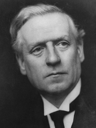
<span class="mw-page-title-main">December 1910 United Kingdom general election</span>

The December 1910 United Kingdom general election was held from 3 to 19 December. It was the last general election to be held over several days and the last to be held before the First World War.

<span class="mw-page-title-main">Lists of places in Wales</span>

These are lists of places in Wales.

<span class="mw-page-title-main">Kingdom of Israel (united monarchy)</span> Hypothesized Israelite kingdom in the Southern Levant

According to the Deuteronomistic history in the Hebrew Bible, a United Monarchy or United Kingdom of Israel existed under the reigns of Saul, Eshbaal, David, and Solomon, encompassing the territories of both the later kingdoms of Judah and Israel.

<span class="mw-page-title-main">Constituencies of the Parliament of the United Kingdom</span> Electoral divisions of the parliament of the United Kingdom

The Parliament of the United Kingdom currently has 650 parliamentary constituencies across the constituent countries, each electing a single member of parliament (MP) to the House of Commons by the plurality voting system, ordinarily every five years. Voting last took place in all 650 of those constituencies at the United Kingdom general election on 12 December 2019.
<span class="mw-page-title-main">United Kingdom of Portugal, Brazil and the Algarves</span> Pluricontinental monarchy

The United Kingdom of Portugal, Brazil and the Algarves was a pluricontinental monarchy formed by the elevation of the Portuguese colony named State of Brazil to the status of a kingdom and by the simultaneous union of that Kingdom of Brazil with the Kingdom of Portugal and the Kingdom of the Algarves, constituting a single state consisting of three kingdoms.

<span class="mw-page-title-main">Unitary authorities of England</span> Local government in some parts of England

The unitary authorities of England are a type of local authority responsible for all local government services in an area. They combine the functions of a non-metropolitan county council and a non-metropolitan district council, which elsewhere in England provide two tiers of local government.

<span class="mw-page-title-main">Kingdom of Portugal</span> Kingdom in Southwestern Europe (1139–1910)

The Kingdom of Portugal was a monarchy in the western Iberian Peninsula and the predecessor of the modern Portuguese Republic. Existing to various extents between 1139 and 1910, it was also known as the Kingdom of Portugal and the Algarves after 1415, and as the United Kingdom of Portugal, Brazil and the Algarves between 1815 and 1822. The name is also often applied to the Portuguese Empire, the realm's overseas colonies.

<span class="mw-page-title-main">United Kingdom in the Eurovision Song Contest</span> History of the United Kingdoms participation in Eurovision

The United Kingdom has participated in the Eurovision Song Contest 66 times. Its first participation was at the second contest, in 1957, and it has entered every year since 1959. The country has won the contest five times: in 1967, with Sandie Shaw and the song "Puppet on a String"; in 1969, with Lulu and the song "Boom Bang-a-Bang"; in 1976, with Brotherhood of Man and the song "Save Your Kisses for Me"; in 1981, with Bucks Fizz and the song "Making Your Mind Up"; and in 1997, with Katrina and the Waves and the song "Love Shine a Light". The UK has also achieved a record sixteen second-place finishes, the first in 1959 and the most recent in 2022.

<span class="mw-page-title-main">Countries of the United Kingdom</span> Component parts of the UK since 1922

Since 1922, the United Kingdom has been made up of four countries: England, Scotland, Wales and Northern Ireland. The UK Prime Minister's website has used the phrase "countries within a country" to describe the United Kingdom.