List of United Kingdom locations: Wam-Way

Last updated

The United Kingdom Uk-map.svg
The United Kingdom

This is part of the list of United Kingdom locations: a gazetteer of place names in the United Kingdom showing each place's locality and geographical coordinates.

Wam–Was

LocationLocality Coordinates
(links to map & photo sources)
OS grid
reference
Wambrook Somerset 50°51′N3°01′W / 50.85°N 03.01°W / 50.85; -03.01 ST2907
Wamphray Water Dumfries and Galloway 55°15′N3°22′W / 55.25°N 03.37°W / 55.25; -03.37 NY130967
Wampool Cumbria 54°52′N3°11′W / 54.87°N 03.18°W / 54.87; -03.18 NY2454
Wanborough Surrey 51°13′N0°40′W / 51.22°N 00.66°W / 51.22; -00.66 SU9348
Wanborough Swindon 51°32′N1°43′W / 51.53°N 01.71°W / 51.53; -01.71 SU2082
Wandel Dyke South Lanarkshire 55°31′N3°40′W / 55.51°N 03.66°W / 55.51; -03.66 NS9526
Wandle Park Croydon 51°22′N0°07′W / 51.36°N 00.11°W / 51.36; -00.11 TQ3165
Wandon End Luton 51°53′N0°21′W / 51.88°N 00.35°W / 51.88; -00.35 TL1322
Wandsworth 51°28′N0°12′W / 51.46°N 00.20°W / 51.46; -00.20 TQ2575
Wangford Suffolk 52°21′N1°37′E / 52.35°N 01.61°E / 52.35; 01.61 TM4679
Wanlip Leicestershire 52°41′N1°07′W / 52.68°N 01.11°W / 52.68; -01.11 SK6010
Wanlockhead Dumfries and Galloway 55°23′N3°47′W / 55.38°N 03.78°W / 55.38; -03.78 NS8712
Wannock East Sussex 50°48′N0°13′E / 50.80°N 00.22°E / 50.80; 00.22 TQ5703
Wansford Cambridgeshire 52°34′N0°25′W / 52.57°N 00.42°W / 52.57; -00.42 TL0799
Wansford East Riding of Yorkshire 53°59′N0°23′W / 53.98°N 00.38°W / 53.98; -00.38 TA0656
Wanshurst Green Kent 51°10′N0°31′E / 51.17°N 00.51°E / 51.17; 00.51 TQ7645
Wanson Cornwall 50°46′N4°34′W / 50.77°N 04.56°W / 50.77; -04.56 SS1900
Wanstead Redbridge 51°34′N0°01′E / 51.57°N 00.01°E / 51.57; 00.01 TQ4088
Wanstrow Somerset 51°10′N2°25′W / 51.16°N 02.41°W / 51.16; -02.41 ST7141
Wansunt Bexley 51°26′49″N0°10′34″E / 51.447°N 00.176°E / 51.447; 00.176 TQ513743
Wanswell Gloucestershire 51°42′N2°28′W / 51.70°N 02.46°W / 51.70; -02.46 SO6801
Wantage Oxfordshire 51°35′N1°25′W / 51.58°N 01.42°W / 51.58; -01.42 SU4087
Wants Green Herefordshire 52°13′N2°21′W / 52.21°N 02.35°W / 52.21; -02.35 SO7657
Wapley South Gloucestershire 51°30′N2°25′W / 51.50°N 02.41°W / 51.50; -02.41 ST7179
Waplington East Riding of Yorkshire 53°55′N0°49′W / 53.91°N 00.82°W / 53.91; -00.82 SE7746
Wappenbury Warwickshire 52°19′N1°27′W / 52.31°N 01.45°W / 52.31; -01.45 SP3769
Wappenham Northamptonshire 52°06′N1°05′W / 52.10°N 01.09°W / 52.10; -01.09 SP6245
Wapping Southwark 51°30′N0°04′W / 51.50°N 00.07°W / 51.50; -00.07 TQ3480
Warbleton East Sussex 50°56′N0°16′E / 50.93°N 00.27°E / 50.93; 00.27 TQ6018
Warblington Hampshire 50°50′N0°58′W / 50.84°N 00.97°W / 50.84; -00.97 SU7206
Warborough Oxfordshire 51°38′N1°08′W / 51.63°N 01.14°W / 51.63; -01.14 SU5993
Warboys Cambridgeshire 52°24′N0°05′W / 52.40°N 00.09°W / 52.40; -00.09 TL3080
Warbreck Lancashire 53°50′N3°02′W / 53.83°N 03.03°W / 53.83; -03.03 SD3238
Warbstow Cornwall 50°41′N4°32′W / 50.68°N 04.54°W / 50.68; -04.54 SX2090
Warbstow Cross Cornwall 50°41′N4°32′W / 50.68°N 04.54°W / 50.68; -04.54 SX2090
Warburton Trafford 53°23′N2°28′W / 53.39°N 02.46°W / 53.39; -02.46 SJ6989
Warburton Green Trafford 53°21′N2°19′W / 53.35°N 02.31°W / 53.35; -02.31 SJ7984
Warcop Cumbria 54°32′N2°24′W / 54.53°N 02.40°W / 54.53; -02.40 NY7415
Warden Powys 52°16′N3°01′W / 52.26°N 03.02°W / 52.26; -03.02 SO3064
Warden Kent 51°24′N0°54′E / 51.40°N 00.90°E / 51.40; 00.90 TR0271
Warden Northumberland 54°59′N2°08′W / 54.98°N 02.14°W / 54.98; -02.14 NY9166
Ward End Birmingham 52°29′N1°50′W / 52.49°N 01.83°W / 52.49; -01.83 SP1188
Warden Hill Gloucestershire 51°52′N2°06′W / 51.87°N 02.10°W / 51.87; -02.10 SO9320
Warden Point Isle of Wight 50°41′N1°32′W / 50.68°N 01.54°W / 50.68; -01.54 SZ3287
Warden Street Bedfordshire 52°05′N0°22′W / 52.08°N 00.36°W / 52.08; -00.36 TL1244
Ward Green Suffolk 52°13′N0°59′E / 52.22°N 00.98°E / 52.22; 00.98 TM0463
Ward Green Barnsley 53°32′N1°29′W / 53.53°N 01.48°W / 53.53; -01.48 SE3404
Ward Green Cross Lancashire 53°49′N2°34′W / 53.82°N 02.56°W / 53.82; -02.56 SD6337
Wardhedges Bedfordshire 52°00′N0°27′W / 52.00°N 00.45°W / 52.00; -00.45 TL0635
Wardhill Orkney Islands 59°07′N2°37′W / 59.11°N 02.61°W / 59.11; -02.61 HY6525
Wardington Oxfordshire 52°07′N1°17′W / 52.11°N 01.28°W / 52.11; -01.28 SP4946
Wardlaw Scottish Borders 55°26′N3°07′W / 55.43°N 03.12°W / 55.43; -03.12 NT2916
Wardle Rochdale 53°38′N2°08′W / 53.64°N 02.13°W / 53.64; -02.13 SD9116
Wardle Cheshire 53°06′N2°35′W / 53.10°N 02.58°W / 53.10; -02.58 SJ6157
Wardle Bank Cheshire 53°07′N2°35′W / 53.11°N 02.58°W / 53.11; -02.58 SJ6158
Wardley West Sussex 51°02′N0°48′W / 51.03°N 00.80°W / 51.03; -00.80 SU8427
Wardley Gateshead 54°56′N1°32′W / 54.94°N 01.54°W / 54.94; -01.54 NZ2961
Wardley Salford 53°31′N2°22′W / 53.51°N 02.36°W / 53.51; -02.36 SD7602
Wardley Rutland 52°35′N0°46′W / 52.59°N 00.77°W / 52.59; -00.77 SK8300
Wardlow Derbyshire 53°16′N1°44′W / 53.26°N 01.73°W / 53.26; -01.73 SK1874
Wardour Wiltshire 51°02′N2°07′W / 51.04°N 02.11°W / 51.04; -02.11 ST9227
Wardpark North Lanarkshire 55°58′N3°58′W / 55.97°N 03.97°W / 55.97; -03.97 NS7777
Wardrobes Buckinghamshire 51°42′N0°49′W / 51.70°N 00.82°W / 51.70; -00.82 SP8101
Wardsend Cheshire 53°20′N2°07′W / 53.33°N 02.12°W / 53.33; -02.12 SJ9282
Wardy Hill Cambridgeshire 52°25′N0°10′E / 52.41°N 00.16°E / 52.41; 00.16 TL4782
Ware Devon 50°43′N2°58′W / 50.71°N 02.96°W / 50.71; -02.96 SY3291
Ware Dorset 50°41′N2°07′W / 50.68°N 02.11°W / 50.68; -02.11 SY9287
Ware Hertfordshire 51°48′N0°01′W / 51.80°N 00.02°W / 51.80; -00.02 TL3614
Ware Kent 51°17′N1°15′E / 51.29°N 01.25°E / 51.29; 01.25 TR2760
Wareham Forest Dorset 50°43′N2°09′W / 50.72°N 02.15°W / 50.72; -02.15 SY890917
Warehorne Kent 51°03′N0°49′E / 51.05°N 00.82°E / 51.05; 00.82 TQ9832
Waren Burn Northumberland 55°34′N1°46′W / 55.57°N 01.76°W / 55.57; -01.76 NU148314
Warenford Northumberland 55°32′N1°47′W / 55.54°N 01.79°W / 55.54; -01.79 NU1328
Waren Mill Northumberland 55°36′N1°46′W / 55.60°N 01.77°W / 55.60; -01.77 NU1434
Wareside Hertfordshire 51°49′N0°01′E / 51.81°N 00.01°E / 51.81; 00.01 TL3915
Waresley Cambridgeshire 52°10′N0°10′W / 52.17°N 00.17°W / 52.17; -00.17 TL2554
Waresley Worcestershire 52°19′N2°14′W / 52.32°N 02.23°W / 52.32; -02.23 SO8470
Ware Street Kent 51°16′N0°34′E / 51.27°N 00.56°E / 51.27; 00.56 TQ7956
Warfield Berkshire 51°26′N0°44′W / 51.44°N 00.74°W / 51.44; -00.74 SU8772
Warfleet Devon 50°20′N3°35′W / 50.33°N 03.58°W / 50.33; -03.58 SX8750
Wargate Lincolnshire 52°51′N0°10′W / 52.85°N 00.17°W / 52.85; -00.17 TF2330
Wargrave Berkshire 51°29′N0°52′W / 51.49°N 00.87°W / 51.49; -00.87 SU7878
Wargrave Cheshire 53°26′N2°38′W / 53.44°N 02.63°W / 53.44; -02.63 SJ5894
Warham Herefordshire 52°02′N2°45′W / 52.04°N 02.75°W / 52.04; -02.75 SO4839
Warham Norfolk 52°56′N0°53′E / 52.93°N 00.88°E / 52.93; 00.88 TF9441
Warhill Tameside 53°27′N2°01′W / 53.45°N 02.01°W / 53.45; -02.01 SJ9995
Warings Green Warwickshire 52°22′N1°49′W / 52.36°N 01.82°W / 52.36; -01.82 SP1274
Wark on Tweed Northumberland 55°38′N2°17′W / 55.63°N 02.28°W / 55.63; -02.28 NT8238
Wark on Tyne Northumberland 55°05′N2°13′W / 55.08°N 02.22°W / 55.08; -02.22 NY8677
Wark Common Northumberland 55°37′N2°17′W / 55.61°N 02.28°W / 55.61; -02.28 NT8236
Warkleigh Devon 50°59′N3°56′W / 50.98°N 03.93°W / 50.98; -03.93 SS6422
Warkton Northamptonshire 52°24′N0°41′W / 52.40°N 00.69°W / 52.40; -00.69 SP8979
Warkworth Northamptonshire 52°03′N1°18′W / 52.05°N 01.30°W / 52.05; -01.30 SP4840
Warkworth Northumberland 55°20′N1°37′W / 55.34°N 01.62°W / 55.34; -01.62 NU2406
Warlaby North Yorkshire 54°19′N1°28′W / 54.31°N 01.47°W / 54.31; -01.47 SE3491
Warland Calderdale 53°40′N2°05′W / 53.67°N 02.09°W / 53.67; -02.09 SD9420
Warleggan Cornwall 50°29′N4°36′W / 50.49°N 04.60°W / 50.49; -04.60 SX1569
Warleigh Bath and North East Somerset 51°22′N2°18′W / 51.37°N 02.30°W / 51.37; -02.30 ST7964
Warley Essex 51°36′N0°17′E / 51.60°N 00.29°E / 51.60; 00.29 TQ5992
Warley Town Calderdale 53°43′N1°55′W / 53.72°N 01.92°W / 53.72; -01.92 SE0525
Warley Woods Sandwell 52°28′N1°59′W / 52.47°N 01.98°W / 52.47; -01.98 SP0186
Warlingham Surrey 51°18′N0°04′W / 51.30°N 00.06°W / 51.30; -00.06 TQ3558
Warmbrook Derbyshire 53°04′N1°35′W / 53.07°N 01.58°W / 53.07; -01.58 SK2853
Warmfield Wakefield 53°40′N1°26′W / 53.67°N 01.44°W / 53.67; -01.44 SE3720
Warmingham Cheshire 53°08′N2°27′W / 53.14°N 02.45°W / 53.14; -02.45 SJ7061
Warminghurst West Sussex 50°56′N0°25′W / 50.93°N 00.42°W / 50.93; -00.42 TQ1116
Warmington Northamptonshire 52°30′N0°25′W / 52.50°N 00.42°W / 52.50; -00.42 TL0791
Warmington Warwickshire 52°07′N1°24′W / 52.12°N 01.40°W / 52.12; -01.40 SP4147
Warminster Wiltshire 51°12′N2°11′W / 51.20°N 02.18°W / 51.20; -02.18 ST8745
Warminster Common Wiltshire 51°11′N2°12′W / 51.19°N 02.20°W / 51.19; -02.20 ST8644
Warmlake Kent 51°13′N0°35′E / 51.21°N 00.59°E / 51.21; 00.59 TQ8149
Warmley South Gloucestershire 51°27′N2°28′W / 51.45°N 02.47°W / 51.45; -02.47 ST6773
Warmley Hill South Gloucestershire 51°27′N2°30′W / 51.45°N 02.50°W / 51.45; -02.50 ST6573
Warmley Tower South Gloucestershire 51°26′N2°29′W / 51.44°N 02.49°W / 51.44; -02.49 ST6672
Warmonds Hill Northamptonshire 52°18′N0°36′W / 52.30°N 00.60°W / 52.30; -00.60 SP9568
Warmsworth Doncaster 53°29′N1°11′W / 53.49°N 01.18°W / 53.49; -01.18 SE5400
Warmwell Dorset 50°40′N2°21′W / 50.66°N 02.35°W / 50.66; -02.35 SY7585
Warnborough Green Hampshire 51°16′N0°58′W / 51.26°N 00.96°W / 51.26; -00.96 SU7252
Warndon Worcestershire 52°12′N2°10′W / 52.20°N 02.17°W / 52.20; -02.17 SO8856
Warndon Worcestershire 52°12′N2°11′W / 52.20°N 02.19°W / 52.20; -02.19 SO8756
Warners End Hertfordshire 51°45′N0°30′W / 51.75°N 00.50°W / 51.75; -00.50 TL0307
Warnford Hampshire 51°00′N1°07′W / 51.00°N 01.11°W / 51.00; -01.11 SU6223
Warnham West Sussex 51°05′N0°21′W / 51.08°N 00.35°W / 51.08; -00.35 TQ1533
Warningcamp West Sussex 50°51′N0°32′W / 50.85°N 00.53°W / 50.85; -00.53 TQ0307
Warninglid West Sussex 51°01′N0°13′W / 51.01°N 00.21°W / 51.01; -00.21 TQ2526
Warpsgrove Oxfordshire 51°40′N1°04′W / 51.67°N 01.07°W / 51.67; -01.07 SU6498
Warren Dorset 50°43′N2°13′W / 50.71°N 02.21°W / 50.71; -02.21 SY8591
Warren Pembrokeshire 51°38′N4°59′W / 51.63°N 04.99°W / 51.63; -04.99 SR9397
Warren Sheffield 53°28′N1°28′W / 53.46°N 01.47°W / 53.46; -01.47 SK3597
Warren Cheshire 53°13′N2°11′W / 53.22°N 02.18°W / 53.22; -02.18 SJ8870
Warrenby Redcar and Cleveland 54°37′N1°06′W / 54.61°N 01.10°W / 54.61; -01.10 NZ5825
Warren Corner Hampshire 51°02′N0°58′W / 51.03°N 00.97°W / 51.03; -00.97 SU7227
Warren Corner Hampshire 51°14′N0°50′W / 51.23°N 00.84°W / 51.23; -00.84 SU8149
Warren Heath Suffolk 52°02′N1°12′E / 52.03°N 01.20°E / 52.03; 01.20 TM2042
Warren Row Berkshire 51°31′N0°50′W / 51.51°N 00.83°W / 51.51; -00.83 SU8180
Warren's Green Hertfordshire 51°56′N0°10′W / 51.93°N 00.16°W / 51.93; -00.16 TL2628
Warren StreetKent 51°14′N0°44′E / 51.24°N 00.74°E / 51.24; 00.74 TQ9253
Warrington Milton Keynes 52°10′N0°41′W / 52.17°N 00.69°W / 52.17; -00.69 SP8954
Warrington Cheshire 53°23′N2°36′W / 53.38°N 02.60°W / 53.38; -02.60 SJ6088
Warriston City of Edinburgh 55°58′N3°12′W / 55.96°N 03.20°W / 55.96; -03.20 NT2575
Warsash Hampshire 50°51′N1°18′W / 50.85°N 01.30°W / 50.85; -01.30 SU4906
Warse Highland 58°38′N3°09′W / 58.63°N 03.15°W / 58.63; -03.15 ND3372
Warsill North Yorkshire 54°05′N1°40′W / 54.08°N 01.66°W / 54.08; -01.66 SE2265
Warslow Staffordshire 53°07′N1°53′W / 53.11°N 01.88°W / 53.11; -01.88 SK0858
Warsop Vale Nottinghamshire 53°11′N1°11′W / 53.19°N 01.19°W / 53.19; -01.19 SK5467
Warstock Birmingham 52°24′N1°52′W / 52.40°N 01.86°W / 52.40; -01.86 SP0979
Warstone Staffordshire 52°38′N2°02′W / 52.64°N 02.04°W / 52.64; -02.04 SJ9705
Warter East Riding of Yorkshire 53°56′N0°41′W / 53.93°N 00.69°W / 53.93; -00.69 SE8650
Warthermarske North Yorkshire 54°11′N1°41′W / 54.19°N 01.69°W / 54.19; -01.69 SE2078
Warthill North Yorkshire 53°59′N0°58′W / 53.98°N 00.97°W / 53.98; -00.97 SE6755
Wartling East Sussex 50°51′N0°20′E / 50.85°N 00.34°E / 50.85; 00.34 TQ6509
Wartnaby Leicestershire 52°48′N0°56′W / 52.80°N 00.94°W / 52.80; -00.94 SK7123
Warton Lancashire 53°44′N2°53′W / 53.74°N 02.89°W / 53.74; -02.89 SD4128
Warton Lancashire 54°08′N2°46′W / 54.14°N 02.76°W / 54.14; -02.76 SD5072
Warton Northumberland 55°19′N2°00′W / 55.31°N 02.00°W / 55.31; -02.00 NU0002
Warton Warwickshire 52°37′N1°35′W / 52.62°N 01.58°W / 52.62; -01.58 SK2803
Warton Bank Lancashire 53°44′N2°55′W / 53.73°N 02.91°W / 53.73; -02.91 SD4027
Warwick Warwickshire 52°17′N1°35′W / 52.28°N 01.59°W / 52.28; -01.59 SP2865
Warwick Bridge Cumbria 54°53′N2°49′W / 54.89°N 02.82°W / 54.89; -02.82 NY4756
Warwick-on-Eden Cumbria 54°53′N2°50′W / 54.89°N 02.84°W / 54.89; -02.84 NY4656
Warwicksland Cumbria 55°05′N2°52′W / 55.08°N 02.87°W / 55.08; -02.87 NY4477
Warwick Wold Surrey 51°15′N0°07′W / 51.25°N 00.12°W / 51.25; -00.12 TQ3152
Wasbister Orkney Islands 59°10′N3°04′W / 59.17°N 03.06°W / 59.17; -03.06 HY3932
Wasdale Cumbria 54°27′N2°43′W / 54.45°N 02.72°W / 54.45; -02.72 NY534072
Wasdale Beck Cumbria 54°32′N2°44′W / 54.54°N 02.73°W / 54.54; -02.73 NY526171
Wasdale Head Cumbria 54°28′N3°16′W / 54.46°N 03.26°W / 54.46; -03.26 NY1808
Wash Derbyshire 53°20′N1°55′W / 53.33°N 01.91°W / 53.33; -01.91 SK0682
Washall Green Hertfordshire 51°57′N0°05′E / 51.95°N 00.09°E / 51.95; 00.09 TL4430
Washaway Cornwall 50°29′N4°46′W / 50.48°N 04.77°W / 50.48; -04.77 SX0369
Washbourne Devon 50°22′N3°42′W / 50.37°N 03.70°W / 50.37; -03.70 SX7954
Washbrook Somerset 51°14′N2°50′W / 51.24°N 02.83°W / 51.24; -02.83 ST4250
Washbrook Suffolk 52°02′N1°04′E / 52.03°N 01.07°E / 52.03; 01.07 TM1142
Washbrook Street Suffolk 52°02′N1°04′E / 52.03°N 01.07°E / 52.03; 01.07 TM1142
Washburn North Yorkshire 54°02′N1°48′W / 54.04°N 01.80°W / 54.04; -01.80 SE131610
Wash Common Berkshire 51°22′N1°21′W / 51.37°N 01.35°W / 51.37; -01.35 SU4564
Wash Dyke Norfolk 52°43′N0°13′E / 52.72°N 00.21°E / 52.72; 00.21 TF5016
Washerwall Staffordshire 53°01′N2°06′W / 53.02°N 02.10°W / 53.02; -02.10 SJ9347
Washfield Devon 50°55′N3°31′W / 50.92°N 03.52°W / 50.92; -03.52 SS9315
Washfold North Yorkshire 54°25′N1°55′W / 54.41°N 01.92°W / 54.41; -01.92 NZ0502
Washford Somerset 51°10′N3°22′W / 51.16°N 03.37°W / 51.16; -03.37 ST0441
Washford Warwickshire 52°17′N1°53′W / 52.28°N 01.89°W / 52.28; -01.89 SP0765
Washford Pyne Devon 50°53′N3°41′W / 50.88°N 03.69°W / 50.88; -03.69 SS8111
Washingborough Lincolnshire 53°13′N0°28′W / 53.21°N 00.47°W / 53.21; -00.47 TF0270
Washingley Cambridgeshire 52°29′N0°20′W / 52.48°N 00.33°W / 52.48; -00.33 TL1389
Washington West Sussex 50°53′N0°24′W / 50.89°N 00.40°W / 50.89; -00.40 TQ1212
Washington Sunderland 54°54′N1°31′W / 54.90°N 01.51°W / 54.90; -01.51 NZ3157
Washington Village Sunderland 54°53′N1°32′W / 54.89°N 01.53°W / 54.89; -01.53 NZ3056
Washmere Green Suffolk 52°05′N0°47′E / 52.08°N 00.78°E / 52.08; 00.78 TL9147
Washpit Kirklees 53°33′N1°47′W / 53.55°N 01.79°W / 53.55; -01.79 SE1406
Wash Water Hampshire 51°22′N1°21′W / 51.36°N 01.35°W / 51.36; -01.35 SU4563
Washwood Heath Birmingham 52°29′N1°51′W / 52.49°N 01.85°W / 52.49; -01.85 SP1088
Wasing Berkshire 51°22′N1°11′W / 51.37°N 01.18°W / 51.37; -01.18 SU5764
Waskerley Durham 54°48′N1°55′W / 54.80°N 01.92°W / 54.80; -01.92 NZ0545
Wasperton Warwickshire 52°13′N1°37′W / 52.21°N 01.62°W / 52.21; -01.62 SP2658
Wasp Green Surrey 51°11′N0°07′W / 51.18°N 00.11°W / 51.18; -00.11 TQ3245
Wasps Nest Lincolnshire 53°10′N0°23′W / 53.16°N 00.38°W / 53.16; -00.38 TF0864
Wass North Yorkshire 54°12′N1°09′W / 54.20°N 01.15°W / 54.20; -01.15 SE5579
Wassand East Riding of Yorkshire 53°54′N0°13′W / 53.90°N 00.21°W / 53.90; -00.21 TA1746
Waste Green Warwickshire 52°19′N1°38′W / 52.31°N 01.64°W / 52.31; -01.64 SP2469
Wastor Devon 50°19′N3°55′W / 50.32°N 03.91°W / 50.32; -03.91 SX6449
Wast Water Cumbria 54°26′N3°17′W / 54.44°N 03.29°W / 54.44; -03.29 NY163060

Wat–Waz

LocationLocality Coordinates
(links to map & photo sources)
OS grid
reference
Watchcombe Devon 50°46′N3°05′W / 50.76°N 03.09°W / 50.76; -03.09 SY2397
Watchet Somerset 51°10′N3°20′W / 51.17°N 03.33°W / 51.17; -03.33 ST0743
Watchfield Somerset 51°13′N2°56′W / 51.21°N 02.94°W / 51.21; -02.94 ST3447
Watchfield Oxfordshire 51°36′N1°39′W / 51.60°N 01.65°W / 51.60; -01.65 SU2490
Watchgate Cumbria 54°23′N2°44′W / 54.38°N 02.74°W / 54.38; -02.74 SD5299
Watchhill Cumbria 54°46′N3°16′W / 54.76°N 03.27°W / 54.76; -03.27 NY1842
Watch House Green Essex 51°52′N0°27′E / 51.86°N 00.45°E / 51.86; 00.45 TL6921
Watchill Dumfries and Galloway 54°59′N3°15′W / 54.98°N 03.25°W / 54.98; -03.25 NY2066
Watcombe Devon 50°29′N3°32′W / 50.49°N 03.53°W / 50.49; -03.53 SX9167
Watendlath Cumbria 54°32′N3°07′W / 54.53°N 03.12°W / 54.53; -03.12 NY2716
Water Devon 50°36′N3°46′W / 50.60°N 03.76°W / 50.60; -03.76 SX7580
Water Lancashire 53°43′N2°14′W / 53.72°N 02.24°W / 53.72; -02.24 SD8425
Waterbeach West Sussex 50°52′N0°44′W / 50.86°N 00.73°W / 50.86; -00.73 SU8908
Waterbeach Cambridgeshire 52°16′N0°11′E / 52.26°N 00.18°E / 52.26; 00.18 TL4965
Waterbeck Dumfries and Galloway 55°05′N3°11′W / 55.08°N 03.19°W / 55.08; -03.19 NY2477
Waterdale Hertfordshire 51°42′N0°23′W / 51.70°N 00.39°W / 51.70; -00.39 TL1102
Waterditch Dorset 50°46′N1°44′W / 50.76°N 01.74°W / 50.76; -01.74 SZ1896
Water Eaton Milton Keynes 51°58′N0°44′W / 51.97°N 00.73°W / 51.97; -00.73 SP8732
Water Eaton Oxfordshire 51°48′N1°16′W / 51.80°N 01.26°W / 51.80; -01.26 SP5112
Water End Bedfordshire 52°06′N0°10′W / 52.10°N 00.17°W / 52.10; -00.17 TL2547
Water End Essex 52°02′N0°18′E / 52.03°N 00.30°E / 52.03; 00.30 TL5840
Water End Bedfordshire 52°07′N0°23′W / 52.11°N 00.39°W / 52.11; -00.39 TL1047
Water End Bedfordshire 52°01′N0°27′W / 52.02°N 00.45°W / 52.02; -00.45 TL0637
Waterend Gloucestershire 51°49′N2°22′W / 51.82°N 02.36°W / 51.82; -02.36 SO7514
Water End Hertfordshire 51°46′N0°30′W / 51.77°N 00.50°W / 51.77; -00.50 TL0310
Waterend Hertfordshire 51°48′N0°16′W / 51.80°N 00.26°W / 51.80; -00.26 TL2013
Waterend Buckinghamshire 51°39′N0°52′W / 51.65°N 00.87°W / 51.65; -00.87 SU7896
Water End Hertfordshire 51°43′N0°14′W / 51.72°N 00.23°W / 51.72; -00.23 TL2204
Water End Hampshire 51°16′N1°01′W / 51.27°N 01.01°W / 51.27; -01.01 SU6953
Waterend Cumbria 54°35′N3°22′W / 54.58°N 03.37°W / 54.58; -03.37 NY1122
Water End East Riding of Yorkshire 53°50′N0°49′W / 53.83°N 00.81°W / 53.83; -00.81 SE7838
Waterfall Staffordshire 53°03′N1°53′W / 53.05°N 01.88°W / 53.05; -01.88 SK0851
Waterfoot Argyll and Bute 55°34′N5°29′W / 55.57°N 05.49°W / 55.57; -05.49 NR8037
Waterfoot Cumbria 54°36′N2°51′W / 54.60°N 02.85°W / 54.60; -02.85 NY4524
Waterfoot Lancashire 53°41′N2°15′W / 53.68°N 02.25°W / 53.68; -02.25 SD8321
Waterfoot East Renfrewshire 55°45′N4°17′W / 55.75°N 04.29°W / 55.75; -04.29 NS5654
Waterford Hampshire 50°44′N1°32′W / 50.74°N 01.53°W / 50.74; -01.53 SZ3394
Waterford Hertfordshire 51°48′N0°06′W / 51.80°N 00.10°W / 51.80; -00.10 TL3114
Water Fryston Wakefield 53°43′N1°18′W / 53.72°N 01.30°W / 53.72; -01.30 SE4626
Water Garth Nook Cumbria 54°05′N3°15′W / 54.09°N 03.25°W / 54.09; -03.25 SD1867
Watergate Cornwall 50°35′N4°40′W / 50.59°N 04.67°W / 50.59; -04.67 SX1181
Watergate Cornwall 50°21′N4°29′W / 50.35°N 04.49°W / 50.35; -04.49 SX2354
Watergore Somerset 50°56′N2°49′W / 50.93°N 02.81°W / 50.93; -02.81 ST4315
Waterhales Essex 51°38′N0°12′E / 51.63°N 00.20°E / 51.63; 00.20 TQ5395
Waterham Kent 51°19′N0°58′E / 51.31°N 00.96°E / 51.31; 00.96 TR0762
Waterhay Wiltshire 51°38′N1°55′W / 51.63°N 01.91°W / 51.63; -01.91 SU0693
Waterhead Devon 50°18′N3°51′W / 50.30°N 03.85°W / 50.30; -03.85 SX6847
Waterhead Cumbria 54°25′N2°58′W / 54.41°N 02.97°W / 54.41; -02.97 NY3703
Waterheads Scottish Borders 55°44′N3°13′W / 55.73°N 03.21°W / 55.73; -03.21 NT2450
Waterheath Norfolk 52°29′N1°35′E / 52.48°N 01.59°E / 52.48; 01.59 TM4494
Waterhouses Durham 54°46′N1°43′W / 54.76°N 01.72°W / 54.76; -01.72 NZ1841
Water Houses North Yorkshire 54°05′N2°11′W / 54.09°N 02.18°W / 54.09; -02.18 SD8867
Waterhouses Staffordshire 53°02′N1°53′W / 53.04°N 01.88°W / 53.04; -01.88 SK0850
Wateringbury Kent 51°15′N0°25′E / 51.25°N 00.42°E / 51.25; 00.42 TQ6953
Waterlane Gloucestershire 51°44′N2°07′W / 51.73°N 02.11°W / 51.73; -02.11 SO9204
Waterlip Somerset 51°11′N2°29′W / 51.19°N 02.48°W / 51.19; -02.48 ST6644
Waterloo Cornwall 50°31′N4°41′W / 50.51°N 04.68°W / 50.51; -04.68 SX1072
Waterloo Derbyshire 53°10′N1°23′W / 53.16°N 01.38°W / 53.16; -01.38 SK4163
Waterloo Highland 57°14′N5°52′W / 57.23°N 05.87°W / 57.23; -05.87 NG6623
Waterloo Lancashire 53°43′N2°31′W / 53.72°N 02.51°W / 53.72; -02.51 SD6625
Waterloo Norfolk 52°22′N1°08′E / 52.36°N 01.14°E / 52.36; 01.14 TM1479
Waterloo Norfolk 52°29′N1°34′E / 52.48°N 01.56°E / 52.48; 01.56 TM4293
Waterloo Norfolk 52°43′N1°17′E / 52.72°N 01.28°E / 52.72; 01.28 TG2219
Waterloo North Lanarkshire 55°45′N3°55′W / 55.75°N 03.91°W / 55.75; -03.91 NS8053
Waterloo Pembrokeshire 51°41′N4°56′W / 51.68°N 04.93°W / 51.68; -04.93 SM9703
Waterloo Perth and Kinross 56°30′N3°32′W / 56.50°N 03.54°W / 56.50; -03.54 NO0536
Waterloo Poole 50°44′N1°59′W / 50.74°N 01.98°W / 50.74; -01.98 SZ0194
Waterloo Sefton 53°28′N3°02′W / 53.47°N 03.04°W / 53.47; -03.04 SJ3198
Waterloo Shropshire 52°53′N2°45′W / 52.89°N 02.75°W / 52.89; -02.75 SJ4933
Waterloo Tameside 53°29′N2°06′W / 53.49°N 02.10°W / 53.49; -02.10 SD9300
Waterloo Park Sefton 53°28′N3°01′W / 53.47°N 03.02°W / 53.47; -03.02 SJ3298
Waterloo Port Gwynedd 53°09′N4°16′W / 53.15°N 04.27°W / 53.15; -04.27 SH4864
Waterlooville Hampshire 50°52′N1°02′W / 50.87°N 01.03°W / 50.87; -01.03 SU6809
Waterman Quarter Kent 51°08′N0°37′E / 51.14°N 00.61°E / 51.14; 00.61 TQ8342
Watermead Gloucestershire 51°50′N2°10′W / 51.83°N 02.16°W / 51.83; -02.16 SO8915
Watermill East Sussex 50°52′N0°27′E / 50.87°N 00.45°E / 50.87; 00.45 TQ7311
Watermillock Cumbria 54°35′N2°52′W / 54.59°N 02.86°W / 54.59; -02.86 NY4422
Watermoor Gloucestershire 51°42′N1°58′W / 51.70°N 01.97°W / 51.70; -01.97 SP0201
Water Newton Cambridgeshire 52°34′N0°22′W / 52.56°N 00.37°W / 52.56; -00.37 TL1097
Water of Ae Dumfries and Galloway 55°10′N3°32′W / 55.16°N 03.53°W / 55.16; -03.53 NY020864
Water of Ailnach Moray 57°08′N3°34′W / 57.13°N 03.56°W / 57.13; -03.56 NJ051056
Water of Ailnack Moray 57°13′N3°25′W / 57.22°N 03.41°W / 57.22; -03.41 NJ145152
Water of Aven Aberdeenshire 56°59′N2°47′W / 56.99°N 02.79°W / 56.99; -02.79 NO519899
Water of Buchat Aberdeenshire 57°11′N3°11′W / 57.19°N 03.19°W / 57.19; -03.19 NJ278125
Water of Chon Stirling 56°11′N4°31′W / 56.18°N 04.51°W / 56.18; -04.51 NN440023
Water of Cruden Aberdeenshire 57°26′N2°01′W / 57.43°N 02.01°W / 57.43; -02.01 NJ994383
Water of Deugh Dumfries and Galloway 55°17′N4°10′W / 55.29°N 04.17°W / 55.29; -04.17 NS619025
Water of Deugh Dumfries and Galloway 55°12′N4°14′W / 55.20°N 04.24°W / 55.20; -04.24 NX572924
Water of Dye Aberdeenshire 56°59′N2°34′W / 56.99°N 02.56°W / 56.99; -02.56 NO660898
Water of Fail South Ayrshire 55°31′N4°29′W / 55.51°N 04.48°W / 55.51; -04.48 NS429272
Water of Feugh Aberdeenshire 57°01′N2°35′W / 57.01°N 02.58°W / 57.01; -02.58 NO643916
Water of Fleet Dumfries and Galloway 54°57′N4°15′W / 54.95°N 04.25°W / 54.95; -04.25 NX556649
Water of Girvan South Ayrshire 55°16′N4°28′W / 55.26°N 04.47°W / 55.26; -04.47 NS430000
Water of Ken Dumfries and Galloway 55°10′N4°11′W / 55.17°N 04.18°W / 55.17; -04.18 NX609894
Water of Leith West Lothian 55°51′N3°25′W / 55.85°N 03.42°W / 55.85; -03.42 NT112637
Water of Luce Dumfries and Galloway 54°57′N4°52′W / 54.95°N 04.86°W / 54.95; -04.86 NX166655
Water of Mark Angus 56°55′N2°56′W / 56.92°N 02.94°W / 56.92; -02.94 NO424816
Water of Minnoch South Ayrshire 55°10′N4°34′W / 55.17°N 04.57°W / 55.17; -04.57 NX359901
Water of Minnoch Dumfries and Galloway 55°02′N4°34′W / 55.03°N 04.57°W / 55.03; -04.57 NX358745
Water of Nevis Highland 56°46′N4°56′W / 56.77°N 04.93°W / 56.77; -04.93 NN205685
Water of Philorth Aberdeenshire 57°38′N2°01′W / 57.63°N 02.01°W / 57.63; -02.01 NJ990609
Water of Ruchill Perth and Kinross 56°20′N4°01′W / 56.34°N 04.01°W / 56.34; -04.01 NN753186
Water of Saughs Angus 56°50′N2°49′W / 56.83°N 02.82°W / 56.83; -02.82 NO498722
Water of Tulla Argyll and Bute 56°33′N4°45′W / 56.55°N 04.75°W / 56.55; -04.75 NN307435
Water of Unich Angus 56°54′N2°56′W / 56.90°N 02.93°W / 56.90; -02.93 NO430796
Water Orton Warwickshire 52°31′N1°45′W / 52.51°N 01.75°W / 52.51; -01.75 SP1791
Waterperry Oxfordshire 51°44′N1°06′W / 51.74°N 01.10°W / 51.74; -01.10 SP6206
Waterrow Somerset 51°01′N3°21′W / 51.01°N 03.35°W / 51.01; -03.35 ST0525
Watersfield West Sussex 50°55′N0°34′W / 50.92°N 00.56°W / 50.92; -00.56 TQ0115
Watersheddings Oldham 53°33′N2°05′W / 53.55°N 02.09°W / 53.55; -02.09 SD9406
Waterside Buckinghamshire 51°41′N0°37′W / 51.69°N 00.61°W / 51.69; -00.61 SP9600
Waterside Cumbria 54°47′N3°13′W / 54.79°N 03.21°W / 54.79; -03.21 NY2245
Waterside Derbyshire 53°20′N1°59′W / 53.34°N 01.98°W / 53.34; -01.98 SK0183
Waterside Doncaster 53°36′N0°59′W / 53.60°N 00.98°W / 53.60; -00.98 SE6713
Waterside Lancashire 53°42′N2°26′W / 53.70°N 02.44°W / 53.70; -02.44 SD7123
Waterside Shropshire 52°46′N2°34′W / 52.76°N 02.56°W / 52.76; -02.56 SJ6219
Waterside Surrey 51°11′N0°01′W / 51.18°N 00.01°W / 51.18; -00.01 TQ3945
Waterside East Ayrshire 55°20′N4°28′W / 55.34°N 04.47°W / 55.34; -04.47 NS4308
Waterside East Ayrshire 55°39′N4°25′W / 55.65°N 04.41°W / 55.65; -04.41 NS4843
Waterside East Dunbartonshire 55°56′N4°08′W / 55.93°N 04.13°W / 55.93; -04.13 NS6773
Waterside East Renfrewshire 55°49′N4°22′W / 55.81°N 04.37°W / 55.81; -04.37 NS5160
Waterslack Lancashire 54°10′N2°49′W / 54.17°N 02.81°W / 54.17; -02.81 SD4776
Water's Nook Bolton 53°32′N2°31′W / 53.54°N 02.51°W / 53.54; -02.51 SD6605
Waterstein Highland 57°26′N6°46′W / 57.43°N 06.76°W / 57.43; -06.76 NG1448
Waterstock Oxfordshire 51°44′N1°05′W / 51.74°N 01.08°W / 51.74; -01.08 SP6305
Waterston Pembrokeshire 51°42′N4°59′W / 51.70°N 04.99°W / 51.70; -04.99 SM9305
Water Stratford Buckinghamshire 52°00′N1°03′W / 52.00°N 01.05°W / 52.00; -01.05 SP6534
Waters Upton Shropshire 52°46′N2°32′W / 52.76°N 02.54°W / 52.76; -02.54 SJ6319
Waterthorpe Sheffield 53°20′N1°21′W / 53.33°N 01.35°W / 53.33; -01.35 SK4382
Waterton Aberdeenshire 57°22′N2°03′W / 57.36°N 02.05°W / 57.36; -02.05 NJ9730
Waterton Bridgend 51°29′N3°32′W / 51.49°N 03.54°W / 51.49; -03.54 SS9378
Waterton Lincolnshire 53°39′N0°43′W / 53.65°N 00.71°W / 53.65; -00.71 SE8518
Water Yeat Cumbria 54°17′N3°06′W / 54.29°N 03.10°W / 54.29; -03.10 SD2889
Watford Hertfordshire 51°40′N0°25′W / 51.66°N 00.41°W / 51.66; -00.41 TQ1097
Watford Northamptonshire 52°18′N1°07′W / 52.30°N 01.12°W / 52.30; -01.12 SP6068
Watford Gap Birmingham 52°35′N1°50′W / 52.59°N 01.83°W / 52.59; -01.83 SK1100
Watford Heath Hertfordshire 51°38′N0°23′W / 51.63°N 00.38°W / 51.63; -00.38 TQ1294
Watford Park Caerphilly 51°34′N3°14′W / 51.56°N 03.24°W / 51.56; -03.24 ST1486
Wath Cumbria 54°26′N2°29′W / 54.43°N 02.49°W / 54.43; -02.49 NY6805
Wath (near Ripon)North Yorkshire 54°11′N1°31′W / 54.18°N 01.51°W / 54.18; -01.51 SE3277
Wath (Ryedale)North Yorkshire 54°10′N0°58′W / 54.16°N 00.97°W / 54.16; -00.97 SE6775
Wath (near Pateley Bridge)North Yorkshire 54°05′N1°47′W / 54.09°N 01.78°W / 54.09; -01.78 SE1467
Wath Brow Cumbria 54°31′N3°31′W / 54.51°N 03.51°W / 54.51; -03.51 NY0214
Watherston Scottish Borders 55°42′N2°54′W / 55.70°N 02.90°W / 55.70; -02.90 NT4346
Wath upon Dearne Rotherham 53°29′N1°21′W / 53.49°N 01.35°W / 53.49; -01.35 SE4300
Watledge Gloucestershire 51°41′N2°14′W / 51.69°N 02.23°W / 51.69; -02.23 SO8400
Watley's End South Gloucestershire 51°31′N2°30′W / 51.52°N 02.50°W / 51.52; -02.50 ST6581
Watlington Oxfordshire 51°38′N1°01′W / 51.64°N 01.01°W / 51.64; -01.01 SU6894
Watlington Norfolk 52°40′N0°22′E / 52.66°N 00.37°E / 52.66; 00.37 TF6110
Watnall Nottinghamshire 53°00′N1°15′W / 53.00°N 01.25°W / 53.00; -01.25 SK5045
Wats Ness Shetland Islands 60°14′N1°41′W / 60.23°N 01.69°W / 60.23; -01.69 HU172502
Watten Highland 58°28′N3°19′W / 58.46°N 03.32°W / 58.46; -03.32 ND2354
Watternish Highland 57°32′N6°34′W / 57.53°N 06.57°W / 57.53; -06.57 NG262590
Wattisfield Suffolk 52°19′N0°56′E / 52.32°N 00.94°E / 52.32; 00.94 TM0174
Wattisham Suffolk 52°07′N0°56′E / 52.12°N 00.93°E / 52.12; 00.93 TM0151
Wattisham Stone Suffolk 52°07′N0°55′E / 52.12°N 00.92°E / 52.12; 00.92 TM0051
Wattlefield Norfolk 52°31′N1°06′E / 52.52°N 01.10°E / 52.52; 01.10 TM1196
Wattlesborough Heath Shropshire 52°41′N2°58′W / 52.69°N 02.96°W / 52.69; -02.96 SJ3511
Watton Dorset 50°43′N2°46′W / 50.72°N 02.77°W / 50.72; -02.77 SY4591
Watton East Riding of Yorkshire 53°56′N0°28′W / 53.93°N 00.46°W / 53.93; -00.46 TA0150
Watton Norfolk 52°34′N0°49′E / 52.56°N 00.81°E / 52.56; 00.81 TF9100
Watton-at-Stone Hertfordshire 51°51′N0°07′W / 51.85°N 00.12°W / 51.85; -00.12 TL2919
Watton Green Norfolk 52°34′N0°50′E / 52.57°N 00.83°E / 52.57; 00.83 TF9201
Watton's Green Essex 51°38′N0°11′E / 51.63°N 00.19°E / 51.63; 00.19 TQ5295
Wattston North Lanarkshire 55°54′N3°58′W / 55.90°N 03.96°W / 55.90; -03.96 NS7770
Wattstown Rhondda, Cynon, Taff 51°37′N3°26′W / 51.62°N 03.43°W / 51.62; -03.43 ST0193
Wattsville Caerphilly 51°37′N3°09′W / 51.61°N 03.15°W / 51.61; -03.15 ST2091
Wauldby East Riding of Yorkshire 53°46′N0°31′W / 53.76°N 00.51°W / 53.76; -00.51 SE9729
Waulkmill Dumfries and Galloway 54°47′N4°26′W / 54.79°N 04.44°W / 54.79; -04.44 NX4347
Waulkmill Angus 56°38′N2°36′W / 56.63°N 02.60°W / 56.63; -02.60 NO6349
Waulkmill Perth and Kinross 56°26′N3°28′W / 56.43°N 03.46°W / 56.43; -03.46 NO1028
Waulkmills Angus 56°35′N2°36′W / 56.58°N 02.60°W / 56.58; -02.60 NO6344
Waun Gwynedd 53°09′N4°10′W / 53.15°N 04.17°W / 53.15; -04.17 SH5564
Waun Powys 52°46′N3°08′W / 52.76°N 03.14°W / 52.76; -03.14 SJ2319
Waunarlwydd Swansea 51°38′N4°01′W / 51.63°N 04.02°W / 51.63; -04.02 SS6095
Waun Beddau Pembrokeshire 51°55′N5°14′W / 51.91°N 05.24°W / 51.91; -05.24 SM7729
Waun Fawr Ceredigion 52°24′N4°03′W / 52.40°N 04.05°W / 52.40; -04.05 SN6081
Waunfawr Gwynedd 53°06′N4°11′W / 53.10°N 04.19°W / 53.10; -04.19 SH5359
Waungilwen Carmarthenshire 52°01′N4°25′W / 52.02°N 04.42°W / 52.02; -04.42 SN3439
Waungron Swansea 51°41′N4°02′W / 51.69°N 04.04°W / 51.69; -04.04 SN5902
Waun-Lwyd Blaenau Gwent 51°44′N3°12′W / 51.74°N 03.20°W / 51.74; -03.20 SO1706
Waun y Clyn Carmarthenshire 51°43′N4°14′W / 51.71°N 04.24°W / 51.71; -04.24 SN4504
Waun y Gilfach Bridgend 51°34′N3°40′W / 51.57°N 03.67°W / 51.57; -03.67 SS8488
Wavendon Milton Keynes 52°01′N0°41′W / 52.02°N 00.68°W / 52.02; -00.68 SP9037
Wavendon Gate Milton Keynes 52°01′N0°41′W / 52.01°N 00.68°W / 52.01; -00.68 SP9036
Waver Cumbria 54°52′N3°17′W / 54.86°N 03.29°W / 54.86; -03.29 NY169525
Waverbridge Cumbria 54°50′N3°13′W / 54.83°N 03.21°W / 54.83; -03.21 NY2249
Waverton Cumbria 54°49′N3°13′W / 54.81°N 03.21°W / 54.81; -03.21 NY2247
Waverton Cheshire 53°10′N2°49′W / 53.17°N 02.82°W / 53.17; -02.82 SJ4564
Wavertree Liverpool 53°23′N2°56′W / 53.39°N 02.93°W / 53.39; -02.93 SJ3889
Wawcott Berkshire 51°24′N1°26′W / 51.40°N 01.44°W / 51.40; -01.44 SU3968
Wawne East Riding of Yorkshire 53°48′N0°22′W / 53.80°N 00.36°W / 53.80; -00.36 TA0836
Waxham Norfolk 52°46′N1°36′E / 52.77°N 01.60°E / 52.77; 01.60 TG4326
Waxholme East Riding of Yorkshire 53°44′N0°00′E / 53.74°N 00.00°E / 53.74; 00.00 TA3229
Way Kent 51°20′N1°19′E / 51.33°N 01.32°E / 51.33; 01.32 TR3265
Waye Devon 50°31′N3°44′W / 50.52°N 03.73°W / 50.52; -03.73 SX7771
Wayend Street Herefordshire 52°01′N2°23′W / 52.02°N 02.38°W / 52.02; -02.38 SO7436
Wayfield Kent 51°21′N0°31′E / 51.35°N 00.51°E / 51.35; 00.51 TQ7565
Wayford Somerset 50°51′N2°51′W / 50.85°N 02.85°W / 50.85; -02.85 ST4006
Waymills Shropshire 52°58′N2°40′W / 52.96°N 02.67°W / 52.96; -02.67 SJ5541
Wayne Green Monmouthshire 51°51′N2°51′W / 51.85°N 02.85°W / 51.85; -02.85 SO4118
Way's Green Cheshire 53°11′N2°32′W / 53.18°N 02.54°W / 53.18; -02.54 SJ6465
Waytown Devon 50°58′N4°20′W / 50.97°N 04.33°W / 50.97; -04.33 SS3622
Waytown Devon 51°04′N4°02′W / 51.07°N 04.04°W / 51.07; -04.04 SS5733
Waytown Dorset 50°46′N2°46′W / 50.77°N 02.76°W / 50.77; -02.76 SY4697
Way Village Devon 50°52′N3°35′W / 50.87°N 03.59°W / 50.87; -03.59 SS8810
Way Wick North Somerset 51°21′N2°53′W / 51.35°N 02.89°W / 51.35; -02.89 ST3862

Related Research Articles

Britain most often refers to:

<span class="mw-page-title-main">Parliament of the United Kingdom</span> Legislative body in the United Kingdom

The Parliament of the United Kingdom of Great Britain and Northern Ireland is the supreme legislative body of the United Kingdom, and may also legislate for the Crown Dependencies and the British Overseas Territories. It meets at the Palace of Westminster in London. Parliament possesses legislative supremacy and thereby holds ultimate power over all other political bodies in the United Kingdom and the Overseas Territories. While Parliament is bicameral, it has three parts: the sovereign (King-in-Parliament), the House of Lords, and the House of Commons. In theory, power is officially vested in the King-in-Parliament. However, the Crown normally acts on the advice of the prime minister, and the powers of the House of Lords are limited to only delaying legislation; thus power is de facto vested in the House of Commons.

June is the sixth month of the year in the Julian and Gregorian calendars. Its length is 30 days. June contains the summer solstice in the Northern Hemisphere, the day with the most daylight hours, and the winter solstice in the Southern Hemisphere, the day with the fewest daylight hours. June in the Northern Hemisphere is the seasonal equivalent to December in the Southern Hemisphere and vice versa. In the Northern Hemisphere, the beginning of the traditional astronomical summer is 21 June. In the Southern Hemisphere, meteorological winter begins on 1 June.

<span class="mw-page-title-main">Prime Minister of the United Kingdom</span> Head of government in the United Kingdom

The prime minister of the United Kingdom is the head of government of the United Kingdom. The prime minister advises the sovereign on the exercise of much of the royal prerogative, chairs the Cabinet and selects its ministers. As modern prime ministers hold office by virtue of their ability to command the confidence of the House of Commons, they sit as members of Parliament.

<span class="mw-page-title-main">Primary school</span> School for children

A primary school, elementary school, or grade school is a school for primary education of children who are 4 to 10 years of age. Primary schooling follows preschool and precedes secondary schooling.
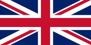
<span class="mw-page-title-main">United Kingdom</span> Country in Northwestern Europe

The United Kingdom of Great Britain and Northern Ireland, commonly known as the United Kingdom (UK) or Britain, is a country in Northwestern Europe, off the north-western coast of the continental mainland. It comprises England, Scotland, Wales, and Northern Ireland. It includes the island of Great Britain, the north-eastern part of the island of Ireland, and most of the smaller islands within the British Isles. Northern Ireland shares a land border with the Republic of Ireland; otherwise, the United Kingdom is surrounded by the Atlantic Ocean, the North Sea, the English Channel, the Celtic Sea, and the Irish Sea. The total area of the United Kingdom is 94,060 square miles (243,610 km2), with an estimated 2022 population of nearly 67 million people.

The Peerage of Ireland consists of those titles of nobility created by the English monarchs in their capacity as Lord or King of Ireland, or later by monarchs of the United Kingdom of Great Britain and Ireland. It is one of the five divisions of Peerages in the United Kingdom. The creation of such titles came to an end in the 19th century. The ranks of the Irish peerage are duke, marquess, earl, viscount and baron. As of 2016, there were 135 titles in the Peerage of Ireland extant: two dukedoms, ten marquessates, 43 earldoms, 28 viscountcies, and 52 baronies. However, these titles have no official recognition in the Republic of Ireland, with Article 40.2 of the Constitution of Ireland forbidding the state conferring titles of nobility and stating that an Irish citizen may not accept titles of nobility or honour except with the prior approval of the Irish government.

<span class="mw-page-title-main">Kingdom of England</span> State from the early tenth century to 1707

The Kingdom of England was a sovereign state on the island of Great Britain from the early tenth century, when it emerged from various Anglo-Saxon kingdoms, until May 1 1707, when it united with Scotland to form the Kingdom of Great Britain, which would later become the United Kingdom. The Kingdom of England was among the most powerful states in Europe during the medieval and early modern colonial periods.

<span class="mw-page-title-main">December 1910 United Kingdom general election</span>

The December 1910 United Kingdom general election was held from 3 to 19 December. It was the last general election to be held over several days and the last to be held before the First World War.

<span class="mw-page-title-main">Lists of places in Wales</span>

These are lists of places in Wales.

<span class="mw-page-title-main">Kingdom of Israel (united monarchy)</span> Israelite kingdom of Israel and Judah (c. 1047–930 BCE)

According to the Deuteronomistic history in the Hebrew Bible, a United Monarchy or United Kingdom of Israel existed under the reigns of Saul, David, and Solomon, encompassing the territories of both the later kingdoms of Judah and Israel.

<span class="mw-page-title-main">United Kingdom of Portugal, Brazil and the Algarves</span> Pluricontinental monarchy

The United Kingdom of Portugal, Brazil and the Algarves was a pluricontinental monarchy formed by the elevation of the Portuguese colony named State of Brazil to the status of a kingdom and by the simultaneous union of that Kingdom of Brazil with the Kingdom of Portugal and the Kingdom of the Algarves, constituting a single state consisting of three kingdoms.

<span class="mw-page-title-main">Unitary authorities of England</span> Local government in some parts of England

The unitary authorities of England are a type of local authority responsible for all local government services in an area. They combine the functions of a non-metropolitan county council and a non-metropolitan district council, which elsewhere in England provide two tiers of local government.

<span class="mw-page-title-main">Kingdom of Portugal</span> Kingdom in Southwestern Europe (1139–1910)

The Kingdom of Portugal was a monarchy in the western Iberian Peninsula and the predecessor of the modern Portuguese Republic. Existing to various extents between 1139 and 1910, it was also known as the Kingdom of Portugal and the Algarves after 1415, and as the United Kingdom of Portugal, Brazil and the Algarves between 1815 and 1822. The name is also often applied to the Portuguese Empire, the realm's overseas colonies.

<span class="mw-page-title-main">United Kingdom in the Eurovision Song Contest</span>

The United Kingdom has participated in the Eurovision Song Contest 65 times. It first took part in the second contest in 1957 and has entered every year since 1959. Along with Sweden and the Netherlands, the UK is one of only three countries with Eurovision victories in four different decades. It is one of the "Big Five" countries, along with France, Germany, Italy and Spain, that are automatically prequalified for the final each year as they are the biggest financial contributors to the European Broadcasting Union (EBU). The British national broadcaster, the BBC, broadcasts the event and has, on multiple occasions, organised different national selection processes to choose the British entry. The United Kingdom has won the Eurovision Song Contest five times, and has finished as runner-up on a record sixteen occasions. The UK has hosted the contest a record nine times, four times in London and once each in Edinburgh (1972), Brighton (1974), Harrogate (1982), Birmingham (1998), and Liverpool (2023).

<span class="mw-page-title-main">Countries of the United Kingdom</span> Component parts of the UK since 1922

Since 1922, the United Kingdom has been made up of four countries: England, Scotland, Wales and Northern Ireland. The UK Prime Minister's website has used the phrase "countries within a country" to describe the United Kingdom. Some statistical summaries, such as those for the twelve NUTS 1 regions of the UK, refer to Northern Ireland, Scotland, and Wales as "regions". With regard to Northern Ireland, Scotland and Wales particularly, the descriptive name one uses "can be controversial, with the choice often revealing one's political preferences".