Emmbrook is a suburb of the town of Wokingham in the county of Berkshire, England.
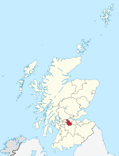
Birkenshaw is a village in North Lanarkshire, Scotland, to the east of Glasgow, and in proximity to Uddingston, Tannochside and Viewpark. Historically part of Lanarkshire Birkenshaw is largely a housing estate, but is more widely known for the Birkenshaw trading estate, popular with couples on weekends for its range of DIY, electrical and furniture stores. Birkenshaw is considered as part of Uddingston and is contained within the Greater Glasgow conurbation.

Ingrow is a suburb of Keighley, West Yorkshire, England that lies on the River Worth. The name Ingrow comes from Old Scandinavian which means 'corner of land in the meadow.' The suburb is located on the A629 road and is 0.93 miles (1.5 km) south west of Keighley town centre.

The A105 road is an A road in London, England. It runs from Canonbury, in between Highbury and Dalston, to Enfield Town. The road is 8 miles (13 km) long. Part of the road forms Green Lanes, one of the longest streets in London, while the A105 also serves as the primary access route to the Shopping City shopping centre.
The South Calder Water,known locally as "The Cawder", is a river in Scotland. It runs west from the high plateau between Shotts and Fauldhouse to the River Clyde.
Dallam is a suburb of Warrington, England. It was historically in Lancashire but is now in Cheshire. It is home to a Royal Mail rail terminus on the main West Coast Main Line railway, opposite a large Eddie Stobart distribution centre. Most housing is former council housing. It is situated at the terminus of the Warrington Borough Transport number 16 and 16A bus routes.

The A1068 is a road in northern England that runs from Seaton Burn in North Tyneside to Alnwick in Northumberland. The section between Ellington and Alnmouth is signposted as part of the Northumberland Coastal Route.
Gosford and Water Eaton is a civil parish in the Cherwell district of the county of Oxfordshire, England. It is north of the city of Oxford and is crossed nearby by two major roads for, or by-passing, the city. The parish contains the village of Gosford and the hamlet of Water Eaton and as at the 2011 census had 1373 people resident across its 8.75km².
Maybush is a district in the city of Southampton, England. Located in the western side of the city, Maybush is probably most famous as the former location of the Ordnance Survey head office.

Woosehill is a suburb of Wokingham in the English county of Berkshire.
Winchbottom is a hamlet in the parish of Little Marlow, in Buckinghamshire, England.
Wotton is a suburb of Gloucester, England. It is situated close to the city centre, the Royal Hospital, the city's railway station and to London Road.

Coltness High School is a secondary school located in Coltness, the largest suburb of Wishaw, North Lanarkshire, Scotland. The school opened in 1966, and as of May 2015 had a roll of 780 pupils. The school serves the catchment area of Coltness and Cambusnethan, as well as settlements outside of Wishaw such as Cleland.
Hylton Castle is a suburb of Sunderland, Tyne and Wear, England. It is named after the nearby Hylton Castle.

Milecastle 15 (Whitchester) was a milecastle of the Roman Hadrian's Wall. Its remains exist as a bold platform with robbed walls located on the southern side of the B6318 Military Road approximately 3 kilometres (1.9 mi) west of its crossing of the A69 road. It has not been excavated.
Dimsdale is a residential area of Wishaw, North Lanarkshire. It is located next to fellow Wishaw suburbs Greenhead and Waterloo.
Milecastle 28 (Walwick) was a milecastle of the Roman Hadrian's Wall in England. No remains are currently visible. Its location is immediately to the south of the B6318 Military Road in Walwick.

Forgewood is a suburb in the north-west of the town of Motherwell, North Lanarkshire, Scotland. It consists mainly of housing and low-rise flats, with the majority of them now 'modernised'. Some of the older-looking flats have since been demolished. Even though Forgewood is a small residential area of Motherwell, it does contain various local services, such as a pharmacy, a post-office and a convenience store. To the south-east of Forgewood, is the secondary school Braidhurst High School, that serves the area. Braidhurst has a school roll of around 600 pupils. Comedian Tam Cowan is a notable former pupil.
Stand is a hamlet in North Lanarkshire, Scotland situated on the A73 near Airdrie. Its Ordnance Survey grid reference is NS7668.

The River Kensey is a river in east Cornwall, England, UK which is a tributary of the River Tamar.