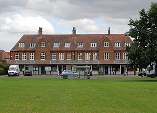
New Earswick is a model village and civil parish in the unitary authority of City of York in North Yorkshire, England, near the River Foss, north of York and south of Haxby. According to the 2001 census the parish had a population of 2,812, reducing to 2,737 at the 2011 Census.

Sherburn in Elmet is a town and civil parish in the district and county of North Yorkshire, England. It is to the west of Selby and south of Tadcaster.

Thornton Watlass is a small village and civil parish in North Yorkshire, England. It is located north of Masham and south of Bedale on the eastern slopes of the Ure Valley at the entrance to Wensleydale and the Yorkshire Dales National Park. It is 11 miles (18 km) north of Ripon, 4 miles (6.4 km) from the A1(M) motorway, 11 miles (18 km) from the main railway line at Northallerton and 18 miles (29 km) from Teesside Airport. Its population was 180 in 2000, 190 in 2005, 224 in 2011 and 240 in 2016.

Thorngumbald is a village and civil parish in the East Riding of Yorkshire, England, in an area known as Holderness, 8 miles (13 km) east of Hull on the A1033. The civil parish is formed by the village and the hamlets of Camerton and Ryehill. At the 2011 census, it had a population of 3,392, an increase on the 2001 UK census figure of 3,106.

Garton on the Wolds is a village and a civil parish on the Yorkshire Wolds in the East Riding of Yorkshire, England. It is situated approximately 3 miles (5 km) north-west of Driffield town centre and lies on the A166 road.

Welburn is a village and civil parish in North Yorkshire, England, on the north bank of the River Derwent. It lies on the edge of the Howardian Hills, near to the stately home Castle Howard. It is about 14 miles from York and 5 miles south-west of Malton/Norton. It is a popular area for walkers and bird-watchers. The parish's population was estimated at 523 people in 2013. This figure includes the developments at Crambeck, Holmes Crescent and Chestnut Avenue that are some distance outside the heart of the village.

Ampleforth is a village and civil parish in North Yorkshire, England, 20 miles (32 km) north of York. The village is situated on the edge of the North York Moors National Park. The parish has a population of 883 according to the 2001 census, increasing to 1,345 at the 2011 Census, and includes Ampleforth College. The name Ampleforth means "the ford where the sorrel grows".

Birstwith is a village and civil parish in Nidderdale in North Yorkshire, England. It is situated on the River Nidd. According to the 2001 census, the parish had a population of 756 and increased to 868 based on the 2011 Census.

Stockton-on-the-Forest is a village and civil parish in the unitary authority of the City of York in North Yorkshire, England.

Gate Helmsley is a village and civil parish in North Yorkshire, England, about seven miles east of York. The village lies on the border with the East Riding of Yorkshire.

Holtby is a small village and civil parish in the unitary authority of the City of York in North Yorkshire, England. The population at the 2011 Census was 166. It lies close to the A166 about 5 miles (8 km) east of York.

Fangfoss is a village and civil parish in the East Riding of Yorkshire, England. It is situated approximately 11 miles (18 km) to the east of the city of York and 3.5 miles (6 km) north-west of the town of Pocklington. The parish includes Bolton. The civil parish is called "Fangfoss" and its parish council is called "Fangfoss with Bolton Parish Council" after Bolton parish was abolished on 1 April 1935 and merged with Fangfoss. The parish covers an area of 900.98 hectares. In 2011 it had a population of 581, a decrease on the 2001 UK census figure of 602.

Hudswell is a village and civil parish on the border of the Yorkshire Dales, in North Yorkshire, England. The population at the ONS Census 2011 was 353.

Yapham is a village and civil parish in the East Riding of Yorkshire, Northern England. It is situated about 2 miles (3.2 km) north-east of Pocklington. The parish includes the hamlet of Meltonby and is approximately 1,830 acres (740 ha).
Nether Silton is a village and civil parish in the Hambleton District of North Yorkshire, England. It lies 6 miles (9.7 km) east of Northallerton, on the border of the North York Moors national park. During 1870–72 Nether Silton was described as, "a chapelry in Leake parish, N. R. Yorkshire; 6½ miles E of Northallerton r. station. Post town, Thirsk. Real property, £1,702. Pop. 178. Houses, 45." by John Marius Wilson, Imperial Gazetteer of England and Wales.

Goldsborough is a village and civil parish in North Yorkshire, England. It is situated near the River Nidd and one mile (1.6 km) east of Knaresborough. Goldsborough is recognised by the well-known stately home Goldsborough Hall and its other features including: Goldsborough Primary School, the Bay Horse Inn and the Goldsborough Cricket Grounds.

North Cave is a village and civil parish in the East Riding of Yorkshire, England. It is situated 15 miles (24 km) to the west of Hull city centre on the B1230 road. South Cave is approximately 2 miles (3 km) to the south-east.

Ruswarp is a village in the civil parish of Whitby, in North Yorkshire, England. It is around 1.8 miles (2.9 km) from Whitby, at the junction of the B1410 and B1416 roads, on the River Esk and the Esk Valley Line, with trains stopping at Ruswarp railway station. Originally it was called Risewarp meaning 'silted land overgrown with brushwood'.

Church Fenton is a village and civil parish in the North Yorkshire district of North Yorkshire, England. It is about 16 miles (26 km) east of Leeds, about 6 miles (10 km) south-east from Tadcaster and 3 miles (5 km) north from Sherburn in Elmet. Neighbouring villages include Barkston Ash, Cawood and Ulleskelf. The former RAF Church Fenton is located immediately north-east, which is now known as Leeds East Airport.
Brockfield Hall is a country house in Warthill, east of York in North Yorkshire, England.


