List of United Kingdom locations: Ka-Key

Last updated

The United Kingdom Uk-map.svg
The United Kingdom

This is part of the list of United Kingdom locations: a gazetteer of place names in the United Kingdom showing each place's locality and geographical coordinates.

Contents

Ka

LocationLocality Coordinates
(links to map & photo sources)
OS grid
reference
Kaber Cumbria 54°29′N2°19′W / 54.49°N 02.32°W / 54.49; -02.32 NY7911
Kaimend South Lanarkshire 55°41′N3°36′W / 55.68°N 03.60°W / 55.68; -03.60 NS9945
Kaimes City of Edinburgh 55°54′N3°11′W / 55.90°N 03.18°W / 55.90; -03.18 NT2668
Kaimhill Aberdeenshire 57°07′N2°08′W / 57.11°N 02.13°W / 57.11; -02.13 NJ9203
Kaimrig End Scottish Borders 55°39′N3°26′W / 55.65°N 03.44°W / 55.65; -03.44 NT0941
Kalnakill Highland 57°31′N5°51′W / 57.51°N 05.85°W / 57.51; -05.85 NG6954
Kames East Ayrshire 55°31′N4°04′W / 55.51°N 04.07°W / 55.51; -04.07 NS6926
Kames Argyll and Bute 55°53′N5°14′W / 55.88°N 05.24°W / 55.88; -05.24 NR9771
Kates Hill Dudley 52°30′N2°04′W / 52.50°N 02.07°W / 52.50; -02.07 SO9590

Ke

Kea-Kem

LocationLocality Coordinates
(links to map & photo sources)
OS grid
reference
Kea Cornwall 50°14′N5°05′W / 50.23°N 05.08°W / 50.23; -05.08 SW8042
Keadby North Lincolnshire 53°35′N0°44′W / 53.58°N 00.74°W / 53.58; -00.74 SE8311
Kealasay Western Isles 58°16′N6°52′W / 58.27°N 06.87°W / 58.27; -06.87 NB145418
Keal Cotes Lincolnshire 53°07′N0°02′E / 53.12°N 00.03°E / 53.12; 00.03 TF3661
Keallasay Beg Western Isles 57°37′N7°10′W / 57.62°N 07.16°W / 57.62; -07.16 NF917710
Keallasay More Western Isles 57°38′N7°10′W / 57.63°N 07.17°W / 57.63; -07.17 NF910719
Kearby Town End North Yorkshire 53°55′N1°29′W / 53.91°N 01.48°W / 53.91; -01.48 SE3447
Kearsney Kent 51°08′N1°15′E / 51.14°N 01.25°E / 51.14; 01.25 TR2843
Kearsley Bolton 53°32′N2°22′W / 53.54°N 02.37°W / 53.54; -02.37 SD7505
Kearstay Western Isles 58°02′N7°08′W / 58.03°N 07.14°W / 58.03; -07.14 NA963171
Kearstwick Cumbria 54°12′N2°37′W / 54.20°N 02.61°W / 54.20; -02.61 SD6079
Kearton North Yorkshire 54°23′N2°01′W / 54.38°N 02.01°W / 54.38; -02.01 SD9999
Keasden North Yorkshire 54°05′N2°25′W / 54.08°N 02.42°W / 54.08; -02.42 SD7266
Keava Western Isles 58°13′N6°46′W / 58.21°N 06.77°W / 58.21; -06.77 NB197350
Kebock Head Western Isles 58°02′N6°22′W / 58.03°N 06.37°W / 58.03; -06.37 NB420134
Kebroyd Calderdale 53°41′N1°56′W / 53.68°N 01.94°W / 53.68; -01.94 SE0421
Keckwick Cheshire 53°20′N2°38′W / 53.34°N 02.64°W / 53.34; -02.64 SJ5783
Keddington Lincolnshire 53°22′N0°01′E / 53.37°N 00.01°E / 53.37; 00.01 TF3488
Keddington Corner Lincolnshire 53°23′N0°01′E / 53.38°N 00.02°E / 53.38; 00.02 TF3589
Kedington Suffolk 52°05′N0°29′E / 52.08°N 00.48°E / 52.08; 00.48 TL7046
Kedleston Derbyshire 52°58′N1°33′W / 52.96°N 01.55°W / 52.96; -01.55 SK3041
Kedlock Fife 56°21′N3°00′W / 56.35°N 03.00°W / 56.35; -03.00 NO3819
Kedlock Feus Fife 56°21′N3°01′W / 56.35°N 03.02°W / 56.35; -03.02 NO3719
Kedslie Scottish Borders 55°39′N2°43′W / 55.65°N 02.71°W / 55.65; -02.71 NT5540
Keekle Cumbria 54°31′N3°32′W / 54.52°N 03.54°W / 54.52; -03.54 NY0016
Keelars Tye Essex 51°52′N0°58′E / 51.86°N 00.97°E / 51.86; 00.97 TM0523
Keelby Lincolnshire 53°34′N0°14′W / 53.57°N 00.24°W / 53.57; -00.24 TA1610
Keele Staffordshire 53°00′N2°17′W / 53.00°N 02.29°W / 53.00; -02.29 SJ8045
Keeley Green Bedfordshire 52°06′N0°32′W / 52.10°N 00.54°W / 52.10; -00.54 TL0046
Keelham Bradford 53°47′N1°53′W / 53.78°N 01.89°W / 53.78; -01.89 SE0732
Keenley Northumberland 54°53′N2°19′W / 54.89°N 02.32°W / 54.89; -02.32 NY7956
Keenthorne Somerset 51°08′N3°08′W / 51.14°N 03.13°W / 51.14; -03.13 ST2139
Keeres Green Essex 51°48′N0°18′E / 51.80°N 00.30°E / 51.80; 00.30 TL5914
Keeston (Keyston) Pembrokeshire 51°50′N5°02′W / 51.83°N 05.04°W / 51.83; -05.04 SM9019
Keevil Wiltshire 51°19′N2°07′W / 51.32°N 02.11°W / 51.32; -02.11 ST9258
Kegworth Leicestershire 52°49′N1°17′W / 52.82°N 01.28°W / 52.82; -01.28 SK4826
Kehelland Cornwall 50°13′N5°20′W / 50.22°N 05.33°W / 50.22; -05.33 SW6241
Keig Aberdeenshire 57°16′N2°38′W / 57.26°N 02.64°W / 57.26; -02.64 NJ6119
Keighley Bradford 53°52′N1°55′W / 53.86°N 01.91°W / 53.86; -01.91 SE0641
Keilarsbrae Clackmannan 56°07′N3°47′W / 56.11°N 03.78°W / 56.11; -03.78 NS8993
Keilhill Aberdeenshire 57°37′N2°29′W / 57.62°N 02.48°W / 57.62; -02.48 NJ7159
Keillbeg Argyll and Bute 55°57′N5°42′W / 55.95°N 05.70°W / 55.95; -05.70 NR6980
Keillmore Argyll and Bute 55°57′N5°43′W / 55.95°N 05.71°W / 55.95; -05.71 NR6880
Keils Argyll and Bute 55°50′N5°58′W / 55.84°N 05.96°W / 55.84; -05.96 NR5268
Keinton Mandeville Somerset 51°04′N2°39′W / 51.06°N 02.65°W / 51.06; -02.65 ST5430
Keiravagh Islands Western Isles 57°25′N7°12′W / 57.41°N 07.20°W / 57.41; -07.20 NF877474
Keir Mill Dumfries and Galloway 55°13′N3°48′W / 55.21°N 03.80°W / 55.21; -03.80 NX8593
Keisby Lincolnshire 52°50′N0°28′W / 52.84°N 00.47°W / 52.84; -00.47 TF0328
Keiss Highland 58°32′N3°08′W / 58.53°N 03.13°W / 58.53; -03.13 ND3461
Keistle Highland 57°28′N6°17′W / 57.47°N 06.28°W / 57.47; -06.28 NG4351
Keith Moray 57°32′N2°58′W / 57.53°N 02.97°W / 57.53; -02.97 NJ4250
Keith Inch Aberdeenshire 57°29′N1°47′W / 57.49°N 01.78°W / 57.49; -01.78 NK1345
Kelbrook Lancashire 53°53′N2°09′W / 53.89°N 02.15°W / 53.89; -02.15 SD9044
Kelby Lincolnshire 52°57′N0°31′W / 52.95°N 00.51°W / 52.95; -00.51 TF0041
Kelcliffe Leeds 53°52′N1°43′W / 53.87°N 01.72°W / 53.87; -01.72 SE1842
Keld Cumbria 54°31′N2°41′W / 54.51°N 02.69°W / 54.51; -02.69 NY5514
Keld North Yorkshire 54°24′N2°10′W / 54.40°N 02.17°W / 54.40; -02.17 NY8901
Keldholme North Yorkshire 54°16′N0°55′W / 54.26°N 00.92°W / 54.26; -00.92 SE7086
Keld Houses North Yorkshire 54°04′N1°50′W / 54.06°N 01.84°W / 54.06; -01.84 SE1063
Kelfield North Yorkshire 53°50′N1°06′W / 53.83°N 01.10°W / 53.83; -01.10 SE5938
Kelfield Lincolnshire 53°29′N0°46′W / 53.49°N 00.76°W / 53.49; -00.76 SE8201
Kelham Nottinghamshire 53°05′N0°51′W / 53.08°N 00.85°W / 53.08; -00.85 SK7755
Kelhurn Argyll and Bute 55°57′N4°40′W / 55.95°N 04.67°W / 55.95; -04.67 NS3377
Kella Isle of Man 54°19′N4°28′W / 54.32°N 04.47°W / 54.32; -04.47 SC3995
Kellacott Devon 50°40′N4°16′W / 50.66°N 04.26°W / 50.66; -04.26 SX4088
Kellamergh Lancashire 53°45′N2°55′W / 53.75°N 02.91°W / 53.75; -02.91 SD4029
Kellas Moray 57°34′N3°23′W / 57.56°N 03.38°W / 57.56; -03.38 NJ1754
Kellas Angus 56°30′N2°53′W / 56.50°N 02.89°W / 56.50; -02.89 NO4535
Kellaton Devon 50°14′N3°41′W / 50.23°N 03.68°W / 50.23; -03.68 SX8039
Kellaways Wiltshire 51°28′N2°04′W / 51.47°N 02.07°W / 51.47; -02.07 ST9575
Kelleth Cumbria 54°26′N2°31′W / 54.43°N 02.52°W / 54.43; -02.52 NY6605
Kelleythorpe East Riding of Yorkshire 53°59′N0°28′W / 53.99°N 00.46°W / 53.99; -00.46 TA0156
Kelling Norfolk 52°56′N1°06′E / 52.93°N 01.10°E / 52.93; 01.10 TG0942
Kellingley North Yorkshire 53°43′N1°13′W / 53.71°N 01.21°W / 53.71; -01.21 SE5224
Kellington North Yorkshire 53°42′N1°10′W / 53.70°N 01.16°W / 53.70; -01.16 SE5524
Kellister Shetland Islands 60°41′N1°01′W / 60.69°N 01.01°W / 60.69; -01.01 HP5402
Kelloe Durham 54°43′N1°28′W / 54.71°N 01.47°W / 54.71; -01.47 NZ3436
Kelloholm Dumfries and Galloway 55°22′N3°59′W / 55.37°N 03.99°W / 55.37; -03.99 NS7411
Kells Cumbria 54°31′N3°36′W / 54.52°N 03.60°W / 54.52; -03.60 NX9616
Kelly Devon 50°36′N4°16′W / 50.60°N 04.27°W / 50.60; -04.27 SX3981
Kelly Cornwall 50°31′N4°48′W / 50.52°N 04.80°W / 50.52; -04.80 SX0173
Kelly Bray Cornwall 50°31′N4°19′W / 50.51°N 04.32°W / 50.51; -04.32 SX3571
Kelmarsh Northamptonshire 52°24′N0°55′W / 52.40°N 00.92°W / 52.40; -00.92 SP7379
Kelmscot Oxfordshire 51°41′N1°38′W / 51.68°N 01.63°W / 51.68; -01.63 SU2599
Kelsale Suffolk 52°14′N1°29′E / 52.23°N 01.48°E / 52.23; 01.48 TM3865
Kelsall Cheshire 53°12′N2°43′W / 53.20°N 02.72°W / 53.20; -02.72 SJ5268
Kelsey Head Cornwall 50°24′N5°08′W / 50.40°N 05.14°W / 50.40; -05.14 SW767604
Kelshall Hertfordshire 52°00′N0°04′W / 52.00°N 00.07°W / 52.00; -00.07 TL3236
Kelsick Cumbria 54°50′N3°16′W / 54.83°N 03.26°W / 54.83; -03.26 NY1950
Kelso Scottish Borders 55°35′N2°26′W / 55.59°N 02.44°W / 55.59; -02.44 NT7234
Kelstedge Derbyshire 53°10′N1°30′W / 53.16°N 01.50°W / 53.16; -01.50 SK3363
Kelstern Lincolnshire 53°23′N0°07′W / 53.39°N 00.12°W / 53.39; -00.12 TF2590
Kelsterton Flintshire 53°13′N3°05′W / 53.22°N 03.09°W / 53.22; -03.09 SJ2770
Kelston Bath and North East Somerset 51°24′N2°26′W / 51.40°N 02.43°W / 51.40; -02.43 ST7067
Keltneyburn Perth and Kinross 56°37′N4°00′W / 56.61°N 04.00°W / 56.61; -04.00 NN7749
Kelton Dumfries and Galloway 55°01′N3°35′W / 55.01°N 03.59°W / 55.01; -03.59 NX9870
Kelton Durham 54°34′N2°07′W / 54.57°N 02.12°W / 54.57; -02.12 NY9220
Kelton Hill Dumfries and Galloway 54°55′N3°58′W / 54.91°N 03.96°W / 54.91; -03.96 NX7459
Kelty Fife 56°08′N3°23′W / 56.13°N 03.38°W / 56.13; -03.38 NT1494
Keltybridge Fife 56°08′N3°23′W / 56.14°N 03.38°W / 56.14; -03.38 NT1495
Kelvedon Essex 51°49′N0°41′E / 51.82°N 00.69°E / 51.82; 00.69 TL8618
Kelvedon Hatch Essex 51°39′N0°15′E / 51.65°N 00.25°E / 51.65; 00.25 TQ5698
Kelvin South Lanarkshire 55°44′N4°11′W / 55.74°N 04.18°W / 55.74; -04.18 NS6352
Kelvindale City of Glasgow 55°53′N4°19′W / 55.88°N 04.31°W / 55.88; -04.31 NS5568
Kelvinside City of Glasgow 55°52′N4°18′W / 55.87°N 04.30°W / 55.87; -04.30 NS5667
Kelynack Cornwall 50°06′N5°40′W / 50.10°N 05.67°W / 50.10; -05.67 SW3729
Kemacott Devon 51°12′N3°55′W / 51.20°N 03.91°W / 51.20; -03.91 SS6647
Kemback Fife 56°19′N2°57′W / 56.32°N 02.95°W / 56.32; -02.95 NO4115
Kemberton Shropshire 52°38′N2°24′W / 52.63°N 02.40°W / 52.63; -02.40 SJ7304
Kemble Gloucestershire 51°40′N2°02′W / 51.67°N 02.03°W / 51.67; -02.03 ST9897
Kemble Wick Gloucestershire 51°39′N2°02′W / 51.65°N 02.03°W / 51.65; -02.03 ST9895
Kemerton Worcestershire 52°02′N2°05′W / 52.03°N 02.08°W / 52.03; -02.08 SO9437
Kemincham Cheshire 53°12′N2°18′W / 53.20°N 02.30°W / 53.20; -02.30 SJ8068
Kemnal Bromley 51°25′26″N0°04′48″E / 51.424°N 00.080°E / 51.424; 00.080 TQ447715
Kemnay Aberdeenshire 57°14′N2°26′W / 57.23°N 02.44°W / 57.23; -02.44 NJ7316
Kempe's Corner Kent 51°10′N0°54′E / 51.17°N 00.90°E / 51.17; 00.90 TR0346
Kempley Gloucestershire 51°57′N2°29′W / 51.95°N 02.48°W / 51.95; -02.48 SO6729
Kempley Green Gloucestershire 51°57′N2°29′W / 51.95°N 02.48°W / 51.95; -02.48 SO6729
Kempsey Worcestershire 52°08′N2°13′W / 52.13°N 02.22°W / 52.13; -02.22 SO8549
Kempsford Gloucestershire 51°40′N1°46′W / 51.66°N 01.77°W / 51.66; -01.77 SU1696
Kemps Green Warwickshire 52°19′N1°47′W / 52.32°N 01.79°W / 52.32; -01.79 SP1470
Kempshott Hampshire 51°14′N1°08′W / 51.24°N 01.14°W / 51.24; -01.14 SU6050
Kempston Bedfordshire 52°07′N0°29′W / 52.12°N 00.49°W / 52.12; -00.49 TL0348
Kempston Church End Bedfordshire 52°07′N0°31′W / 52.11°N 00.52°W / 52.11; -00.52 TL0147
Kempston Hardwick Bedfordshire 52°05′N0°29′W / 52.08°N 00.49°W / 52.08; -00.49 TL0344
Kempston West End Bedfordshire 52°07′N0°33′W / 52.11°N 00.55°W / 52.11; -00.55 SP9947
Kempton Shropshire 52°26′N2°57′W / 52.43°N 02.95°W / 52.43; -02.95 SO3582
Kemp Town Brighton and Hove 50°49′N0°07′W / 50.81°N 00.12°W / 50.81; -00.12 TQ3203
Kemsing Kent 51°18′N0°13′E / 51.30°N 00.22°E / 51.30; 00.22 TQ5558
Kemsley Kent 51°22′N0°43′E / 51.36°N 00.72°E / 51.36; 00.72 TQ9066
Kemsley Street Kent 51°19′N0°35′E / 51.32°N 00.58°E / 51.32; 00.58 TQ8062

Ken-Key

LocationLocality Coordinates
(links to map & photo sources)
OS grid
reference
Kenardington Kent 51°03′N0°48′E / 51.05°N 00.80°E / 51.05; 00.80 TQ9732
Kenchester Herefordshire 52°05′N2°50′W / 52.08°N 02.83°W / 52.08; -02.83 SO4343
Kencot Oxfordshire 51°44′N1°38′W / 51.73°N 01.63°W / 51.73; -01.63 SP2504
Kendal Cumbria 54°19′N2°45′W / 54.32°N 02.75°W / 54.32; -02.75 SD5192
Kendal End Worcestershire 52°22′N2°00′W / 52.36°N 02.00°W / 52.36; -02.00 SP0074
Kendleshire South Gloucestershire 51°30′N2°29′W / 51.50°N 02.49°W / 51.50; -02.49 ST6679
Kendon Caerphilly 51°40′N3°10′W / 51.67°N 03.17°W / 51.67; -03.17 ST1998
Kendoon Dumfries and Galloway 55°09′N4°11′W / 55.15°N 04.19°W / 55.15; -04.19 NX6087
Kendram Highland 57°41′N6°19′W / 57.68°N 06.31°W / 57.68; -06.31 NG4374
Kendray Barnsley 53°32′N1°27′W / 53.54°N 01.45°W / 53.54; -01.45 SE3605
Kenfig Bridgend 51°31′N3°44′W / 51.51°N 03.73°W / 51.51; -03.73 SS8081
Kenfig Hill Bridgend 51°32′N3°41′W / 51.53°N 03.68°W / 51.53; -03.68 SS8383
Kenilworth Warwickshire 52°20′N1°34′W / 52.33°N 01.57°W / 52.33; -01.57 SP2971
Kenley Croydon 51°19′N0°06′W / 51.31°N 00.10°W / 51.31; -00.10 TQ3259
Kenley Shropshire 52°35′N2°39′W / 52.59°N 02.65°W / 52.59; -02.65 SJ5600
Kenmore Highland 57°32′N5°46′W / 57.54°N 05.76°W / 57.54; -05.76 NG7557
Kenmore Perth and Kinross 56°35′N4°00′W / 56.58°N 04.00°W / 56.58; -04.00 NN7745
Kenn Devon 50°39′N3°31′W / 50.65°N 03.52°W / 50.65; -03.52 SX9285
Kenn North Somerset 51°25′N2°50′W / 51.41°N 02.84°W / 51.41; -02.84 ST4169
Kennards House Cornwall 50°37′N4°26′W / 50.62°N 04.43°W / 50.62; -04.43 SX2883
Kenneggy Cornwall 50°06′N5°25′W / 50.10°N 05.41°W / 50.10; -05.41 SW5628
Kenneggy Downs Cornwall 50°07′N5°25′W / 50.11°N 05.41°W / 50.11; -05.41 SW5629
Kennerleigh Devon 50°51′N3°41′W / 50.85°N 03.69°W / 50.85; -03.69 SS8107
Kennet Clackmannan 56°06′N3°44′W / 56.10°N 03.73°W / 56.10; -03.73 NS9291
Kennet End Suffolk 52°16′N0°29′E / 52.26°N 00.49°E / 52.26; 00.49 TL7066
Kennethmont Aberdeenshire 57°20′N2°47′W / 57.34°N 02.78°W / 57.34; -02.78 NJ5328
Kennett Cambridgeshire 52°17′N0°28′E / 52.28°N 00.47°E / 52.28; 00.47 TL6968
Kennford Devon 50°40′N3°32′W / 50.66°N 03.54°W / 50.66; -03.54 SX9186
Kenninghall Norfolk 52°26′N0°59′E / 52.43°N 00.98°E / 52.43; 00.98 TM0386
Kennington Kent 51°10′N0°52′E / 51.16°N 00.87°E / 51.16; 00.87 TR0144
Kennington Oxfordshire 51°43′N1°14′W / 51.71°N 01.24°W / 51.71; -01.24 SP5202
Kennington Lambeth 51°28′N0°07′W / 51.47°N 00.12°W / 51.47; -00.12 TQ3077
Kennishead City of Glasgow 55°49′N4°20′W / 55.81°N 04.33°W / 55.81; -04.33 NS5460
Kenn Moor Gate North Somerset 51°23′N2°48′W / 51.39°N 02.80°W / 51.39; -02.80 ST4467
Kennoway Fife 56°12′N3°02′W / 56.20°N 03.04°W / 56.20; -03.04 NO3502
Kenny Somerset 50°56′N2°59′W / 50.94°N 02.98°W / 50.94; -02.98 ST3117
Kenny Hill Suffolk 52°23′N0°26′E / 52.38°N 00.43°E / 52.38; 00.43 TL6679
Kennythorpe North Yorkshire 54°04′N0°48′W / 54.07°N 00.80°W / 54.07; -00.80 SE7865
Kenovay Argyll and Bute 56°31′N6°53′W / 56.51°N 06.89°W / 56.51; -06.89 NL9946
Kensaleyre Highland 57°28′N6°18′W / 57.47°N 06.30°W / 57.47; -06.30 NG4251
Kensal Green Hammersmith and Fulham 51°31′N0°13′W / 51.52°N 00.22°W / 51.52; -00.22 TQ2382
Kensal Rise Brent 51°32′N0°13′W / 51.53°N 00.21°W / 51.53; -00.21 TQ2483
Kensal Town Royal Borough of Kensington and Chelsea 51°31′N0°13′W / 51.52°N 00.21°W / 51.52; -00.21 TQ2482
Kensington Royal Borough of Kensington and Chelsea 51°29′N0°12′W / 51.49°N 00.20°W / 51.49; -00.20 TQ2579
Kensington Liverpool 53°25′N2°58′W / 53.41°N 02.96°W / 53.41; -02.96 SJ3691
Kensworth Bedfordshire 51°51′N0°31′W / 51.85°N 00.52°W / 51.85; -00.52 TL0218
Kentallen Highland 56°40′N5°16′W / 56.66°N 05.26°W / 56.66; -05.26 NN0057
Kentangaval Western Isles 56°57′N7°31′W / 56.95°N 07.51°W / 56.95; -07.51 NL6598
Kentchurch Monmouthshire 51°55′N2°51′W / 51.92°N 02.85°W / 51.92; -02.85 SO4125
Kentford Suffolk 52°16′N0°29′E / 52.26°N 00.49°E / 52.26; 00.49 TL7066
Kent Gate Bromley 51°21′50″N0°01′08″W / 51.364°N 00.019°W / 51.364; -00.019 TQ380646
Kent House Bromley 51°24′43″N0°02′38″W / 51.412°N 00.044°W / 51.412; -00.044 TQ361699
Kentisbeare Devon 50°52′N3°20′W / 50.86°N 03.33°W / 50.86; -03.33 ST0608
Kentisbury Devon 51°10′N3°58′W / 51.16°N 03.97°W / 51.16; -03.97 SS6243
Kentisbury Ford Devon 51°10′N3°59′W / 51.16°N 03.98°W / 51.16; -03.98 SS6142
Kentish Town Camden 51°32′N0°09′W / 51.54°N 00.15°W / 51.54; -00.15 TQ2884
Kentmere Cumbria 54°25′N2°50′W / 54.42°N 02.84°W / 54.42; -02.84 NY4504
Kenton Devon 50°38′N3°29′W / 50.63°N 03.48°W / 50.63; -03.48 SX9583
Kenton Suffolk 52°14′N1°12′E / 52.23°N 01.20°E / 52.23; 01.20 TM1965
Kenton Brent 51°34′N0°19′W / 51.57°N 00.31°W / 51.57; -00.31 TQ1788
Kenton Newcastle upon Tyne 54°59′N1°39′W / 54.99°N 01.65°W / 54.99; -01.65 NZ2267
Kenton Bankfoot Newcastle upon Tyne 55°00′N1°41′W / 55.00°N 01.68°W / 55.00; -01.68 NZ2068
Kenton Bar Newcastle upon Tyne 54°59′N1°40′W / 54.99°N 01.67°W / 54.99; -01.67 NZ2167
Kenton Corner Suffolk 52°14′N1°13′E / 52.23°N 01.22°E / 52.23; 01.22 TM2065
Kenton Green Gloucestershire 51°49′N2°20′W / 51.82°N 02.33°W / 51.82; -02.33 SO7714
Kentra Highland 56°45′N5°50′W / 56.75°N 05.84°W / 56.75; -05.84 NM6569
Kentrigg Cumbria 54°20′N2°45′W / 54.33°N 02.75°W / 54.33; -02.75 SD5194
Kents Cornwall 50°43′N4°34′W / 50.72°N 04.56°W / 50.72; -04.56 SX1995
Kents Bank Cumbria 54°10′N2°56′W / 54.17°N 02.93°W / 54.17; -02.93 SD3976
Kent's Green Gloucestershire 51°54′N2°22′W / 51.90°N 02.37°W / 51.90; -02.37 SO7423
Kents Hill Milton Keynes 52°01′N0°42′W / 52.02°N 00.70°W / 52.02; -00.70 SP8937
Kents Oak Hampshire 51°01′N1°32′W / 51.01°N 01.54°W / 51.01; -01.54 SU3224
Kent Street West Sussex 50°58′N0°16′W / 50.97°N 00.26°W / 50.97; -00.26 TQ2221
Kent Street Kent 51°16′N0°22′E / 51.26°N 00.37°E / 51.26; 00.37 TQ6654
Kenwick Shropshire 52°52′N2°52′W / 52.86°N 02.86°W / 52.86; -02.86 SJ4230
Kenwick Park Shropshire 52°51′N2°52′W / 52.85°N 02.87°W / 52.85; -02.87 SJ4129
Kenwyn Cornwall 50°16′N5°04′W / 50.26°N 05.06°W / 50.26; -05.06 SW8245
Kenyon Cheshire 53°27′N2°34′W / 53.45°N 02.57°W / 53.45; -02.57 SJ6295
Kepdowrie Stirling 56°07′N4°20′W / 56.11°N 04.33°W / 56.11; -04.33 NS5594
Kepnal Wiltshire 51°20′N1°45′W / 51.33°N 01.75°W / 51.33; -01.75 SU1760
Kepwick North Yorkshire 54°18′N1°17′W / 54.30°N 01.29°W / 54.30; -01.29 SE4690
Kerchesters Scottish Borders 55°36′N2°22′W / 55.60°N 02.36°W / 55.60; -02.36 NT7735
Kerdiston Norfolk 52°46′N1°05′E / 52.77°N 01.08°E / 52.77; 01.08 TG0824
Keresforth Hill Barnsley 53°32′N1°31′W / 53.54°N 01.51°W / 53.54; -01.51 SE3205
Keresley Coventry 52°27′N1°32′W / 52.45°N 01.54°W / 52.45; -01.54 SP3184
Keresley Newlands Coventry 52°27′N1°32′W / 52.45°N 01.53°W / 52.45; -01.53 SP3284
Kerfield Scottish Borders 55°38′N3°11′W / 55.64°N 03.19°W / 55.64; -03.19 NT2540
Keristal Isle of Man 54°07′N4°31′W / 54.12°N 04.52°W / 54.12; -04.52 SC3573
Kerley Downs Cornwall 50°15′N5°08′W / 50.25°N 05.14°W / 50.25; -05.14 SW7644
Kernborough Devon 50°15′N3°41′W / 50.25°N 03.69°W / 50.25; -03.69 SX7941
Kerne Bridge Herefordshire 51°51′N2°37′W / 51.85°N 02.61°W / 51.85; -02.61 SO5818
Kerrera Argyll and Bute 56°23′N5°33′W / 56.39°N 05.55°W / 56.39; -05.55 NM806283
Kerridge Cheshire 53°17′N2°06′W / 53.28°N 02.10°W / 53.28; -02.10 SJ9376
Kerridge-end Cheshire 53°16′N2°05′W / 53.27°N 02.09°W / 53.27; -02.09 SJ9475
Kerris Cornwall 50°05′N5°35′W / 50.08°N 05.58°W / 50.08; -05.58 SW4427
Kerroogarroo Isle of Man 54°20′N4°28′W / 54.34°N 04.47°W / 54.34; -04.47 SC3997
Kerrow Highland 57°20′N4°46′W / 57.33°N 04.77°W / 57.33; -04.77 NH3330
Kerry Powys 52°29′N3°16′W / 52.49°N 03.26°W / 52.49; -03.26 SO1489
Kerrycroy Argyll and Bute 55°48′N5°02′W / 55.80°N 05.03°W / 55.80; -05.03 NS1061
Kerry Hill Staffordshire 53°02′N2°07′W / 53.03°N 02.12°W / 53.03; -02.12 SJ9249
Kerry's Gate Herefordshire 51°59′N2°53′W / 51.99°N 02.88°W / 51.99; -02.88 SO3933
Kersal Salford 53°30′N2°17′W / 53.50°N 02.28°W / 53.50; -02.28 SD8101
Kersall Nottinghamshire 53°09′N0°56′W / 53.15°N 00.93°W / 53.15; -00.93 SK7162
Kersbrook Devon 50°38′N3°20′W / 50.63°N 03.33°W / 50.63; -03.33 SY0683
Kersbrook Cross Cornwall 50°33′N4°23′W / 50.55°N 04.38°W / 50.55; -04.38 SX3175
Kerscott Devon 51°02′N3°57′W / 51.04°N 03.95°W / 51.04; -03.95 SS6329
Kersey Suffolk 52°03′N0°55′E / 52.05°N 00.91°E / 52.05; 00.91 TM0044
Kersey Tye Suffolk 52°03′N0°53′E / 52.05°N 00.88°E / 52.05; 00.88 TL9843
Kersey Upland Suffolk 52°02′N0°54′E / 52.04°N 00.90°E / 52.04; 00.90 TL9942
Kershopefoot Cumbria 55°08′N2°50′W / 55.13°N 02.83°W / 55.13; -02.83 NY4782
Kersoe Worcestershire 52°02′N2°01′W / 52.04°N 02.01°W / 52.04; -02.01 SO9939
Kerswell Devon 50°50′N3°18′W / 50.84°N 03.30°W / 50.84; -03.30 ST0806
Kerswell Green Worcestershire 52°07′N2°12′W / 52.11°N 02.20°W / 52.11; -02.20 SO8646
Kerthen Wood Cornwall 50°08′N5°23′W / 50.14°N 05.38°W / 50.14; -05.38 SW5833
Kesgrave Suffolk 52°03′N1°13′E / 52.05°N 01.22°E / 52.05; 01.22 TM2145
Kessingland Suffolk 52°25′N1°42′E / 52.41°N 01.70°E / 52.41; 01.70 TM5286
Kessingland Beach Suffolk 52°24′N1°43′E / 52.40°N 01.71°E / 52.40; 01.71 TM5385
Kestle Cornwall 50°16′N4°49′W / 50.27°N 04.82°W / 50.27; -04.82 SW9945
Kestle Mill Cornwall 50°23′N5°01′W / 50.39°N 05.02°W / 50.39; -05.02 SW8559
Keston Bromley 51°21′N0°01′E / 51.35°N 00.02°E / 51.35; 00.02 TQ4164
Keston Mark Bromley 51°22′N0°02′E / 51.36°N 00.03°E / 51.36; 00.03 TQ4265
Keswick Cumbria 54°35′N3°08′W / 54.59°N 03.14°W / 54.59; -03.14 NY2623
Keswick (North Norfolk)Norfolk 52°50′N1°29′E / 52.84°N 01.48°E / 52.84; 01.48 TG3533
Keswick (South Norfolk)Norfolk 52°35′N1°14′E / 52.58°N 01.24°E / 52.58; 01.24 TG2004
Kete Pembrokeshire 51°41′N5°11′W / 51.69°N 05.18°W / 51.69; -05.18 SM8004
Ketford Gloucestershire 51°58′N2°24′W / 51.96°N 02.40°W / 51.96; -02.40 SO7230
Ketley Shropshire 52°41′N2°29′W / 52.68°N 02.48°W / 52.68; -02.48 SJ6710
Ketley Bank Shropshire 52°41′N2°28′W / 52.68°N 02.46°W / 52.68; -02.46 SJ6910
Ketsby Lincolnshire 53°16′N0°02′E / 53.26°N 00.03°E / 53.26; 00.03 TF3676
Kettering Northamptonshire 52°23′N0°43′W / 52.39°N 00.72°W / 52.39; -00.72 SP8778
Ketteringham Norfolk 52°34′N1°11′E / 52.57°N 01.18°E / 52.57; 01.18 TG1602
Kettins Perth and Kinross 56°31′N3°15′W / 56.52°N 03.25°W / 56.52; -03.25 NO2338
Kettlebaston Suffolk 52°07′N0°52′E / 52.11°N 00.86°E / 52.11; 00.86 TL9650
Kettlebridge Fife 56°15′N3°08′W / 56.25°N 03.13°W / 56.25; -03.13 NO3007
Kettlebrook Staffordshire 52°37′N1°41′W / 52.62°N 01.69°W / 52.62; -01.69 SK2103
Kettleburgh Suffolk 52°11′N1°18′E / 52.19°N 01.30°E / 52.19; 01.30 TM2660
Kettle Corner Kent 51°15′N0°28′E / 51.25°N 00.46°E / 51.25; 00.46 TQ7253
Kettle Green Hertfordshire 51°50′N0°02′E / 51.84°N 00.04°E / 51.84; 00.04 TL4118
Kettlehill Fife 56°15′N3°05′W / 56.25°N 03.09°W / 56.25; -03.09 NO3207
Kettleholm Dumfries and Galloway 55°04′N3°20′W / 55.07°N 03.34°W / 55.07; -03.34 NY1476
Kettleshulme Cheshire 53°18′N2°02′W / 53.30°N 02.03°W / 53.30; -02.03 SJ9879
Kettlesing North Yorkshire 54°00′N1°40′W / 54.00°N 01.66°W / 54.00; -01.66 SE2256
Kettlesing Bottom North Yorkshire 54°00′N1°40′W / 54.00°N 01.66°W / 54.00; -01.66 SE2257
Kettlester Shetland Islands 60°29′N1°04′W / 60.49°N 01.07°W / 60.49; -01.07 HU5179
Kettlestone Norfolk 52°50′N0°54′E / 52.84°N 00.90°E / 52.84; 00.90 TF9631
Kettlethorpe Lincolnshire 53°16′N0°44′W / 53.26°N 00.74°W / 53.26; -00.74 SK8475
Kettlethorpe Wakefield 53°38′N1°31′W / 53.64°N 01.51°W / 53.64; -01.51 SE3216
Kettletoft Orkney Islands 59°13′N2°37′W / 59.22°N 02.61°W / 59.22; -02.61 HY6538
Kettlewell North Yorkshire 54°08′N2°02′W / 54.14°N 02.04°W / 54.14; -02.04 SD9772
Ketton Rutland 52°37′N0°34′W / 52.62°N 00.56°W / 52.62; -00.56 SK9704
Kevington Bromley 51°22′01″N0°02′17″E / 51.367°N 00.038°E / 51.367; 00.038 TQ420651
Kevingtown Bromley 51°23′13″N0°07′52″E / 51.387°N 00.131°E / 51.387; 00.131 TQ484675 T
Kew Richmond Upon Thames 51°28′N0°17′W / 51.47°N 00.28°W / 51.47; -00.28 TQ1977
Keward Somerset 51°11′N2°39′W / 51.19°N 02.65°W / 51.19; -02.65 ST5444
Kewstoke North Somerset 51°22′N2°58′W / 51.36°N 02.96°W / 51.36; -02.96 ST3363
Kexbrough Barnsley 53°34′N1°32′W / 53.57°N 01.54°W / 53.57; -01.54 SE3009
Kexby York 53°57′N0°56′W / 53.95°N 00.93°W / 53.95; -00.93 SE7051
Kexby Lincolnshire 53°21′N0°41′W / 53.35°N 00.69°W / 53.35; -00.69 SK8785
Keybridge Cornwall 50°31′N4°43′W / 50.52°N 04.71°W / 50.52; -04.71 SX0873
Keycol Kent 51°20′N0°41′E / 51.34°N 00.68°E / 51.34; 00.68 TQ8764
Keyford Somerset 51°13′N2°20′W / 51.22°N 02.33°W / 51.22; -02.33 ST7747
Key Green North Yorkshire 54°25′N0°46′W / 54.42°N 00.76°W / 54.42; -00.76 NZ8004
Key Green Cheshire 53°10′N2°10′W / 53.16°N 02.16°W / 53.16; -02.16 SJ8963
Keyham Leicestershire 52°38′N1°01′W / 52.64°N 01.01°W / 52.64; -01.01 SK6706
Keyhaven Hampshire 50°43′N1°34′W / 50.71°N 01.57°W / 50.71; -01.57 SZ3091
Keyhead Aberdeenshire 57°35′N1°53′W / 57.58°N 01.88°W / 57.58; -01.88 NK0755
Keyingham East Riding of Yorkshire 53°42′N0°07′W / 53.70°N 00.12°W / 53.70; -00.12 TA2425
Keymer West Sussex 50°55′N0°08′W / 50.91°N 00.13°W / 50.91; -00.13 TQ3115
Keynsham Bath and North East Somerset 51°25′N2°30′W / 51.41°N 02.50°W / 51.41; -02.50 ST6568
Keysers Estate Hertfordshire 51°44′N0°01′W / 51.73°N 00.01°W / 51.73; -00.01 TL3706
Key's Green Kent 51°07′N0°21′E / 51.12°N 00.35°E / 51.12; 00.35 TQ6539
Keysoe Bedfordshire 52°14′N0°26′W / 52.24°N 00.43°W / 52.24; -00.43 TL0762
Keysoe Row Bedfordshire 52°14′N0°25′W / 52.23°N 00.41°W / 52.23; -00.41 TL0861
Keyston Cambridgeshire 52°22′N0°28′W / 52.36°N 00.47°W / 52.36; -00.47 TL0475
Key Street Kent 51°20′N0°41′E / 51.34°N 00.69°E / 51.34; 00.69 TQ8864
Keyworth Nottinghamshire 52°52′N1°05′W / 52.86°N 01.09°W / 52.86; -01.09 SK6130

Related Research Articles

Britain most often refers to:

<span class="mw-page-title-main">Parliament of the United Kingdom</span> Legislative body in the United Kingdom

The Parliament of the United Kingdom is the supreme legislative body of the United Kingdom, and may also legislate for the Crown Dependencies and the British Overseas Territories. It meets at the Palace of Westminster, London. It possesses legislative supremacy and thereby ultimate power over all other political bodies in the UK and the overseas territories. Parliament is bicameral but has three parts, consisting of the sovereign (King-in-Parliament), the House of Lords, and the House of Commons. In theory, power is officially vested in the King-in-Parliament. However, the Crown normally acts on the advice of the prime minister, and the powers of the House of Lords are limited to only delaying legislation; thus power is de facto vested in the House of Commons.

June is the sixth month of the year in the Julian and Gregorian calendars and is the second of four months to have a length of 30 days, and the third of five months to have a length of less than 31 days. June contains the summer solstice in the Northern Hemisphere, the day with the most daylight hours, and the winter solstice in the Southern Hemisphere, the day with the fewest daylight hours. June in the Northern Hemisphere is the seasonal equivalent to December in the Southern Hemisphere and vice versa. In the Northern Hemisphere, the beginning of the traditional astronomical summer is 21 June. In the Southern Hemisphere, meteorological winter begins on 1 June.

<span class="mw-page-title-main">Prime Minister of the United Kingdom</span> Head of government in the United Kingdom

The prime minister of the United Kingdom is the head of government of the United Kingdom. The prime minister advises the sovereign on the exercise of much of the royal prerogative, chairs the Cabinet and selects its ministers. As modern prime ministers hold office by virtue of their ability to command the confidence of the House of Commons, they sit as members of Parliament.

<span class="mw-page-title-main">Primary school</span> School for children

A primary school, elementary school or grade school is a school for primary education of children who are four to eleven years of age. Primary schooling follows pre-school and precedes secondary schooling.
<span class="mw-page-title-main">United Kingdom</span> Country in north-west Europe

The United Kingdom of Great Britain and Northern Ireland, commonly known as the United Kingdom (UK) or Britain, is a country in Europe, off the north-western coast of the continental mainland. It comprises England, Scotland, Wales and Northern Ireland. The United Kingdom includes the island of Great Britain, the north-eastern part of the island of Ireland, and many smaller islands within the British Isles. Northern Ireland shares a land border with the Republic of Ireland; otherwise, the United Kingdom is surrounded by the Atlantic Ocean, the North Sea, the English Channel, the Celtic Sea and the Irish Sea. The total area of the United Kingdom is 242,495 square kilometres (93,628 sq mi), with an estimated 2023 population of over 68 million people.

The Peerage of Ireland consists of those titles of nobility created by the English monarchs in their capacity as Lord or King of Ireland, or later by monarchs of the United Kingdom of Great Britain and Ireland. It is one of the five divisions of Peerages in the United Kingdom. The creation of such titles came to an end in the 19th century. The ranks of the Irish peerage are duke, marquess, earl, viscount and baron. As of 2016, there were 135 titles in the Peerage of Ireland extant: two dukedoms, ten marquessates, 43 earldoms, 28 viscountcies, and 52 baronies. The Crown of the United Kingdom of Great Britain and Northern Ireland continues to exercise jurisdiction over the Peerage of Ireland, including those peers whose titles derive from places located in what is now the Republic of Ireland. Article 40.2 of the Constitution of Ireland forbids the state conferring titles of nobility and an Irish citizen may not accept titles of nobility or honour except with the prior approval of the Irish government. This issue has not arisen in respect of the Peerage of Ireland because no creation of titles in it has been made since the constitution came into force.

<span class="mw-page-title-main">Kingdom of England</span> Kingdom on the British Isles from 927 to 1707

The Kingdom of England existed on the island of Great Britain from 12 July 927, when it unified from various Anglo-Saxon kingdoms, until 1 May 1707, when it united with Scotland to form the Kingdom of Great Britain.
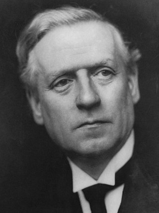
<span class="mw-page-title-main">December 1910 United Kingdom general election</span>

The December 1910 United Kingdom general election was held from 3 to 19 December. It was the last general election to be held over several days and the last to be held before the First World War.

<span class="mw-page-title-main">EFL League Two</span> Fourth tier of English league football

The English Football League Two, simply known as League Two in England and for sponsorship purposes as Sky Bet League Two, is the 3rd and lowest division of the English Football League (EFL) and fourth-highest division overall in the English football league system.

<span class="mw-page-title-main">Lists of places in Wales</span>

This is a list of lists of places in Wales.

<span class="mw-page-title-main">Unitary authorities of England</span> Local government in some parts of England

The unitary authorities of England are those local authorities which are responsible for the provision of all local government services within a district. They are constituted under the Local Government Act 1992, which amended the Local Government Act 1972 to allow the existence of counties that do not have multiple districts. They typically allow large towns to have separate local authorities from the less urbanised parts of their counties and originally provided a single authority for small counties where division into districts would be impractical. However, the UK government has more recently created much larger unitary authority areas, including a single authority for North Yorkshire, the largest non-metropolitan county in England, previously divided into seven districts.

<span class="mw-page-title-main">Kingdom of Portugal</span> Kingdom in Southwestern Europe (1139–1910)

The Kingdom of Portugal was a monarchy in the western Iberian Peninsula and the predecessor of the modern Portuguese Republic. Existing to various extents between 1139 and 1910, it was also known as the Kingdom of Portugal and the Algarves after 1415, and as the United Kingdom of Portugal, Brazil and the Algarves between 1815 and 1822. The name is also often applied to the Portuguese Empire, the realm's overseas colonies.

The World Figure Skating Championships is an annual figure skating competition sanctioned by the International Skating Union in which figure skaters compete for the title of World Champion.

<span class="mw-page-title-main">United Kingdom in the Eurovision Song Contest</span>

The United Kingdom has participated in the Eurovision Song Contest 64 times. It first took part in the second contest in 1957 and has entered every year since 1959. Along with Sweden and the Netherlands, the UK is one of only three countries with Eurovision victories in four different decades. It is one of the "Big Five" countries, along with France, Germany, Italy and Spain, that are automatically prequalified for the final each year as they are the biggest financial contributors to the European Broadcasting Union (EBU). The British national broadcaster, the BBC, broadcasts the event and has, on multiple occasions, organised different national selection processes to choose the British entry. The United Kingdom has won the Eurovision Song Contest five times, and has finished as runner-up on a record sixteen occasions. The UK has hosted the contest a record eight times, four times in London and once each in Edinburgh (1972), Brighton (1974), Harrogate (1982) and Birmingham (1998), and will host the contest for a ninth time in 2023 in Liverpool.

<span class="mw-page-title-main">Countries of the United Kingdom</span> Component parts of the UK since 1922

Since 1922, the United Kingdom comprises four constituent countries: England, Scotland, and Wales, as well as Northern Ireland. The UK Prime Minister's website has used the phrase "countries within a country" to describe the United Kingdom. Some statistical summaries, such as those for the twelve NUTS 1 regions of the UK, refer to Northern Ireland, Scotland, and Wales as "regions". With regard to Northern Ireland, Scotland and Wales particularly, the descriptive name one uses "can be controversial, with the choice often revealing one's political preferences".

The World Figure Skating Championships is an annual figure skating competition sanctioned by the International Skating Union in which figure skaters compete for the title of World Champion.