The Royal Albert Bridge is a railway bridge which spans the River Tamar in England between Plymouth, Devon and Saltash, Cornwall. Its unique design consists of two 455-foot (138.7 m) lenticular iron trusses 100 feet (30.5 m) above the water, with conventional plate-girder approach spans. This gives it a total length of 2,187.5 feet (666.8 m). It carries the Cornish Main Line railway in and out of Cornwall. It is adjacent to the Tamar Bridge which opened in 1962 to carry the A38 road.

The River Rivelin is a river in Sheffield, South Yorkshire, England.

Malin Bridge is a suburb of the city of Sheffield, England. It is located at grid reference SK325893 and stands 2½ miles north-west of the city centre where the rivers Loxley and Rivelin meet. Malin Bridge is only a small district centred on the road bridge over the River Loxley which carries the B6076 road to Stannington ; it is surrounded by the suburbs of Hillsborough, Wisewood, Walkley and Stannington.
Ponsworthy is a hamlet on the eastern side of Dartmoor, Devon, England. It lies in the steep valley of the West Webburn River about 3.5 km (2.2 mi) southwest of the village of Widecombe-in-the-Moor.

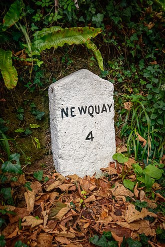
The Camel Trail is a permissive cycleway in Cornwall, England, United Kingdom, that provides a recreational route for walkers, runners, cyclists and horse riders. The trail is flat ; running from Padstow to Wenford Bridge via Wadebridge and Bodmin, it is 17.3 miles (27.8 km) long and used by an estimated 400,000 users each year generating an income of approximately £3 million a year.
St Columb Canal sometimes referred to as Edyvean's Canal, was an abortive canal scheme in Cornwall, England, designed for the carriage of sea sand for use as manure. It was authorised in 1773, and part of it may have been briefly used around 1780.

A tide mill is a water mill driven by tidal rise and fall. A dam with a sluice is created across a suitable tidal inlet, or a section of river estuary is made into a reservoir. As the tide comes in, it enters the mill pond through a one-way gate, and this gate closes automatically when the tide begins to fall. When the tide is low enough, the stored water can be released to turn a water wheel.

The Old Hay Brook is a small river in Sheffield, South Yorkshire, England. It is formed from the Redcar Brook, Blacka Dike and another stream, which rise on moors to the south of Sheffield, and is joined by Needham's Dyke near Totley Grange. At Totley Rise it joins Totley Brook, to become the River Sheaf. Water from the river was used to power mills processing lead, corn and paper from at least the 17th century, which were later used for grinding scythes as the Sheffield metal industry expanded. All the mills were defunct by 1900, although some remnants including weirs and dams are still visible.

Perranarworthal is a civil parish and village in Cornwall, England, United Kingdom. The village is about four miles (6.5 km) northwest of Falmouth and five miles (8 km) southwest of Truro. Perranarworthal parish is bordered on the north by Kea parish, on the east by Restronguet Creek and Mylor parish, on the south by St Gluvias and Stithians parishes and on the west by Gwennap parish. The parish population at the 2011 census was 1,496. The name derives from the Manor of Arworthal which has had a number of spellings in the past including Hareworthal (1187), Arwoethel and Arwythel. By the 18th-century two names appear on maps "Perran Arworthal" meaning St Piran's by the creek or estuary. William Penaluna described the settlement in 1838. Perranwell railway station is on the Maritime Line.
There are seventeen disused railway stations on the Cornish Main Line between Plymouth in Devon and Penzance in Cornwall, England. The remains of nine of these can be seen from passing trains. While a number of these were closed following the so-called "Beeching Axe" in the 1960s, many of them had been closed much earlier, the traffic for which they had been built failing to materialise.
There are eight disused railway stations between Wadebridge and Bodmin North on the former Bodmin and Wadebridge Railway in Cornwall, in the United Kingdom, with ten other closed sidings on the branches to Ruthern Bridge and Wenfordbridge. The section from Boscarne Junction to Bodmin General is currently part of the Bodmin and Wenford Steam Railway; the line from Wadebridge to Wenfordbridge is now part of the Camel Trail, and the line to Ruthern Bridge can be followed for much of its length as it runs parallel to a public road.

Tresillian is a small village in mid Cornwall, England, United Kingdom. It is three miles (5 km) east of Truro on the A390 road. Tresillian means "a place of eels" in the Cornish language, according to a 19th-century writer. However, modern toponymists agree that the name in fact translates as "farm/settlement of a man called Sulyen".

The River Stour has been used for centuries as a source of power. Many different processes were performed by the use of water power:- Corn milling, fulling, paper making and electricity generation. Many of the mills survive today as house conversions, with two of them still working commercially.

Edenbridge Mill is a Grade II listed house converted tower mill in Edenbridge, Kent, England. It is on the west side of Mill Hill, just north of the hospital.

The River Menalhyl is a river in Cornwall, England, that flows through the civil parishes of St Columb Major and Mawgan-in-Pydar. Its length is about 12 miles and it flows in a generally north-west direction. The name comes from the Cornish words melyn meaning mill and heyl meaning estuary - estuary mills. The name was recorded as Mellynheyl in the 19th century, but it had been known as Glyvion.

Slaughterbridge, Treague and Camelford Station are three adjoining settlements in north Cornwall, England. They straddle the boundary of Forrabury and Minster and Lanteglos by Camelford civil parishes just over a mile (2 km) north-west of the market town of Camelford

Little Matlock Rolling Mill also known as Low Matlock Rolling Mill is a Grade II* Listed building situated on the River Loxley in the village of Loxley on the outskirts of the City of Sheffield, South Yorkshire, England. The building continues to operate as a rolling mill, owned and operated by Pro-Roll Ltd, a specialist hand rolling company. A brick building extension was added to the original 1882 structure in 1939.

Tregidden is a hamlet south of Manaccan in Cornwall, England, United Kingdom. A little further south is Tregidden Farm. Tregidden is located in the parish of St Martin-in-Meneage and also partly in the parish of Manaccan.
Trequite is a hamlet in the parish of St Kew, Cornwall, England, United Kingdom. It is half a mile east of St Kew.
Eagley Mills is a complex of former cotton mills in Eagley, Bolton, England. The complex is adjacent to a model village originally built for the millworkers. The surviving mill buildings have since been converted to residential use.