Kemerton | |
---|---|
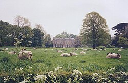
![]() Main street through the village of Kemerton | |
Location within Worcestershire | |
Population | 393 in 2001 |
OS grid reference | SO94613720 |
Civil parish |
|
District | |
Shire county | |
Region | |
Country | England |
Sovereign state | United Kingdom |
Post town | TEWKESBURY |
Postcode district | GL20 |
Dialling code | 01386 |
Police | West Mercia |
Fire | Hereford and Worcester |
Ambulance | West Midlands |
UK Parliament | |
Kemerton is a village and civil parish in Worcestershire in England. It lies at the extreme south of the county in the local government district of Wychavon. Until boundary changes in 1931, it formed part of neighbouring Gloucestershire, and it remains in the Diocese of Gloucester. The northern half of the parish lies within the Cotswolds Area of Outstanding Natural Beauty.
The parish is approximately 5.8 km (3.6 miles) long by 1.2 km (0.7 miles) wide, and encompasses approximately 6.738 square kilometres (1,665 acres). It descends from the summit of Bredon Hill in the north, (elevation 300 m / 981 ft) to the Carrant Brook in the south (elevation 20 m / 65 ft). The north and south parish boundaries are recorded in a Saxon charter of the 8th century. [1]
Notable historic features include Kemerton Camp, an Iron Age hill fort surmounting Bredon Hill, thought to have been vacated suddenly after a considerable battle. On the fort's south rampart is a two-storey stone tower known as Parsons Folly (or the Tower), built in the mid-18th century by John Parsons V, MP (1732–1805), the squire of Kemerton, who reputedly wished to raise the summit of Bredon Hill to 1000 ft (305 m). [2] Significant buildings include the Church of St Nicholas and Kemerton Court, both of which are listed Grade II*. [3]
The parish includes several important wildlife sites including the Kemerton Lake Nature Reserve and sections of the Bredon Hill Special Area of Conservation, which are managed by Kemerton Conservation Trust. Well known residents of Kemerton have included the anarchist publisher Charlotte Wilson and the bestselling author John Moore.
Tewkesbury is a market town and civil parish in Gloucestershire, England. It stands at the confluence of the River Severn and the River Avon, and also minor tributaries the Swilgate and Carrant Brook. It gives its name to the Borough of Tewkesbury, of which the town is the second largest settlement. It lies in the far north of the county, forming part of the border with Worcestershire.
Wychavon is a local government district in Worcestershire, England. Its council is based in the town of Pershore, and the other towns in the district are Droitwich Spa and Evesham. The district extends from the south-east corner of Worcestershire north and west. It borders all the other districts of Worcestershire, as well as the counties of Gloucestershire and Warwickshire.
Bredon is a village and civil parish in Wychavon district at the southern edge of Worcestershire in England. It lies on the banks of the River Avon on the lower slopes of Bredon Hill, at "the beginning of the Cotswolds". As "Brensham Village", it has been made famous by the writer John Moore, whose descriptions of village life between the wars are widely celebrated.
May Hill is a prominent English hill between Gloucester and Ross-on-Wye. Its summit, on the western edge of Gloucestershire and its northern slopes in Herefordshire, is distinguishable by a clump of trees on its summit, which forms an official Site of Special Scientific Interest. It is reached by three public footpaths, two as parts of the Gloucestershire Way and Wysis Way.
Bredon Hill is a hill in Worcestershire, England, south-west of Evesham in the Vale of Evesham. The summit of the hill is in the parish of Kemerton, and it extends over parts of eight other parishes. The hill is geologically part of the Cotswolds and lies within the Cotswolds Area of Outstanding Natural Beauty. However, it now stands isolated in the Vale of Evesham due to natural causes.
Broad Law is a hill in the Manor Hills range, part of the Southern Uplands of Scotland. The second highest point in the Southern Uplands and the highest point in the Scottish Borders, it has an elevation of 840 metres, a prominence of 653 metres and an isolation of 81 kilometres. It is only 3 m (10 ft) lower than its parent, Merrick. Like many of its neighbours it is smooth, rounded and grassy, although the surrounding glens have very steep sides — country somewhat akin to the Cheviots or the Howgill Fells. The hill is most easily climbed from the Megget Stane to the south, beginning at an elevation of 452 m (1,483 ft), but is also frequently climbed from the villages near its base, or as part of a long, 50 km (30 mi) trek across the local area between the towns of Peebles and Moffat. On the summit is the highest VOR beacon in the UK, and also a radio tower.
Ashton under Hill is a village and civil parish in the Wychavon district of Worcestershire in England. It is situated at the foot of Bredon Hill. According to the 2001 census the parish had a population of 743, about six miles south-west of Evesham. A five house hamlet named Paris is located above the village with panoramic views over the surrounding hills.
Wothorpe is a village and civil parish in the Peterborough unitary authority of Cambridgeshire, England. It is in the far north-west of the district, and to the south of Stamford. The parish borders Northamptonshire on its west.
Elmley Castle is a village and civil parish in Worcestershire, in England, United Kingdom. It is located on the north side of Bredon Hill 3 miles south east of Pershore in the local government district of Wychavon.
Stoke-sub-Hamdon, also known as Stoke under Ham, is a large village and civil parish in the South Somerset district of Somerset, England. It is situated 5 miles (8 km) west of Yeovil, with which it is linked by the A3088 road. The parish is located near the River Parrett, and includes the village of East Stoke.
Edworth is a hamlet and civil parish in the Central Bedfordshire district of the county of Bedfordshire, England about 12 miles (19 km) south-east of the county town of Bedford. It sits just off the Great North Road (A1) between Baldock and Biggleswade. There are fewer than one hundred inhabitants in the village. At the 2011 Census the village population was included in the civil parish of Dunton.
Overbury is a village and civil parish in Worcestershire, England, midway between Evesham and Tewkesbury south of Bredon Hill.
Kemerton Court is the principal manor house of the village of Kemerton, near Tewkesbury in Gloucestershire.
Grafton is a hamlet in Worcestershire, England, situated between the villages of Beckford and Ashton under Hill, south-east of Bredon Hill.
Great Comberton is a village in Worcestershire, England, United Kingdom.
Hinton on the Green is a village and civil parish in the Wychavon district of Worcestershire in England. It is situated at the foot of Bredon Hill, about two miles south of Evesham.
Upton Warren is a village and civil parish in the Wychavon district, in Worcestershire, England. The village is situated just off the A38 road between Bromsgrove and Droitwich Spa, and on the River Salwarpe. In the 2001 census, the parish, which also contains the small hamlet of Cooksey Green, had a population of 291.
Strensham is a village in the Wychavon district of Worcestershire. In the 2001 census, the civil parish of Strensham had a population of 314 across 127 households. Since 1991, the population has risen 28.7% from 244 residents.
Great Coxwell is a village and civil parish about 2 miles (3 km) southwest of Faringdon in the Vale of White Horse, England. It was in Berkshire until the 1974 boundary changes transferred it to Oxfordshire. The 2001 Census recorded the parish's population as 274.
Bredon's Norton or Norton-by-Bredon is a village and civil parish 11 miles (18 km) south east of Worcester, in the Wychavon district, in the county of Worcestershire, England. In 2011 the parish had a population of 247. The parish touches Eckington, Bredon, Strensham and Kemerton.
![]() | Wikimedia Commons has media related to Kemerton . |