Pirton, Worcestershire

Last updated

Pirton
Pirton - geograph.org.uk - 22099.jpg
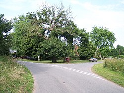
Village Green complete with oak tree.
Worcestershire UK location map.svg
Red pog.svg
Pirton
Location within Worcestershire
OS grid reference SO879474
District
Shire county
Region
Country England
Sovereign state United Kingdom
Post town WORCESTER
Postcode district WR8
Police West Mercia
Fire Hereford and Worcester
Ambulance West Midlands
List of places
UK
England
Worcestershire
52°07′29″N2°10′41″W / 52.12478°N 2.17816°W / 52.12478; -2.17816 Coordinates: 52°07′29″N2°10′41″W / 52.12478°N 2.17816°W / 52.12478; -2.17816

Pirton is a small village in the English county of Worcestershire. The village has been occupied since at least 1086, when Domesday listed the village of Peritone within the hundred of Pershore. [1]

Pirton has some uncommon features for a village. The most unusual is an 18th-century folly named Pirton Tower near a lake named Pirton Pool. It is one of the remaining artifices which the Earl of Coventry built to add artistic interest to views from the park at his distant estate, Croome Court. Pirton Tower and some of the other follies became purposed as local picnic houses. The follies were allowed to fall into disrepair.

Pirton has a Council-owned wood, beside Pirton Green.

Pirton Church has a storied history. It is about half a mile away from "main" Pirton. When the Black Death arrived in Pirton c. 1357, it was tremendously harmful for the villagers. There is a ditch which was a mass grave for those who died because of the illness. The surviving residents had to move to the countryside at the time of the black death. The current Pirton Church is about 500 years old and has been in continuous use. It still conducts services on Sundays or e.g.: Mass.

Pirton has a nearby level crossing which used to be called Pirton Sidings due to the sidings that used to be there. Pirton Level Crossing is a highly filmed location for Rail Enthusiasts.

Related Research Articles

Alveley Human settlement in England

Alveley is a village in the Severn Valley in southeast Shropshire, England, about 11 miles (18 km) south-southeast of Bridgnorth. It is in the civil parish of Alveley and Romsley. The 2011 Census recorded the parish population as 2,098. It is served by bus service 297 operated by Arriva Midlands. It is most famously known as being the hometown of Jack Jones, a local magician.

Abberley Human settlement in England

Abberley is a village and civil parish in north west Worcestershire, England.

Frankley

Frankley is a village and civil parish in Birmingham. The modern Frankley estate is part of the New Frankley civil parish in Birmingham, and has been part of the city since 1995. The parish has a population of 122.

Wadborough Human settlement in England

Wadborough is a small village 2 miles outside Pershore and 7 miles from Worcester. The village is in Worcestershire, England. The village is an old farming community, with its nearest church a mile away in Pirton.

Ufton Nervet Human settlement in England

Ufton Nervet is a village and civil parish in West Berkshire, England centred 6 miles (10 km) west southwest of the large town of Reading and 7 miles east of Thatcham. Ufton Nervet has an elected civil parish council.

Broadway, Worcestershire Human settlement in England

Broadway is a large village and civil parish within the Cotswolds, located in the county of Worcestershire, England. Its population was 2,540 in the 2011 census, a small increase on the 2,496 in the 2001 census. It is situated in the far southeast of Worcestershire and very close to the Gloucestershire border, midway between the towns of Evesham and Moreton-in-Marsh. It is sometimes referred to as the "Jewel of the Cotswolds".

Alvechurch Human settlement in England

Alvechurch is a large village and civil parish in the Bromsgrove district in northeast Worcestershire, England, in the valley of the River Arrow. The Lickey Hills Country Park is 2.5 miles to the northwest. It is 11 miles south of Birmingham, 5 mi (8 km) north of Redditch and 6 mi (10 km) east of Bromsgrove. At the 2001 Census, the population was 5,316.

Hixon, Staffordshire Human settlement in England

Hixon is a village and a civil parish in the English county of Staffordshire.
grid reference SK003259

Bredon Hill

Bredon Hill is a hill in Worcestershire, England, south-west of Evesham in the Vale of Evesham. The summit of the hill is in the parish of Kemerton, and it extends over parts of eight other parishes. The hill is geologically part of the Cotswolds and lies within the Cotswolds Area of Outstanding Natural Beauty. However, it now stands isolated in the Vale of Evesham due to natural causes.

Kempsey, Worcestershire Human settlement in England

Kempsey is a village and civil parish in the Malvern Hills District in the county of Worcestershire, England. It is bounded by the River Severn on the west, and the A38 main road runs through it and is about 3 miles south of Worcester. The village has a long history. Its name is derived from the Saxon "Kemys' Eye", or the island of Kemys. Kemys was a Saxon chief, whose island lay between marshes and the River Severn. One of the roads in Kempsey, Lyf's Lane, is named after another Saxon chief. The village was recorded in the 11th century Domesday Book as having a value of £7.

Pirton, Hertfordshire

Pirton is a large village and civil parish three miles north-west of Hitchin in Hertfordshire, England. The population of the civil parish as of the 2011 census is 1,274. The church, rebuilt in 1877, but with the remains of its 12th-century tower, is built within the bailey of a former castle, Toot Hill. Pirton Grange, which was remodelled in the 18th century, is in the north of the parish, and is a particularly interesting, moated Elizabethan house with a timber framed gatehouse. Hammonds Farm and Rectory Farm, with its tithe barn, are also Elizabethan.

Brantham Human settlement in England

Brantham is a village and civil parish in the Babergh district of Suffolk, England. It is located close to the River Stour and the border with Essex, around 2 miles (3 km) north of Manningtree, and around 9 miles (14 km) southwest of Ipswich.

Abbots Morton Human settlement in England

Abbots Morton is a village and civil parish in the English county of Worcestershire. It consists of approximately 70 dwellings and 250 people. It retains 4 mixed working farms within the village boundaries. The village was the country retreat for the Abbots of Evesham Abbey and the moat that surrounded their house is still visible. The village church is dedicated to St Peter and is over 1000 years old.

Birlingham Human settlement in England

Birlingham is a village and civil parish in the Wychavon district of Worcestershire. The village is south of Pershore, located in a bend of the River Avon.

Histon and Impington Human settlement in England

Histon and Impington are villages in the county of Cambridgeshire, England. They are situated just north of Cambridge with the main bulk of the settlements being separated from the city by the A14 road (England).

Hagley Large village in Worcestershire, England

Hagley is a large village and civil parish in Worcestershire, England. It is on the boundary of the West Midlands and Worcestershire counties between the Metropolitan Borough of Dudley and Kidderminster. In 2019 it had an estimated population of 7,162.

Sway, Hampshire Human settlement in England

Sway is a village and civil parish in Hampshire in the New Forest national park in England. The civil parish was formed in 1879, when lands were taken from the extensive parish of Boldre. The village has shops and pubs, and a railway station on the South West Main Line from Weymouth and Bournemouth to Southampton and London Waterloo. It is the site of Sway Tower, a 66-metre (217 ft) concrete folly built in the 19th century.

Croome Court

Croome Court is a mid-18th-century Neo-Palladian mansion surrounded by extensive landscaped parkland at Croome D'Abitot, near Upton-upon-Severn in south Worcestershire, England. The mansion and park were designed by Lancelot "Capability" Brown for the 6th Earl of Coventry, and they were Brown's first landscape design and first major architectural project. Some of the mansion's rooms were designed by Robert Adam. The Church of St Mary Magdalene that sits within the grounds of the park is owned and cared for by the Churches Conservation Trust.

Leziate Human settlement in England

Leziate is a village and civil parish in the English county of Norfolk. The village is 44 miles (71 km) west of Norwich, 5.7 miles (9.2 km) east of King's Lynn and 106 miles (171 km) north-north-east of London. The Village is located a small distance south of the B1145 a route which runs between King's Lynn and Mundesley. The nearest railway station is at King's Lynn for the Fen Line which runs between King's Lynn and Cambridge. The nearest airport is Norwich International Airport. The parish of Leziate in the 2001 census, has a population of 581, including Ashwicken and increasing to 592 at the 2011 census.

Little Berkhamsted Human settlement in England

Little Berkhamsted is a village and civil parish in Hertfordshire, England, five miles south-west of the town of Hertford.

References