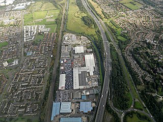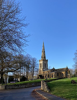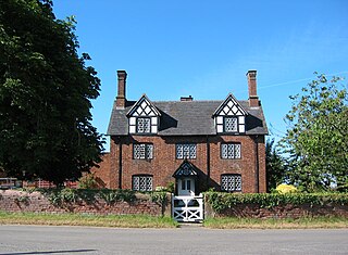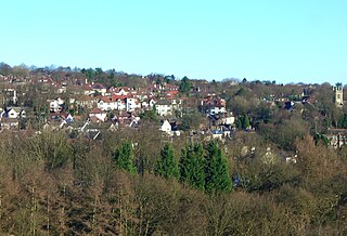
Orton is a suburb of the City of Peterborough, in Cambridgeshire, England, about 3 miles (4.8 km) south west of Peterborough city centre to the south of the River Nene. It is located on the route of the A1.

Featherstone is a town and civil parish in the City of Wakefield, West Yorkshire, England, two miles south-west of Pontefract. Historically part of the West Riding of Yorkshire, in 2011 it had a population of 15,244. Featherstone railway station is on the Pontefract Line.

Castle Bromwich is a large suburban village and civil parish in the Metropolitan Borough of Solihull in the West Midlands, England. It borders the rest of the borough to the south east, Sutton Coldfield to the east and north east, Shard End to the south west, Castle Vale, Erdington and Minworth to the north and Hodge Hill to the west.

Seacroft is an outer-city suburb/township consisting mainly of council estate housing covering an extensive area of east Leeds, West Yorkshire, England. It lies in the LS14 Leeds postcode area, around 4 miles (6.4 km) east of Leeds city centre.

Merrow is a suburb in the north-east of Guildford, in Surrey, England. It is 2 miles (3.2 km) from the town's centre, on the edge of the ridge of hills that forms the North Downs. Although now a relatively obscure suburb, the village can trace its origins back many hundreds of years. Merrow is separated from Burpham by the New Guildford Line, the second railway line between Guildford and London.

Lydiate is a village and civil parish in the Metropolitan Borough of Sefton on Merseyside, England but historically in Lancashire. It is located 1.5 miles (2 km) north of Maghull, with which it has a common history. At the 2001 Census the civil parish of Lydiate had a population of 6,672, reducing to 6,308 at the 2011 Census.

Headcorn is a village and civil parish in the borough of Maidstone in Kent, England. The parish is on the floodplain of the River Beult south east of Maidstone.

Meopham is a large linear village and civil parish in the Borough of Gravesham in north-west Kent, England, lying to the south of Gravesend. The parish covers 6.5 square miles (17 km2), and comprises two villages and two smaller settlements; it had a population of 6,795 at the 2021 census. Meopham village is sometimes described as the longest settlement in England although others such as Brinkworth which is one village make the same claim. Meopham is one of the longest linear settlements in Europe, being 7 miles (11 km) in length.

Netherton is an area of the Metropolitan Borough of Sefton, in Merseyside, England.

Kingsthorpe is a suburb and civil parish of Northampton, England. It is situated to the north of Northampton town centre and is served by the A508 and A5199 roads which join at Kingsthorpe's centre. The 2011 Census recorded the population of the district council ward as 4,477.

Walmley is a suburban village situated in the civil parish of Sutton Coldfield, West Midlands. It lies within the City of Birmingham on its northeastern outer fringe, where it forms part of the Sutton Walmley and Minworth electoral ward. It is in southern Sutton Coldfield, close to Minworth, Erdington, Wylde Green, Pype Hayes and south of Thimble End. It is approximately 7 miles (11.3 km) northeast of Birmingham City Centre. It is the main focus of the Sutton New Hall Birmingham City Council ward.

Cottingham is a large village and civil parish in the East Riding of Yorkshire, England. It lies 4 miles (6 km) north-west of the centre of Kingston upon Hull, and 6 miles (10 km) south-east of Beverley on the eastern edge of the Yorkshire Wolds. It has two main shopping streets, Hallgate and King Street, which cross each other near the Church of Saint Mary the Virgin, and a market square called Market Green. Cottingham had a population of 17,164 residents in 2011, making it larger by area and population than many towns. As a result, it is one of the villages claiming to be the largest village in England.

Eccleston is a village and civil parish of the Borough of Chorley in Lancashire, England. It is beside the River Yarrow, and was formerly an agricultural and later a weaving settlement.

Burland is a village and former civil parish, now in the parish of Burland and Acton, in the unitary authority area of Cheshire East and the ceremonial county of Cheshire, England, about 2+1⁄2 miles west of Nantwich. The civil parish also included the small settlements of Burland Lower Green, Burland Upper Green, Hollin Green and Stoneley Green, as well as parts of Gradeley Green and Swanley. The eastern part of the village of Ravensmoor also falls within the civil parish.

Smallthorne is an area in the city of Stoke-on-Trent in Staffordshire, England. It is in the north-east of the city, near Burslem. Smallthorne borders Bradeley and Chell in the north, Norton-in-the-Moors in the east, Sneyd Green in the south, and Burslem in the west.

Headley is a village and civil parish in the North Downs in Surrey, England. The nearest settlements are, to the west, Mickleham and Leatherhead; to the north, Ashtead and Langley Vale; to the east, Walton-on-the-Hill; and to the south, Box Hill. It is just outside the M25 motorway encircling London.

Faddiley is a small village and civil parish in the unitary authority of Cheshire East and the ceremonial county of Cheshire, England. The village is located 4 miles to the west of Nantwich. The parish also includes the small settlements of Larden Green and Woodhey or Woodhey Green, with a total population of just over 150, measured at 163 during the 2011 Census. Nearby villages include Brindley, Burland, Chorley, Haughton and Ravensmoor.

Lawshall is a village and civil parish in Suffolk, England. Located around a mile off the A134 between Bury St Edmunds and Sudbury, it is part of Babergh district. The parish has nine settlements comprising the three main settlements of The Street, Lambs Lane and Bury Road along with the six small hamlets of Audley End, Hanningfield Green, Harrow Green, Hart's Green, Hibb's Green and Lawshall Green.

Bury Road, Lawshall is a linear settlement in the civil parish of Lawshall in the Babergh district in the county of Suffolk, England. The northern part of the settlement is in the civil parish of Bradfield Combust with Stanningfield in West Suffolk. Bury Road is located between Hawstead and Lambs Lane / The Glebe and is two miles off the A134 between Bury St Edmunds and Sudbury.

Fulwood is a residential suburb and ward of the City of Sheffield in England, it lies 5.5 km west-southwest of the city centre. Formerly an ancient settlement and village on the Porter Brook, it became integrated into the city in the 1930s. It is bounded by the suburbs of Lodge Moor to the NW, Ranmoor to the east and Crosspool to the NE. The open countryside of the Peak District lies to the west and SW. The sub districts of Stumperlowe and Goole Green are part of the suburb. The population of the ward at the 2011 Census was 18,233. Fulwood is located in the Sheffield Hallam constituency which, as of the 2019 general election voted Labour.


