| Conderton | |
|---|---|
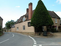 The Yew Tree Inn | |
 Conderton Location within Worcestershire | |
| Civil parish | |
| District | |
| Shire county | |
| Region | |
| Country | England |
| Sovereign state | United Kingdom |
| Post town | Tewkesbury |
| Postcode district | GL20 |
| Dialling code | 01386 |
| Police | West Mercia |
| Fire | Hereford and Worcester |
| Ambulance | West Midlands |
| UK Parliament | |
Conderton is a small hamlet in the Wychavon district of Worcestershire, England.