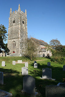
North Petherwin is a civil parish and village in east Cornwall, England, United Kingdom. The village is situated five miles (8 km) northwest of Launceston on a ridge above the River Ottery valley.

Ludgvan is a civil parish and village in Cornwall, England, UK, 2 1⁄2 miles (4.0 km) northeast of Penzance. Ludgvan village is split between Churchtown, on the hill, and Lower Quarter to the east, adjoining Crowlas. For the purposes of local government, Ludgvan elects a parish council every four years; the local authority is Cornwall Council.
Blisland is a village and civil parish in Cornwall, England, United Kingdom. It is approximately five miles northeast of Bodmin. According to the 2001 census, the parish had a population of 565. This had increased to 608 at the 2011 census.

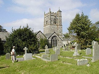
Lewannick is a civil parish and village in Cornwall, England, United Kingdom. The village is situated approximately five miles (8 km) southwest of Launceston. The civil parish had a population of 973 at the 2011 census.

Manaccan is a civil parish and village on the Lizard peninsula in south Cornwall, England, United Kingdom. The village is about five miles (8 km) south-southwest of Falmouth.

Perranzabuloe is a coastal civil parish and a hamlet in Cornwall, England, United Kingdom. Perranzabuloe parish is bordered to the west by the Atlantic coast and St Agnes parish, to the north by Cubert parish, to the east by St Newlyn East and St Allen parishes and to the south by Kenwyn parish. The hamlet is situated just over a mile (2 km) south of the principal settlement of the parish, Perranporth; the hamlet is also seven miles (11 km) south-southwest of Newquay. Other settlements in the parish include Perrancoombe, Goonhavern, Mount and Callestick. The parish population was 5,382 in the 2001 census, increasing to 5,486 at the 2011 census.

Helland is a civil parish and village in Cornwall, England, United Kingdom. It is situated 2 1⁄2 miles (4.0 km) north of Bodmin. The meaning of the name Helland is unclear: it is possible that the origin is in Cornish hen & lan. The original dedication of the church is unknown but St Helena is now recognised as the patron.

Lezant is a civil parish and village in east Cornwall, England, United Kingdom. Lezant village is about five miles south of Launceston. The population of the parish in the 2001 census was 751, increasing slightly to 765 in the 2011 census.
St Thomas the Apostle Rural, also known as St Thomas-by-Launceston is a civil parish in east Cornwall, England, United Kingdom. It is centred on the village of Tregadillett and is in the Registration District of Launceston.

St Dominic is a civil parish and village in Cornwall, England, United Kingdom. The village is situated 2 1⁄2 miles (4.0 km) east of Callington and five miles (8 km) north of Saltash.

Degibna is a hamlet in the parish of Helston, Cornwall, England, UK. It lies on the eastern bank of the largest natural freshwater lake in Cornwall, The Loe, and forms part of the Penrose Estate.

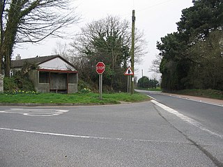
Gummow's Shop is a hamlet in the civil parish of St Newlyn East in mid Cornwall, England, UK. It is on the A3058 road southeast of Kestle Mill. Before 1938, there was a blacksmith in the building now known as "The Old Smithy". It is in the civil parish of Cubert

Halsetown is a village near St Ives, Cornwall, England.
Lockengate is a hamlet in Cornwall, England, UK. It is two miles south of Lanivet on the A391 road. It is in the civil parish of Luxulyan
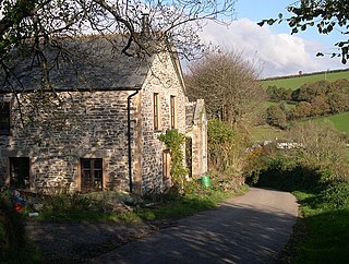
Lower Croan is a farmstead in Cornwall, England, UK. It is in the parish of Egloshayle and Croan house and Croanford are to the east. Croan House is a manor house of two storeys and seven bays which was built in the 1690s for a prosperous attorney.

Menherion is a farm in the parish of Stithians in Cornwall, England. Menherion is west of Stithians churchtown. Menherion is also the name of a hamlet in Cornwall.
Milcombe is a hamlet in the parish of Pelynt in Cornwall, England. Milcombe is in the valley of the West Looe River south of Sowden's Bridge and east of Muchlarnick.
Penpont is a hamlet in the parish of St Breward, in north Cornwall, England, UK, in the Camel Valley.

Tregidden is a hamlet south of Manaccan in Cornwall, England, United Kingdom. A little further south is Tregidden Farm. Tregidden is located in the parish of St Martin-in-Meneage and also partly in the parish of Manaccan.
Penpol Creek is a tidal creek which is a tributary of the River Fowey in Cornwall, England, UK. It lies between the parishes of St Veep and Lanteglos-by-Fowey. The tidal limit is at the bridge at lower Penpol.
