List of United Kingdom locations: Litn-Liz

Last updated

The United Kingdom Uk-map.svg
The United Kingdom

This is part of the list of United Kingdom locations: a gazetteer of place names in the United Kingdom showing each place's locality and geographical coordinates.

Contents

Lit (continued)

Little A

LocationLocality Coordinates
(links to map & photo sources)
OS grid
reference
Little Abington Cambridgeshire 52°07′N0°14′E / 52.11°N 00.23°E / 52.11; 00.23 TL5349
Little Addington Northamptonshire 52°20′N0°36′W / 52.34°N 00.60°W / 52.34; -00.60 SP9573
Little Airmyn North Yorkshire 53°43′N0°55′W / 53.71°N 00.91°W / 53.71; -00.91 SE7225
Little Almshoe Hertfordshire 51°55′N0°16′W / 51.91°N 00.27°W / 51.91; -00.27 TL1925
Little Alne Warwickshire 52°14′N1°49′W / 52.24°N 01.81°W / 52.24; -01.81 SP1361
Little Altcar Sefton 53°32′N3°03′W / 53.54°N 03.05°W / 53.54; -03.05 SD3006
Little Ann Hampshire 51°11′N1°31′W / 51.18°N 01.52°W / 51.18; -01.52 SU3343
Little Ansty (or Pleck)Dorset 50°50′N2°20′W / 50.83°N 02.34°W / 50.83; -02.34 ST7604
Little Arowry Wrexham 52°57′N2°49′W / 52.95°N 02.82°W / 52.95; -02.82 SJ4540
Little Asby Cumbria 54°28′N2°28′W / 54.47°N 02.47°W / 54.47; -02.47 NY6909
Little Ashley Wiltshire 51°21′N2°16′W / 51.35°N 02.27°W / 51.35; -02.27 ST8162
Little Aston Staffordshire 52°35′N1°52′W / 52.59°N 01.86°W / 52.59; -01.86 SK0900
Little Atherfield Isle of Wight 50°37′N1°21′W / 50.61°N 01.35°W / 50.61; -01.35 SZ4680
Little Ayton North Yorkshire 54°29′N1°07′W / 54.48°N 01.12°W / 54.48; -01.12 NZ5710

Little B

LocationLocality Coordinates
(links to map & photo sources)
OS grid
reference
Little Baddow Essex 51°44′N0°34′E / 51.73°N 00.56°E / 51.73; 00.56 TL7707
Little Badminton South Gloucestershire 51°33′N2°17′W / 51.55°N 02.28°W / 51.55; -02.28 ST8084
Little Ballinluig Perth and Kinross 56°38′N3°46′W / 56.64°N 03.77°W / 56.64; -03.77 NN9152
Little Bampton Cumbria 54°53′N3°09′W / 54.88°N 03.15°W / 54.88; -03.15 NY2655
Little Bardfield Essex 51°56′N0°23′E / 51.94°N 00.39°E / 51.94; 00.39 TL6530
Little Barford Bedfordshire 52°11′N0°16′W / 52.18°N 00.27°W / 52.18; -00.27 TL1856
Little Barningham Norfolk 52°51′N1°10′E / 52.85°N 01.16°E / 52.85; 01.16 TG1333
Little Barrington Gloucestershire 51°48′N1°43′W / 51.80°N 01.71°W / 51.80; -01.71 SP2012
Little Barrow Cheshire 53°13′N2°49′W / 53.22°N 02.81°W / 53.22; -02.81 SJ4670
Little Barugh North Yorkshire 54°12′N0°50′W / 54.20°N 00.83°W / 54.20; -00.83 SE7679
Little Bavington Northumberland 55°05′N2°02′W / 55.09°N 02.03°W / 55.09; -02.03 NY9878
Little Bayham East Sussex 51°06′N0°19′E / 51.10°N 00.32°E / 51.10; 00.32 TQ6336
Little Bealings Suffolk 52°04′N1°15′E / 52.07°N 01.25°E / 52.07; 01.25 TM2347
Little Beckford Worcestershire 52°00′N2°02′W / 52.00°N 02.04°W / 52.00; -02.04 SO9734
Little Bedwyn Wiltshire 51°23′N1°35′W / 51.38°N 01.58°W / 51.38; -01.58 SU2965
Little Bentley Essex 51°53′N1°04′E / 51.88°N 01.06°E / 51.88; 01.06 TM1125
Little Berkamstead Hertfordshire 51°45′N0°08′W / 51.75°N 00.13°W / 51.75; -00.13 TL2908
Little Bernera Western Isles 58°16′N6°52′W / 58.26°N 06.87°W / 58.26; -06.87 NB142409
Little Billing Northamptonshire 52°15′N0°49′W / 52.25°N 00.82°W / 52.25; -00.82 SP8062
Little Billington Bedfordshire 51°53′N0°38′W / 51.88°N 00.64°W / 51.88; -00.64 SP9322
Little Birch Herefordshire 51°58′N2°43′W / 51.97°N 02.71°W / 51.97; -02.71 SO5131
Little Bispham Lancashire 53°52′N3°03′W / 53.86°N 03.05°W / 53.86; -03.05 SD3141
Little Blakenham Suffolk 52°05′N1°04′E / 52.09°N 01.06°E / 52.09; 01.06 TM1048
Little Blencow Cumbria 54°41′N2°51′W / 54.68°N 02.85°W / 54.68; -02.85 NY4532
Little Bloxwich Walsall 52°37′N2°00′W / 52.62°N 02.00°W / 52.62; -02.00 SK0003
Little Bognor West Sussex 50°58′N0°34′W / 50.97°N 00.57°W / 50.97; -00.57 TQ0020
Little Bolehill Derbyshire 53°05′N1°34′W / 53.08°N 01.56°W / 53.08; -01.56 SK2954
Little Bollington Cheshire 53°22′N2°25′W / 53.37°N 02.42°W / 53.37; -02.42 SJ7286
Little Bolton Trafford 53°28′N2°20′W / 53.47°N 02.33°W / 53.47; -02.33 SJ7898
Little Bookham Surrey 51°16′N0°23′W / 51.27°N 00.39°W / 51.27; -00.39 TQ1254
Littleborough Devon 50°52′N3°40′W / 50.87°N 03.67°W / 50.87; -03.67 SS8210
Littleborough Nottinghamshire 53°19′N0°46′W / 53.32°N 00.77°W / 53.32; -00.77 SK8282
Littleborough Rochdale 53°38′N2°06′W / 53.64°N 02.10°W / 53.64; -02.10 SD9316
Little Bosullow Cornwall 50°08′N5°37′W / 50.14°N 05.62°W / 50.14; -05.62 SW4133
Littlebourne Kent 51°16′N1°09′E / 51.26°N 01.15°E / 51.26; 01.15 TR2057
Little Bourton Oxfordshire 52°05′N1°20′W / 52.09°N 01.34°W / 52.09; -01.34 SP4544
Little Bowden Leicestershire 52°28′N0°55′W / 52.47°N 00.91°W / 52.47; -00.91 SP7487
Little Boys Heath Buckinghamshire 51°40′N0°41′W / 51.67°N 00.69°W / 51.67; -00.69 SU9098
Little Bradley Suffolk 52°08′N0°27′E / 52.14°N 00.45°E / 52.14; 00.45 TL6852
Little Braithwaite Cumbria 54°35′N3°11′W / 54.59°N 03.19°W / 54.59; -03.19 NY2323
Little Brampton Shropshire 52°25′N2°56′W / 52.42°N 02.94°W / 52.42; -02.94 SO3681
Little Braxted Essex 51°47′N0°39′E / 51.79°N 00.65°E / 51.79; 00.65 TL8314
Little Bray Devon 51°05′N3°53′W / 51.09°N 03.88°W / 51.09; -03.88 SS6835
Little Brechin Angus 56°44′N2°41′W / 56.74°N 02.68°W / 56.74; -02.68 NO5862
Littlebredy Dorset 50°41′N2°35′W / 50.69°N 02.59°W / 50.69; -02.59 SY5889
Little Brickhill Buckinghamshire 51°58′N0°41′W / 51.97°N 00.69°W / 51.97; -00.69 SP9032
Little Bridgeford Staffordshire 52°50′N2°11′W / 52.84°N 02.19°W / 52.84; -02.19 SJ8727
Little Brington Northamptonshire 52°16′N1°02′W / 52.26°N 01.03°W / 52.26; -01.03 SP6663
Little Bristol South Gloucestershire 51°37′N2°24′W / 51.61°N 02.40°W / 51.61; -02.40 ST7291
Little Britain Warwickshire 52°11′N1°50′W / 52.18°N 01.84°W / 52.18; -01.84 SP1154
Little Bromley Essex 51°55′N1°02′E / 51.91°N 01.03°E / 51.91; 01.03 TM0928
Little Bromwich Birmingham 52°28′N1°51′W / 52.47°N 01.85°W / 52.47; -01.85 SP1086
Little Broughton Cumbria 54°40′N3°26′W / 54.66°N 03.44°W / 54.66; -03.44 NY0731
Little Budworth Cheshire 53°11′N2°37′W / 53.18°N 02.61°W / 53.18; -02.61 SJ5965
Little Burstead Essex 51°36′N0°23′E / 51.60°N 00.39°E / 51.60; 00.39 TQ6692
Littlebury Essex 52°01′N0°11′E / 52.02°N 00.19°E / 52.02; 00.19 TL5139
Littlebury Green Essex 52°01′N0°09′E / 52.02°N 00.15°E / 52.02; 00.15 TL4838
Little Bytham Lincolnshire 52°44′N0°30′W / 52.74°N 00.50°W / 52.74; -00.50 TF0117

Little C

LocationLocality Coordinates
(links to map & photo sources)
OS grid
reference
Little Cambridge Essex 51°55′N0°20′E / 51.91°N 00.33°E / 51.91; 00.33 TL6127
Little Canford Poole 50°47′N1°56′W / 50.79°N 01.94°W / 50.79; -01.94 SZ0499
Little Carleton Lancashire 53°50′N3°01′W / 53.83°N 03.01°W / 53.83; -03.01 SD3338
Little Carlton Lincolnshire 53°20′N0°05′E / 53.34°N 00.08°E / 53.34; 00.08 TF3985
Little Carlton Nottinghamshire 53°06′N0°51′W / 53.10°N 00.85°W / 53.10; -00.85 SK7757
Little Casterton Rutland 52°40′N0°30′W / 52.66°N 00.50°W / 52.66; -00.50 TF0109
Little Catwick East Riding of Yorkshire 53°53′N0°17′W / 53.88°N 00.29°W / 53.88; -00.29 TA1244
Little Catworth Cambridgeshire 52°20′N0°23′W / 52.33°N 00.38°W / 52.33; -00.38 TL1072
Little Cawthorpe Lincolnshire 53°19′N0°01′E / 53.32°N 00.02°E / 53.32; 00.02 TF3583
Little Chalfield Wiltshire 51°22′N2°13′W / 51.36°N 02.21°W / 51.36; -02.21 ST8563
Little Chalfont Buckinghamshire 51°40′N0°34′W / 51.66°N 00.56°W / 51.66; -00.56 SU9997
Little Chart Kent 51°11′N0°46′E / 51.18°N 00.77°E / 51.18; 00.77 TQ9446
Little Chart Forstal Kent 51°10′N0°47′E / 51.17°N 00.78°E / 51.17; 00.78 TQ9545
Little Chell City of Stoke-on-Trent 53°04′N2°11′W / 53.06°N 02.19°W / 53.06; -02.19 SJ8752
Little Chester City of Derby 52°55′N1°29′W / 52.92°N 01.48°W / 52.92; -01.48 SK3537
Little Chesterford Essex 52°02′N0°12′E / 52.04°N 00.20°E / 52.04; 00.20 TL5141
Little Chesterton Oxfordshire 51°52′N1°12′W / 51.87°N 01.20°W / 51.87; -01.20 SP5520
Little Cheverell Wiltshire 51°16′N2°01′W / 51.27°N 02.01°W / 51.27; -02.01 ST9953
Little Chishill Cambridgeshire 52°01′N0°03′E / 52.01°N 00.05°E / 52.01; 00.05 TL4137
Little Clacton Essex 51°49′N1°08′E / 51.82°N 01.13°E / 51.82; 01.13 TM1619
Little Clanfield Oxfordshire 51°42′N1°37′W / 51.70°N 01.61°W / 51.70; -01.61 SP2701
Little Clegg Rochdale 53°37′N2°07′W / 53.62°N 02.12°W / 53.62; -02.12 SD9214
Little Clifton Cumbria 54°38′N3°28′W / 54.63°N 03.47°W / 54.63; -03.47 NY0528
Little Coates North East Lincolnshire 53°33′N0°07′W / 53.55°N 00.12°W / 53.55; -00.12 TA2408
Little Colonsay Argyll and Bute 56°26′N6°16′W / 56.44°N 06.26°W / 56.44; -06.26 NM375365
Little Comberton Worcestershire 52°05′N2°03′W / 52.08°N 02.05°W / 52.08; -02.05 SO9643
Little Comfort Cornwall 50°35′N4°20′W / 50.59°N 04.34°W / 50.59; -04.34 SX3480
Little Common East Sussex 50°50′N0°25′E / 50.83°N 00.42°E / 50.83; 00.42 TQ7107
Little Common Lincolnshire 52°49′N0°01′W / 52.82°N 00.01°W / 52.82; -00.01 TF3427
Little Common Shropshire 52°23′N2°53′W / 52.38°N 02.89°W / 52.38; -02.89 SO3977
Little Common West Sussex 50°59′N0°40′W / 50.98°N 00.66°W / 50.98; -00.66 SU9421
Little Compton Warwickshire 51°58′N1°37′W / 51.96°N 01.62°W / 51.96; -01.62 SP2630
Little Corby Cumbria 54°54′N2°49′W / 54.90°N 02.82°W / 54.90; -02.82 NY4757
Little Cornard Suffolk 52°01′N0°46′E / 52.01°N 00.76°E / 52.01; 00.76 TL9039
Littlecote Buckinghamshire 51°54′N0°47′W / 51.90°N 00.79°W / 51.90; -00.79 SP8324
Littlecott Wiltshire 51°15′N1°48′W / 51.25°N 01.80°W / 51.25; -01.80 SU1451
Little Cowarne Herefordshire 52°09′N2°35′W / 52.15°N 02.58°W / 52.15; -02.58 SO6051
Little Coxwell Oxfordshire 51°38′N1°35′W / 51.63°N 01.59°W / 51.63; -01.59 SU2893
Little Crakehall North Yorkshire 54°18′N1°38′W / 54.30°N 01.63°W / 54.30; -01.63 SE2490
Little Cransley Northamptonshire 52°22′N0°47′W / 52.37°N 00.78°W / 52.37; -00.78 SP8376
Little Crawley Milton Keynes 52°05′N0°39′W / 52.09°N 00.65°W / 52.09; -00.65 SP9245
Little Creaton Northamptonshire 52°20′N0°58′W / 52.33°N 00.97°W / 52.33; -00.97 SP7071
Little Cressingham Norfolk 52°34′N0°45′E / 52.56°N 00.75°E / 52.56; 00.75 TF8700
Little Crosby Sefton 53°30′N3°02′W / 53.50°N 03.04°W / 53.50; -03.04 SD3101
Little Cubley Derbyshire 52°56′N1°46′W / 52.93°N 01.76°W / 52.93; -01.76 SK1637
Little Cumbrae Isle North Ayrshire 55°43′N4°57′W / 55.72°N 04.95°W / 55.72; -04.95 NS146513

Little D

LocationLocality Coordinates
(links to map & photo sources)
OS grid
reference
Little Dalby Leicestershire 52°43′N0°52′W / 52.71°N 00.86°W / 52.71; -00.86 SK7714
Little Dawley Shropshire 52°39′N2°28′W / 52.65°N 02.47°W / 52.65; -02.47 SJ6806
Littledean Gloucestershire 51°49′N2°29′W / 51.81°N 02.48°W / 51.81; -02.48 SO6713
Littledean Hill Gloucestershire 51°49′N2°29′W / 51.82°N 02.49°W / 51.82; -02.49 SO6614
Little Dewchurch Herefordshire 51°58′N2°41′W / 51.97°N 02.68°W / 51.97; -02.68 SO5331
Little Ditton Cambridgeshire 52°11′N0°25′E / 52.19°N 00.42°E / 52.19; 00.42 TL6658
Little Doward Herefordshire 51°50′N2°40′W / 51.84°N 02.66°W / 51.84; -02.66 SO5416
Littledown Bournemouth 50°44′N1°50′W / 50.73°N 01.83°W / 50.73; -01.83 SZ1293
Little Down Hampshire 51°19′N1°31′W / 51.31°N 01.51°W / 51.31; -01.51 SU3457
Little Downham Cambridgeshire 52°25′N0°14′E / 52.42°N 00.23°E / 52.42; 00.23 TL5283
Little Drayton Shropshire 52°53′N2°30′W / 52.89°N 02.50°W / 52.89; -02.50 SJ6633
Little Driffield East Riding of Yorkshire 53°59′N0°28′W / 53.99°N 00.47°W / 53.99; -00.47 TA0057
Little Drybrook Gloucestershire 51°46′N2°35′W / 51.76°N 02.59°W / 51.76; -02.59 SO5907
Little Dunham Norfolk 52°40′N0°44′E / 52.67°N 00.74°E / 52.67; 00.74 TF8612
Little Dunkeld Perth and Kinross 56°34′N3°35′W / 56.56°N 03.59°W / 56.56; -03.59 NO0242
Little Dunmow Essex 51°52′N0°23′E / 51.86°N 00.39°E / 51.86; 00.39 TL6521
Little Durnford Wiltshire 51°06′N1°49′W / 51.10°N 01.82°W / 51.10; -01.82 SU1234

Little E

LocationLocality Coordinates
(links to map & photo sources)
OS grid
reference
Little Eastbury Worcestershire 52°13′N2°16′W / 52.21°N 02.26°W / 52.21; -02.26 SO8257
Little Easton Essex 51°53′N0°19′E / 51.88°N 00.32°E / 51.88; 00.32 TL6023
Little Eaton Derbyshire 52°58′N1°28′W / 52.96°N 01.46°W / 52.96; -01.46 SK3641
Little Eccleston Lancashire 53°51′N2°53′W / 53.85°N 02.89°W / 53.85; -02.89 SD4140
Little Ellingham Norfolk 52°33′N0°56′E / 52.55°N 00.94°E / 52.55; 00.94 TM0099
Little End Cambridgeshire 52°12′N0°17′W / 52.20°N 00.28°W / 52.20; -00.28 TL1758
Little End East Riding of Yorkshire 53°50′N0°47′W / 53.83°N 00.78°W / 53.83; -00.78 SE8038
Little End Essex 51°40′N0°13′E / 51.67°N 00.22°E / 51.67; 00.22 TL5400
Little Everdon Northamptonshire 52°13′N1°08′W / 52.21°N 01.13°W / 52.21; -01.13 SP5958
Little Eversden Cambridgeshire 52°09′N0°00′E / 52.15°N -00.00°E / 52.15; -00.00 TL3753

Little F

LocationLocality Coordinates
(links to map & photo sources)
OS grid
reference
Little Faringdon Oxfordshire 51°42′N1°41′W / 51.70°N 01.68°W / 51.70; -01.68 SP2201
Little Fencote North Yorkshire 54°20′N1°34′W / 54.33°N 01.57°W / 54.33; -01.57 SE2893
Little Fenton North Yorkshire 53°48′N1°13′W / 53.80°N 01.21°W / 53.80; -01.21 SE5235
Littleferry Highland 57°55′N4°01′W / 57.92°N 04.02°W / 57.92; -04.02 NH8095
Littlefield North East Lincolnshire 53°33′N0°05′W / 53.55°N 00.09°W / 53.55; -00.09 TA2608
Littlefield Common Surrey 51°15′N0°38′W / 51.25°N 00.63°W / 51.25; -00.63 SU9552
Littlefield Green Berkshire 51°28′N0°46′W / 51.47°N 00.77°W / 51.47; -00.77 SU8576
Little Finborough Suffolk 52°08′N0°57′E / 52.14°N 00.95°E / 52.14; 00.95 TM0254
Little Fransham Norfolk 52°40′N0°48′E / 52.67°N 00.80°E / 52.67; 00.80 TF9012
Little Frith Kent 51°16′N0°46′E / 51.26°N 00.77°E / 51.26; 00.77 TQ9455

Little G

LocationLocality Coordinates
(links to map & photo sources)
OS grid
reference
Little Gaddesden Hertfordshire 51°48′N0°34′W / 51.80°N 00.56°W / 51.80; -00.56 SP9913
Littlegain Shropshire 52°34′N2°19′W / 52.56°N 02.32°W / 52.56; -02.32 SO7896
Little Gidding Cambridgeshire 52°25′N0°21′W / 52.41°N 00.35°W / 52.41; -00.35 TL1281
Little Glemham Suffolk 52°10′N1°25′E / 52.17°N 01.42°E / 52.17; 01.42 TM3458
Little Gorsley Herefordshire 51°55′N2°28′W / 51.92°N 02.46°W / 51.92; -02.46 SO6825
Little Gransden Cambridgeshire 52°10′N0°08′W / 52.17°N 00.14°W / 52.17; -00.14 TL2755
Little Green Cambridgeshire 52°05′N0°08′W / 52.08°N 00.13°W / 52.08; -00.13 TL2845
Little Green Nottinghamshire 52°58′N0°55′W / 52.97°N 00.92°W / 52.97; -00.92 SK7243
Little Green Somerset 51°14′N2°24′W / 51.23°N 02.40°W / 51.23; -02.40 ST7248
Little Green (Gislingham)Suffolk 52°17′N1°01′E / 52.29°N 01.02°E / 52.29; 01.02 TM0671
Little Green (Burgate)Suffolk 52°19′N1°02′E / 52.32°N 01.03°E / 52.32; 01.03 TM0774
Little Green Wrexham 52°57′N2°46′W / 52.95°N 02.77°W / 52.95; -02.77 SJ4840
Little Grimsby Lincolnshire 53°23′N0°01′W / 53.39°N 00.01°W / 53.39; -00.01 TF3291
Little Gringley Nottinghamshire 53°19′N0°54′W / 53.31°N 00.90°W / 53.31; -00.90 SK7380

Little H

LocationLocality Coordinates
(links to map & photo sources)
OS grid
reference
Little Habton North Yorkshire 54°11′N0°52′W / 54.18°N 00.86°W / 54.18; -00.86 SE7477
Little Hadham Hertfordshire 51°52′N0°05′E / 51.87°N 00.09°E / 51.87; 00.09 TL4422
Little Hale Lincolnshire 52°57′N0°18′W / 52.95°N 00.30°W / 52.95; -00.30 TF1441
Little Hale Norfolk 52°37′N0°52′E / 52.61°N 00.86°E / 52.61; 00.86 TF9406
Little Hallam Derbyshire 52°57′N1°19′W / 52.95°N 01.31°W / 52.95; -01.31 SK4640
Little Hallingbury Essex 51°50′N0°10′E / 51.83°N 00.17°E / 51.83; 00.17 TL5017
Littleham (Torridge)Devon 50°59′N4°14′W / 50.98°N 04.23°W / 50.98; -04.23 SS4323
Littleham (Exmouth)Devon 50°37′N3°23′W / 50.62°N 03.38°W / 50.62; -03.38 SY0281
Little Hampden Buckinghamshire 51°43′N0°45′W / 51.71°N 00.75°W / 51.71; -00.75 SP8603
Littlehampton West Sussex 50°48′N0°33′W / 50.80°N 00.55°W / 50.80; -00.55 TQ0202
Little Haresfield Gloucestershire 51°46′N2°17′W / 51.77°N 02.29°W / 51.77; -02.29 SO8009
Little Harrowden Northamptonshire 52°20′N0°44′W / 52.33°N 00.73°W / 52.33; -00.73 SP8671
Little Harwood Lancashire 53°45′N2°28′W / 53.75°N 02.47°W / 53.75; -02.47 SD6929
Little Haseley Oxfordshire 51°41′N1°04′W / 51.69°N 01.07°W / 51.69; -01.07 SP6400
Little Hatfield East Riding of Yorkshire 53°52′N0°13′W / 53.87°N 00.22°W / 53.87; -00.22 TA1743
Little Hautbois Norfolk 52°44′N1°20′E / 52.74°N 01.33°E / 52.74; 01.33 TG2521
Little Haven Pembrokeshire 51°46′N5°07′W / 51.76°N 05.11°W / 51.76; -05.11 SM8512
Little Haven West Sussex 51°04′N0°19′W / 51.07°N 00.31°W / 51.07; -00.31 TQ1832
Little Havra Shetland Islands 60°01′N1°22′W / 60.02°N 01.37°W / 60.02; -01.37 HU351263
Little Hay Staffordshire 52°37′N1°49′W / 52.61°N 01.82°W / 52.61; -01.82 SK1202
Little Hayfield Derbyshire 53°23′N1°57′W / 53.38°N 01.95°W / 53.38; -01.95 SK0388
Little Haywood Staffordshire 52°47′N2°00′W / 52.78°N 02.00°W / 52.78; -02.00 SK0021
Little Heath Berkshire 51°27′N1°04′W / 51.45°N 01.06°W / 51.45; -01.06 SU6573
Little Heath (Christleton)Cheshire 53°10′N2°50′W / 53.17°N 02.83°W / 53.17; -02.83 SJ4465
Little Heath (Audlem)Cheshire 52°59′N2°30′W / 52.99°N 02.50°W / 52.99; -02.50 SJ6644
Little Heath Coventry 52°26′N1°30′W / 52.43°N 01.50°W / 52.43; -01.50 SP3482
Little Heath (near Hemel Hempstead)Hertfordshire 51°46′N0°32′W / 51.76°N 00.53°W / 51.76; -00.53 TL0108
Little Heath (near Potters Bar)Hertfordshire 51°42′N0°11′W / 51.70°N 00.19°W / 51.70; -00.19 TL2502
Little Heath Redbridge 51°34′N0°07′E / 51.57°N 00.11°E / 51.57; 00.11 TQ4788
Little Heath Staffordshire 52°45′N2°08′W / 52.75°N 02.14°W / 52.75; -02.14 SJ9017
Little Heath Surrey 51°19′N0°22′W / 51.32°N 00.37°W / 51.32; -00.37 TQ1360
Little Heck North Yorkshire 53°41′N1°06′W / 53.69°N 01.10°W / 53.69; -01.10 SE5922
Littlehempston Devon 50°26′N3°40′W / 50.44°N 03.67°W / 50.44; -03.67 SX8162
Little Henham Essex 51°56′N0°13′E / 51.94°N 00.22°E / 51.94; 00.22 TL5330
Little Herbert's Gloucestershire 51°52′N2°03′W / 51.86°N 02.05°W / 51.86; -02.05 SO9619
Little Hereford Herefordshire 52°18′N2°40′W / 52.30°N 02.66°W / 52.30; -02.66 SO5568
Little Hill Herefordshire 51°56′N2°46′W / 51.93°N 02.77°W / 51.93; -02.77 SO4727
Little Hill Somerset 50°55′N3°03′W / 50.91°N 03.05°W / 50.91; -03.05 ST2613
Little Holbury Hampshire 50°50′N1°24′W / 50.83°N 01.40°W / 50.83; -01.40 SU4204
Little Honeyborough Pembrokeshire 51°43′N4°58′W / 51.71°N 04.96°W / 51.71; -04.96 SM9506
Little Hoole Moss Houses Lancashire 53°42′N2°47′W / 53.70°N 02.78°W / 53.70; -02.78 SD4823
Little Horkesley Essex 51°57′N0°51′E / 51.95°N 00.85°E / 51.95; 00.85 TL9632
Little Hormead Hertfordshire 51°56′N0°02′E / 51.94°N 00.03°E / 51.94; 00.03 TL4029
Little Horsted East Sussex 50°56′N0°05′E / 50.94°N 00.09°E / 50.94; 00.09 TQ4718
Little Horton Bradford 53°46′N1°46′W / 53.77°N 01.77°W / 53.77; -01.77 SE1531
Little Horton Wiltshire 51°21′N1°56′W / 51.35°N 01.94°W / 51.35; -01.94 SU0462
Little Horwood Buckinghamshire 51°58′N0°51′W / 51.96°N 00.85°W / 51.96; -00.85 SP7930
Littlehoughton Northumberland 55°26′N1°38′W / 55.43°N 01.63°W / 55.43; -01.63 NU2316
Little Houghton Barnsley 53°32′N1°22′W / 53.54°N 01.36°W / 53.54; -01.36 SE4205
Little Houghton Northamptonshire 52°13′N0°50′W / 52.22°N 00.83°W / 52.22; -00.83 SP8059
Little Hucklow Derbyshire 53°17′N1°46′W / 53.29°N 01.76°W / 53.29; -01.76 SK1678
Little Hulton Salford 53°31′N2°25′W / 53.52°N 02.42°W / 53.52; -02.42 SD7203
Little Hungerford Berkshire 51°27′N1°16′W / 51.45°N 01.26°W / 51.45; -01.26 SU5173

Little I

LocationLocality Coordinates
(links to map & photo sources)
OS grid
reference
Little Ilford Newham 51°32′N0°04′E / 51.54°N 00.06°E / 51.54; 00.06 TQ4385
Little Ingestre Staffordshire 52°49′N2°01′W / 52.81°N 02.01°W / 52.81; -02.01 SJ9924
Little Inkberrow Worcestershire 52°13′N2°00′W / 52.21°N 02.00°W / 52.21; -02.00 SP0057
Little Irchester Northamptonshire 52°17′N0°41′W / 52.28°N 00.68°W / 52.28; -00.68 SP9066

Little K

LocationLocality Coordinates
(links to map & photo sources)
OS grid
reference
Little Kelk East Riding of Yorkshire 54°02′N0°19′W / 54.03°N 00.32°W / 54.03; -00.32 TA1060
Little Keyford Somerset 51°13′N2°20′W / 51.21°N 02.33°W / 51.21; -02.33 ST7746
Little Kimble Buckinghamshire 51°45′N0°49′W / 51.75°N 00.81°W / 51.75; -00.81 SP8207
Little Kineton Warwickshire 52°08′N1°31′W / 52.14°N 01.51°W / 52.14; -01.51 SP3350
Little Kingshill Buckinghamshire 51°41′N0°43′W / 51.68°N 00.71°W / 51.68; -00.71 SU8999
Little Knowle Devon 50°38′N3°20′W / 50.63°N 03.33°W / 50.63; -03.33 SY0682
Little Knowles Green Suffolk 52°11′N0°35′E / 52.19°N 00.58°E / 52.19; 00.58 TL7758

Little L

LocationLocality Coordinates
(links to map & photo sources)
OS grid
reference
Little Langdale Cumbria 54°25′N3°04′W / 54.41°N 03.06°W / 54.41; -03.06 NY3103
Little Langford Wiltshire 51°07′N1°56′W / 51.12°N 01.94°W / 51.12; -01.94 SU0436
Little Laver Essex 51°45′N0°14′E / 51.75°N 00.23°E / 51.75; 00.23 TL5409
Little Lawford Warwickshire 52°23′N1°19′W / 52.38°N 01.32°W / 52.38; -01.32 SP4677
Little Layton Lancashire 53°49′N3°02′W / 53.82°N 03.03°W / 53.82; -03.03 SD3237
Little Leigh Cheshire 53°16′N2°35′W / 53.27°N 02.58°W / 53.27; -02.58 SJ6175
Little Leighs Essex 51°49′N0°28′E / 51.81°N 00.47°E / 51.81; 00.47 TL7116
Little Lepton Kirklees 53°37′N1°41′W / 53.62°N 01.69°W / 53.62; -01.69 SE2014
Little Leven East Riding of Yorkshire 53°53′N0°19′W / 53.88°N 00.32°W / 53.88; -00.32 TA1045
Little Lever Bolton 53°33′N2°22′W / 53.55°N 02.37°W / 53.55; -02.37 SD7507
Little Limber Lincolnshire 53°34′N0°18′W / 53.57°N 00.30°W / 53.57; -00.30 TA1210
Little Linford Milton Keynes 52°05′N0°46′W / 52.08°N 00.77°W / 52.08; -00.77 SP8444
Little Linga Shetland Islands 60°22′N1°03′W / 60.36°N 01.05°W / 60.36; -01.05 HU524650
Little Load Somerset 51°01′N2°46′W / 51.01°N 02.77°W / 51.01; -02.77 ST4624
Little London Bradford 53°50′N1°41′W / 53.84°N 01.69°W / 53.84; -01.69 SE2039
Little London (near Oakley)Buckinghamshire 51°48′N1°04′W / 51.80°N 01.07°W / 51.80; -01.07 SP6412
Little London (near Wendover)Buckinghamshire 51°44′N0°45′W / 51.73°N 00.75°W / 51.73; -00.75 SP8605
Little London Cambridgeshire 52°32′N0°04′E / 52.54°N 00.07°E / 52.54; 00.07 TL4196
Little London East Sussex 50°56′N0°14′E / 50.94°N 00.23°E / 50.94; 00.23 TQ5719
Little London (Berden)Essex 51°56′N0°08′E / 51.94°N 00.13°E / 51.94; 00.13 TL4729
Little London (Finchingfield)Essex 51°59′N0°26′E / 51.98°N 00.44°E / 51.98; 00.44 TL6835
Little London Gloucestershire 51°52′N2°26′W / 51.86°N 02.43°W / 51.86; -02.43 SO7018
Little London (Andover)Hampshire 51°14′N1°28′W / 51.23°N 01.47°W / 51.23; -01.47 SU3749
Little London (Tadley)Hampshire 51°19′N1°07′W / 51.32°N 01.11°W / 51.32; -01.11 SU6259
Little London City of Leeds 53°48′N1°32′W / 53.80°N 01.54°W / 53.80; -01.54 SE3034
Little London (Legsby)Lincolnshire 53°21′N0°17′W / 53.35°N 00.28°W / 53.35; -00.28 TF1486
Little London (Spalding)Lincolnshire 52°46′N0°10′W / 52.76°N 00.17°W / 52.76; -00.17 TF2320
Little London (Stallingborough)Lincolnshire 53°35′31″N0°12′29″W / 53.592°N 0.208°W / 53.592; -0.208 TA187121
Little London (Tetford)Lincolnshire 53°15′N0°01′W / 53.25°N 00.01°W / 53.25; -00.01 TF3375
Little London (Long Sutton)Lincolnshire 52°47′N0°07′E / 52.78°N 00.11°E / 52.78; 00.11 TF4323
Little London (Corpusty)Norfolk 52°49′N1°07′E / 52.82°N 01.11°E / 52.82; 01.11 TG1030
Little London (Marsham)Norfolk 52°46′N1°13′E / 52.76°N 01.22°E / 52.76; 01.22 TG1823
Little London (Northwold)Norfolk 52°32′N0°35′E / 52.53°N 00.59°E / 52.53; 00.59 TL7696
Little London (North Walsham)Norfolk 52°49′N1°23′E / 52.82°N 01.39°E / 52.82; 01.39 TG2931
Little London Oxfordshire 51°42′N1°14′W / 51.70°N 01.24°W / 51.70; -01.24 SP5201
Little London Powys 52°29′N3°25′W / 52.49°N 03.41°W / 52.49; -03.41 SO0489
Little London Shropshire 52°29′N2°44′W / 52.48°N 02.73°W / 52.48; -02.73 SO5088
Little London Somerset 51°13′N2°32′W / 51.22°N 02.54°W / 51.22; -02.54 ST6247
Little London Suffolk 52°09′N0°59′E / 52.15°N 00.98°E / 52.15; 00.98 TM0455
Little London Worcestershire 52°20′N2°32′W / 52.33°N 02.54°W / 52.33; -02.54 SO6371
Little Longstone Derbyshire 53°14′N1°44′W / 53.23°N 01.73°W / 53.23; -01.73 SK1871
Little Lyth Shropshire 52°38′N2°47′W / 52.64°N 02.78°W / 52.64; -02.78 SJ4706

Little M

LocationLocality Coordinates
(links to map & photo sources)
OS grid
reference
Little Madeley Staffordshire 53°00′N2°20′W / 53.00°N 02.34°W / 53.00; -02.34 SJ7745
Little Malvern Worcestershire 52°03′N2°21′W / 52.05°N 02.35°W / 52.05; -02.35 SO7640
Little Mancot Flintshire 53°11′N3°01′W / 53.18°N 03.01°W / 53.18; -03.01 SJ3266
Little Maplestead Essex 51°58′N0°38′E / 51.97°N 00.64°E / 51.97; 00.64 TL8234
Little Marcle Herefordshire 52°01′N2°29′W / 52.02°N 02.48°W / 52.02; -02.48 SO6736
Little Marlow Buckinghamshire 51°35′N0°44′W / 51.58°N 00.74°W / 51.58; -00.74 SU8788
Little Marsden Lancashire 53°49′N2°13′W / 53.82°N 02.22°W / 53.82; -02.22 SD8537
Little Marsh Buckinghamshire 51°54′N1°03′W / 51.90°N 01.05°W / 51.90; -01.05 SP6523
Little Marsh Norfolk 52°54′N0°58′E / 52.90°N 00.97°E / 52.90; 00.97 TG0038
Little Marsh Wiltshire 51°20′N2°09′W / 51.33°N 02.15°W / 51.33; -02.15 ST8959
Little Marton Lancashire 53°47′N3°00′W / 53.79°N 03.00°W / 53.79; -03.00 SD3434
Little Mascalls Essex 51°41′N0°30′E / 51.69°N 00.50°E / 51.69; 00.50 TL7302
Little Massingham Norfolk 52°47′N0°39′E / 52.78°N 00.65°E / 52.78; 00.65 TF7924
Little Melton Norfolk 52°36′N1°11′E / 52.60°N 01.18°E / 52.60; 01.18 TG1606
Little Merthyr Herefordshire 52°07′N3°05′W / 52.12°N 03.08°W / 52.12; -03.08 SO2648
Little Milford Pembrokeshire 51°46′N4°57′W / 51.76°N 04.95°W / 51.76; -04.95 SM9611
Little Mill Kent 51°12′N0°22′E / 51.20°N 00.36°E / 51.20; 00.36 TQ6548
Little Mill Torfaen 51°43′N2°59′W / 51.71°N 02.98°W / 51.71; -02.98 SO3202
Littlemill East Ayrshire 55°24′N4°26′W / 55.40°N 04.44°W / 55.40; -04.44 NS4515
Littlemill Highland 57°31′N3°49′W / 57.52°N 03.82°W / 57.52; -03.82 NH9150
Little Milton Oxfordshire 51°41′N1°07′W / 51.69°N 01.11°W / 51.69; -01.11 SP6100
Little Minster Oxfordshire 51°47′N1°33′W / 51.79°N 01.55°W / 51.79; -01.55 SP3111
Little Missenden Buckinghamshire 51°40′N0°40′W / 51.67°N 00.67°W / 51.67; -00.67 SU9298
Little Mongeham Kent 51°12′N1°20′E / 51.20°N 01.33°E / 51.20; 01.33 TR3350
Littlemoor Derbyshire 53°10′N1°28′W / 53.16°N 01.46°W / 53.16; -01.46 SK3663
Littlemoor Dorset 50°38′N2°27′W / 50.63°N 02.45°W / 50.63; -02.45 SY6882
Little Moor Lancashire 53°51′N2°23′W / 53.85°N 02.39°W / 53.85; -02.39 SD7440
Little Moor Stockport 53°23′N2°08′W / 53.39°N 02.13°W / 53.39; -02.13 SJ9189
Little Moor End Lancashire 53°44′N2°25′W / 53.73°N 02.41°W / 53.73; -02.41 SD7327
Littlemore Oxfordshire 51°43′N1°14′W / 51.71°N 01.23°W / 51.71; -01.23 SP5302
Little Morrell Warwickshire 52°12′N1°32′W / 52.20°N 01.54°W / 52.20; -01.54 SP3156
Littlemoss Tameside 53°29′N2°08′W / 53.48°N 02.13°W / 53.48; -02.13 SJ9199
Little Mountain Flintshire 53°09′N3°04′W / 53.15°N 03.06°W / 53.15; -03.06 SJ2963
Little Musgrave Cumbria 54°31′N2°23′W / 54.51°N 02.38°W / 54.51; -02.38 NY7513

Little N

LocationLocality Coordinates
(links to map & photo sources)
OS grid
reference
Little Ness Shropshire 52°46′N2°53′W / 52.76°N 02.89°W / 52.76; -02.89 SJ4019
Little Neston Cheshire 53°16′N3°04′W / 53.27°N 03.06°W / 53.27; -03.06 SJ2976
Little Newcastle Pembrokeshire 51°55′N4°57′W / 51.91°N 04.95°W / 51.91; -04.95 SM9728
Little Newsham Durham 54°32′N1°49′W / 54.54°N 01.81°W / 54.54; -01.81 NZ1217
Little Norlington East Sussex 50°54′N0°04′E / 50.90°N 00.06°E / 50.90; 00.06 TQ4514
Little Norton Somerset 50°56′N2°45′W / 50.93°N 02.75°W / 50.93; -02.75 ST4715

Little O

LocationLocality Coordinates
(links to map & photo sources)
OS grid
reference
Little Oakley Essex 51°55′N1°13′E / 51.91°N 01.22°E / 51.91; 01.22 TM2229
Little Oakley Northamptonshire 52°27′N0°41′W / 52.45°N 00.69°W / 52.45; -00.69 SP8985
Little Odell Bedfordshire 52°12′N0°35′W / 52.20°N 00.59°W / 52.20; -00.59 SP9657
Little Offley Hertfordshire 51°56′N0°21′W / 51.93°N 00.35°W / 51.93; -00.35 TL1328
Little Onn Staffordshire 52°44′N2°15′W / 52.74°N 02.25°W / 52.74; -02.25 SJ8316
Little Ormside Cumbria 54°32′N2°28′W / 54.53°N 02.46°W / 54.53; -02.46 NY7016
Little Orton Cumbria 54°53′N3°01′W / 54.88°N 03.01°W / 54.88; -03.01 NY3555
Little Orton Leicestershire 52°38′N1°32′W / 52.64°N 01.54°W / 52.64; -01.54 SK3105
Little Ouse Cambridgeshire 52°28′N0°23′E / 52.47°N 00.38°E / 52.47; 00.38 TL6289
Little Ouseburn North Yorkshire 54°02′N1°19′W / 54.03°N 01.32°W / 54.03; -01.32 SE4460
Littleover City of Derby 52°53′N1°31′W / 52.89°N 01.52°W / 52.89; -01.52 SK3233
Little Overton Wrexham 52°58′N2°56′W / 52.96°N 02.93°W / 52.96; -02.93 SJ3741
Little Oxney Green Essex 51°43′N0°24′E / 51.71°N 00.40°E / 51.71; 00.40 TL6605

Little P

LocationLocality Coordinates
(links to map & photo sources)
OS grid
reference
Little Packington Warwickshire 52°27′N1°41′W / 52.45°N 01.69°W / 52.45; -01.69 SP2184
Little Parndon Essex 51°46′N0°04′E / 51.77°N 00.07°E / 51.77; 00.07 TL4310
Little Paxton Cambridgeshire 52°14′N0°16′W / 52.24°N 00.27°W / 52.24; -00.27 TL1862
Little Petherick Cornwall 50°31′N4°56′W / 50.51°N 04.94°W / 50.51; -04.94 SW9172
Little Plumpton Lancashire 53°47′N2°57′W / 53.78°N 02.95°W / 53.78; -02.95 SD3732
Little Plumstead Norfolk 52°39′N1°25′E / 52.65°N 01.41°E / 52.65; 01.41 TG3112
Little Ponton Lincolnshire 52°52′N0°38′W / 52.87°N 00.63°W / 52.87; -00.63 SK9232
Littleport Cambridgeshire 52°27′N0°17′E / 52.45°N 00.29°E / 52.45; 00.29 TL5686
Little Posbrook Hampshire 50°50′N1°14′W / 50.83°N 01.24°W / 50.83; -01.24 SU5304
Little Poulton Lancashire 53°50′N2°59′W / 53.84°N 02.98°W / 53.84; -02.98 SD3539
Little Preston Kent 51°17′N0°29′E / 51.29°N 00.48°E / 51.29; 00.48 TQ7358
Little Preston City of Leeds 53°46′N1°25′W / 53.76°N 01.42°W / 53.76; -01.42 SE3830

Little R

LocationLocality Coordinates
(links to map & photo sources)
OS grid
reference
Littler Cheshire 53°11′N2°33′W / 53.19°N 02.55°W / 53.19; -02.55 SJ6366
Little Raveley Cambridgeshire 52°23′N0°10′W / 52.39°N 00.16°W / 52.39; -00.16 TL2579
Little Reedness East Riding of Yorkshire 53°41′N0°47′W / 53.68°N 00.78°W / 53.68; -00.78 SE8022
Little Reynoldston Swansea 51°34′N4°11′W / 51.57°N 04.19°W / 51.57; -04.19 SS4889
Little Ribston North Yorkshire 53°58′N1°25′W / 53.97°N 01.42°W / 53.97; -01.42 SE3853
Little Rissington Gloucestershire 51°52′N1°43′W / 51.86°N 01.72°W / 51.86; -01.72 SP1919
Little Roe Shetland Islands 60°29′N1°16′W / 60.49°N 01.27°W / 60.49; -01.27 HU400795
Little Rogart Highland 57°59′N4°10′W / 57.99°N 04.16°W / 57.99; -04.16 NC7203
Little Rollright Oxfordshire 51°58′N1°34′W / 51.96°N 01.57°W / 51.96; -01.57 SP2930
Little Ryburgh Norfolk 52°49′N0°54′E / 52.81°N 00.90°E / 52.81; 00.90 TF9628
Little Ryton Shropshire 52°37′N2°46′W / 52.62°N 02.76°W / 52.62; -02.76 SJ4803

Little S

LocationLocality Coordinates
(links to map & photo sources)
OS grid
reference
Little Salisbury Wiltshire 51°20′N1°44′W / 51.33°N 01.74°W / 51.33; -01.74 SU1860
Little Salkeld Cumbria 54°43′N2°41′W / 54.71°N 02.68°W / 54.71; -02.68 NY5636
Little Sampford Essex 51°58′N0°24′E / 51.97°N 00.40°E / 51.97; 00.40 TL6533
Little Sandhurst Berkshire 51°21′N0°48′W / 51.35°N 00.80°W / 51.35; -00.80 SU8362
Little Saredon Staffordshire 52°40′N2°05′W / 52.66°N 02.09°W / 52.66; -02.09 SJ9407
Little Saxham Suffolk 52°14′N0°37′E / 52.23°N 00.62°E / 52.23; 00.62 TL7963
Little Scotland Wigan 53°35′N2°36′W / 53.58°N 02.60°W / 53.58; -02.60 SD6010
Little Shelford Cambridgeshire 52°08′N0°07′E / 52.13°N 00.11°E / 52.13; 00.11 TL4551
Little Shoddesden Hampshire 51°14′N1°36′W / 51.23°N 01.60°W / 51.23; -01.60 SU2848
Little Shurdington Gloucestershire 51°51′N2°08′W / 51.85°N 02.13°W / 51.85; -02.13 SO9117
Little Silver (Marwood)Devon 51°08′N4°05′W / 51.14°N 04.08°W / 51.14; -04.08 SS5440
Little Silver (Cadeleigh)Devon 50°52′N3°33′W / 50.87°N 03.55°W / 50.87; -03.55 SS9109
Little Singleton Lancashire 53°50′N2°57′W / 53.84°N 02.95°W / 53.84; -02.95 SD3739
Little Skipwith North Yorkshire 53°50′N1°01′W / 53.83°N 01.01°W / 53.83; -01.01 SE6538
Little Smeaton (Hambleton)North Yorkshire 54°25′N1°28′W / 54.42°N 01.47°W / 54.42; -01.47 NZ3403
Little Smeaton (Selby)North Yorkshire 53°38′N1°13′W / 53.64°N 01.21°W / 53.64; -01.21 SE5216
Little Snoring Norfolk 52°51′N0°53′E / 52.85°N 00.89°E / 52.85; 00.89 TF9532
Little Sodbury South Gloucestershire 51°32′N2°22′W / 51.54°N 02.36°W / 51.54; -02.36 ST7583
Little Sodbury End South Gloucestershire 51°32′N2°22′W / 51.54°N 02.37°W / 51.54; -02.37 ST7483
Little Somborne Hampshire 51°05′N1°27′W / 51.08°N 01.45°W / 51.08; -01.45 SU3832
Little Somerford Wiltshire 51°33′N2°03′W / 51.55°N 02.05°W / 51.55; -02.05 ST9684
Little Soudley Shropshire 52°50′N2°26′W / 52.84°N 02.43°W / 52.84; -02.43 SJ7128
Little Stainforth North Yorkshire 54°05′N2°17′W / 54.09°N 02.29°W / 54.09; -02.29 SD8167
Little Stainton Darlington 54°34′N1°28′W / 54.57°N 01.47°W / 54.57; -01.47 NZ3420
Little Stanmore Harrow 51°35′N0°17′W / 51.59°N 00.29°W / 51.59; -00.29 TQ1890
Little Stanney Cheshire 53°16′N2°53′W / 53.26°N 02.88°W / 53.26; -02.88 SJ4174
Little Staughton Bedfordshire 52°14′N0°23′W / 52.24°N 00.39°W / 52.24; -00.39 TL1062
Littlestead Green Berkshire 51°28′N0°57′W / 51.47°N 00.95°W / 51.47; -00.95 SU7376
Little Steeping Lincolnshire 53°08′N0°08′E / 53.13°N 00.13°E / 53.13; 00.13 TF4362
Littlester Shetland Islands 60°30′N1°05′W / 60.50°N 01.09°W / 60.50; -01.09 HU5080
Little Stoke South Gloucestershire 51°31′N2°34′W / 51.52°N 02.56°W / 51.52; -02.56 ST6181
Little Stoke Staffordshire 52°53′N2°08′W / 52.88°N 02.13°W / 52.88; -02.13 SJ9132
Littlestone-on-Sea Kent 50°58′N0°56′E / 50.97°N 00.94°E / 50.97; 00.94 TR0724
Little Stonham Suffolk 52°11′N1°05′E / 52.18°N 01.08°E / 52.18; 01.08 TM1159
Little Stretton Leicestershire 52°35′N1°01′W / 52.59°N 01.02°W / 52.59; -01.02 SK6600
Little Stretton Shropshire 52°31′N2°49′W / 52.51°N 02.82°W / 52.51; -02.82 SO4491
Little Strickland Cumbria 54°34′N2°41′W / 54.56°N 02.68°W / 54.56; -02.68 NY5619
Little Studley North Yorkshire 54°08′N1°31′W / 54.14°N 01.52°W / 54.14; -01.52 SE3172
Little Stukeley Cambridgeshire 52°22′N0°14′W / 52.36°N 00.23°W / 52.36; -00.23 TL2075
Little Sugnall Staffordshire 52°52′N2°17′W / 52.87°N 02.29°W / 52.87; -02.29 SJ8031
Little Sutton Cheshire 53°17′N2°56′W / 53.28°N 02.94°W / 53.28; -02.94 SJ3777
Little Sutton Lincolnshire 52°46′N0°08′E / 52.77°N 00.14°E / 52.77; 00.14 TF4522
Little Sutton Shropshire 52°26′N2°43′W / 52.43°N 02.72°W / 52.43; -02.72 SO5182
Little Swinburne Northumberland 55°05′N2°05′W / 55.08°N 02.09°W / 55.08; -02.09 NY9477

Little T

LocationLocality Coordinates
(links to map & photo sources)
OS grid
reference
Little Tarrington Herefordshire 52°04′N2°33′W / 52.06°N 02.55°W / 52.06; -02.55 SO6241
Little Tew Oxfordshire 51°56′N1°26′W / 51.94°N 01.44°W / 51.94; -01.44 SP3828
Little Tey Essex 51°52′N0°44′E / 51.87°N 00.74°E / 51.87; 00.74 TL8923
Little Thetford Cambridgeshire 52°22′N0°14′E / 52.36°N 00.24°E / 52.36; 00.24 TL5376
Little Thornage Norfolk 52°54′N1°02′E / 52.90°N 01.04°E / 52.90; 01.04 TG0538
Little Thornton Lancashire 53°52′N2°59′W / 53.86°N 02.98°W / 53.86; -02.98 SD3541
Little Thorpe Durham 54°46′N1°20′W / 54.77°N 01.34°W / 54.77; -01.34 NZ4242
Little Thorpe Kirklees 53°41′N1°43′W / 53.69°N 01.72°W / 53.69; -01.72 SE1822
Littlethorpe Leicestershire 52°33′N1°12′W / 52.55°N 01.20°W / 52.55; -01.20 SP5496
Littlethorpe North Yorkshire 54°07′N1°31′W / 54.11°N 01.51°W / 54.11; -01.51 SE3269
Little Thurlow Suffolk 52°08′N0°26′E / 52.13°N 00.43°E / 52.13; 00.43 TL6751
Little Thurlow Green Suffolk 52°08′N0°27′E / 52.13°N 00.45°E / 52.13; 00.45 TL6851
Little Thurrock Essex 51°29′N0°20′E / 51.48°N 00.33°E / 51.48; 00.33 TQ6279
Littleton Bath and North East Somerset 51°22′N2°38′W / 51.36°N 02.64°W / 51.36; -02.64 ST5563
Littleton Cheshire 53°11′N2°50′W / 53.18°N 02.83°W / 53.18; -02.83 SJ4466
Littleton Dorset 50°50′N2°09′W / 50.83°N 02.15°W / 50.83; -02.15 ST8904
Littleton Hampshire 51°05′N1°21′W / 51.08°N 01.35°W / 51.08; -01.35 SU4532
Littleton Somerset 51°04′N2°43′W / 51.06°N 02.72°W / 51.06; -02.72 ST4930
Littleton (Guildford)Surrey 51°13′N0°35′W / 51.21°N 00.59°W / 51.21; -00.59 SU9847
Littleton (Spelthorne)Surrey 51°24′N0°28′W / 51.40°N 00.46°W / 51.40; -00.46 TQ0768
Littleton Wiltshire 51°20′N2°08′W / 51.33°N 02.13°W / 51.33; -02.13 ST9160
Littleton Common Surrey 51°25′N0°26′W / 51.41°N 00.44°W / 51.41; -00.44 TQ0870
Littleton Drew Wiltshire 51°31′N2°14′W / 51.51°N 02.24°W / 51.51; -02.24 ST8380
Littleton Panell Wiltshire 51°17′N2°01′W / 51.28°N 02.01°W / 51.28; -02.01 ST9954
Littleton-upon-Severn South Gloucestershire 51°36′N2°35′W / 51.60°N 02.59°W / 51.60; -02.59 ST5990
Little Torboll Highland 57°57′N4°07′W / 57.95°N 04.11°W / 57.95; -04.11 NH7598
Little Torrington Devon 50°55′N4°09′W / 50.92°N 04.15°W / 50.92; -04.15 SS4916
Little Totham Essex 51°46′N0°43′E / 51.76°N 00.72°E / 51.76; 00.72 TL8811
Little Town Cheshire 53°26′N2°32′W / 53.44°N 02.54°W / 53.44; -02.54 SJ6494
Little Town Cumbria 54°34′N3°11′W / 54.56°N 03.19°W / 54.56; -03.19 NY2319
Little Town Highland 57°52′N4°01′W / 57.87°N 04.02°W / 57.87; -04.02 NH8089
Little Town Lancashire 53°49′N2°32′W / 53.81°N 02.53°W / 53.81; -02.53 SD6535
Littletown Devon 50°47′N3°11′W / 50.78°N 03.19°W / 50.78; -03.19 SY1699
Littletown Durham 54°47′N1°28′W / 54.78°N 01.47°W / 54.78; -01.47 NZ3443
Littletown Isle of Wight 50°42′N1°15′W / 50.70°N 01.25°W / 50.70; -01.25 SZ5390
Littletown Kirklees 53°43′N1°41′W / 53.71°N 01.69°W / 53.71; -01.69 SE2024
Little Tring Hertfordshire 51°47′N0°41′W / 51.79°N 00.68°W / 51.79; -00.68 SP9112
Little Twycross Leicestershire 52°38′N1°31′W / 52.64°N 01.51°W / 52.64; -01.51 SK3305

Little U – Little Z

LocationLocality Coordinates
(links to map & photo sources)
OS grid
reference
Little Urswick Cumbria 54°08′N3°08′W / 54.14°N 03.13°W / 54.14; -03.13 SD2673
Little Vantage West Lothian 55°51′N3°26′W / 55.85°N 03.43°W / 55.85; -03.43 NT1063
Little Wakering Essex 51°33′N0°47′E / 51.55°N 00.78°E / 51.55; 00.78 TQ9388
Little Walden Essex 52°02′N0°14′E / 52.04°N 00.24°E / 52.04; 00.24 TL5441
Little Waldingfield Suffolk 52°04′N0°48′E / 52.07°N 00.80°E / 52.07; 00.80 TL9245
Little Walsingham Norfolk 52°53′N0°52′E / 52.88°N 00.86°E / 52.88; 00.86 TF9336
Little Waltham Essex 51°47′N0°28′E / 51.78°N 00.46°E / 51.78; 00.46 TL7012
Little Walton Warwickshire 52°26′N1°17′W / 52.44°N 01.28°W / 52.44; -01.28 SP4983
Little Warley Essex 51°35′N0°18′E / 51.58°N 00.30°E / 51.58; 00.30 TQ6090
Little Warton Warwickshire 52°37′N1°35′W / 52.62°N 01.58°W / 52.62; -01.58 SK2803
Little Washbourne Gloucestershire 51°59′N2°01′W / 51.99°N 02.01°W / 51.99; -02.01 SO9933
Little Weighton East Riding of Yorkshire 53°47′N0°31′W / 53.78°N 00.51°W / 53.78; -00.51 SE9833
Little Welland Herefordshire 52°02′N2°17′W / 52.04°N 02.29°W / 52.04; -02.29 SO8038
Little Welnetham Suffolk 52°12′N0°46′E / 52.20°N 00.76°E / 52.20; 00.76 TL8960
Little Welton Lincolnshire 53°22′N0°02′W / 53.36°N 00.04°W / 53.36; -00.04 TF3087
Little Wenham Suffolk 52°01′N1°01′E / 52.01°N 01.02°E / 52.01; 01.02 TM0839
Little Wenlock Shropshire 52°39′N2°32′W / 52.65°N 02.53°W / 52.65; -02.53 SJ6406
Little Weston Somerset 51°01′N2°32′W / 51.02°N 02.54°W / 51.02; -02.54 ST6225
Little Whitehouse Isle of Wight 50°43′N1°22′W / 50.71°N 01.36°W / 50.71; -01.36 SZ4591
Little Whittingham Green Suffolk 52°20′N1°20′E / 52.33°N 01.34°E / 52.33; 01.34 TM2876
Littlewick Green Berkshire 51°31′N0°48′W / 51.51°N 00.80°W / 51.51; -00.80 SU8380
Little Wigborough Essex 51°47′N0°51′E / 51.79°N 00.85°E / 51.79; 00.85 TL9715
Little Wilbraham Cambridgeshire 52°11′N0°15′E / 52.19°N 00.25°E / 52.19; 00.25 TL5458
Littlewindsor Dorset 50°50′N2°47′W / 50.83°N 02.79°W / 50.83; -02.79 ST4404
Little Wisbeach Lincolnshire 52°52′N0°20′W / 52.86°N 00.33°W / 52.86; -00.33 TF1231
Little Witcombe Gloucestershire 51°50′N2°08′W / 51.83°N 02.13°W / 51.83; -02.13 SO9115
Little Witley Worcestershire 52°16′N2°19′W / 52.26°N 02.32°W / 52.26; -02.32 SO7863
Little Wittenham Oxfordshire 51°38′N1°11′W / 51.63°N 01.19°W / 51.63; -01.19 SU5693
Little Wolford Warwickshire 52°01′N1°37′W / 52.01°N 01.62°W / 52.01; -01.62 SP2635
Littlewood Staffordshire 52°40′N2°02′W / 52.66°N 02.03°W / 52.66; -02.03 SJ9807
Little Wood Corner Buckinghamshire 51°42′N0°41′W / 51.70°N 00.68°W / 51.70; -00.68 SP9101
Little Woodcote Sutton 51°20′N0°10′W / 51.33°N 00.16°W / 51.33; -00.16 TQ2861
Littlewood Green Warwickshire 52°15′N1°53′W / 52.25°N 01.89°W / 52.25; -01.89 SP0762
Little Woolgarston Dorset 50°37′N2°02′W / 50.62°N 02.04°W / 50.62; -02.04 SY9781
Littleworth Bedfordshire 52°05′N0°26′W / 52.08°N 00.43°W / 52.08; -00.43 TL0744
Littleworth Doncaster 53°28′N1°04′W / 53.47°N 01.06°W / 53.47; -01.06 SK6298
Littleworth (Minchinhampton)Gloucestershire 51°42′N2°13′W / 51.70°N 02.21°W / 51.70; -02.21 SO8501
Littleworth (Chipping Campden)Gloucestershire 52°02′N1°47′W / 52.04°N 01.79°W / 52.04; -01.79 SP1439
Littleworth (South Oxfordshire)Oxfordshire 51°44′N1°10′W / 51.74°N 01.16°W / 51.74; -01.16 SP5805
Littleworth (Vale of White Horse)Oxfordshire 51°40′N1°33′W / 51.67°N 01.55°W / 51.67; -01.55 SU3197
Littleworth (Wallingford)Oxfordshire 51°37′N1°07′W / 51.61°N 01.12°W / 51.61; -01.12 SU6191
Littleworth (Cannock)Staffordshire 52°42′N1°59′W / 52.70°N 01.98°W / 52.70; -01.98 SK0112
Littleworth (Stafford)Staffordshire 52°48′N2°06′W / 52.80°N 02.10°W / 52.80; -02.10 SJ9323
Littleworth (Woodseaves)Staffordshire 52°49′N2°18′W / 52.82°N 02.30°W / 52.82; -02.30 SJ7925
Littleworth Warwickshire 52°16′N1°40′W / 52.26°N 01.66°W / 52.26; -01.66 SP2363
Littleworth West Sussex 50°58′N0°18′W / 50.96°N 00.30°W / 50.96; -00.30 TQ1920
Littleworth Wiltshire 51°20′N1°44′W / 51.34°N 01.74°W / 51.34; -01.74 SU1861
Littleworth (Feckenham)Worcestershire 52°15′N2°01′W / 52.25°N 02.01°W / 52.25; -02.01 SO9962
Littleworth (Norton Juxta Kempsey)Worcestershire 52°08′N2°10′W / 52.13°N 02.17°W / 52.13; -02.17 SO8849
Littleworth Common Buckinghamshire 51°34′N0°39′W / 51.56°N 00.65°W / 51.56; -00.65 SU9386
Little Worthen Shropshire 52°38′N2°59′W / 52.63°N 02.99°W / 52.63; -02.99 SJ3305
Littleworth End Birmingham 52°34′N1°47′W / 52.57°N 01.78°W / 52.57; -01.78 SP1597
Little Wratting Suffolk 52°05′N0°27′E / 52.09°N 00.45°E / 52.09; 00.45 TL6847
Little Wymington Bedfordshire 52°16′N0°36′W / 52.27°N 00.60°W / 52.27; -00.60 SP9565
Little Wymondley Hertfordshire 51°55′N0°14′W / 51.92°N 00.24°W / 51.92; -00.24 TL2127
Little Wyrley Staffordshire 52°38′N1°59′W / 52.64°N 01.98°W / 52.64; -01.98 SK0105
Little Wytheford Shropshire 52°46′N2°39′W / 52.76°N 02.65°W / 52.76; -02.65 SJ5619
Little Yeldham Essex 52°01′N0°34′E / 52.02°N 00.57°E / 52.02; 00.57 TL7739
Littley Green Essex 51°49′N0°27′E / 51.82°N 00.45°E / 51.82; 00.45 TL6917

Litto

LocationLocality Coordinates
(links to map & photo sources)
OS grid
reference
Litton Derbyshire 53°16′N1°46′W / 53.27°N 01.76°W / 53.27; -01.76 SK1675
Litton North Yorkshire 54°10′N2°09′W / 54.16°N 02.15°W / 54.16; -02.15 SD9074
Litton Somerset 51°17′N2°35′W / 51.28°N 02.58°W / 51.28; -02.58 ST5954
Litton Cheney Dorset 50°42′N2°38′W / 50.70°N 02.63°W / 50.70; -02.63 SY5590
Litton Mill Derbyshire 53°14′N1°46′W / 53.24°N 01.77°W / 53.24; -01.77 SK1572

Liu–Liz

LocationLocality Coordinates
(links to map & photo sources)
OS grid
reference
Liurbost Western Isles 58°08′N6°30′W / 58.14°N 06.50°W / 58.14; -06.50 NB3526
Liurbost Western Isles 58°08′N6°28′W / 58.13°N 06.47°W / 58.13; -06.47 NB3725
Livermead Devon 50°26′N3°33′W / 50.44°N 03.55°W / 50.44; -03.55 SX9062
Liverpool City of Liverpool 53°25′N2°56′W / 53.41°N 02.94°W / 53.41; -02.94 SJ3791
Liversedge Kirklees 53°42′N1°41′W / 53.70°N 01.69°W / 53.70; -01.69 SE2023
Liverton Devon 50°34′N3°41′W / 50.56°N 03.69°W / 50.56; -03.69 SX8075
Liverton Redcar and Cleveland 54°31′N0°54′W / 54.52°N 00.90°W / 54.52; -00.90 NZ7115
Liverton Mines Redcar and Cleveland 54°32′N0°54′W / 54.54°N 00.90°W / 54.54; -00.90 NZ7117
Liverton Street Kent 51°13′N0°40′E / 51.21°N 00.67°E / 51.21; 00.67 TQ8750
Livesey Street Kent 51°16′N0°26′E / 51.26°N 00.43°E / 51.26; 00.43 TQ7054
Livingshayes Devon 50°49′N3°28′W / 50.81°N 03.47°W / 50.81; -03.47 SS9603
Livingston West Lothian 55°53′N3°30′W / 55.89°N 03.50°W / 55.89; -03.50 NT0668
Livingston Village West Lothian 55°52′N3°33′W / 55.87°N 03.55°W / 55.87; -03.55 NT0366
Lixwm Flintshire 53°13′N3°15′W / 53.22°N 03.25°W / 53.22; -03.25 SJ1671
Lizard Cornwall 49°58′N5°12′W / 49.96°N 05.20°W / 49.96; -05.20 SW7012
Lizard Point Cornwall 49°58′N5°13′W / 49.96°N 05.21°W / 49.96; -05.21 SW696117

Related Research Articles

Britain most often refers to:

<span class="mw-page-title-main">Parliament of the United Kingdom</span> Legislative body in the United Kingdom

The Parliament of the United Kingdom of Great Britain and Northern Ireland is the supreme legislative body of the United Kingdom, and may also legislate for the Crown Dependencies and the British Overseas Territories. It meets at the Palace of Westminster in London. Parliament possesses legislative supremacy and thereby holds ultimate power over all other political bodies in the United Kingdom and the Overseas Territories. While Parliament is bicameral, it has three parts: the sovereign, the House of Lords, and the House of Commons. The three parts acting together to legislate may be described as the King-in-Parliament. The Crown normally acts on the advice of the prime minister, and the powers of the House of Lords are limited to only delaying legislation; thus power is de facto vested in the House of Commons.

<span class="mw-page-title-main">Northern Ireland</span> Part of the United Kingdom

Northern Ireland is a part of the United Kingdom in the north-east of the island of Ireland that is variously described as a country, province or region. Northern Ireland shares an open border to the south and west with the Republic of Ireland. At the 2021 census, its population was 1,903,175, making up around 3% of the UK's population and 27% of the population on the island of Ireland. The Northern Ireland Assembly, established by the Northern Ireland Act 1998, holds responsibility for a range of devolved policy matters, while other areas are reserved for the UK Government. The government of Northern Ireland cooperates with the government of Ireland in several areas under the terms of the Belfast Agreement. The Republic of Ireland also has a consultative role on non-devolved governmental matters through the British–Irish Governmental Conference (BIIG).

<span class="mw-page-title-main">Prime Minister of the United Kingdom</span> Head of government in the United Kingdom

The prime minister of the United Kingdom is the head of government of the United Kingdom. The prime minister advises the sovereign on the exercise of much of the royal prerogative, chairs the Cabinet and selects its ministers. As modern prime ministers hold office by virtue of their ability to command the confidence of the House of Commons, they sit as members of Parliament. The current prime minister is Rishi Sunak of the Conservative Party, who assumed the office on 25 October 2022.

<span class="mw-page-title-main">Primary school</span> School for children

A primary school, elementary school, or grade school is a school for primary education of children who are 4 to 10 years of age. Primary schooling follows preschool and precedes secondary schooling.

<span class="mw-page-title-main">United Kingdom</span> Country in Northwestern Europe

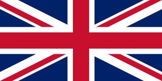
The United Kingdom of Great Britain and Northern Ireland, commonly known as the United Kingdom (UK) or Britain, is a country in Northwestern Europe, off the coast of the continental mainland. It comprises England, Scotland, Wales, and Northern Ireland. The UK includes the island of Great Britain, the north-eastern part of the island of Ireland, and most of the smaller islands within the British Isles. Northern Ireland shares a land border with the Republic of Ireland; otherwise, the United Kingdom is surrounded by the Atlantic Ocean, the North Sea, the English Channel, the Celtic Sea, and the Irish Sea. The total area of the United Kingdom is 94,354 square miles (244,376 km2), with an estimated population of nearly 67.6 million people in 2022.

The Peerage of Ireland consists of those titles of nobility created by the English monarchs in their capacity as Lord or King of Ireland, or later by monarchs of the United Kingdom of Great Britain and Ireland. It is one of the five divisions of Peerages in the United Kingdom. The creation of such titles came to an end in the 19th century. The ranks of the Irish peerage are duke, marquess, earl, viscount and baron. As of 2016, there were 135 titles in the Peerage of Ireland extant: two dukedoms, ten marquessates, 43 earldoms, 28 viscountcies, and 52 baronies. However, these titles have no official recognition in the Republic of Ireland, with Article 40.2 of the Constitution of Ireland forbidding the state conferring titles of nobility and stating that an Irish citizen may not accept titles of nobility or honour except with the prior approval of the Irish government.

<span class="mw-page-title-main">October 1974 United Kingdom general election</span>

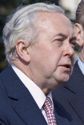
The October 1974 United Kingdom general election took place on Thursday 10 October 1974 to elect 635 members of the House of Commons. It was the second general election held that year; the first year that two general elections were held in the same year since 1910; and the first time that two general elections were held less than a year apart from each other since the 1923 and 1924 elections, which took place 10 months apart. The election resulted in the Labour Party, led by Prime Minister Harold Wilson, winning a bare majority of three seats. That enabled the remainder of the Labour government to take place, but it saw a gradual loss of its majority.

<span class="mw-page-title-main">December 1910 United Kingdom general election</span>

The December 1910 United Kingdom general election was held from 3 to 19 December. It was the last general election to be held over several days and the last to be held before the First World War.

<span class="mw-page-title-main">2004 European Parliament election in the United Kingdom</span> Election

The 2004 European Parliament election was the United Kingdom's part of the wider 2004 European Parliament election which was held between 10 and 13 June 2004 in the 25 member states of the European Union. The United Kingdom's part of this election was held on Thursday 10 June 2004. The election also coincided with the 2004 local elections and the London Assembly and mayoral elections. In total, 78 Members of the European Parliament were elected from the United Kingdom using proportional representation.

<span class="mw-page-title-main">Lists of places in Wales</span>

These are lists of places in Wales.

<span class="mw-page-title-main">Kingdom of Israel (united monarchy)</span> Hypothesized Israelite kingdom in the Southern Levant

According to the Deuteronomistic history in the Hebrew Bible, a United Monarchy or United Kingdom of Israel existed under the reigns of Saul, Eshbaal, David, and Solomon, encompassing the territories of both the later kingdoms of Judah and Israel.

<span class="mw-page-title-main">Constituencies of the Parliament of the United Kingdom</span> Electoral divisions of the parliament of the United Kingdom

The Parliament of the United Kingdom currently has 650 parliamentary constituencies across the constituent countries, each electing a single member of parliament (MP) to the House of Commons by the plurality voting system, ordinarily every five years. Voting last took place in all 650 of those constituencies at the United Kingdom general election on 12 December 2019.

<span class="mw-page-title-main">Unitary authorities of England</span> Local government in some parts of England

The unitary authorities of England are a type of local authority responsible for all local government services in an area. They combine the functions of a non-metropolitan county council and a non-metropolitan district council, which elsewhere in England provide two tiers of local government.

<span class="mw-page-title-main">Kingdom of Portugal</span> Kingdom in Southwestern Europe (1139–1910)

The Kingdom of Portugal was a monarchy in the western Iberian Peninsula and the predecessor of the modern Portuguese Republic. Existing to various extents between 1139 and 1910, it was also known as the Kingdom of Portugal and the Algarves after 1415, and as the United Kingdom of Portugal, Brazil and the Algarves between 1815 and 1822. The name is also often applied to the Portuguese Empire, the realm's overseas colonies.

<span class="mw-page-title-main">United Kingdom in the Eurovision Song Contest</span>

The United Kingdom has participated in the Eurovision Song Contest 65 times. Its first participation was at the second contest, in 1957, and it has entered every year since 1959. The country has won the contest five times: in 1967, with Sandie Shaw and the song "Puppet on a String"; in 1969, with Lulu and the song "Boom Bang-a-Bang"; in 1976, with Brotherhood of Man and the song "Save Your Kisses for Me"; in 1981, with Bucks Fizz and the song "Making Your Mind Up"; and in 1997, with Katrina and the Waves and the song "Love Shine a Light". The UK has also achieved a record sixteen second-place finishes, the first in 1959 and the most recent in 2022.

<span class="mw-page-title-main">Countries of the United Kingdom</span> Component parts of the UK since 1922

Since 1922, the United Kingdom has been made up of four countries: England, Scotland, Wales and Northern Ireland. The UK Prime Minister's website has used the phrase "countries within a country" to describe the United Kingdom. Some statistical summaries, such as those for the twelve NUTS 1 regions of the UK, refer to Northern Ireland, Scotland, and Wales as "regions". With regard to Northern Ireland, Scotland and Wales particularly, the descriptive name one uses "can be controversial, with the choice often revealing one's political preferences".