
Frithsden is a small hamlet in Hertfordshire, England. It is located in the Chiltern Hills, about two miles north of Berkhamsted, to which it belongs. It is in the Dacorum Ward of Nettleden with Potten End.

The Borough of Dacorum is a local government district in Hertfordshire, England that includes the towns of Hemel Hempstead, Berkhamsted, Tring and Kings Langley. The district, which was formed in 1974, had a population of 137,799 in 2001. Its name was taken from the old hundred of Dacorum which covered approximately the same area. It is the westernmost of Hertfordshire's districts, being bordered to the west by the Chiltern and Aylesbury Vale districts of Buckinghamshire.

Hertford Heath is a village and civil parish near the county town of Hertford in Hertfordshire, England. The population at the 2011 Census was 2,672.

Totternhoe Stone is a relatively hard chalk outcropping in the middle of the Lower Chalk in the Chiltern Hills in Hertfordshire, Buckinghamshire, Bedfordshire and Cambridgeshire, England. Geologically, it is located in the upper part of the Cenomanian stage of the Cretaceous.

Broadmoor to Bagshot Woods and Heaths is a 1,696.3-hectare (4,192-acre) biological Site of Special Scientific Interest (SSSI) in Berkshire and Surrey that extend from a minority of the parish of Crowthorne including around Broadmoor Hospital in the west to Bagshot south-east, Bracknell north-east, and Sandhurst, south. It is part of the Thames Basin Heaths Special Protection Area. Two nature reserves which are managed by the Surrey Wildlife Trust are in the SSSI, Barossa nature reserve and Poors Allotment. Broadmoor Bottom, which is part of Wildmoor Heath, also falls within the SSSI; this reserve is managed by the Berkshire, Buckinghamshire and Oxfordshire Wildlife Trust.
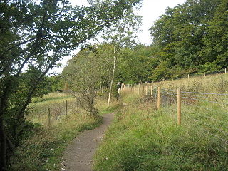
Aldbury Nowers is a 19.7 hectares biological Site of Special Scientific Interest (SSSI) in the Chiltern Hills, north-east of Tring in Hertfordshire. The site was notified in 1990 under the Wildlife and Countryside Act 1981. It is managed by the Hertfordshire and Middlesex Wildlife Trust. The site, formerly known as "Duchie's Piece," comprises two areas of hillside, linked by The Ridgeway. The calcareous meadow element of the site hosts the flowers of chalk grassland and has butterfly habitats with thirty-four different species of butterfly recently recorded, including the Duke of Burgundy, hairstreaks and the Essex skipper. The site also includes a "beech hanger", a type of upland ancient woodland, and is considered one of the best examples of this feature in Hertfordshire.
Warners End is a neighbourhood or district of Hemel Hempstead, a new town in Hertfordshire, England. At the 2011 Census the population of the District was included in the Chaulden and Warner's End ward of Dacorum Council. It was the fourth of the new districts built during the expansion of Hemel Hempstead into a new town with work on its construction commencing in 1953.

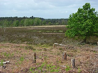
Sandhurst to Owlsmoor Bogs and Heaths is an 85.8-hectare (212-acre) biological Site of Special Scientific Interest (SSSI) on the northern outskirts of Sandhurst in Berkshire. Part of the SSSI is Wildmoor Heath nature reserve, which is managed by the Berkshire, Buckinghamshire and Oxfordshire Wildlife Trust. and the SSSI is part of Thames Basin Heaths Special Protection Area.

Herts and Middlesex Wildlife Trust manages over 40 nature reserves covering nearly 810 hectares north of London, in Hertfordshire and the historic county of Middlesex, part of which is divided between the London boroughs of Barnet, Enfield, Harrow and Hillingdon. It has over 21,000 members, and is one of 46 Wildlife Trusts across the UK. It is a Registered Charity, with its Registered Office in St Albans, and had an income in the year to 31 March 2014 of over £1.5 million.

Fields End is a hamlet to the North West of Hemel Hempstead, just beyond Warner's End on Boxted Road, in Hertfordshire, England. At the 2011 Census the population of the hamlet was included in the Dacorum ward of Chaulden and Warner's End.
Woolmer Forest is a 1,298.5-hectare (3,209-acre) biological Site of Special Scientific Interest south of Bordon in Hampshire and West Sussex. It is also a Special Area of Conservation and part of the Wealden Heaths Phase II Special Protection Area. Two areas are Nature Conservation Review sites, Grade I.

Moor Mill Quarry, West is a 0.16 hectare geological Site of Special Scientific Interest in How Wood in Hertfordshire. The local planning authority is St Albans City and District Council. It was notified in 1992 as representing the former Moor Mill Quarry SSSI, which was lost to landfill operations. It is listed by the Geological Conservation Review.

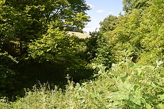
Tring Woodlands is a 23.8 hectare biological Site of Special Scientific Interest in Tring in Hertfordshire. It is part of the Chilterns Area of Outstanding Natural Beauty and the local planning authority is Dacorum District Council. The wood has a rich flora, showing that it is well established. It is a good example of a semi-natural beech wood in Hertfordshire. Plants that are abundant include woodruff, wood anemone and dog's mercury, and there are a variety of woodland birds. There is access to the wood from Hastoe Hill.

Little Heath Pit is a 0.3 hectare geological Site of Special Scientific Interest at Little Heath near Potten End in Hertfordshire. It is part of the Ashridge Estate, owned by the National Trust, and the local planning authority is Dacorum Borough Council. It is listed in the Geological Conservation Review.
Hill End Pit is a 0.7 hectare a nature reserve on the site of a former chalk pit, in St Paul's Walden in North Hertfordshire. It was formerly managed by the Herts and Middlesex Wildlife Trust (HMWT). In February 2016 HMWT announced that three sites, Barkway Chalk Pit, Hill End Pit and Pryor's Wood, which HMWT managed on behalf of their owner, North Hertfordshire District Council, were to return to Council management as the Trust was no longer able to meet the cost. It has the largest colony of Azeca goodalli snails in Hertfordshire. Plants include viper's bugloss, cowslip and marjoram, there are butterflies such as common blue and gatekeeper, and many birds including woodpeckers.

Nine Acres Pit is a 20.7 hectare geological Site of Special Scientific Importance north-east of Leighton Buzzard in Bedfordshire. It was notified in 1986 under Section 28 of the Wildlife and Countryside Act 1981, and the local planning authority is Central Bedfordshire Council. It is a Geological Conservation Review site.
