List of United Kingdom locations: Wd-West End

Last updated

The United Kingdom Uk-map.svg
The United Kingdom

This is part of the list of United Kingdom locations: a gazetteer of place names in the United Kingdom showing each place's locality and geographical coordinates.

Contents

Wd

LocationLocality Coordinates
(links to map & photo sources)
OS grid
reference
Wdig Pembrokeshire 52°00′N5°00′W / 52.00°N 05.00°W / 52.00; -05.00 SM9438

We

Wea-Wen

LocationLocality Coordinates
(links to map & photo sources)
OS grid
reference
Weacombe Somerset 51°09′N3°16′W / 51.15°N 03.27°W / 51.15; -03.27 ST1140
Weald Oxfordshire 51°43′N1°34′W / 51.71°N 01.56°W / 51.71; -01.56 SP3002
Wealdstone Harrow 51°35′N0°20′W / 51.58°N 00.34°W / 51.58; -00.34 TQ1589
Wearde Cornwall 50°24′N4°13′W / 50.40°N 04.22°W / 50.40; -04.22 SX4258
Weardley Leeds 53°53′N1°34′W / 53.89°N 01.56°W / 53.89; -01.56 SE2944
Weare Somerset 51°16′N2°50′W / 51.26°N 02.84°W / 51.26; -02.84 ST4152
Weare Giffard Devon 50°58′N4°11′W / 50.96°N 04.18°W / 50.96; -04.18 SS4721
Wearhead Durham 54°44′N2°14′W / 54.74°N 02.23°W / 54.74; -02.23 NY8539
Wearne Somerset 51°02′N2°49′W / 51.04°N 02.82°W / 51.04; -02.82 ST4228
Weasdale Cumbria 54°25′N2°28′W / 54.42°N 02.47°W / 54.42; -02.47 NY6903
Weasenham All Saints Norfolk 52°45′N0°43′E / 52.75°N 00.72°E / 52.75; 00.72 TF8421
Weasenham St Peter Norfolk 52°46′N0°44′E / 52.76°N 00.74°E / 52.76; 00.74 TF8522
Weaste Salford 53°28′N2°18′W / 53.47°N 02.30°W / 53.47; -02.30 SJ8098
Weatherhill Surrey 51°10′N0°07′W / 51.17°N 00.12°W / 51.17; -00.12 TQ3143
Weatheroak Hill Worcestershire 52°22′N1°55′W / 52.36°N 01.92°W / 52.36; -01.92 SP0574
Weaverham Cheshire 53°16′N2°35′W / 53.26°N 02.58°W / 53.26; -02.58 SJ6174
Weavering Street Kent 51°16′N0°33′E / 51.27°N 00.55°E / 51.27; 00.55 TQ7856
Weaverslake Staffordshire 52°46′N1°48′W / 52.76°N 01.80°W / 52.76; -01.80 SK1319
Weaverthorpe North Yorkshire 54°07′N0°32′W / 54.11°N 00.53°W / 54.11; -00.53 SE9670
Webbington Somerset 51°17′N2°53′W / 51.29°N 02.89°W / 51.29; -02.89 ST3855
Webheath Worcestershire 52°17′N1°59′W / 52.29°N 01.98°W / 52.29; -01.98 SP0166
Webscott Shropshire 52°47′N2°47′W / 52.79°N 02.78°W / 52.79; -02.78 SJ4722
Wecock Hampshire 50°53′N1°02′W / 50.89°N 01.03°W / 50.89; -01.03 SU6811
Wedder Holm Shetland Islands 60°39′N0°53′W / 60.65°N 00.88°W / 60.65; -00.88 HU613974
Wedderlairs Aberdeenshire 57°22′N2°15′W / 57.37°N 02.25°W / 57.37; -02.25 NJ8532
Weddington Warwickshire 52°31′N1°28′W / 52.52°N 01.47°W / 52.52; -01.47 SP3692
Weddington Kent 51°17′N1°17′E / 51.28°N 01.28°E / 51.28; 01.28 TR2959
Wedhampton Wiltshire 51°19′N1°55′W / 51.31°N 01.91°W / 51.31; -01.91 SU0657
Wedmore Somerset 51°13′N2°49′W / 51.21°N 02.81°W / 51.21; -02.81 ST4347
Wednesbury Sandwell 52°33′N2°02′W / 52.55°N 02.03°W / 52.55; -02.03 SO9895
Wednesbury Oak Sandwell 52°32′N2°04′W / 52.54°N 02.06°W / 52.54; -02.06 SO9694
Wednesfield Wolverhampton 52°35′N2°05′W / 52.59°N 02.09°W / 52.59; -02.09 SJ9400
Weecar Nottinghamshire 53°11′N0°46′W / 53.18°N 00.77°W / 53.18; -00.77 SK8266
Weedon Buckinghamshire 51°51′N0°49′W / 51.85°N 00.82°W / 51.85; -00.82 SP8118
Weedon Bec Northamptonshire 52°13′N1°05′W / 52.22°N 01.09°W / 52.22; -01.09 SP6259
Weedon Lois Northamptonshire 52°07′N1°07′W / 52.11°N 01.12°W / 52.11; -01.12 SP6047
Weeford Staffordshire 52°37′N1°47′W / 52.62°N 01.79°W / 52.62; -01.79 SK1403
Week (Chulmleigh)Devon 50°56′13″N3°48′18″W / 50.937°N 03.805°W / 50.937; -03.805 SS7316
Week (Dartington)Devon 50°26′N3°43′W / 50.44°N 03.71°W / 50.44; -03.71 SX7862
Week (Tawstock)Devon 51°01′N4°03′W / 51.02°N 04.05°W / 51.02; -04.05 SS5627
Week (Milton Abbot)Devon 50°36′N4°11′W / 50.60°N 04.19°W / 50.60; -04.19 SX4581
Weeke Hampshire 51°04′N1°20′W / 51.06°N 01.34°W / 51.06; -01.34 SU4630
Weeke Devon 50°50′N3°46′W / 50.84°N 03.76°W / 50.84; -03.76 SS7606
Week Green Cornwall 50°44′N4°31′W / 50.74°N 04.51°W / 50.74; -04.51 SX2397
Weekley Northamptonshire 52°25′N0°42′W / 52.41°N 00.70°W / 52.41; -00.70 SP8880
Weekmoor Somerset 51°01′N3°14′W / 51.01°N 03.24°W / 51.01; -03.24 ST1325
Weeks Isle of Wight 50°43′N1°10′W / 50.71°N 01.16°W / 50.71; -01.16 SZ5991
Week St Mary Cornwall 50°44′N4°31′W / 50.74°N 04.51°W / 50.74; -04.51 SX2397
Weel East Riding of Yorkshire 53°50′N0°23′W / 53.83°N 00.39°W / 53.83; -00.39 TA0639
Weeley Essex 51°51′N1°06′E / 51.85°N 01.10°E / 51.85; 01.10 TM1422
Weeley Heath Essex 51°50′N1°07′E / 51.83°N 01.11°E / 51.83; 01.11 TM1520
Weelsby North East Lincolnshire 53°33′N0°04′W / 53.55°N 00.06°W / 53.55; -00.06 TA2808
Weem Perth and Kinross 56°37′N3°53′W / 56.61°N 03.89°W / 56.61; -03.89 NN8449
Weeping Cross Staffordshire 52°47′N2°05′W / 52.78°N 02.09°W / 52.78; -02.09 SJ9421
Weethley Warwickshire 52°11′N1°55′W / 52.19°N 01.92°W / 52.19; -01.92 SP0555
Weethley Bank Warwickshire 52°11′N1°55′W / 52.18°N 01.92°W / 52.18; -01.92 SP0554
Weethley Gate Warwickshire 52°11′N1°55′W / 52.18°N 01.92°W / 52.18; -01.92 SP0554
Weeting Norfolk 52°28′N0°36′E / 52.47°N 00.60°E / 52.47; 00.60 TL7789
Weeton East Riding of Yorkshire 53°40′N0°03′E / 53.66°N 00.05°E / 53.66; 00.05 TA3520
Weeton Lancashire 53°47′N2°56′W / 53.79°N 02.94°W / 53.79; -02.94 SD3834
Weeton Leeds 53°54′N1°34′W / 53.90°N 01.57°W / 53.90; -01.57 SE2846
Weetwood Leeds 53°49′N1°35′W / 53.82°N 01.59°W / 53.82; -01.59 SE2737
Weetwood Common Cheshire 53°11′N2°43′W / 53.18°N 02.71°W / 53.18; -02.71 SJ5266
Weir Essex 51°34′N0°35′E / 51.57°N 00.59°E / 51.57; 00.59 TQ8089
Weirbrook Shropshire 52°48′N2°59′W / 52.80°N 02.98°W / 52.80; -02.98 SJ3424
Weir Quay Devon 50°28′N4°13′W / 50.46°N 04.21°W / 50.46; -04.21 SX4365
Weisdale Shetland Islands 60°16′N1°17′W / 60.26°N 01.29°W / 60.26; -01.29 HU3953
Welborne Norfolk 52°38′N1°02′E / 52.63°N 01.04°E / 52.63; 01.04 TG0609
Welborne Common Norfolk 52°38′N1°01′E / 52.64°N 01.02°E / 52.64; 01.02 TG0509
Welbourn Lincolnshire 53°04′N0°34′W / 53.07°N 00.56°W / 53.07; -00.56 SK9654
Welburn (Kirkbymoorside)North Yorkshire 54°14′N0°57′W / 54.24°N 00.95°W / 54.24; -00.95 SE6884
Welburn (Welburn-on-Derwent, near Malton)North Yorkshire 54°05′N0°54′W / 54.09°N 00.90°W / 54.09; -00.90 SE7267
Welbury North Yorkshire 54°25′N1°24′W / 54.41°N 01.40°W / 54.41; -01.40 NZ3902
Welby Lincolnshire 52°56′N0°33′W / 52.93°N 00.55°W / 52.93; -00.55 SK9738
Welcombe Devon 50°56′N4°32′W / 50.93°N 04.53°W / 50.93; -04.53 SS2218
Weld Bank Lancashire 53°38′N2°38′W / 53.63°N 02.63°W / 53.63; -02.63 SD5816
Weldon Northamptonshire 52°29′N0°38′W / 52.49°N 00.64°W / 52.49; -00.64 SP9289
Weldon Northumberland 55°16′N1°47′W / 55.27°N 01.79°W / 55.27; -01.79 NZ1398
Welford Northamptonshire 52°25′N1°04′W / 52.41°N 01.06°W / 52.41; -01.06 SP6480
Welford Berkshire 51°27′N1°25′W / 51.45°N 01.42°W / 51.45; -01.42 SU4073
Welford-on-Avon Warwickshire 52°09′N1°47′W / 52.15°N 01.79°W / 52.15; -01.79 SP1451
Welham Somerset 51°04′N2°29′W / 51.07°N 02.48°W / 51.07; -02.48 ST6631
Welham Leicestershire 52°31′N0°53′W / 52.52°N 00.88°W / 52.52; -00.88 SP7692
Welham Nottinghamshire 53°20′N0°55′W / 53.33°N 00.92°W / 53.33; -00.92 SK7282
Welhambridge East Riding of Yorkshire 53°47′N0°48′W / 53.79°N 00.80°W / 53.79; -00.80 SE7934
Welham Green Hertfordshire 51°44′N0°13′W / 51.73°N 00.22°W / 51.73; -00.22 TL2305
Well Hampshire 51°12′N0°55′W / 51.20°N 00.91°W / 51.20; -00.91 SU7646
Well North Yorkshire 54°13′N1°36′W / 54.22°N 01.60°W / 54.22; -01.60 SE2681
Well Lincolnshire 53°14′N0°09′E / 53.23°N 00.15°E / 53.23; 00.15 TF4473
Welland Worcestershire 52°02′N2°18′W / 52.04°N 02.30°W / 52.04; -02.30 SO7939
Welland Stone Worcestershire 52°02′N2°16′W / 52.04°N 02.27°W / 52.04; -02.27 SO8138
Wellbank Angus 56°31′N2°52′W / 56.51°N 02.86°W / 56.51; -02.86 NO4736
Well Bottom Dorset 50°56′N2°07′W / 50.94°N 02.12°W / 50.94; -02.12 ST9116
Wellbrook East Sussex 51°01′N0°14′E / 51.01°N 00.23°E / 51.01; 00.23 TQ5726
Welldale Dumfries and Galloway 54°59′N3°17′W / 54.98°N 03.28°W / 54.98; -03.28 NY1866
Well End Hertfordshire 51°40′N0°16′W / 51.66°N 00.26°W / 51.66; -00.26 TQ2098
Well End Buckinghamshire 51°35′N0°44′W / 51.58°N 00.73°W / 51.58; -00.73 SU8888
Weller's Town Kent 51°10′N0°08′E / 51.17°N 00.14°E / 51.17; 00.14 TQ5044
Wellesbourne Warwickshire 52°11′N1°36′W / 52.19°N 01.60°W / 52.19; -01.60 SP2755
Well Green Trafford 53°22′N2°20′W / 53.37°N 02.33°W / 53.37; -02.33 SJ7886
Well Heads Bradford 53°47′N1°53′W / 53.79°N 01.88°W / 53.79; -01.88 SE0833
Well Hall Greenwich 51°27′25″N0°03′00″E / 51.457°N 0.050°E / 51.457; 0.050 TQ425751
Well Hill Kent 51°21′16″N0°08′53″E / 51.3544°N 0.1480°E / 51.3544; 0.1480 TQ495639
Wellhouse Berkshire 51°26′N1°15′W / 51.44°N 01.25°W / 51.44; -01.25 SU5272
Wellhouse Kirklees 53°37′N1°52′W / 53.62°N 01.86°W / 53.62; -01.86 SE0914
Welling Bexley 51°27′N0°06′E / 51.45°N 00.10°E / 51.45; 00.10 TQ4675
Wellingborough Northamptonshire 52°17′N0°41′W / 52.29°N 00.69°W / 52.29; -00.69 SP8967
Wellingham Norfolk 52°46′N0°46′E / 52.76°N 00.77°E / 52.76; 00.77 TF8722
Wellingore Lincolnshire 53°05′N0°32′W / 53.09°N 00.53°W / 53.09; -00.53 SK9856
Wellington Somerset 50°58′N3°13′W / 50.97°N 03.22°W / 50.97; -03.22 ST1420
Wellington Herefordshire 52°07′N2°44′W / 52.12°N 02.74°W / 52.12; -02.74 SO4948
Wellington Cumbria 54°25′N3°26′W / 54.42°N 03.43°W / 54.42; -03.43 NY0704
Wellington Shropshire 52°41′N2°32′W / 52.69°N 02.53°W / 52.69; -02.53 SJ6411
Wellington Heath Herefordshire 52°03′N2°25′W / 52.05°N 02.42°W / 52.05; -02.42 SO7140
Wellington Hill Leeds 53°50′N1°28′W / 53.83°N 01.46°W / 53.83; -01.46 SE3538
Wellisford Somerset 50°59′N3°17′W / 50.98°N 03.29°W / 50.98; -03.29 ST0921
Wellow Isle of Wight 50°41′N1°28′W / 50.69°N 01.46°W / 50.69; -01.46 SZ3888
Wellow Bath and North East Somerset 51°19′N2°23′W / 51.32°N 02.38°W / 51.32; -02.38 ST7358
Wellow North East Lincolnshire 53°33′N0°05′W / 53.55°N 00.09°W / 53.55; -00.09 TA2608
Wellow Nottinghamshire 53°11′N0°59′W / 53.18°N 00.99°W / 53.18; -00.99 SK6766
Wellow Wood Hampshire 50°59′N1°35′W / 50.98°N 01.58°W / 50.98; -01.58 SU2921
Well Place Oxfordshire 51°34′N1°04′W / 51.56°N 01.06°W / 51.56; -01.06 SU6585
Wellpond Green Hertfordshire 51°52′N0°02′E / 51.87°N 00.04°E / 51.87; 00.04 TL4121
Wellroyd Leeds 53°49′N1°41′W / 53.82°N 01.68°W / 53.82; -01.68 SE2137
Wells Somerset 51°12′N2°39′W / 51.20°N 02.65°W / 51.20; -02.65 ST5445
Wellsborough Leicestershire 52°37′N1°28′W / 52.61°N 01.46°W / 52.61; -01.46 SK3602
Wells Green Cheshire 53°04′N2°28′W / 53.07°N 02.47°W / 53.07; -02.47 SJ6853
Wells-Next-The-Sea Norfolk 52°57′N0°50′E / 52.95°N 00.84°E / 52.95; 00.84 TF9143
Wellsprings Somerset 51°01′N3°07′W / 51.02°N 03.11°W / 51.02; -03.11 ST2226
Well Street Kent 51°16′N0°25′E / 51.27°N 00.42°E / 51.27; 00.42 TQ6956
Wellstye Green Essex 51°50′N0°22′E / 51.83°N 00.37°E / 51.83; 00.37 TL6418
Wellswood Devon 50°28′N3°31′W / 50.46°N 03.52°W / 50.46; -03.52 SX9264
Well Town Devon 50°52′N3°34′W / 50.87°N 03.56°W / 50.87; -03.56 SS9009
Welltown Cornwall 50°28′N4°38′W / 50.47°N 04.63°W / 50.47; -04.63 SX1367
Wellwood Fife 56°05′N3°28′W / 56.08°N 03.46°W / 56.08; -03.46 NT0989
Welney Norfolk 52°31′N0°14′E / 52.52°N 00.23°E / 52.52; 00.23 TL5294
Welsford Devon 50°58′N4°28′W / 50.96°N 04.46°W / 50.96; -04.46 SS2721
Welshampton Shropshire 52°54′N2°50′W / 52.90°N 02.84°W / 52.90; -02.84 SJ4334
Welsh Bicknor Herefordshire 51°51′N2°35′W / 51.85°N 02.59°W / 51.85; -02.59 SO5917
Welsh End Shropshire 52°55′N2°44′W / 52.91°N 02.73°W / 52.91; -02.73 SJ5135
Welsh Frankton Shropshire 52°53′N2°57′W / 52.88°N 02.95°W / 52.88; -02.95 SJ3632
Welsh Harp Brent 51°34′N0°15′W / 51.56°N 00.25°W / 51.56; -00.25 TQ2186
Welsh Hook Pembrokeshire 51°54′N5°01′W / 51.90°N 05.01°W / 51.90; -05.01 SM9327
Welsh Newton Herefordshire 51°50′N2°43′W / 51.84°N 02.72°W / 51.84; -02.72 SO5017
Welsh Newton Common Herefordshire 51°50′N2°43′W / 51.84°N 02.71°W / 51.84; -02.71 SO5117
Welshpool (Y Trallwng)Powys 52°39′N3°09′W / 52.65°N 03.15°W / 52.65; -03.15 SJ2207
Welsh St Donats The Vale Of Glamorgan 51°28′N3°25′W / 51.47°N 03.41°W / 51.47; -03.41 ST0276
Welshwood Park Essex 51°53′N0°56′E / 51.89°N 00.93°E / 51.89; 00.93 TM0226
Welstor Devon 50°32′N3°46′W / 50.54°N 03.77°W / 50.54; -03.77 SX7473
Welton Northamptonshire 52°17′N1°09′W / 52.28°N 01.15°W / 52.28; -01.15 SP5866
Welton Bath and North East Somerset 51°17′N2°28′W / 51.28°N 02.47°W / 51.28; -02.47 ST6754
Welton East Ayrshire 55°31′N4°22′W / 55.51°N 04.37°W / 55.51; -04.37 NS5027
Welton Cumbria 54°47′N3°01′W / 54.78°N 03.01°W / 54.78; -03.01 NY3544
Welton East Riding of Yorkshire 53°44′N0°32′W / 53.73°N 00.54°W / 53.73; -00.54 SE9627
Welton Lincolnshire 53°17′N0°29′W / 53.29°N 00.48°W / 53.29; -00.48 TF0179
Welton Hill Lincolnshire 53°19′N0°26′W / 53.31°N 00.44°W / 53.31; -00.44 TF0481
Welton le Marsh Lincolnshire 53°11′N0°11′E / 53.18°N 00.19°E / 53.18; 00.19 TF4768
Welton le Wold Lincolnshire 53°22′N0°05′W / 53.36°N 00.09°W / 53.36; -00.09 TF2787
Welwick East Riding of Yorkshire 53°40′N0°01′E / 53.66°N 00.02°E / 53.66; 00.02 TA3421
Welwyn Hertfordshire 51°49′N0°14′W / 51.82°N 00.23°W / 51.82; -00.23 TL2216
Welwyn Garden City Hertfordshire 51°48′N0°12′W / 51.80°N 00.20°W / 51.80; -00.20 TL2413
Wem Shropshire 52°51′N2°43′W / 52.85°N 02.72°W / 52.85; -02.72 SJ5129
Wembdon Somerset 51°07′N3°02′W / 51.12°N 03.03°W / 51.12; -03.03 ST2837
Wembley Brent 51°33′N0°19′W / 51.55°N 00.31°W / 51.55; -00.31 TQ1785
Wembley Park Brent 51°34′N0°17′W / 51.56°N 00.28°W / 51.56; -00.28 TQ1986
Wembury Devon 50°19′N4°05′W / 50.31°N 04.08°W / 50.31; -04.08 SX5248
Wembworthy Devon 50°52′N3°54′W / 50.86°N 03.90°W / 50.86; -03.90 SS6609
Wemyss Bay Inverclyde 55°53′N4°53′W / 55.88°N 04.89°W / 55.88; -04.89 NS1969
Wenallt Ceredigion 52°19′N3°57′W / 52.32°N 03.95°W / 52.32; -03.95 SN6771
Wenallt Gwynedd 52°44′N3°53′W / 52.73°N 03.88°W / 52.73; -03.88 SH7317
Wendens Ambo Essex 52°00′N0°11′E / 52.00°N 00.19°E / 52.00; 00.19 TL5136
Wendlebury Oxfordshire 51°52′N1°11′W / 51.86°N 01.18°W / 51.86; -01.18 SP5619
Wendling Norfolk 52°41′N0°51′E / 52.68°N 00.85°E / 52.68; 00.85 TF9313
Wendover Buckinghamshire 51°46′N0°45′W / 51.76°N 00.75°W / 51.76; -00.75 SP8608
Wendover Dean Buckinghamshire 51°43′N0°44′W / 51.72°N 00.74°W / 51.72; -00.74 SP8704
Wendron Cornwall 50°08′N5°16′W / 50.13°N 05.26°W / 50.13; -05.26 SW6731
Wendy Cambridgeshire 52°06′N0°04′W / 52.10°N 00.07°W / 52.10; -00.07 TL3247
Wenfordbridge Cornwall 50°32′N4°43′W / 50.54°N 04.71°W / 50.54; -04.71 SX0875
Wenhaston Suffolk 52°19′N1°32′E / 52.32°N 01.54°E / 52.32; 01.54 TM4275
Wenhaston Black Heath Suffolk 52°19′N1°32′E / 52.31°N 01.53°E / 52.31; 01.53 TM4174
Wennington Cambridgeshire 52°23′N0°11′W / 52.39°N 00.19°W / 52.39; -00.19 TL2379
Wennington Havering 51°29′N0°13′E / 51.49°N 00.21°E / 51.49; 00.21 TQ5480
Wennington Lancashire 54°07′N2°35′W / 54.12°N 02.59°W / 54.12; -02.59 SD6170
Wensley North Yorkshire 54°17′N1°52′W / 54.29°N 01.86°W / 54.29; -01.86 SE0989
Wensley Derbyshire 53°08′N1°37′W / 53.14°N 01.61°W / 53.14; -01.61 SK2661
Wentbridge Wakefield 53°38′N1°16′W / 53.64°N 01.27°W / 53.64; -01.27 SE4817
Wentnor Shropshire 52°31′N2°55′W / 52.52°N 02.91°W / 52.52; -02.91 SO3892
Wentworth Cambridgeshire 52°23′N0°09′E / 52.38°N 00.15°E / 52.38; 00.15 TL4778
Wentworth Rotherham 53°28′N1°25′W / 53.47°N 01.42°W / 53.47; -01.42 SK3898
Wenvoe The Vale of Glamorgan 51°26′N3°16′W / 51.44°N 03.26°W / 51.44; -03.26 ST1272

Weo-Wess

LocationLocality Coordinates
(links to map & photo sources)
OS grid
reference
Weobley Herefordshire 52°09′N2°52′W / 52.15°N 02.87°W / 52.15; -02.87 SO4051
Weobley Marsh Herefordshire 52°09′N2°52′W / 52.15°N 02.86°W / 52.15; -02.86 SO4151
Weoley Castle Birmingham 52°26′N1°58′W / 52.43°N 01.97°W / 52.43; -01.97 SP0282
Wepham West Sussex 50°52′N0°31′W / 50.86°N 00.52°W / 50.86; -00.52 TQ0408
Wepre Flintshire 53°13′N3°04′W / 53.21°N 03.06°W / 53.21; -03.06 SJ2969
Wereham Norfolk 52°35′N0°28′E / 52.58°N 00.47°E / 52.58; 00.47 TF6801
Wereham Row Norfolk 52°34′N0°28′E / 52.57°N 00.46°E / 52.57; 00.46 TF6700
Wereton Staffordshire 53°02′N2°19′W / 53.04°N 02.31°W / 53.04; -02.31 SJ7950
Wergs Staffordshire 52°35′N2°11′W / 52.59°N 02.19°W / 52.59; -02.19 SJ8700
Wern (LLangynidr)Powys 51°50′N3°17′W / 51.84°N 03.29°W / 51.84; -03.29 SO1117
Wern Swansea 51°37′N4°07′W / 51.62°N 04.12°W / 51.62; -04.12 SS5394
Wern Gwynedd 52°55′N4°10′W / 52.92°N 04.17°W / 52.92; -04.17 SH5439
Wern Shropshire 52°53′N3°05′W / 52.89°N 03.08°W / 52.89; -03.08 SJ2734
Wern (Carreghofa)Powys 52°46′N3°07′W / 52.77°N 03.11°W / 52.77; -03.11 SJ2520
Wern (Llandrinio)Powys 52°42′N3°07′W / 52.70°N 03.11°W / 52.70; -03.11 SJ2513
Wern ddu Shropshire 52°49′N3°08′W / 52.82°N 03.14°W / 52.82; -03.14 SJ2326
Werneth Oldham 53°32′N2°08′W / 53.53°N 02.13°W / 53.53; -02.13 SD9104
Werneth Low Stockport 53°25′N2°04′W / 53.42°N 02.07°W / 53.42; -02.07 SJ9592
Wernffrwd Swansea 51°37′N4°09′W / 51.62°N 04.15°W / 51.62; -04.15 SS5194
Wernlas Shropshire 52°46′N3°01′W / 52.77°N 03.02°W / 52.77; -03.02 SJ3120
Wern-olau Swansea 51°38′N4°05′W / 51.63°N 04.08°W / 51.63; -04.08 SS5695
Wernrheolydd Monmouthshire 51°48′N2°53′W / 51.80°N 02.88°W / 51.80; -02.88 SO3912
Wern Tarw Bridgend 51°32′N3°30′W / 51.54°N 03.50°W / 51.54; -03.50 SS9684
Wern-y-cwrt Monmouthshire 51°46′N2°53′W / 51.76°N 02.88°W / 51.76; -02.88 SO3908
Wern-y-gaer Flintshire 53°13′N3°11′W / 53.21°N 03.19°W / 53.21; -03.19 SJ2069
Werrington Cornwall 50°39′N4°22′W / 50.65°N 04.37°W / 50.65; -04.37 SX3287
Werrington Staffordshire 53°01′N2°05′W / 53.02°N 02.09°W / 53.02; -02.09 SJ9447
Werrington Cambridgeshire 52°37′N0°17′W / 52.61°N 00.28°W / 52.61; -00.28 TF1603
Wervin Cheshire 53°14′N2°52′W / 53.23°N 02.87°W / 53.23; -02.87 SJ4271
Wescoe Hill North Yorkshire 53°54′N1°35′W / 53.90°N 01.59°W / 53.90; -01.59 SE2746
Wesham Lancashire 53°47′N2°53′W / 53.78°N 02.88°W / 53.78; -02.88 SD4232
Wessington Derbyshire 53°06′N1°26′W / 53.10°N 01.44°W / 53.10; -01.44 SK3757

West A

LocationLocality Coordinates
(links to map & photo sources)
OS grid
reference
West Aberthaw The Vale Of Glamorgan 51°23′N3°24′W / 51.38°N 03.40°W / 51.38; -03.40 ST0266
Westacott Devon 51°04′N4°01′W / 51.06°N 04.02°W / 51.06; -04.02 SS5832
West Acre Norfolk 52°42′N0°37′E / 52.70°N 00.61°E / 52.70; 00.61 TF7715
West Acton Ealing 51°31′N0°17′W / 51.51°N 00.28°W / 51.51; -00.28 TQ1981
West Adderbury Oxfordshire 52°01′N1°20′W / 52.01°N 01.33°W / 52.01; -01.33 SP4635
West Allotment North Tyneside 55°01′N1°32′W / 55.02°N 01.53°W / 55.02; -01.53 NZ3070
West Alvington Devon 50°16′N3°47′W / 50.27°N 03.79°W / 50.27; -03.79 SX7243
West Amesbury Wiltshire 51°10′N1°48′W / 51.16°N 01.80°W / 51.16; -01.80 SU1441
West Anstey Devon 51°02′N3°38′W / 51.03°N 03.64°W / 51.03; -03.64 SS8527
West Appleton North Yorkshire 54°20′N1°40′W / 54.34°N 01.67°W / 54.34; -01.67 SE2194
West Ardsley Leeds 53°43′N1°34′W / 53.72°N 01.57°W / 53.72; -01.57 SE2825
West Arthurlie East Renfrewshire 55°47′N4°25′W / 55.79°N 04.41°W / 55.79; -04.41 NS4958
West Ashby Lincolnshire 53°14′N0°07′W / 53.23°N 00.11°W / 53.23; -00.11 TF2672
West Ashford Devon 51°05′N4°07′W / 51.09°N 04.11°W / 51.09; -04.11 SS5235
West Ashling West Sussex 50°51′N0°52′W / 50.85°N 00.86°W / 50.85; -00.86 SU8007
West Ashton Wiltshire 51°17′N2°11′W / 51.29°N 02.18°W / 51.29; -02.18 ST8755
West Auckland Durham 54°37′N1°43′W / 54.62°N 01.72°W / 54.62; -01.72 NZ1826
West Ayton North Yorkshire 54°14′N0°29′W / 54.24°N 00.49°W / 54.24; -00.49 SE9884

West B

LocationLocality Coordinates
(links to map & photo sources)
OS grid
reference
West Bagborough Somerset 51°05′N3°11′W / 51.09°N 03.18°W / 51.09; -03.18 ST1733
West Balmirmer Angus 56°32′N2°42′W / 56.53°N 02.70°W / 56.53; -02.70 NO5738
West Bank Blaenau Gwent 51°44′N3°08′W / 51.73°N 03.14°W / 51.73; -03.14 SO2105
West Bank Cheshire 53°20′N2°44′W / 53.34°N 02.73°W / 53.34; -02.73 SJ5183
Westbank Derbyshire 53°02′N1°28′W / 53.03°N 01.46°W / 53.03; -01.46 SK3649
West Barkwith Lincolnshire 53°18′N0°16′W / 53.30°N 00.27°W / 53.30; -00.27 TF1580
West Barnby North Yorkshire 54°29′N0°45′W / 54.49°N 00.75°W / 54.49; -00.75 NZ8112
West Barnes Kingston upon Thames 51°23′N0°14′W / 51.38°N 00.24°W / 51.38; -00.24 TQ2267
West Barns East Lothian 55°59′N2°34′W / 55.99°N 02.56°W / 55.99; -02.56 NT6578
West Barsham Norfolk 52°52′N0°49′E / 52.86°N 00.82°E / 52.86; 00.82 TF9033
West Bay Dorset 50°42′N2°46′W / 50.70°N 02.76°W / 50.70; -02.76 SY4690
West Beckham Norfolk 52°54′N1°10′E / 52.90°N 01.16°E / 52.90; 01.16 TG1339
West Bedfont Surrey 51°26′N0°28′W / 51.44°N 00.46°W / 51.44; -00.46 TQ0773
West Benhar North Lanarkshire 55°50′N3°47′W / 55.84°N 03.79°W / 55.84; -03.79 NS8863
West Bennan North Ayrshire 55°26′N5°11′W / 55.44°N 05.19°W / 55.44; -05.19 NR9821
Westbere Kent 51°18′N1°08′E / 51.30°N 01.14°E / 51.30; 01.14 TR1961
West Bergholt Essex 51°54′N0°50′E / 51.90°N 00.84°E / 51.90; 00.84 TL9627
West Bexington Dorset 50°40′N2°40′W / 50.67°N 02.66°W / 50.67; -02.66 SY5386
West Bilney Norfolk 52°42′N0°31′E / 52.70°N 00.52°E / 52.70; 00.52 TF7115
West Blackdene Durham 54°44′N2°13′W / 54.74°N 02.21°W / 54.74; -02.21 NY8639
West Blackdown Devon 50°36′N4°08′W / 50.60°N 04.13°W / 50.60; -04.13 SX4981
West Blatchington Brighton and Hove 50°50′N0°11′W / 50.83°N 00.19°W / 50.83; -00.19 TQ2706
West Bold Scottish Borders 55°37′N3°01′W / 55.61°N 03.01°W / 55.61; -03.01 NT3636
West Boldon South Tyneside 54°56′N1°27′W / 54.94°N 01.45°W / 54.94; -01.45 NZ3561
Westborough Lincolnshire 52°59′N0°44′W / 52.98°N 00.73°W / 52.98; -00.73 SK8544
Westbourne Hampshire 50°51′N0°56′W / 50.85°N 00.93°W / 50.85; -00.93 SU7507
Westbourne Bournemouth 50°43′N1°54′W / 50.71°N 01.90°W / 50.71; -01.90 SZ0791
Westbourne Suffolk 52°04′N1°07′E / 52.06°N 01.12°E / 52.06; 01.12 TM1445
Westbourne Green City of Westminster 51°31′N0°11′W / 51.52°N 00.19°W / 51.52; -00.19 TQ2582
West Bourton Dorset 51°04′N2°20′W / 51.06°N 02.34°W / 51.06; -02.34 ST7629
West Bowling Bradford 53°46′N1°45′W / 53.77°N 01.75°W / 53.77; -01.75 SE1631
West Bradford Lancashire 53°53′N2°23′W / 53.89°N 02.39°W / 53.89; -02.39 SD7444
West Bradley Somerset 51°07′N2°38′W / 51.12°N 02.64°W / 51.12; -02.64 ST5536
West Bretton Wakefield 53°37′N1°34′W / 53.61°N 01.57°W / 53.61; -01.57 SE2813
West Bridgford Nottinghamshire 52°55′N1°08′W / 52.91°N 01.13°W / 52.91; -01.13 SK5836
West Brompton Hammersmith and Fulham 51°28′N0°12′W / 51.47°N 00.20°W / 51.47; -00.20 TQ2577
West Bromwich Sandwell 52°31′N2°01′W / 52.52°N 02.01°W / 52.52; -02.01 SO9992
Westbrook Berkshire 51°26′N1°23′W / 51.43°N 01.39°W / 51.43; -01.39 SU4271
Westbrook Cheshire 53°24′N2°38′W / 53.40°N 02.64°W / 53.40; -02.64 SJ5790
Westbrook Herefordshire 52°05′N3°03′W / 52.08°N 03.05°W / 52.08; -03.05 SO2843
Westbrook Kent 51°23′N1°22′E / 51.38°N 01.36°E / 51.38; 01.36 TR3470
Westbrook Surrey 51°10′N0°37′W / 51.17°N 00.62°W / 51.17; -00.62 SU9643
Westbrook Wiltshire 51°23′N2°04′W / 51.38°N 02.07°W / 51.38; -02.07 ST9565
Westbrook Green Norfolk 52°23′N1°05′E / 52.38°N 01.09°E / 52.38; 01.09 TM1181
Westbrook Hay Hertfordshire 51°44′N0°31′W / 51.73°N 00.52°W / 51.73; -00.52 TL0205
West Broughton Derbyshire 52°53′N1°47′W / 52.89°N 01.79°W / 52.89; -01.79 SK1433
West Buckland Somerset 50°58′N3°11′W / 50.97°N 03.18°W / 50.97; -03.18 ST1720
West Buckland Devon 51°04′N3°55′W / 51.06°N 03.92°W / 51.06; -03.92 SS6531
Westburn South Lanarkshire 55°49′N4°08′W / 55.81°N 04.14°W / 55.81; -04.14 NS6660
West Burnside Aberdeenshire 56°49′N2°29′W / 56.82°N 02.49°W / 56.82; -02.49 NO7070
West Burra Shetland Islands 60°04′N1°19′W / 60.07°N 01.32°W / 60.07; -01.32 HU376327
West Burrafirth Shetland Islands 60°17′N1°32′W / 60.28°N 01.54°W / 60.28; -01.54 HU2556
West Burton West Sussex 50°54′N0°35′W / 50.90°N 00.59°W / 50.90; -00.59 SU9913
West Burton North Yorkshire 54°16′N1°59′W / 54.27°N 01.98°W / 54.27; -01.98 SE0186
Westbury Wiltshire 51°14′N2°12′W / 51.24°N 02.20°W / 51.24; -02.20 ST8650
Westbury Oxfordshire 52°01′N1°05′W / 52.01°N 01.09°W / 52.01; -01.09 SP6235
Westbury Shropshire 52°40′N2°58′W / 52.67°N 02.96°W / 52.67; -02.96 SJ3509
Westbury Leigh Wiltshire 51°14′N2°12′W / 51.24°N 02.20°W / 51.24; -02.20 ST8650
Westbury-on-Severn Gloucestershire 51°49′N2°25′W / 51.82°N 02.42°W / 51.82; -02.42 SO7114
Westbury on Trym City of Bristol 51°29′N2°38′W / 51.49°N 02.63°W / 51.49; -02.63 ST5677
Westbury Park City of Bristol 51°28′N2°37′W / 51.47°N 02.62°W / 51.47; -02.62 ST5775
Westbury-sub-Mendip Somerset 51°13′N2°43′W / 51.22°N 02.71°W / 51.22; -02.71 ST5048
West Butsfield Durham 54°47′N1°50′W / 54.79°N 01.84°W / 54.79; -01.84 NZ1044
West Butterwick North Lincolnshire 53°32′N0°44′W / 53.53°N 00.74°W / 53.53; -00.74 SE8305
Westby Lancashire 53°46′N2°56′W / 53.77°N 02.94°W / 53.77; -02.94 SD3831
Westby Lincolnshire 52°50′N0°34′W / 52.84°N 00.56°W / 52.84; -00.56 SK9728
West Byfleet Surrey 51°19′N0°30′W / 51.32°N 00.50°W / 51.32; -00.50 TQ0460

West C

LocationLocality Coordinates
(links to map & photo sources)
OS grid
reference
West Caister Norfolk 52°38′N1°41′E / 52.63°N 01.69°E / 52.63; 01.69 TG5011
West Calder West Lothian 55°51′N3°35′W / 55.85°N 03.58°W / 55.85; -03.58 NT0163
West Camel Somerset 51°01′N2°37′W / 51.01°N 02.61°W / 51.01; -02.61 ST5724
West Carlton Leeds 53°52′N1°41′W / 53.87°N 01.69°W / 53.87; -01.69 SE2042
West Carr City of Kingston upon Hull 53°46′N0°20′W / 53.77°N 00.34°W / 53.77; -00.34 TA0932
West Carr North Lincolnshire 53°33′N0°53′W / 53.55°N 00.88°W / 53.55; -00.88 SE7407
West Chadsmoor Staffordshire 52°42′N2°02′W / 52.70°N 02.03°W / 52.70; -02.03 SJ9812
West Challow Oxfordshire 51°35′N1°29′W / 51.58°N 01.48°W / 51.58; -01.48 SU3688
West Charleton Devon 50°16′N3°45′W / 50.26°N 03.75°W / 50.26; -03.75 SX7542
West Chelborough Dorset 50°50′N2°39′W / 50.84°N 02.65°W / 50.84; -02.65 ST5405
West Chevington Northumberland 55°16′N1°39′W / 55.26°N 01.65°W / 55.26; -01.65 NZ2297
West Chiltington West Sussex 50°57′N0°26′W / 50.95°N 00.44°W / 50.95; -00.44 TQ0918
West Chiltington Common West Sussex 50°56′N0°28′W / 50.94°N 00.46°W / 50.94; -00.46 TQ0817
West Chinnock Somerset 50°55′N2°46′W / 50.91°N 02.76°W / 50.91; -02.76 ST4613
West Chirton North Tyneside 55°00′N1°29′W / 55.00°N 01.48°W / 55.00; -01.48 NZ3368
West Chisenbury Wiltshire 51°16′N1°49′W / 51.26°N 01.81°W / 51.26; -01.81 SU1352
West Clandon Surrey 51°15′N0°31′W / 51.25°N 00.51°W / 51.25; -00.51 TQ0452
West Cliff Poole 50°42′N1°54′W / 50.70°N 01.90°W / 50.70; -01.90 SZ0790
West Cliff North Yorkshire 54°29′N0°38′W / 54.48°N 00.64°W / 54.48; -00.64 NZ8811
West Cliffe Kent 51°08′N1°20′E / 51.14°N 01.34°E / 51.14; 01.34 TR3444
Westcliff-on-Sea Essex 51°32′N0°41′E / 51.53°N 00.68°E / 51.53; 00.68 TQ8685
West Clyne Highland 58°01′N3°53′W / 58.02°N 03.89°W / 58.02; -03.89 NC8805
West Coker Somerset 50°55′N2°41′W / 50.91°N 02.69°W / 50.91; -02.69 ST5113
Westcombe (near Shepton Mallet) Somerset 51°08′N2°28′W / 51.14°N 02.47°W / 51.14; -02.47 ST6739
Westcombe Park Greenwich 51°29′02″N0°01′05″E / 51.484°N 0.018°E / 51.484; 0.018 TQ402780
Westcombe (near Somerton) Somerset 51°03′N2°46′W / 51.05°N 02.77°W / 51.05; -02.77 ST4629
West Common Hampshire 50°47′N1°22′W / 50.79°N 01.37°W / 50.79; -01.37 SU4400
West Compton Somerset 51°10′N2°35′W / 51.17°N 02.58°W / 51.17; -02.58 ST5942
West Compton Dorset 50°44′N2°37′W / 50.74°N 02.62°W / 50.74; -02.62 SY5694
West Cornforth Durham 54°41′N1°31′W / 54.69°N 01.52°W / 54.69; -01.52 NZ3133
Westcot Oxfordshire 51°35′N1°31′W / 51.58°N 01.52°W / 51.58; -01.52 SU3387
Westcotes City of Leicester 52°37′N1°09′W / 52.62°N 01.15°W / 52.62; -01.15 SK5703
Westcott Surrey 51°13′N0°22′W / 51.22°N 00.36°W / 51.22; -00.36 TQ1448
Westcott Devon 50°49′N3°23′W / 50.82°N 03.39°W / 50.82; -03.39 ST0204
Westcott Buckinghamshire 51°50′N0°58′W / 51.84°N 00.97°W / 51.84; -00.97 SP7117
Westcott Shropshire 52°36′N2°53′W / 52.60°N 02.88°W / 52.60; -02.88 SJ4001
Westcott Barton Oxfordshire 51°55′N1°23′W / 51.92°N 01.39°W / 51.92; -01.39 SP4225
Westcourt Wiltshire 51°20′N1°41′W / 51.34°N 01.68°W / 51.34; -01.68 SU2261
West Cowick East Riding of Yorkshire 53°41′N1°02′W / 53.68°N 01.03°W / 53.68; -01.03 SE6421
Westcroft Milton Keynes 51°59′N0°48′W / 51.99°N 00.80°W / 51.99; -00.80 SP8234
Westcroft Wolverhampton 52°37′N2°06′W / 52.61°N 02.10°W / 52.61; -02.10 SJ9302
West Cross Kent 51°02′N0°36′E / 51.04°N 00.60°E / 51.04; 00.60 TQ8331
West Cross Swansea 51°35′N4°00′W / 51.58°N 04.00°W / 51.58; -04.00 SS6189
West Crudwell Wiltshire 51°38′N2°05′W / 51.63°N 02.08°W / 51.63; -02.08 ST9493
West Curry Cornwall 50°43′N4°26′W / 50.71°N 04.43°W / 50.71; -04.43 SX2893
West Curthwaite Cumbria 54°49′N3°03′W / 54.82°N 03.05°W / 54.82; -03.05 NY3248

West D

LocationLocality Coordinates
(links to map & photo sources)
OS grid
reference
West Dean Wiltshire 51°02′N1°38′W / 51.04°N 01.64°W / 51.04; -01.64 SU2527
West Dean West Sussex 50°54′N0°46′W / 50.90°N 00.77°W / 50.90; -00.77 SU8612
Westdean East Sussex 50°46′N0°09′E / 50.77°N 00.15°E / 50.77; 00.15 TV5299
West Deeping Lincolnshire 52°39′N0°22′W / 52.65°N 00.36°W / 52.65; -00.36 TF1108
West Denant Pembrokeshire 51°46′N5°02′W / 51.77°N 05.04°W / 51.77; -05.04 SM9013
Westdene Brighton and Hove 50°51′N0°10′W / 50.85°N 00.16°W / 50.85; -00.16 TQ2908
West Denside Angus 56°32′N2°52′W / 56.53°N 02.87°W / 56.53; -02.87 NO4638
West Denton Newcastle upon Tyne 54°59′N1°43′W / 54.98°N 01.72°W / 54.98; -01.72 NZ1866
West Derby Liverpool 53°26′N2°55′W / 53.43°N 02.91°W / 53.43; -02.91 SJ3993
West Dereham Norfolk 52°35′N0°26′E / 52.58°N 00.44°E / 52.58; 00.44 TF6601
West Didsbury Manchester 53°25′N2°15′W / 53.41°N 02.25°W / 53.41; -02.25 SJ8391
West Down Hampshire 51°08′N1°27′W / 51.14°N 01.45°W / 51.14; -01.45 SU3838
West Down Devon 51°09′N4°08′W / 51.15°N 04.13°W / 51.15; -04.13 SS5142
Westdown Camp Wiltshire 51°13′N1°56′W / 51.22°N 01.94°W / 51.22; -01.94 SU0447
Westdowns Cornwall 50°36′N4°45′W / 50.60°N 04.75°W / 50.60; -04.75 SX0582
West Downs Cornwall 50°26′N4°46′W / 50.44°N 04.77°W / 50.44; -04.77 SX0364
West Drayton Hillingdon 51°30′N0°28′W / 51.50°N 00.47°W / 51.50; -00.47 TQ0679
West Drayton Nottinghamshire 53°15′N0°57′W / 53.25°N 00.95°W / 53.25; -00.95 SK7074
West Dulwich Lambeth 51°26′N0°06′W / 51.43°N 00.10°W / 51.43; -00.10 TQ3272
West Dunnet Highland 58°37′N3°22′W / 58.62°N 03.36°W / 58.62; -03.36 ND2171

West E

LocationLocality Coordinates
(links to map & photo sources)
OS grid
reference
West Ealing Ealing 51°30′N0°19′W / 51.50°N 00.32°W / 51.50; -00.32 TQ1680
West Edge Derbyshire 53°10′N1°30′W / 53.16°N 01.50°W / 53.16; -01.50 SK3363
West Ella East Riding of Yorkshire 53°44′N0°29′W / 53.74°N 00.48°W / 53.74; -00.48 TA0029

West End

LocationLocality Coordinates
(links to map & photo sources)
OS grid
reference
West End (Bedford)Bedfordshire 52°10′N0°34′W / 52.16°N 00.56°W / 52.16; -00.56 SP9853
West End (Little Staughton)Bedfordshire 52°14′N0°24′W / 52.24°N 00.40°W / 52.24; -00.40 TL0962
West End (Waltham St Lawrence)Berkshire 51°28′N0°49′W / 51.46°N 00.82°W / 51.46; -00.82 SU8275
West End (Warfield)Berkshire 51°26′N0°46′W / 51.43°N 00.76°W / 51.43; -00.76 SU8671
West End Cumbria 54°55′N3°04′W / 54.91°N 03.06°W / 54.91; -03.06 NY3258
West End Doncaster 53°33′N1°00′W / 53.55°N 01.00°W / 53.55; -01.00 SE6607
West End Dorset 50°49′N2°08′W / 50.81°N 02.14°W / 50.81; -02.14 ST9002
West End (South Cave)East Riding of Yorkshire 53°45′N0°37′W / 53.75°N 00.62°W / 53.75; -00.62 SE9130
West End (Kilham)East Riding of Yorkshire 54°04′N0°23′W / 54.06°N 00.39°W / 54.06; -00.39 TA0564
West End (Ulrome)East Riding of Yorkshire 53°59′N0°14′W / 53.98°N 00.23°W / 53.98; -00.23 TA1656
West End (Preston)East Riding of Yorkshire 53°45′N0°13′W / 53.75°N 00.22°W / 53.75; -00.22 TA1730
West End (Halsham)East Riding of Yorkshire 53°43′N0°04′W / 53.72°N 00.07°W / 53.72; -00.07 TA2727
West End Gloucestershire 51°40′N2°11′W / 51.67°N 02.18°W / 51.67; -02.18 ST8797
West End (Fareham)Hampshire 50°50′N1°12′W / 50.84°N 01.20°W / 50.84; -01.20 SU5605
West End (East Hampshire)Hampshire 51°07′N1°06′W / 51.11°N 01.10°W / 51.11; -01.10 SU6335
West End (Farnham)Hampshire 51°10′N0°49′W / 51.17°N 00.82°W / 51.17; -00.82 SU8242
West End Hertfordshire 51°45′N0°10′W / 51.75°N 00.17°W / 51.75; -00.17 TL2608
West End (Doddington)Kent 51°16′N0°45′E / 51.27°N 00.75°E / 51.27; 00.75 TQ9257
West End (Herne Bay)Kent 51°20′N1°05′E / 51.34°N 01.08°E / 51.34; 01.08 TR1565
West End Kirklees 53°43′N1°43′W / 53.72°N 01.72°W / 53.72; -01.72 SE1825
West End (Morecambe)Lancashire 54°04′N2°52′W / 54.06°N 02.87°W / 54.06; -02.87 SD4363
West End (Oswaldtwistle)Lancashire 53°44′N2°25′W / 53.74°N 02.41°W / 53.74; -02.41 SD7328
West End Leeds 53°50′N1°39′W / 53.83°N 01.65°W / 53.83; -01.65 SE2338
West End Leicestershire 52°46′N1°22′W / 52.76°N 01.37°W / 52.76; -01.37 SK4219
West End (Marshchapel)Lincolnshire 53°28′N0°02′E / 53.46°N 00.03°E / 53.46; 00.03 TF3598
West End (Benington)Lincolnshire 52°59′N0°03′E / 52.99°N 00.05°E / 52.99; 00.05 TF3846
West End (Bradenham)Norfolk 52°38′N0°48′E / 52.64°N 00.80°E / 52.64; 00.80 TF9009
West End (West Caister)Norfolk 52°38′N1°40′E / 52.63°N 01.67°E / 52.63; 01.67 TG4911
West End North Somerset 51°25′N2°48′W / 51.41°N 02.80°W / 51.41; -02.80 ST4469
West End (Thruscross)North Yorkshire 54°00′N1°47′W / 54.00°N 01.78°W / 54.00; -01.78 SE1457
West End (Ulleskelf)North Yorkshire 53°51′N1°13′W / 53.85°N 01.22°W / 53.85; -01.22 SE5140
West End (Wistow)North Yorkshire 53°48′N1°07′W / 53.80°N 01.12°W / 53.80; -01.12 SE5835
Westend Oxfordshire 51°53′N1°32′W / 51.89°N 01.53°W / 51.89; -01.53 SP3222
West End (Stanton Harcourt)Oxfordshire 51°44′N1°23′W / 51.73°N 01.39°W / 51.73; -01.39 SP4204
West End (Cholsey)Oxfordshire 51°34′N1°10′W / 51.57°N 01.16°W / 51.57; -01.16 SU5886
West End (Chewton Mendip)Somerset 51°16′N2°38′W / 51.26°N 02.63°W / 51.26; -02.63 ST5652
West End (Bruton)Somerset 51°06′N2°28′W / 51.10°N 02.47°W / 51.10; -02.47 ST6734
Westend South Gloucestershire 51°37′N2°34′W / 51.62°N 02.57°W / 51.62; -02.57 ST6092
West End South Gloucestershire 51°35′N2°25′W / 51.59°N 02.42°W / 51.59; -02.42 ST7188
West End City of Southampton 50°55′N1°20′W / 50.92°N 01.34°W / 50.92; -01.34 SU4614
West End Suffolk 52°23′N1°37′E / 52.39°N 01.61°E / 52.39; 01.61 TM4683
West End (Woking)Surrey 51°20′N0°39′W / 51.33°N 00.65°W / 51.33; -00.65 SU9460
West End (Esher)Surrey 51°21′N0°23′W / 51.35°N 00.39°W / 51.35; -00.39 TQ1263
West End West Sussex 50°56′N0°17′W / 50.93°N 00.29°W / 50.93; -00.29 TQ2016
West End (Donhead St Andrew)Wiltshire 51°00′N2°07′W / 51.00°N 02.12°W / 51.00; -02.12 ST9123
West End (Bremhill)Wiltshire 51°29′N2°02′W / 51.49°N 02.04°W / 51.49; -02.04 ST9777
West End (Ebbesbourne Wake)Wiltshire 51°01′N2°01′W / 51.01°N 02.02°W / 51.01; -02.02 ST9824
West End Worcestershire 52°01′N1°52′W / 52.02°N 01.87°W / 52.02; -01.87 SP0936
West End Caerphilly 51°38′N3°08′W / 51.64°N 03.14°W / 51.64; -03.14 ST2195
West End (Marian-y-mor)Gwynedd 52°52′N4°26′W / 52.87°N 04.43°W / 52.87; -04.43 SH3634
West End Monmouthshire 51°40′N2°49′W / 51.66°N 02.81°W / 51.66; -02.81 ST4496
West End South Lanarkshire 55°41′N3°39′W / 55.69°N 03.65°W / 55.69; -03.65 NS9646
West End Green Hampshire 51°20′N1°03′W / 51.34°N 01.05°W / 51.34; -01.05 SU6661
West-end Town The Vale Of Glamorgan 51°24′N3°29′W / 51.40°N 03.49°W / 51.40; -03.49 SS9668
West End Town Northumberland 54°58′N2°22′W / 54.97°N 02.36°W / 54.97; -02.36 NY7765

Related Research Articles

Britain most often refers to:

<span class="mw-page-title-main">Parliament of the United Kingdom</span> Supreme legislative body of the United Kingdom

The Parliament of the United Kingdom of Great Britain and Northern Ireland is the supreme legislative body of the United Kingdom, and may also legislate for the Crown Dependencies and the British Overseas Territories. It meets at the Palace of Westminster in London. Parliament possesses legislative supremacy and thereby holds ultimate power over all other political bodies in the United Kingdom and the Overseas Territories. While Parliament is bicameral, it has three parts: the sovereign, the House of Lords, and the House of Commons. The three parts acting together to legislate may be described as the King-in-Parliament. The Crown normally acts on the advice of the prime minister, and the powers of the House of Lords are limited to only delaying legislation.

<span class="mw-page-title-main">Prime Minister of the United Kingdom</span> Head of government of the United Kingdom

The prime minister of the United Kingdom is the head of government of the United Kingdom. The prime minister advises the sovereign on the exercise of much of the royal prerogative, chairs the Cabinet, and selects its ministers. As modern prime ministers hold office by virtue of their ability to command the confidence of the House of Commons, they sit as members of Parliament.

<span class="mw-page-title-main">Primary school</span> School for children

A primary school, elementary school, or grade school is a school for primary education of children who are 4 to 10 years of age. Primary schooling follows preschool and precedes secondary schooling.

<span class="mw-page-title-main">United Kingdom</span> Island country in Northwestern Europe

The United Kingdom of Great Britain and Northern Ireland, commonly known as the United Kingdom (UK) or Britain, is a country in Northwestern Europe, off the coast of the continental mainland. It comprises England, Scotland, Wales, and Northern Ireland. The UK includes the island of Great Britain, the north-eastern part of the island of Ireland, and most of the smaller islands within the British Isles, making up a total area of 94,354 square miles (244,376 km2). Northern Ireland shares a land border with the Republic of Ireland; otherwise, the United Kingdom is surrounded by the Atlantic Ocean, the North Sea, the English Channel, the Celtic Sea, and the Irish Sea. The United Kingdom had an estimated population of over 68.2 million people in 2023. The capital and largest city of both England and the United Kingdom is London, whose wider metropolitan area is the largest in Western Europe, with a population of 14.9 million. The cities of Edinburgh, Cardiff, and Belfast are the national capitals of Scotland, Wales, and Northern Ireland, respectively.

The Peerage of Ireland consists of those titles of nobility created by the English monarchs in their capacity as Lord or King of Ireland, or later by monarchs of the United Kingdom of Great Britain and Ireland. It is one of the five divisions of Peerages in the United Kingdom. The creation of such titles came to an end in the 19th century. The ranks of the Irish peerage are duke, marquess, earl, viscount and baron. As of 2016, there were 135 titles in the Peerage of Ireland extant: two dukedoms, ten marquessates, 43 earldoms, 28 viscountcies, and 52 baronies. However, these titles have no official recognition in Ireland, with Article 40.2 of the Constitution of Ireland forbidding the state conferring titles of nobility and stating that an Irish citizen may not accept titles of nobility or honour except with the prior approval of the Irish government.

<span class="mw-page-title-main">Kingdom of England</span> Kingdom in northwestern Europe (886–1707)

The Kingdom of England was a sovereign state on the island of Great Britain from the early tenth century, when it was unified from various Anglo-Saxon kingdoms, until 1 May 1707, when it united with Scotland to form the Kingdom of Great Britain, which would later become the United Kingdom. The Kingdom of England was among the most powerful states in Europe during the medieval and early modern periods.
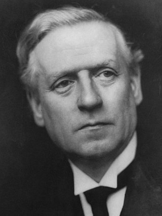
<span class="mw-page-title-main">December 1910 United Kingdom general election</span>

The December 1910 United Kingdom general election was held from 3 to 19 December. It was the last general election to be held over several days and the last to be held before the First World War.

<span class="mw-page-title-main">2004 European Parliament election in the United Kingdom</span> Election

The 2004 European Parliament election was the United Kingdom's part of the wider 2004 European Parliament election which was held between 10 and 13 June 2004 in the 25 member states of the European Union. The United Kingdom's part of this election was held on Thursday 10 June 2004. The election also coincided with the 2004 local elections and the London Assembly and mayoral elections. In total, 78 Members of the European Parliament were elected from the United Kingdom using proportional representation.

<span class="mw-page-title-main">Lists of places in Wales</span>

These are lists of places in Wales.

<span class="mw-page-title-main">Member of Parliament (United Kingdom)</span> Representative in the House of Commons

In the United Kingdom, a member of Parliament (MP) is an individual elected to serve in the House of Commons, the lower house of the Parliament of the United Kingdom.
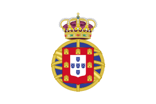
<span class="mw-page-title-main">United Kingdom of Portugal, Brazil and the Algarves</span> Pluricontinental monarchy

The United Kingdom of Portugal, Brazil and the Algarves was a pluricontinental monarchy formed by the elevation of the Portuguese colony named State of Brazil to the status of a kingdom and by the simultaneous union of that Kingdom of Brazil with the Kingdom of Portugal and the Kingdom of the Algarves, constituting a single state consisting of three kingdoms.

<span class="mw-page-title-main">Unitary authorities of England</span> Local government in some parts of England

The unitary authorities of England are a type of local authority responsible for all local government services in an area. They combine the functions of a non-metropolitan county council and a non-metropolitan district council, which elsewhere in England provide two tiers of local government.

<span class="mw-page-title-main">Kingdom of Portugal</span> Kingdom in Southwestern Europe (1139–1910)

The Kingdom of Portugal was a monarchy in the western Iberian Peninsula and the predecessor of the modern Portuguese Republic. Existing to various extents between 1139 and 1910, it was also known as the Kingdom of Portugal and the Algarves after 1415, and as the United Kingdom of Portugal, Brazil and the Algarves between 1815 and 1822. The name is also often applied to the Portuguese Empire, the realm's overseas colonies.

<span class="mw-page-title-main">United Kingdom in the Eurovision Song Contest</span>

The United Kingdom has participated in the Eurovision Song Contest 66 times. Its first participation was at the second contest, in 1957, and it has entered every year since 1959. The British participant broadcaster in the contest is the British Broadcasting Corporation (BBC). The country has won the contest five times: in 1967, with "Puppet on a String" performed by Sandie Shaw; in 1969, with "Boom Bang-a-Bang" by Lulu ; in 1976, with "Save Your Kisses for Me" by Brotherhood of Man; in 1981, with "Making Your Mind Up" by Bucks Fizz; and in 1997, with "Love Shine a Light" by Katrina and the Waves. The UK has also achieved a record sixteen second-place finishes, the first in 1959 and the most recent in 2022.

<span class="mw-page-title-main">Countries of the United Kingdom</span> Component parts of the UK since 1922

Since 1922, the United Kingdom has been made up of four countries: England, Scotland, Wales and Northern Ireland. The UK Prime Minister's website has used the phrase "countries within a country" to describe the United Kingdom.