Well End | |
---|---|
Location within Buckinghamshire | |
Population | 530 |
OS grid reference | SU889879 |
Civil parish | |
Unitary authority | |
Ceremonial county | |
Region | |
Country | England |
Sovereign state | United Kingdom |
Post town | BOURNE END |
Postcode district | SL8 |
Dialling code | 01628 |
Police | Thames Valley |
Fire | Buckinghamshire |
Ambulance | South Central |
UK Parliament | |
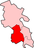
Well End is a hamlet in the parish of Little Marlow, in Buckinghamshire, England. [1] [2] It is situated on the north-west side of the village of Bourne End. Although it lies in a separate parish, it is geographically contiguous with and subordinate to Bourne End; but unlike most of the hamlets consumed by its larger neighbour, it retains a distinct character, and the use of the name is common and well recognised locally.
The area was once known as Fontibus de Merlow, (Marlow Fountain), of which Well End is a likely etymological derivative.
It is endowed with Abbotsbrook Hall, a small, parish council-owned venue used for community events. The local hostelry is The Black Lion situated on Marlow Road. Claytons School, the junior school serving Well End and Bourne End, is sited locally on Wendover Road. There is nearby access to the Little Marlow Gravel Pits nature reserve and to the River Thames towpath.
Well End was formerly home to a Congregationalist mission hall and The Blacksmiths Arms public house.
Stanbury is a village in the Haworth, Cross Roads and Stanbury civil parish, and in the metropolitan borough of the City of Bradford in West Yorkshire, England. The name Stanbury translates as Stone Fort from Old English.
Bledlow Ridge is a village in the civil parish of Bledlow-cum-Saunderton in Buckinghamshire, England. In 2004 the population was 940. It is situated in the Chiltern Hills, about 4 miles SSW of Princes Risborough and on the road between the High Wycombe and Chinnor.
Bourne End is a village mostly in the parish of Wooburn, but partly in the parish of Little Marlow, in Buckinghamshire, England. It is about five miles (8 km) south-east of High Wycombe and three miles (5 km) east of Marlow, near the border with Berkshire and close to where the Buckinghamshire River Wye empties into the Thames.
Coldmoorholme is a hamlet in the parish of Little Marlow in Buckinghamshire, England. It is now considered part of the village of Bourne End, and locally the area is known as 'Spade Oak'.
Handy Cross is a hamlet in the parish of Little Marlow, Buckinghamshire, England. It is located on Marlow Hill, on the old road between Marlow and High Wycombe. At the 2011 Census the population of the hamlet was included in the civil parish of Great Marlow. Today the hamlet consists of a farm, several households and a Harvester pub & restaurant.
Marlow is a town and civil parish within the Unitary Authority of Buckinghamshire, England. It is located on the River Thames, 4 miles (6 km) south south-west of High Wycombe, 5 miles (8 km) west north-west of Maidenhead and 33 miles (53 km) west of central London.
Wooburn is a village in Buckinghamshire, England. It is located off the A4094 road between Wooburn Green and Bourne End in the very south of the county near the River Thames, about two miles south west of Beaconsfield and four miles east of Marlow. Wooburn is one of the two principal settlements within Wooburn, a civil parish in Wycombe district.
Bargeddie is a village in North Lanarkshire, Scotland, just outside the suburban fringe of Glasgow, 8 miles (13 km) east of the city centre, and close to the junction of the M73 and M8 motorways. The nearest major town is Coatbridge, 2 miles (3 km) to the east.
The A151 road is relatively minor part of the British road system. It lies entirely in the county of Lincolnshire, England. Its western end lies at coordinates 52°48.1892′N0°36.5179′W otherwise, grid reference SK938238.1
Thurlby is a village and civil parish in the South Kesteven district of Lincolnshire, England. It is situated just west of the A15 road, 2 miles (3 km) south from the town of Bourne, and on the edge of the Lincolnshire Fens. It is sometimes referred to as Thurlby by Bourne to distinguish it from other villages in Lincolnshire with the same name. Thurlby and the hamlet of Northorpe to its north are conjoined. The parish had a population of 2,136 at the 2001 census, although this had increased to 2,153 at the 2011 census.
Little Meadle is a hamlet in Buckinghamshire, England. It is part of the civil parish of Longwick-cum-Ilmer and is located between the hamlets of Owlswick and Meadle. It is approximately 5 miles (8.0 km) from Aylesbury and 20 miles (32 km) from Oxford. In addition to the Farm House it consists of a collection of houses built over the past 60 years, and it gained an official name with the Royal Mail in 2004, as well as being mapped with the Ordnance Survey 2006. The term Little Meadle is a relatively new one it has no historical meaning in itself, except that it is close to the village of Meadle and is a small hamlet that was previously known only by the name of the road in which it is situated Stockwell Lane.
Trench Green is a hamlet in Oxfordshire about 1 mile (1.6 km) northeast of the village of Mapledurham and about 4 miles (6.4 km) northwest of Reading in neighbouring Berkshire. It is situated on the rural road from Caversham to Goring Heath and Goring-on-Thames, at its junction with the access lane to Mapledurham village.
Burrington is a small village and civil parish in Somerset, England. It is situated in the unitary authority of North Somerset, 5 miles (8.0 km) north east of Axbridge and about 10 miles (16 km) east of Weston-super-Mare. The parish includes the hamlets of Bourne and Rickford and has a population of 464.
Codrington is a settlement in South Gloucestershire, England. It is located near Junction 18 of the M4 motorway south of Wapley and Yate.
Wooburn Green is a village in the civil parish of Wooburn, Buckinghamshire, England.
Fern is a hamlet in the parish of Little Marlow, in Buckinghamshire, England.
Winchbottom is a hamlet in the parish of Little Marlow, in Buckinghamshire, England.
Chazey Heath is a hamlet in Oxfordshire, England, about 3 miles (4.8 km) north of Reading, Berkshire. It is situated on the A4074 road, between Caversham and Oxford, at its junction with the rural road to Goring Heath and Goring-on-Thames.
Bovingdon Green is a hamlet in the civil parish of Great Marlow, just to the west of the town of Marlow in Buckinghamshire, England.
Bockmer End is a hamlet in the civil parish of Medmenham to the west of Marlow in Buckinghamshire, England. It is in the town of Marlow.
This Buckinghamshire location article is a stub. You can help Wikipedia by expanding it. |