Longwick

Last updated

Longwick
Pasture, Longwick - geograph.org.uk - 2233513.jpg
Pasture, Longwick, 2010
Buckinghamshire UK location map.svg
Red pog.svg
Longwick
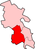
Location within Buckinghamshire
Population1,267  [1]
1,347 (2011 Census. parish) [2]
OS grid reference SP7805
Civil parish
Unitary authority
Ceremonial county
Region
Country England
Sovereign state United Kingdom
Post town Princes Risborough
Postcode district HP27
Dialling code 01844
Police Thames Valley
Fire Buckinghamshire
Ambulance South Central
UK Parliament
List of places
UK
England
Buckinghamshire
51°44′10″N0°51′25″W / 51.736°N 0.857°W / 51.736; -0.857

Longwick is a village 1+14 miles (2 km) northwest of Princes Risborough, Buckinghamshire, England, on the A4129 road.

Contents

A Roman gold finger ring, dated to c. 200 - c. 300 CE and found in Longwick-cum-Ilmer in 2019 Roman gold polygonal finger-ring (FindID 986782).jpg
A Roman gold finger ring, dated to c.200 – c.300 CE and found in Longwick-cum-Ilmer in 2019

The toponym is from the Old English for "long farm".[ citation needed ]

With Ilmer, Owlswick, Meadle and Horsenden, it forms the civil parish of Longwick-cum-Ilmer which was created in 1934. In 1951 its population was 786,[ citation needed ] since when it has increased significantly to 1,267 in 2001.

Longwick was the location for the Sunrise/Back to the Future Acid House party on 12 August 1989.[ citation needed ]

Transport

Longwick is served on a daily basis by the Risborough Area Community Bus (RCB) with hourly services to Princes Risborough, five times a day. Longwick is also served by Redline Buses' 320 rail link service between Princes Risborough and Chinnor at peak times.

Related Research Articles

<span class="mw-page-title-main">Reedham, Norfolk</span> Village and civil parish in Norfolk, England

Reedham is a village and civil parish in the English county of Norfolk and within The Broads. It is on the north bank of the River Yare, 12 miles (19 km) east of the city of Norwich, 7.5 mi (12.1 km) south-west of the town of Great Yarmouth and the same distance north-west of the Suffolk town of Lowestoft.

<span class="mw-page-title-main">Great and Little Hampden</span> Human settlement in England

Great and Little Hampden is a civil parish in Buckinghamshire, England, about three miles south-east of Princes Risborough. It incorporates the villages of Great Hampden and Little Hampden, and the hamlets of Green Hailey and Hampden Row. Great Hampden is the ancestral home of the Hobart-Hampden family, the most famous of whom was the English Civil War protagonist John Hampden.

<span class="mw-page-title-main">Owlswick</span>

Owlswick is a hamlet in Buckinghamshire, England, about 3 miles E of Thame and 4 miles SSE of Aylesbury. It is part of the civil parish of Longwick-cum-Ilmer and is in the ecclesiastical parish of Monks Risborough.

<span class="mw-page-title-main">Princes Risborough</span> Market town in Buckinghamshire, England

Princes Risborough is a market town and civil parish in Buckinghamshire, England, about 9 miles (14 km) south of Aylesbury and 8 miles (13 km) north west of High Wycombe. It lies at the foot of the Chiltern Hills, at the north end of a gap or pass through the Chilterns, the south end of which is at West Wycombe. The A4010 road follows this route from West Wycombe through the town and then on to Aylesbury.

<span class="mw-page-title-main">Bledlow</span> Human settlement in England

Bledlow is a village and former civil parish, now in the parish of Bledlow-cum-Saunderton, in Buckinghamshire, England. It is about 1+12 miles (2.4 km) WSW of Princes Risborough, and is on the county boundary with Oxfordshire. In 1931 the parish had a population of 925. On 1 April 1934 the parish was abolished to form "Bledlow cum Saunderton".

<span class="mw-page-title-main">Thame</span> Human settlement in England

Thame is a market town and civil parish in Oxfordshire, about 13 miles (21 km) east of the city of Oxford and 10 miles (16 km) southwest of Aylesbury. It derives its name from the River Thame which flows along the north side of the town and forms part of the county border with Buckinghamshire. The parish includes the hamlet of Moreton south of the town. The 2011 Census recorded the parish's population as 11,561. Thame was founded in the Anglo-Saxon era and was in the kingdom of Wessex.

<span class="mw-page-title-main">Horsenden</span> Human settlement in England

Horsenden is a hamlet and former civil parish, now in the parish of Longwick-cum-Ilmer, in Buckinghamshire, England. It is approximately one mile West of Princes Risborough, seven miles south of Aylesbury and three miles south-west of Chinnor in Oxfordshire. The Icknield Way passes just to the north of the village from north-east to south-west, although there is no connecting road through the hamlet itself. In 1931 the parish had a population of 53.

<span class="mw-page-title-main">Ilmer</span> Human settlement in England

Ilmer is a village and former civil parish, now in the parish of Longwick-cum-Ilmer, in Buckinghamshire, England. It is at the foot of the Chiltern Hills about 3 miles (5 km) northwest of Princes Risborough, near the boundary with Oxfordshire. In 1931 the parish had a population of 40. On 1 April 1934 the parish was abolished to form "Longwick cum Ilmer".

<span class="mw-page-title-main">Lacey Green</span> Village and civil parish in Buckinghamshire, England

Lacey Green is a village and civil parish in the Buckinghamshire district, south-east of Princes Risborough, in the ceremonial county of Buckinghamshire, England. It is in the Chiltern Hills above the town.

<span class="mw-page-title-main">Meadle</span>

Meadle is a hamlet in the civil parish of Longwick-cum-Ilmer, in Buckinghamshire, England. It is located to the north of the village of Monks Risborough and near Little Kimble. The current population of Meadle is about 75. Most of the buildings are very old: farmhouses and labourers' cottages built in traditional red clay brick with thatched roofs. A small stream rises in the village and ultimately joins the Thames.

<span class="mw-page-title-main">Radclive</span> Human settlement in England

Radclive is a village on the River Great Ouse just over 1 mile (1.6 km) west of Buckingham in Buckinghamshire, England. It is in the civil parish of Radclive-cum-Chackmore in Aylesbury Vale district. The parish includes the hamlet of Chackmore about 1.5 miles (2.4 km) north of Buckingham.

<span class="mw-page-title-main">Saunderton</span> Human settlement in England

Saunderton is a village and former civil parish, now in the parish of Bledlow-cum-Saunderton, Buckinghamshire, England. It is in the Saunderton Valley in the Chiltern Hills, the village consists of three main areas: a linear settlement along Bledlow Road about 1+14 miles (2 km) southwest of Princes Risborough, Saunderton Lee, about 1+12 miles (2 km) further south and a residential area on the A4010 road around Saunderton railway station, about 4+12 miles (7 km) northwest of High Wycombe. This residential area, unlike the other two parts of the village, is in the HP14 postcode district, meaning its post town is High Wycombe, not Princes Risborough, the boundary between the two post towns passing just south of Grange Farm. In 1931 the parish had a population of 454.

<span class="mw-page-title-main">Aylesbury (UK Parliament constituency)</span> Parliamentary constituency in the United Kingdom, 1801 onwards

Aylesbury is a constituency represented in the House of Commons of the UK Parliament since 2019 by Rob Butler of the Conservative Party.

Little Meadle is a hamlet in Buckinghamshire, England. It is part of the civil parish of Longwick-cum-Ilmer and is located between the hamlets of Owlswick and Meadle. It is approximately 5 miles (8.0 km) from Aylesbury and 20 miles (32 km) from Oxford. In addition to the Farm House it consists of a collection of houses built over the past 60 years, and it gained an official name with the Royal Mail in 2004, as well as being mapped with the Ordnance Survey 2006. The term Little Meadle is a relatively new one it has no historical meaning in itself, except that it is close to the village of Meadle and is a small hamlet that was previously known only by the name of the road in which it is situated Stockwell Lane.

<span class="mw-page-title-main">Stow cum Quy</span> Human settlement in England

Stow cum Quy, commonly referred to as Quy, is a village and civil parish in Cambridgeshire, England. Situated around 4 miles (6.4 km) north east of Cambridge lying between the Burwell Road (B1102) and the medieval Cambridge to Newmarket road, it covers an area of 764 hectares.

<span class="mw-page-title-main">Gunthorpe, Nottinghamshire</span> Riverside village in Nottinghamshire, England

Gunthorpe is a village and civil parish in Nottinghamshire, England. Its population of 752 at the 2011 census was estimated at 559 in 2019. It lies on the left bank of the River Trent. Gunthorpe's on the A6097 is the only road bridge over the river between Newark and Nottingham.

Sutton Cum Lound is a village located in Bassetlaw, north Nottinghamshire. It is located 3 miles from Retford. The civil parish is called Sutton. According to the 2001 census it has a population of 687, including Tithby and falling slightly to 673 at the 2011 census. The parish church of St Bartholomew is Norman, rebuilt in the Perpendicular style, with "unbridled curvilinear tracery" in the chancel windows. The village has a primary school. It borders the village of Barnby Moor which is about 1 mile away and is also very close to the village of Lound. The village has a number of public footpaths and walks such as those on Mire Hill.

Stathern is an English village and civil parish in the Melton district of Leicestershire. It lies in the Vale of Belvoir about 10 miles (16 km) north of Melton Mowbray. Its church has an unusual dedication and its school a long history. Its pub doubles as a post office.

<span class="mw-page-title-main">Dodcott cum Wilkesley</span> Human settlement in England

Dodcott cum Wilkesley is a civil parish in the unitary authority of Cheshire East and the ceremonial county of Cheshire, England. The hamlet of Wilkesley lies 2+12 miles to the west of Audlem and 7 miles to the south west of Nantwich. The parish also includes the village of Burleydam, the largest settlement, as well as the small settlements of Butterley Heyes, Cheshire Fields, Combermere, Lightwood Green and Royal's Green. It also formerly contained the settlements of Pinsley Green and Smeaton Wood, now located in Wrenbury cum Frith civil parish. Nearby villages include Adderley and Calverhall in Shropshire and Audlem, Newhall and Wrenbury within Cheshire.

<span class="mw-page-title-main">Shavington cum Gresty</span> Human settlement in England

Shavington cum Gresty is a civil parish in the unitary authority of Cheshire East and the ceremonial county of Cheshire, England. It lies to the south of Crewe. It includes the large village of Shavington, which lies 2+12 miles south of Crewe, as well as the smaller settlements of Dodds Bank, Park Estate, Puseydale, Sugar Loaf and part of Goodall's Corner. Nearby villages include Basford, Hough, Willaston, Wistaston and Wybunbury. The total population of the civil parish is a little under 5,000.

References

  1. Neighbourhood Statistics 2001 Census
  2. "Civil Parish population 2011". Neighbourhood Statistics. Office for National Statistics. Retrieved 23 November 2016.
  3. Fittock, M. "Finds record for: BH-348FD3". The Portable Antiquities Scheme. Retrieved 7 September 2022.

For a map see the Wycombe District site describing the Parish of Longwick-cum-Ilmer