Fawley, Buckinghamshire

Last updated

Fawley
St Mary's, Fawley.jpg
Buckinghamshire UK location map.svg
Red pog.svg
Fawley
Location within Buckinghamshire
Population255  [1]
258 (2011 Census) [2]
OS grid reference SU7586
Civil parish
  • Fawley
Unitary authority
Ceremonial county
Region
Country England
Sovereign state United Kingdom
Post town HENLEY-ON-THAMES
Postcode district RG9
Dialling code 01491
Police Thames Valley
Fire Buckinghamshire
Ambulance South Central
UK Parliament
List of places
UK
England
Buckinghamshire
51°34′34″N0°54′36″W / 51.576°N 0.910°W / 51.576; -0.910

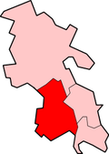
Fawley is a village and civil parish in Wycombe district in the south-western corner of Buckinghamshire, England. It is on the boundary between Buckinghamshire and Oxfordshire, about seven miles west of Great Marlow and north of Henley-on-Thames.

Contents

The village toponym is derived from the Old English for "fallow-coloured woodland clearing". It was recorded in the Domesday Book of 1086 as Falelie. There are two other places in England called Fawley.

Sir Bulstrode Whitelocke, a prominent Member of Parliament in Cromwell's day, was from Fawley. In 1642 he allowed soldiers fighting in the English Civil War to stay at the manor house in Fawley, known as Fawley Court but they were quite raucous in their behaviour and destroyed the contents of the house. In 1684 the house was redesigned, following a design by Sir Christopher Wren.

The Church of England parish church of Saint Mary the Virgin was rebuilt in 1748. It has a Tree of Life stained glass window designed by the artist John Piper (who lived nearby in Fawley Bottom) and Patrick Reyntiens.

See also

St Mary's Church, Fawley St Mary's, Fawley - geograph.org.uk - 295268.jpg
St Mary's Church, Fawley

Related Research Articles

<span class="mw-page-title-main">Quainton</span> Human settlement in England

Quainton is a village and civil parish in Buckinghamshire, England, 7 miles (11 km) north-west of Aylesbury. The population of the civil parish at the 2011 Census was 1,295. The village has two churches, a school and one public house. The location means that while many commute to London, others are employed in neighbouring towns and villages.

<span class="mw-page-title-main">Chetwode</span> Human settlement in England

Chetwode is a village and civil parish about 4 miles (6.4 km) southwest of Buckingham in the Aylesbury Vale district of Buckinghamshire. The parish is bounded to the southwest and southeast by a brook called The Birne, which here also forms part of the county boundary with Oxfordshire.

<span class="mw-page-title-main">Edlesborough</span> Human settlement in England

Edlesborough is a village and civil parish in the Aylesbury Vale district of Buckinghamshire, England. Edlesborough is also next to the village of Eaton Bray just over the county boundary in Bedfordshire, about 3 miles (5 km) west-south-west of Dunstable.

<span class="mw-page-title-main">Hoggeston</span> Human settlement in England

Hoggeston is a village and civil parish within the Aylesbury Vale district in Buckinghamshire, England. It is located around 2+12 miles (4 km) south-east of Winslow, and around 8 miles (13 km) north of Aylesbury. It is in the civil parish of Dunton.

<span class="mw-page-title-main">Horton, Berkshire</span> Village and civil parish in England

Horton is a village and civil parish in Berkshire, England. It is between Windsor and Staines-upon-Thames.

Pitchcott is a village and civil parish in the Aylesbury Vale district of Buckinghamshire, England. It is about 3 miles (5 km) north-east of Waddesdon, slightly less than 4 miles (6.4 km) south of Winslow and slightly more than 4 miles north of Aylesbury. It is in the civil parish of Oving.

<span class="mw-page-title-main">Radclive</span> Human settlement in England

Radclive is a village on the River Great Ouse just over 1 mile (1.6 km) west of Buckingham in Buckinghamshire, England. It is in the civil parish of Radclive-cum-Chackmore in Aylesbury Vale district. The parish includes the hamlet of Chackmore about 1.5 miles (2.4 km) north of Buckingham.

<span class="mw-page-title-main">Radnage</span> Village in Buckinghamshire, England

Radnage is a village and civil parish in the Buckinghamshire district of Buckinghamshire, England. It is in the Chiltern Hills about two miles north east of Stokenchurch and six miles WNW of High Wycombe.

<span class="mw-page-title-main">Turweston</span> Human settlement in England

Turweston is a village and civil parish in north-west Buckinghamshire, England. The village is beside the River Great Ouse, which bounds the parish to the north, west and south. Turweston is the most northwesterly parish in Buckinghamshire: the Ouse here forms the county boundary with Northamptonshire to the north and west and Oxfordshire to the south. Across the river, the Northamptonshire market town of Brackley is just west of Turweston, with the town centre about 1 mile (1.6 km) west of the village. The parish has an area of 1,295 acres (524 ha) and had a population of 211 at the 2011 Census.

<span class="mw-page-title-main">Maidwell</span> Human settlement in England

Maidwell is a village and civil parish in West Northamptonshire in England. At the time of the 2001 census, the parish had 325 inhabitants, including Draughton, and this increased to 429 at the 2011 census.

<span class="mw-page-title-main">Fawley, Berkshire</span> Village in England

Fawley is a village and civil parish in West Berkshire, England. The hub of the village is centred 3.5 miles (5.6 km) east of Lambourn and has a sub-community within its bounds, Little or South Fawley. It includes the depopulated small hill settlement of Whatcombe. Fawley is the inspiration for "Marygreen" in Thomas Hardy's Jude the Obscure.

<span class="mw-page-title-main">Pishill</span> Human settlement in England

Pishill is a village and former civil parish, now in the parish of Pishill with Stonor, in the South Oxfordshire district, in the county of Oxfordshire, England. It is about 5 miles (8 km) north of Henley-on-Thames, in the Stonor valley in the Chiltern Hills about 430 feet (130 m) above sea level. In 1921 the parish had a population of 147.

<span class="mw-page-title-main">Waterperry</span> Human settlement in England

Waterperry is a village and former civil parish, now in the parish of Waterperry with Thomley, in the South Oxfordshire district, in Oxfordshire and close to the county boundary with Buckinghamshire, England. It is beside the River Thame, about 7 miles (11 km) east of Oxford. The Church of England parish church of Saint Mary the Virgin is partly Saxon and has notable medieval stained glass, sculptural memorials, Georgian box pews and memorial brasses. In 1961 the parish had a population of 161. On 1 April 1994 the parish was abolished and merged with Thomley to form "Waterperry with Thomley".

<span class="mw-page-title-main">Whittlesford</span> Human settlement in England

Whittlesford is a village in Cambridgeshire, England, and also the name of an old hundred. The village is situated on the Granta branch of the River Cam, seven miles south of Cambridge. Whittlesford Parkway railway station serves the village.

<span class="mw-page-title-main">Drayton St. Leonard</span> Human settlement in England

Drayton St. Leonard is a village and civil parish on the River Thame in Oxfordshire, about 8 miles (13 km) southeast of Oxford.

<span class="mw-page-title-main">Hound, Hampshire</span> Human settlement in England

Hound is a village and civil parish in the borough of Eastleigh in southern Hampshire, England. The parish encompasses the villages of Netley, Butlocks Heath and Old Netley, and includes such landmarks as Netley Castle and Netley Abbey. In the 2001 census, the parish had a headcount of 6,846 living in 2,928 households.

Nicholas Patrick Reyntiens OBE was a British stained-glass artist, described as "the leading practitioner of stained glass in this country."

<span class="mw-page-title-main">Horton-cum-Studley</span> Human settlement in England

Horton-cum-Studley is a village and civil parish in Oxfordshire about 6+12 miles (10.5 km) northeast of the centre of Oxford and bordering Otmoor, and is one of the "Seven Towns" of Otmoor. The 2011 Census recorded the parish's population as 455. A majority of residents in the village work in the Healthcare and Educational Sectors.

<span class="mw-page-title-main">St Mary the Virgin's Church, Fawley</span> Church in Buckinghamshire, England

St Mary the Virgin's Church is in centre of the village of Fawley, Buckinghamshire, England. It is an active Anglican parish church on the deanery of Wycombe, the archdeaconry of Buckingham, and the diocese of Oxford. Its benefice has been united with those of five other local churches to form the benefice of Hambleden Valley. The church is recorded in the National Heritage List for England as a designated Grade II* listed building.

<span class="mw-page-title-main">Itchen Stoke and Ovington</span> Human settlement in England

Itchen Stoke and Ovington is an English civil parish consisting of two adjoining villages in Hampshire, England, 2 miles (3.2 km) west of Alresford town centre in the valley of the River Itchen, 5 miles (8.0 km) north-east of Winchester, and 2 miles (3.2 km) south-east of Itchen Abbas.

References

  1. "Neighbourhood Statistics 2001 Census". Archived from the original on 21 November 2016. Retrieved 17 July 2008.
  2. "Civil Parish population 2011". Neighbourhood Statistics. Office for National Statistics. Archived from the original on 21 November 2016. Retrieved 20 November 2016.