Dunsmore | |
---|---|
The Church of the Resurrection, Dunsmore | |
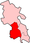
Location within Buckinghamshire | |
Unitary authority | |
Ceremonial county | |
Region | |
Country | England |
Sovereign state | United Kingdom |
Post town | AYLESBURY |
Postcode district | HP22 |
Police | Thames Valley |
Fire | Buckinghamshire |
Ambulance | South Central |
UK Parliament | |
Dunsmore is a hamlet in the parish of Ellesborough, in Buckinghamshire, England. It occupies a hilltop position in the Chiltern Hills about 2 miles south of Wendover. Access is by two steep, single-track hillside lanes.
The place name is Anglo Saxon in origin, and means literally Dunna's moor. [1]
Much of the surrounding land is owned by the National Trust and is heavily wooded with beech trees, and bracken. Due to its elevation the village is occasionally cut off by treacherous road conditions during harsh winters.
Central features of the hamlet are the village pond, the village hall and the Church of the Resurrection, Dunsmore. In the past the village supported a shop and two public houses, The Fox and The Black Horse, but these have now closed and been converted into residential dwellings.
Dunsmore is close by to Chequers, the country retreat for the serving Prime Minister, & the local Second Boer War memorial on Coombe Hill, Buckinghamshire. The memorial stands above Wendover in the Aylesbury Vale. There are many good, rural walks nearby. [2]
The A413 is a major road in England that runs between Gerrards Cross to Towcester. It passes through or near various towns and villages including Amersham, Great Missenden, Wendover, Aylesbury, Winslow, and Buckingham. Most of the road is in Buckinghamshire, with a part at the north end in Northamptonshire.
Stoke Mandeville is a village and civil parish in the Vale of Aylesbury in Buckinghamshire, England. It is located 3 miles (4.9 km) from Aylesbury and 3.4 miles (5.5 km) from the market town of Wendover. Although a separate civil parish, the village falls within the Aylesbury Urban Area. According to the Census Report the area of this parish is 1,460 acres (5.9 km2).
The Chiltern Hills or, as they are known locally and historically, the Chilterns, form a chalk escarpment across Oxfordshire, Buckinghamshire, Hertfordshire, and Bedfordshire. In 1965, a large part of the Chilterns was designated as an Area of Outstanding Natural Beauty (AONB).
Wendover is a market town and civil parish at the foot of the Chiltern Hills in Buckinghamshire, England. It is situated at the point where the main road across the Chilterns between London and Aylesbury intersects with the once important road along the foot of the Chilterns. The town is some 35 miles (56 km) north west of London and 5 miles (8 km) south east of Aylesbury, and is very popular with commuters working in London.
Whiteleaf is a hamlet in the civil parish of Princes Risborough and the ecclesiastical parish of Monks Risborough in Buckinghamshire, England. It is located 7 miles south of the county town of Aylesbury and 8 miles north of High Wycombe. It lies halfway up the northern scarp of the Chilterns, about half a mile from the parish church of Monks Risborough.
Asheridge is a small hamlet in the parish of Chartridge, in Buckinghamshire, England. Prior to 1898 it was part of Chesham parish. It is situated in the Chiltern Hills, about two and a half miles north west of Chesham, 5 miles from Great Missenden and 6 miles from Wendover.
Halton is a small village and civil parish in the Aylesbury Vale district of Buckinghamshire, England and is located about 2 miles north of Wendover & 5 miles southeast of Aylesbury.
Buckland is a village and civil parish in Aylesbury Vale district in Buckinghamshire, England. The village is near the boundary with Hertfordshire, close to Aston Clinton. The hamlet of Buckland Wharf is in the parish. It takes its name from its wharf on the Wendover Branch of the Grand Union Canal that passes through the parish.
Coleshill is a village and civil parish within Chiltern district in Buckinghamshire, England. It is 2 miles (3.2 km) south of Amersham and 3 miles (4.8 km) north of Beaconsfield.
Ellesborough is a village and civil parish in Wycombe district in Buckinghamshire, England. The village is at the foot of the Chiltern Hills just to the south of the Vale of Aylesbury, two miles from Wendover and five miles from Aylesbury. It lies between Wendover and the village of Little Kimble.
Little Kingshill is a small village in the parish of Little Missenden in Buckinghamshire, England. It is located in the Chiltern Hills, about five miles west of Amersham, about two and a half miles south of Great Missenden and about four and a half miles north west of High Wycombe.
Medmenham is a village and civil parish in the Wycombe district of Buckinghamshire, England. It is on the River Thames, about 3 1⁄2 miles (5.6 km) southwest of Marlow and 3 miles (4.8 km) east of Henley-on-Thames. The parish also includes Danesfield, a housing estate for predominantly RAF officers, although families of other ranks from the RAF, Royal Navy and British Army also live there.
Nash Lee is a hamlet in the parish of Ellesborough, in Buckinghamshire, England. It is located to the north of the village, about two miles west of Wendover.
Nettleden is a village in Hertfordshire, England. It is in the Chiltern Hills, about four miles north-west of Hemel Hempstead, near Little Gaddesden, Great Gaddesden and Frithsden. Nettleden with Potten End is a civil parish in Dacorum District.
Oving is a village and also a civil parish within Aylesbury Vale district in Buckinghamshire, England. It is located about three and a half miles north east of Waddesdon, four miles south of Winslow.
Pednor is a hamlet in the parish of Chartridge, in Buckinghamshire, England. It is located in the Chiltern Hills two miles northwest of Chesham and seven miles southeast of Wendover.
Weston Turville is a historic village and civil parish in the Vale of Aylesbury in Buckinghamshire, England. The village is at the foot of the Chiltern Hills, 3 miles (4.9 km) from the market town of Wendover and 3.5 miles (5.7 km) from Aylesbury.
Coombe Hill is a hill in The Chilterns, located next to the hamlet of Dunsmore, Buckinghamshire, England, near the small town of Wendover, and overlooking Aylesbury Vale. It is not to be confused with another Coombe Hill on the flank of Haddington Hill, some two miles (3 km) to the north-east. It is part of the Bacombe and Coombe Hills Site of Special Scientific Interest.
Turnfurlong is an area of Aylesbury in Buckinghamshire, England. It is roughly defined as the area of housing that adjoins the two roads, Turnfurlong and Turnfurlong Lane.
World's End is a hamlet 0.5 miles (0.80 km) north of Wendover, Buckinghamshire. It is part of the civil parish of Wendover which is in Aylesbury Vale district. Today the settlement straddles the B4009. Prior to the construction of the Wendover Bypass World's End was on the A413.
Wikimedia Commons has media related to Dunsmore, Buckinghamshire . |