Great Marlow

Last updated

Great Marlow
Buckinghamshire UK location map.svg
Red pog.svg
Great Marlow
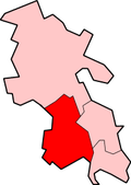
Location within Buckinghamshire
Population1,321  [1]
1,167 (2011 Census) [2]
OS grid reference SU843881
Civil parish
  • Great Marlow
Unitary authority
Ceremonial county
Region
Country England
Sovereign state United Kingdom
Post town MARLOW
Postcode district SL7
Dialling code 01628
Police Thames Valley
Fire Buckinghamshire
Ambulance South Central
UK Parliament
List of places
UK
England
Buckinghamshire
51°35′10″N0°48′15″W / 51.5861°N 0.8042°W / 51.5861; -0.8042 Coordinates: 51°35′10″N0°48′15″W / 51.5861°N 0.8042°W / 51.5861; -0.8042

Great Marlow is a civil parish within Wycombe district in the English county of Buckinghamshire, lying north of the town of Marlow and south of High Wycombe. The parish includes the hamlets of Bovingdon Green, Burroughs Grove, Chisbridge Cross and Marlow Common. Prior to November 2007 the major settlement in Great Marlow was Marlow Bottom which has now become a civil parish in its own right.

The parish has been so named since Norman times. The ancient parish of Great Marlow, named to distinguish it from Little Marlow, was large, including the town of Marlow and rural areas north and west of it. The ancient parish became a civil parish in the 19th century, and in 1896 was divided: the town became Great Marlow Urban District (later renamed Marlow Urban District), leaving the rural areas in the parish of Great Marlow. [3] In 1934 Lane End, in the far north of the parish, was transferred from Great Marlow to the parish of Fingest. [4]

The ecclesiastical parish of Great Marlow, which includes the town of Marlow, is now united with the parishes of Marlow Bottom, Little Marlow and Bisham (in Berkshire). [5]

Related Research Articles

Buckinghamshire County of England

Buckinghamshire, abbreviated Bucks, is a ceremonial county in South East England that borders Greater London to the south-east, Berkshire to the south, Oxfordshire to the west, Northamptonshire to the north, Bedfordshire to the north-east and Hertfordshire to the east.

Harold Wood Suburban neighbourhood in Havering, east London

Harold Wood is a suburban neighbourhood of Romford in the London Borough of Havering. It is situated 16.5 miles (26.6 km) east-northeast of Charing Cross close to the Essex boundary.

High Wycombe Market town in Buckinghamshire, England

High Wycombe, often referred to as Wycombe, is a large market town in Buckinghamshire, England. Lying in the valley of the River Wye surrounded by the Chiltern Hills, it is 29 miles (47 km) west-northwest of Charing Cross in London; this information is also engraved on the Corn Market building in the centre of the town. It is also 13.2 miles (21.2 km) south-southeast of the county town of Aylesbury, 23.4 miles (37.7 km) southeast of Oxford, 15.4 miles (24.8 km) northeast of Reading and 7.7 miles (12.4 km) north of Maidenhead. According to the ONS official estimates for 2016, High Wycombe has a population of 125,257 and it is the second largest town in the county of Buckinghamshire after Milton Keynes. High Wycombe Urban Area, the conurbation of which the town is the largest component, has a population of 133,204.

Wycombe District Non-metropolitan district in England

Wycombe District was a local government district in Buckinghamshire in south-central England. Its council was based in the town of High Wycombe. The district was abolished on 31 March 2020 and its area is now administered by the unitary Buckinghamshire Council.

Marlow, Buckinghamshire Human settlement in England

Marlow is a town and civil parish within the Unitary Authority of Buckinghamshire, England. It is located on the River Thames, 4 miles (6 km) south south-west of High Wycombe, 5 miles (8 km) west north-west of Maidenhead and 33 miles (53 km) west of central London.

Lane End, Buckinghamshire Human settlement in England

Lane End is a village and civil parish within Wycombe district in Buckinghamshire, England. It is just south of the M40 from High Wycombe, about two miles (3 km) west of Booker. The village is twinned with Saint-Pierre-d'Oléron in France.

Breckland District Non-metropolitan district in England

Breckland is a local government district in Norfolk, England. Its council is based in Dereham. The district had a population of 130,491 at the 2011 Census.

Civil parish Territorial designation and lowest tier of local government in England

In England, a civil parish is a type of administrative parish used for local government. It is a territorial designation which is the lowest tier of local government below districts and counties, or their combined form, the unitary authority. Civil parishes can trace their origin to the ancient system of ecclesiastical parishes which historically played a role in both civil and ecclesiastical administration; civil and religious parishes were formally split into two types in the 19th century and are now entirely separate. The unit was devised and rolled out across England in the 1860s.

Chorleywood Human settlement in England

Chorleywood is a village and civil parish in the Three Rivers District, Hertfordshire, England, in the far southwest of the county on the border with Buckinghamshire, approximately 20 miles (32 km) northwest of Charing Cross. It is part of the London commuter belt and included in the government-defined Greater London Urban Area. The parish of Chorleywood was created in 1845 from part of Rickmansworth. The population of the parish was 11,286 at the 2011 census.

Civil parishes in Cumbria

A civil parish in England is the lowest unit of local government. There are 284 civil parishes in the ceremonial county of Cumbria, with most of the county being parished, and Allerdale, Copeland, Eden and South Lakeland being entirely parished. At the 2001 census, there were 359,692 people living in those 284 parishes, accounting for 73.8 per cent of the county's population.

Little Ilford Human settlement in England

Little Ilford is a district of London, England in the London Borough of Newham and the name of a ward in that borough.

Civil parishes in Cheshire

A civil parish is a country subdivision, forming the lowest unit of local government in England. There are 333 civil parishes in the ceremonial county of Cheshire, most of the county being parished. At the 2001 census, there were 565,259 people living in 332 parishes, accounting for 57.5 per cent of the county's population.

Civil parishes in South Yorkshire

A civil parish is a country subdivision, forming the lowest unit of local government in England. There are 93 civil parishes in the ceremonial county of South Yorkshire, most of the county being unparished. At the 2001 census, there were 360,191 people living in the 93 parishes, increasing to 369,220 in 2011, accounting for 27.5 per cent of the county's population.

Civil parishes in the West Midlands (county)

A civil parish is a subnational entity, forming the lowest unit of local government in England. There are 18 civil parishes in the ceremonial county of West Midlands, most of the county being unparished; Dudley, Sandwell, Walsall and Wolverhampton are completely unparished. At the 2001 census, there were 89,621 people living in the 18 parishes, accounting for 3.5 per cent of the county's population.

Chepping Wycombe Human settlement in England

Chepping Wycombe is a civil parish within Wycombe district in the ceremonial county of Buckinghamshire. The parish includes the three large villages of Tylers Green, Loudwater and Flackwell Heath. The central part of the parish comprises extensive business and industrial development lying adjacent and underneath an elevated section of the M40 in the valley of the River Wye.

Wycombe (UK Parliament constituency) Parliamentary constituency in the United Kingdom, 1868 onwards

Wycombe is a constituency represented in the House of Commons of the UK Parliament since 2010 by Steve Baker, a Conservative.

Beaconsfield (UK Parliament constituency)

Beaconsfield is a constituency represented in the House of Commons of the UK Parliament since 2019 by Joy Morrissey of the Conservative Party.

Marlow Bottom Human settlement in England

Marlow Bottom is a linear village occupying a valley to the north of Marlow, Buckinghamshire. It is also a civil parish in Wycombe district having been created in November 2007. Formerly it was part of the parish of Great Marlow.

Horton, Lancashire Human settlement in England

Horton, historically known as Horton-in-Craven, is a village and a civil parish in the Ribble Valley district of the English county of Lancashire. Population details are now included in the civil parish of Newsholme. It is near the town of Barnoldswick. Horton has a place of worship, anciently called a chapelry or chapel of ease. For transport, there is the A59 nearby.

References

  1. Wycombe DC Fact Pack 2001 Census [ permanent dead link ]
  2. "Civil Parish population 2011". Neighbourhood Statistics. Office for National Statistics. Retrieved 17 November 2016.
  3. William Page (editor) (1925). "Parishes: Great Marlow". A History of the County of Buckingham: Volume 3. Institute of Historical Research. Retrieved 14 July 2011.CS1 maint: extra text: authors list (link)
  4. "Great Marlow CP/AP through time | Census tables with data for the Parish-level Unit". www.visionofbritain.org.uk. Retrieved 2 October 2016.
  5. "Parish Profile, February 2010" (PDF). Archived from the original (PDF) on 27 September 2011. Retrieved 15 July 2011.

See also