Bovingdon Green | |
---|---|
The Green at Bovingdon Green, 2008 | |
Location within Buckinghamshire | |
OS grid reference | SU8386 |
Civil parish | |
Unitary authority | |
Ceremonial county | |
Region | |
Country | England |
Sovereign state | United Kingdom |
Post town | Marlow |
Postcode district | SL7 |
Dialling code | 01628 |
Police | Thames Valley |
Fire | Buckinghamshire |
Ambulance | South Central |
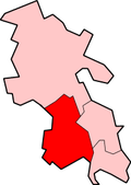
Bovingdon Green is a hamlet in the civil parish of Great Marlow, just to the west of the town of Marlow in Buckinghamshire, England. [1] [2]
Eye Green is a hamlet in the unitary authority of Peterborough, England. It lies north of Eye and south of Crowland.
Handy Cross is a hamlet in the parish of Little Marlow, Buckinghamshire, England. It is located on Marlow Hill, on the old road between Marlow and High Wycombe. At the 2011 Census the population of the hamlet was included in the civil parish of Great Marlow. Today the hamlet consists of a farm, several households and a Harvester pub & restaurant.
Great Marlow is a civil parish within Wycombe district in the English county of Buckinghamshire, lying north of the town of Marlow and south of High Wycombe. The parish includes the hamlets of Bovingdon Green, Burroughs Grove, Chisbridge Cross and Marlow Common. Prior to November 2007 the major settlement in Great Marlow was Marlow Bottom which has now become a civil parish in its own right.
Wooburn is a village in Buckinghamshire, England. It is located off the A4094 road between Wooburn Green and Bourne End in the very south of the county near the River Thames, about two miles south west of Beaconsfield and four miles east of Marlow. Wooburn is one of the two principal settlements within Wooburn, a civil parish in Wycombe district.
Cornsay is a hamlet and civil parish in County Durham, England. The population of the Civil Parish taken at the 2011 census was 1,128. It is 6 miles (9.7 km) southeast of Consett and 7 miles (11 km) southwest of Durham. It consists of nineteen dwellings, including four farms & is the home of Greenacres nudist club. All formerly belonged to Ushaw College for the training of Catholic priests, hence the organised nomenclature. East and West Farms are now in private hands as homes but the other two are still active, South Farm run by the Suddes family and North Farm by the Tweddle family.
Ashmore Green is a small hamlet in Berkshire, England. It is situated just to the west of the village of Cold Ash and to the north of Thatcham in the West Berkshire district.
Adswood is a suburb of Stockport, Greater Manchester, England. The name is said to be derived from "Adders wood"; in the reign of King Charles, the area was royal hunting grounds with a large population of snakes. Adswood has its own coat of arms, a snake wrapped around a tree.
Gaunt's Earthcott, sometimes spelt Gaunts Earthcott, is a hamlet in the civil parish of Almondsbury in South Gloucestershire, England. It consists of a ruined chapel, a few houses and two farms, Green Farm and Court Farm. The village is located approximately 2.5 miles (4 km) from Rudgeway and the A38 road and about the same distance from Frampton Cotterell and Winterbourne. The village is located close to the interchange between the M4 and M5 motorways. There is no real industry as such and the main economic activity in the area is farming.
Curtisden Green is a hamlet, lying 3 miles (4.8 km) to the north of Goudhurst, Kent, England. It is the location of Bethany School.
Wooburn Green is a village in the civil parish of Wooburn, Buckinghamshire, England.
Well End is a hamlet in the parish of Little Marlow, in Buckinghamshire, England. It is situated on the north-west side of the village of Bourne End. Although it lies in a separate parish, it is geographically contiguous with and subordinate to Bourne End; but unlike most of the hamlets consumed by its larger neighbour, it retains a distinct character, and the use of the name is common and well recognised locally.
Winchbottom is a hamlet in the parish of Little Marlow, in Buckinghamshire, England.
Bockmer End is a hamlet in the civil parish of Medmenham to the west of Marlow in Buckinghamshire, England. It is in the town of Marlow.
Glasinfryn is a small village in Gwynedd, Wales. It is situated between the village of Tregarth and the city of Bangor, Gwynedd, and in the community of Pentir. The village is residential in nature but with many outlying farms.
Darby Green is a village in the parish of Yateley, North East Hampshire, England. The electoral ward of Frogmore and Darby Green is separated from the rest of the parish by a small gap around Clarks Farm, until recently a composting farm in the mushroom producing industry. The ward has a boundary shared with Blackwater, which is one part of the Civil Parish of Hawley.
Brightwalton Green is a hamlet in the civil parish of Brightwalton in the county of Berkshire, England. The settlement lies near to the A338 road, and is situated approximately 8 miles (13 km) north-west of Newbury.
Goddard's Green is a hamlet and part of the civil parish of Wokefield in Berkshire, England. The settlement lies between art the villages of Burghfield Common and Mortimer Common, and is located approximately 5.5 miles (8.9 km) south-east of Reading. The Garth and South Berks Hunt had kennels here until 2002.
Ordnance Survey (OS) is the national mapping agency for Great Britain. The agency's name indicates its original military purpose, which was to map Scotland in the wake of the Jacobite rising of 1745. There was also a more general and nationwide need in light of the potential threat of invasion during the Napoleonic Wars. Since 1 April 2015 Ordnance Survey has operated as Ordnance Survey Ltd, a government-owned company, 100% in public ownership. The Ordnance Survey Board remains accountable to the Secretary of State for Business, Energy and Industrial Strategy. It was also a member of the Public Data Group.
Forty Green is a small, mainly undeveloped, agricultural area on the west side of Marlow in Buckinghamshire, England. It comprises field parcel numbers 883, 892, 895, 896 and 838 on the civil parish Ordnance Survey map. Its boundaries are not marked with signposts but parcel 892 has an entrance from a residential street carrying the name, Forty Green Drive. At the 2011 Census the population of the area was included in the civil parish of Great Marlow.
Fanner's Green is a hamlet and cul-de-sac road in the Great Waltham civil parish of the Chelmsford district of Essex, England. It is situated 1 mile (1.6 km) south-west from the village of Great Waltham. The county town of Chelmsford is approximately 2 miles (3 km) to the south-east. Fanner's Green comprises Fanner's farm, and a barn 200 yards (183 m) south on Breed's Road.
Media related to Bovingdon Green at Wikimedia Commons